If you have questions, comments, or corrections please feel free to contact me here.
I have not intended this to be a history, wanting only to post some pictures. Inevitably, some history has sneaked into the project. To keep track of everything I put together a spreadsheet of dates for various buildings and some of Gardner's history, downloadable here --->>> Gardner Timeline
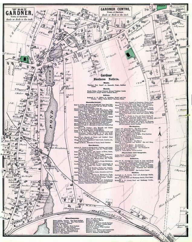
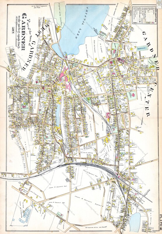
Below I have provided the 1870 (left) and the 1898 (right) maps that helped in finding many of the landmarks shown. I also used other maps. A list of references which I used from the local library and museum can be seen here --->>> Gardner References.
Below I have provided the 1870 (left) and the 1898 (right) maps that helped in finding many of the landmarks shown. I also used other maps. A list of references which I used from the local library and museum can be seen here --->>> Gardner References.
|
|
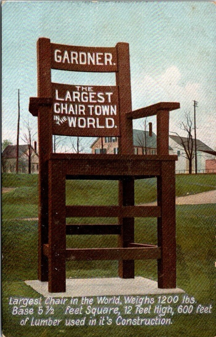
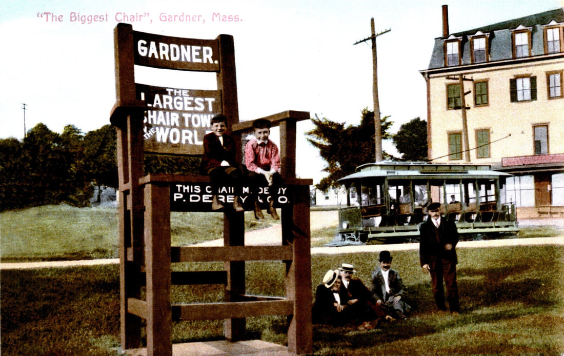
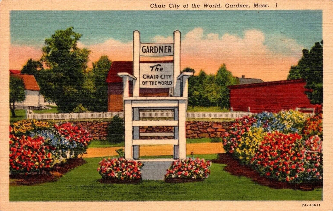
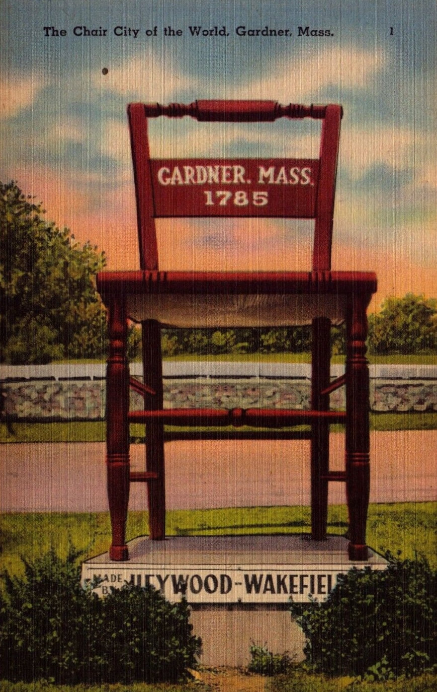
OK. It seems like the best place to start with is The Big Chair because Gardner is known as the Chair Capital of The World. This was probably true at some point but mass chair manufacturing has gone by the wayside. The name has stuck.

|
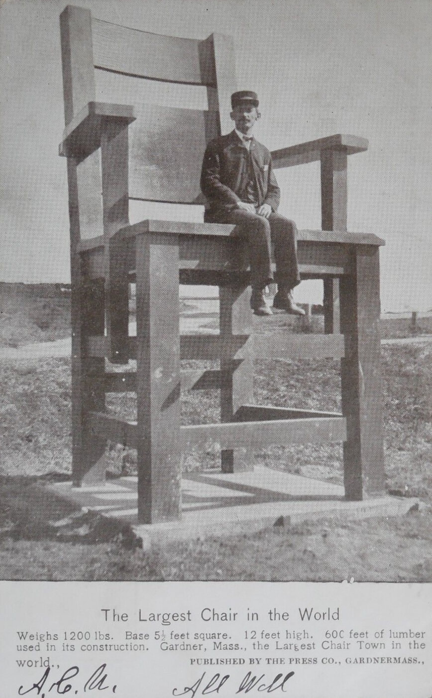
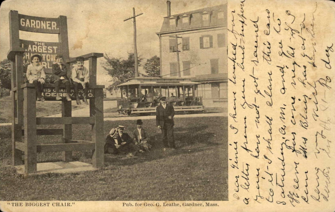
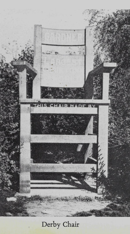
1. Unknown date - The image of the Derby Chair appears to be the earliest as it has no wording on it while the second does.
2. Unknown date
3. c1910
4. c1910 - Same picture as #3 except, curiously, the left-most boy was removed from the photo so that the words on the chair's back can be read.
5. Date unknown - The same chair amongst the weeds. This chair was at the train station for a time until 1935.
6. 1938 - The white chair in the postcard doesn't seem to be real but a doctored version of the Derby Chair.
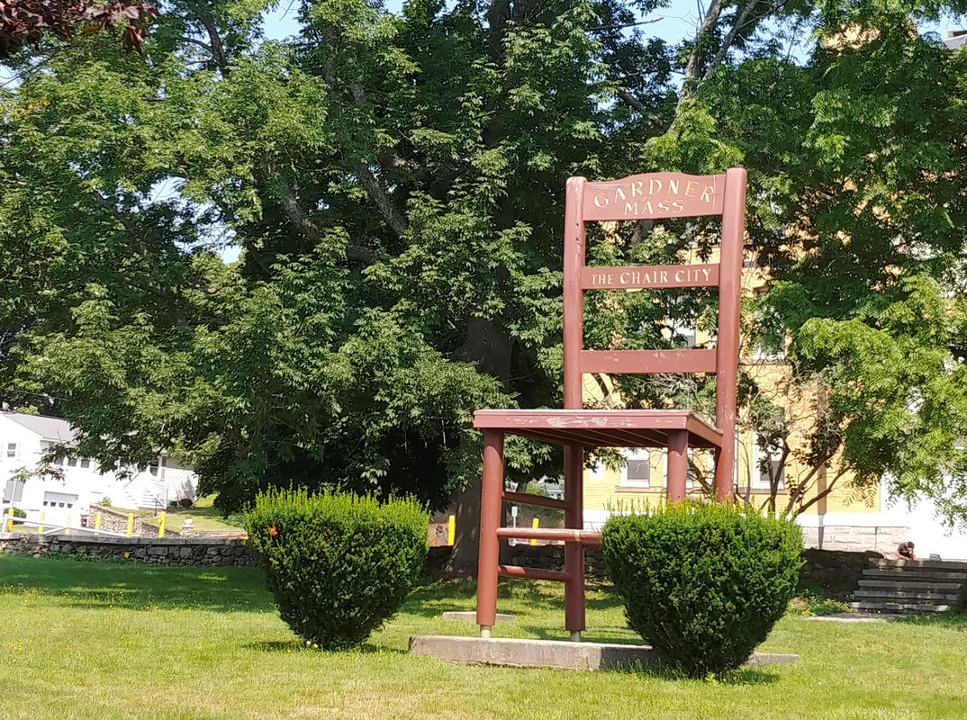
7. 1943 - The one made by Heywood-Wakefield was built in 1935. The Heywood-Wakefield chair spent some time on West Broadway and then moved to the old Gardner Center onto the empty Seth Heywood lot in 1962 because Route 2 was being built where the chair was situated. Check out the chair story at Gardner Magazine.
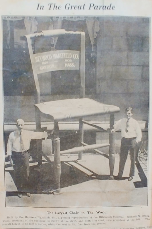
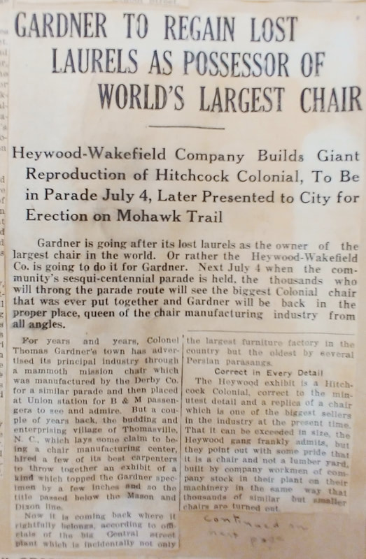
8 & 9. 1935 - A newspaper article and accompanying picture from Reference 24 celebrating Gardner's Sesquicentennial.
2. Unknown date
3. c1910
4. c1910 - Same picture as #3 except, curiously, the left-most boy was removed from the photo so that the words on the chair's back can be read.
5. Date unknown - The same chair amongst the weeds. This chair was at the train station for a time until 1935.
6. 1938 - The white chair in the postcard doesn't seem to be real but a doctored version of the Derby Chair.
7. 1943 - The one made by Heywood-Wakefield was built in 1935. The Heywood-Wakefield chair spent some time on West Broadway and then moved to the old Gardner Center onto the empty Seth Heywood lot in 1962 because Route 2 was being built where the chair was situated. Check out the chair story at Gardner Magazine.
8 & 9. 1935 - A newspaper article and accompanying picture from Reference 24 celebrating Gardner's Sesquicentennial.
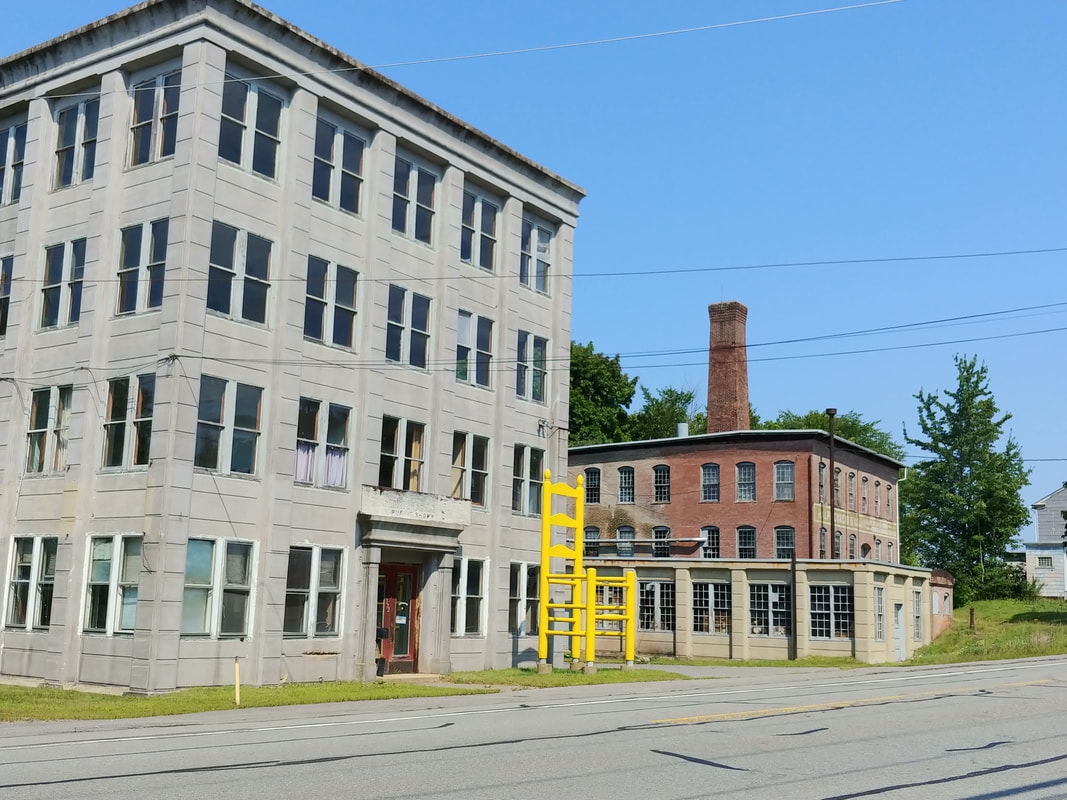
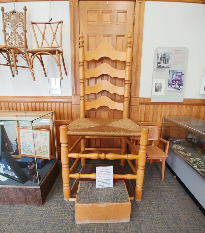
At least three other chairs are on display in modern day Gardner. One is in front of the building at 130 Elm Street (made 1976) called the Bicenttenial Chair made by Leon LaPlante. The second is the yellow one at 372 E. Broadway. The predecessor to the yellow chair was built c1938 by Ralph Curio and as far as I can tell it looked the same, only not yellow. It was destroyed by a truck in 1989 and replaced by Ralph's son Leonard and crafted by Leon Laplante (ref. 29). The beautiful one in the third picture is at the Gardner Museum. It was made by Ralph Curio who, by the way, had his business in the brick building seen in the second photo. There is also a large chair inside City Hall, details unknown, but it has moved to the auditorium and I probably won't get a picture.

|
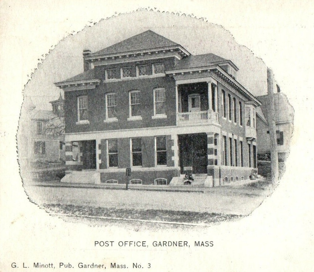
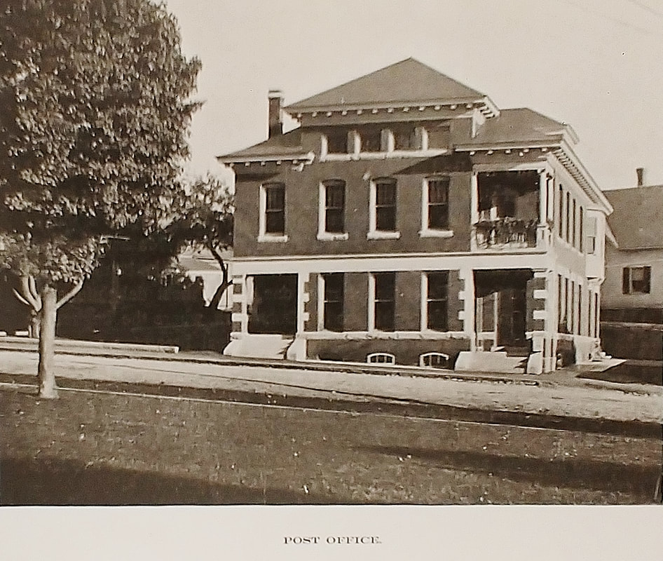

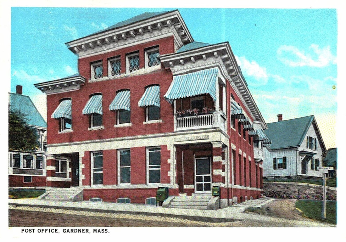
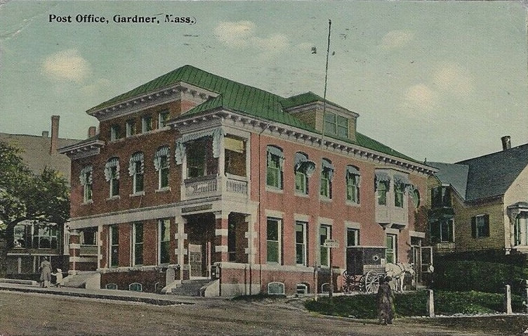
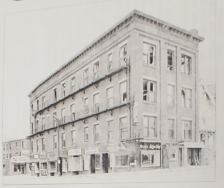
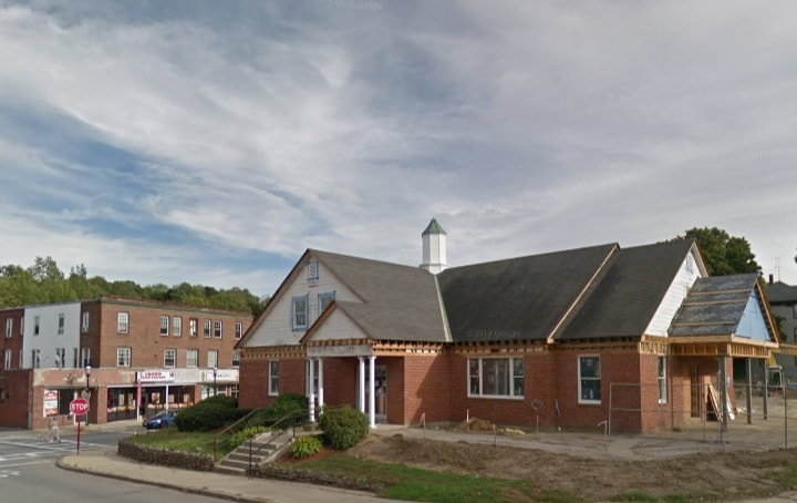
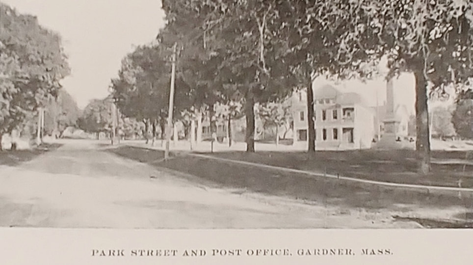
The old post office is located at 144 Central Street. The images are from 1898, c1903, 1913, and 1925.
 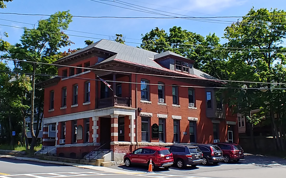 |
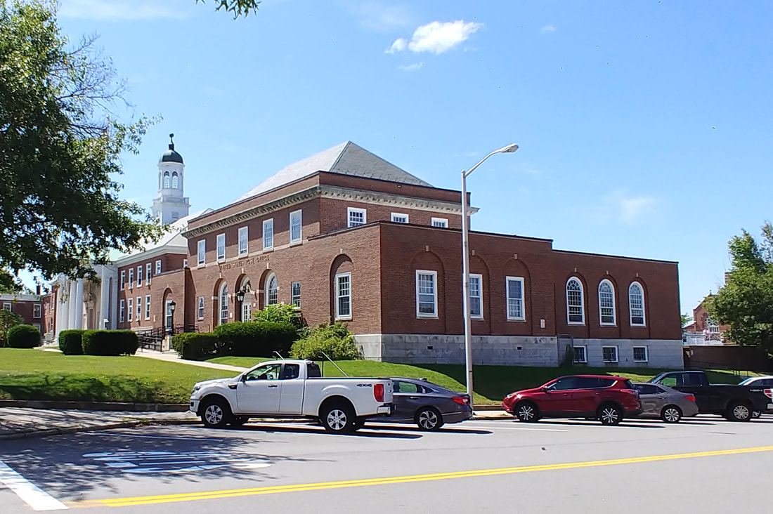
Not too much has changed on the old Post Office except that the building is now occupied by the Fick Law Group.
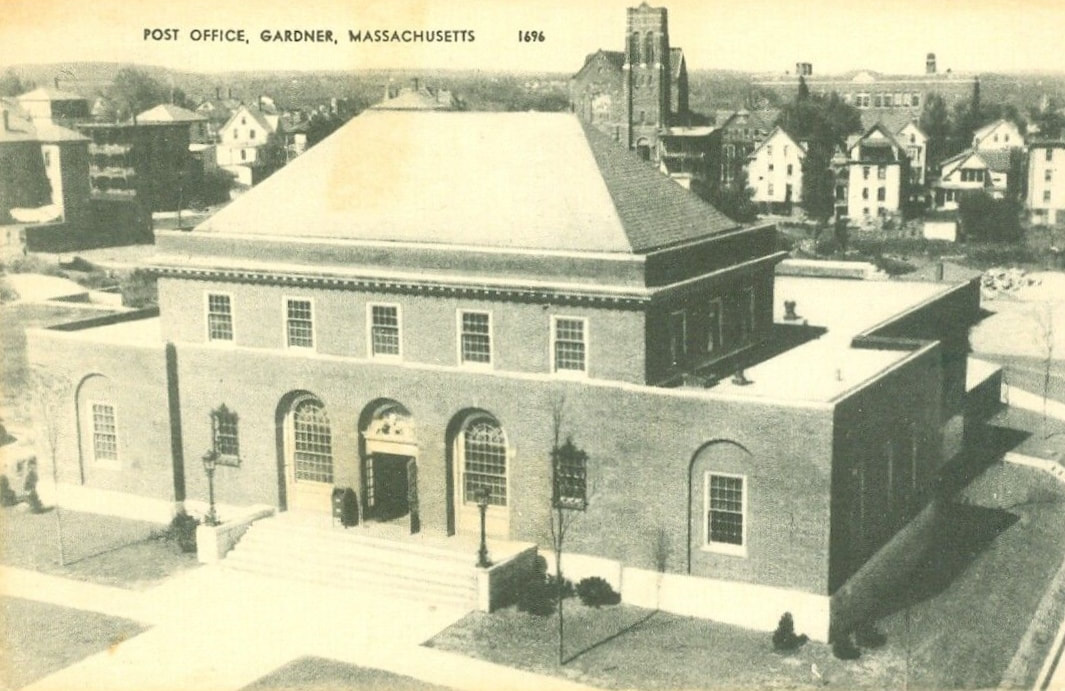
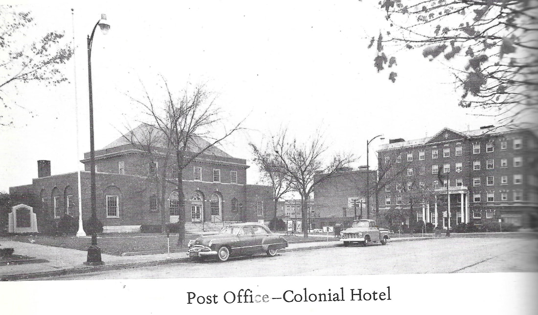
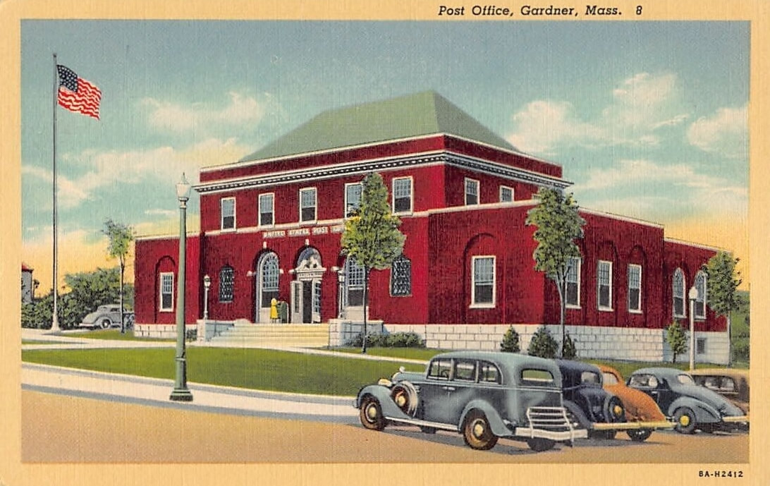
The current Post Office is located at 69 Pleasant Street. The first image is from c1947 but the second is from an unknown time. I would guess roughly the same time. Note the Holy Rosary Church in the background. The third picture is from 1967 (ref. 20) and you can see its relation to the Colonial Hotel.
  |
Not exactly the same vantage point but close enough. Lots of trees made taking the actual vantage point picture pointless so I moved over a bit. This image is what you see when you are standing in front of the Colonial Hotel (now Apartments).
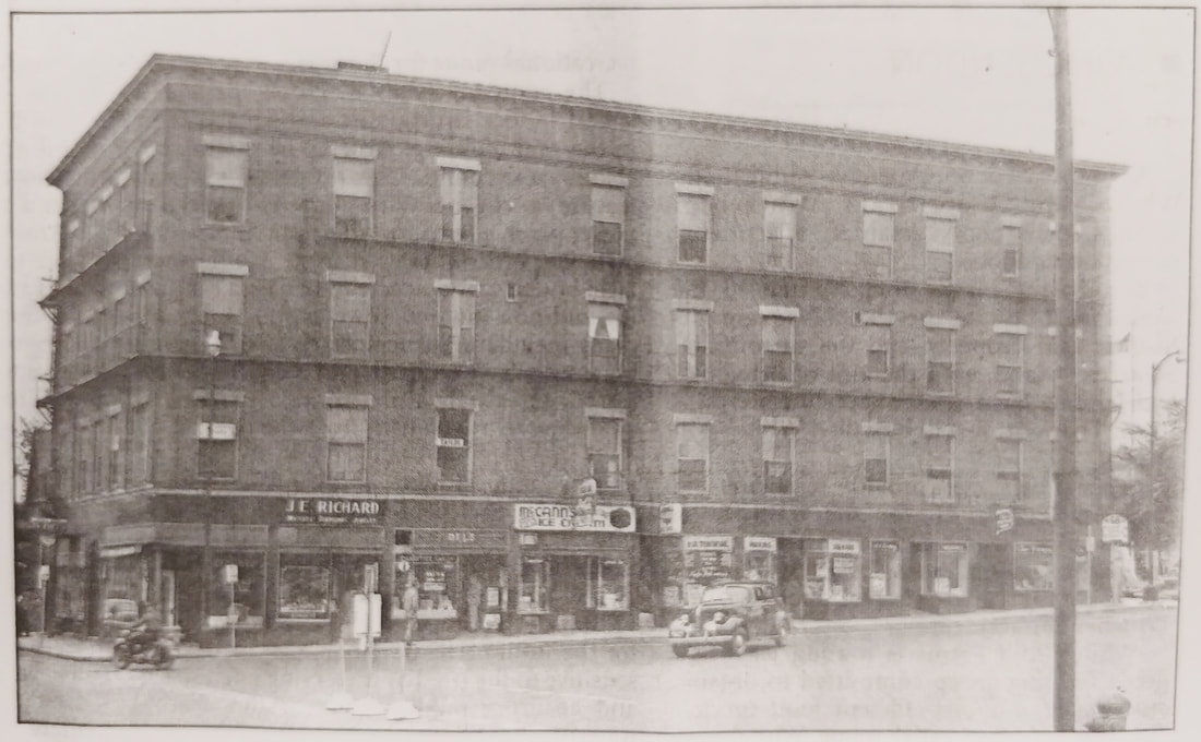
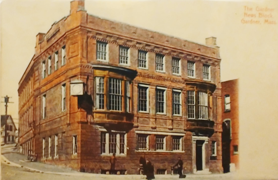
I am putting these two old pictures (ref. 29) here only because this building was referred to as the Post Office Block. Why it was called that makes me scratch my head because there was an Old and a New Post Office that were used presumably one right after the other so why would you call this the Post Office Block? Maybe because the actual Post Office was across the street on Pleasant Street and they had to name it something??? Anyway, it seems to have been built between c1912 and was there to at least 1940. I believe I read that it burned down. In its place is Fidelity Bank today. The first map it appeared on in 1914 had it labeled with Lock-Up, Office, Police Court Room, Public Hall, Tailor, and Candy Kitchen so it had various uses. Per the directories it was called the Court House Building & Court House Block up until 1929, Casino Hall from 1930-1937, and the Post Office Block after that. Early pictures suggest to me that these were all the same building.

|
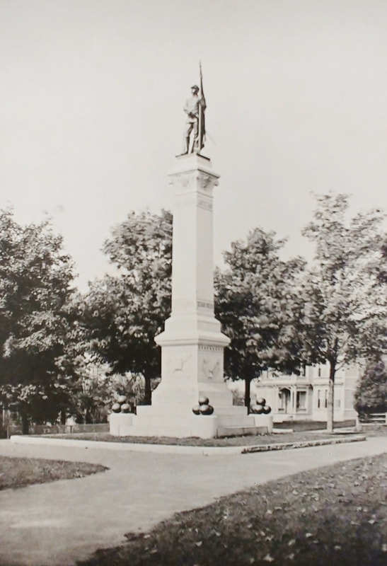
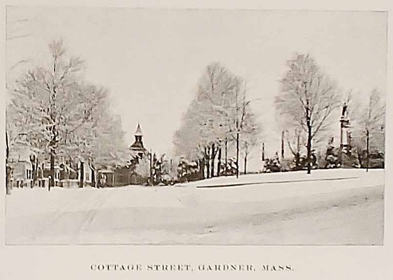
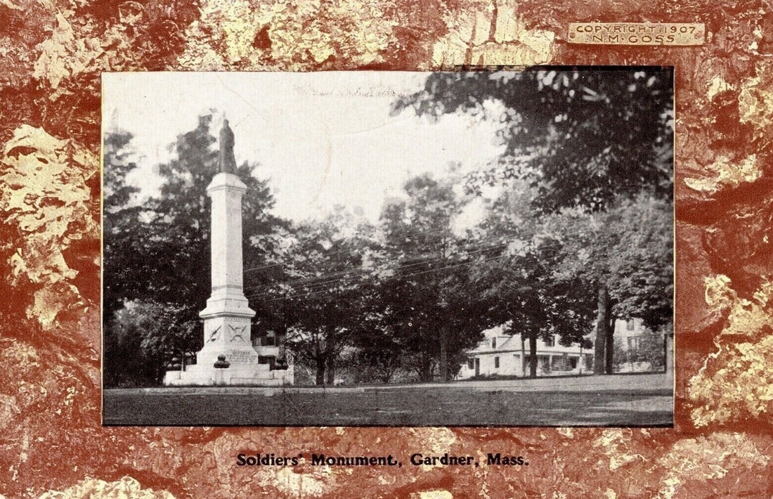
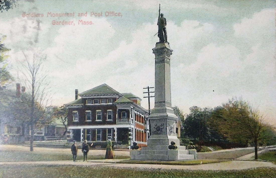
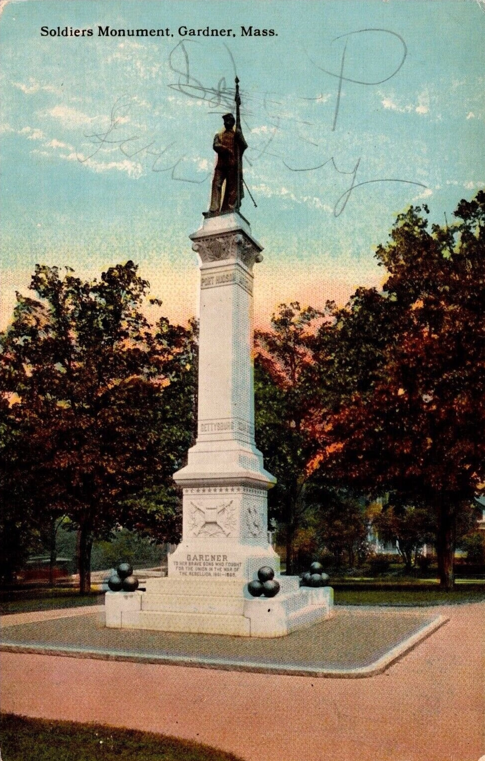
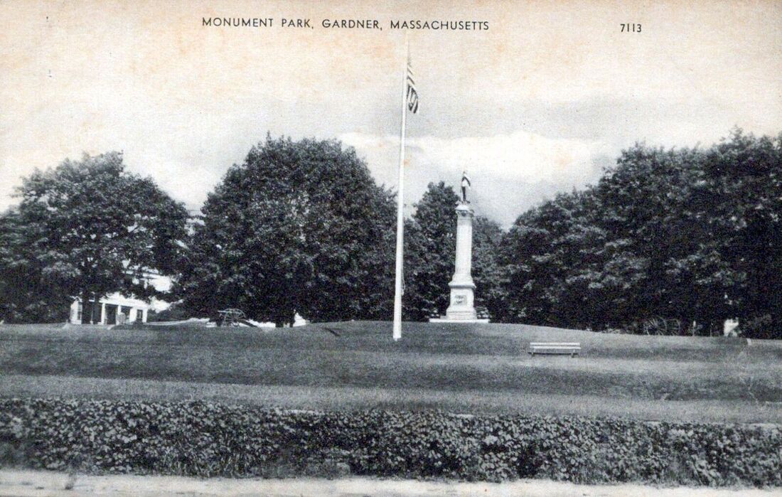
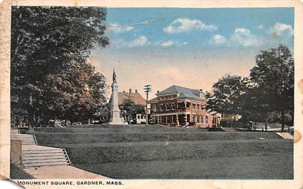
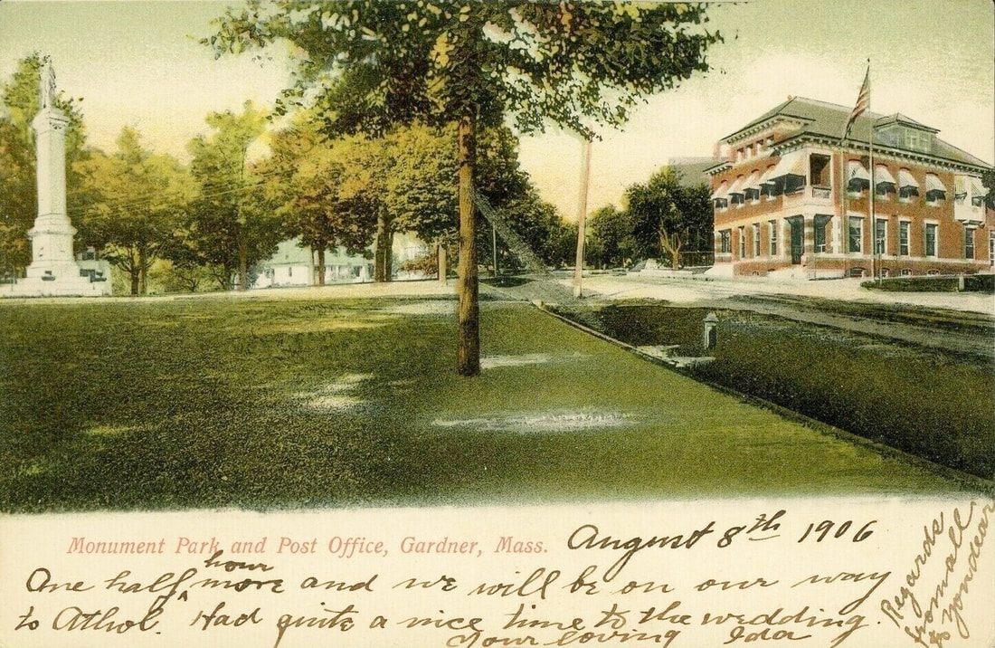
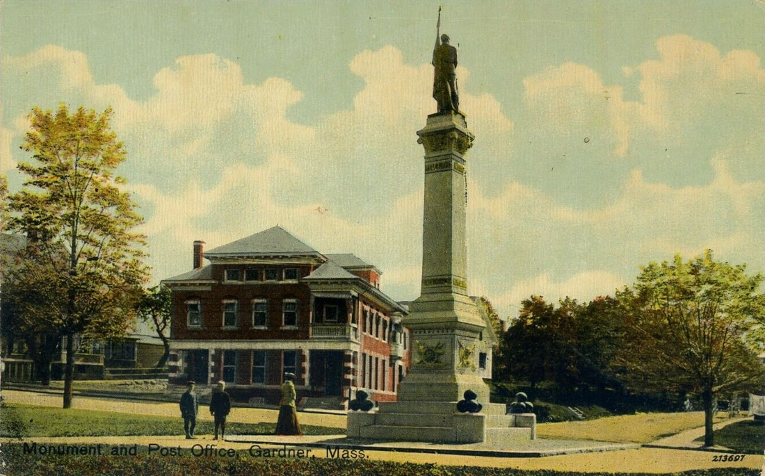
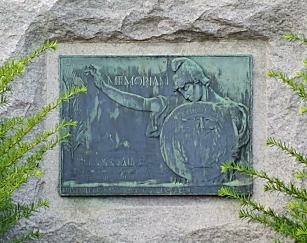
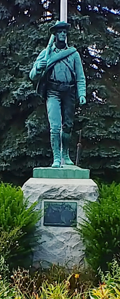
This Civil War Memorial is located in Monument Park which is a triangular park bordered by Cottage, Park, and Central Streets.
1. 1889 - (ref. 22, page 12)
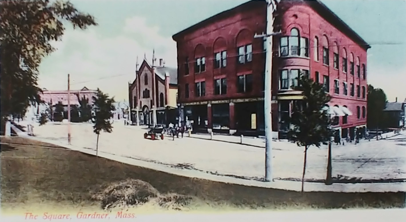
2 & 3. c1903 - (ref. 10). Technically Street Views, I put them here because they are taken around Monument Park and you actually can see the monument in both. The tall building in the third picture is unknown. It looks like back in 1898 Cottage Street used to point north and Monument Park was smaller because of it. In modern maps it points a little northwest, paralleling the railroad tracks that used to run by the Heywood buildings. So, the view from c1903 is probably pointing north to where the Elks is located and not toward the empty parking lot next to it. The Elks does not have a pointy top so either it's a different building or it lost its top. Cottage Street was altered some time from 1909-1914 to enlarge the park.
4. 1906 - It is taken from Cottage Street and shows the Old Post Office (see above).
5. c1907 - It is taken from Central Street while standing in front of the Post Office.
6. 1909 - Taken from the Park Street side of the park.
7. Early 1900s - Also taken from in front of the Post Office.
8. Unknown date - View from Cottage Street or possibly taken from in front of the bandstand.
9. Unknown date - Taken from on the park grounds near the bandstand.
1. 1889 - (ref. 22, page 12)
2 & 3. c1903 - (ref. 10). Technically Street Views, I put them here because they are taken around Monument Park and you actually can see the monument in both. The tall building in the third picture is unknown. It looks like back in 1898 Cottage Street used to point north and Monument Park was smaller because of it. In modern maps it points a little northwest, paralleling the railroad tracks that used to run by the Heywood buildings. So, the view from c1903 is probably pointing north to where the Elks is located and not toward the empty parking lot next to it. The Elks does not have a pointy top so either it's a different building or it lost its top. Cottage Street was altered some time from 1909-1914 to enlarge the park.
4. 1906 - It is taken from Cottage Street and shows the Old Post Office (see above).
5. c1907 - It is taken from Central Street while standing in front of the Post Office.
6. 1909 - Taken from the Park Street side of the park.
7. Early 1900s - Also taken from in front of the Post Office.
8. Unknown date - View from Cottage Street or possibly taken from in front of the bandstand.
9. Unknown date - Taken from on the park grounds near the bandstand.
 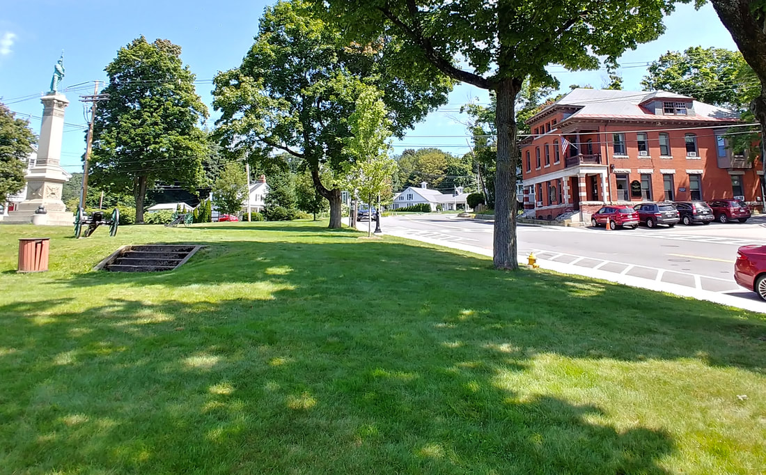 |
The view of the memorial and old Post Office is very similar today except that there are now some steps in the park. Note that the fire hydrant is still there, too.
 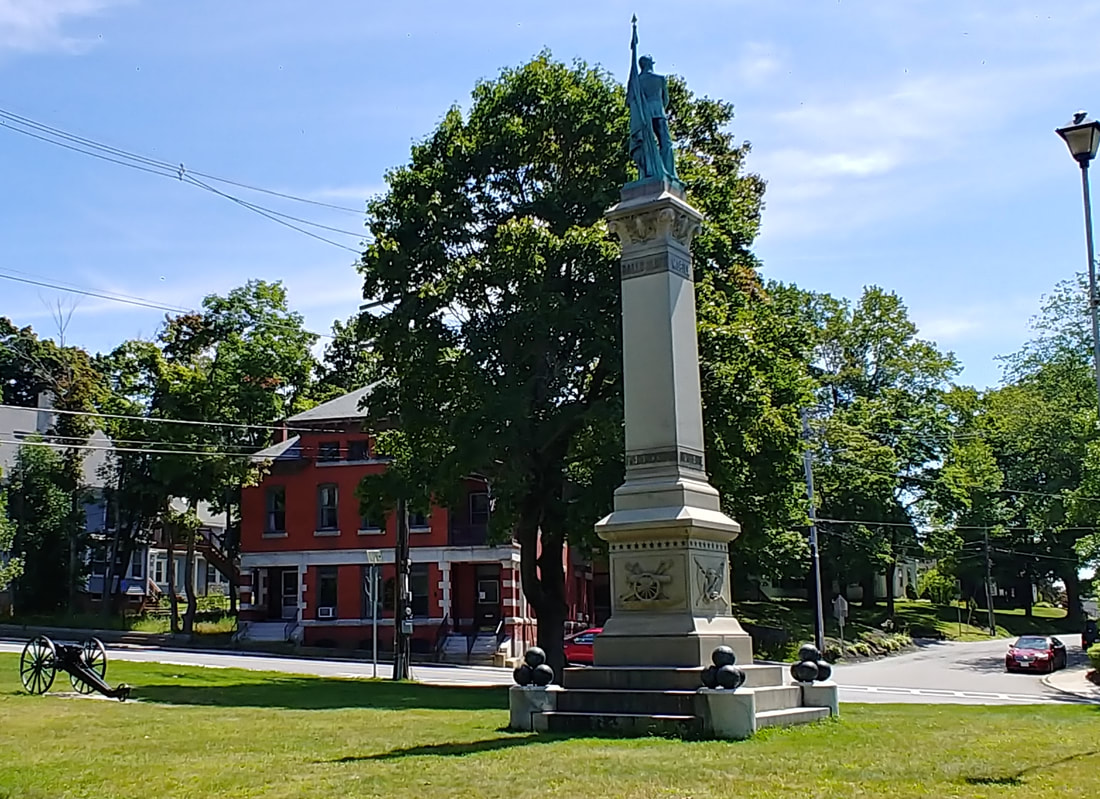 |
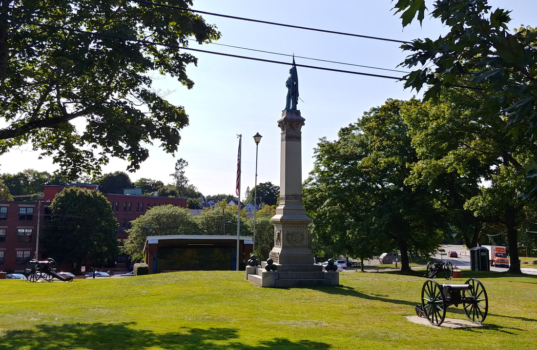
Today's view is also very similar to the old one. The house to the left is still around. The walkway around the monument and the base appear to have been grown over by grass. There are some cool canons around the park now. The view below gives a different angle from 2023. Reference 2 has some history about this monument on page 58.
|
|
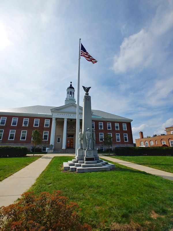
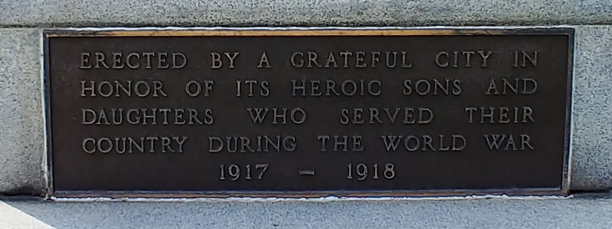
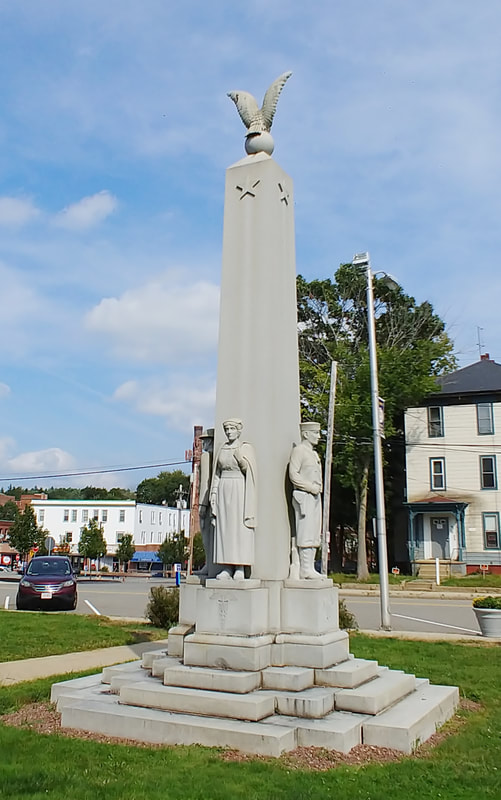
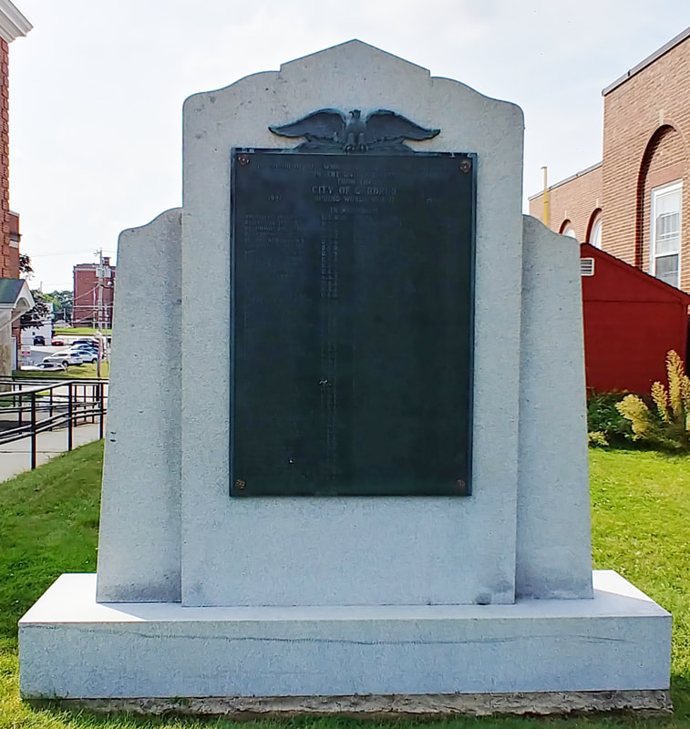
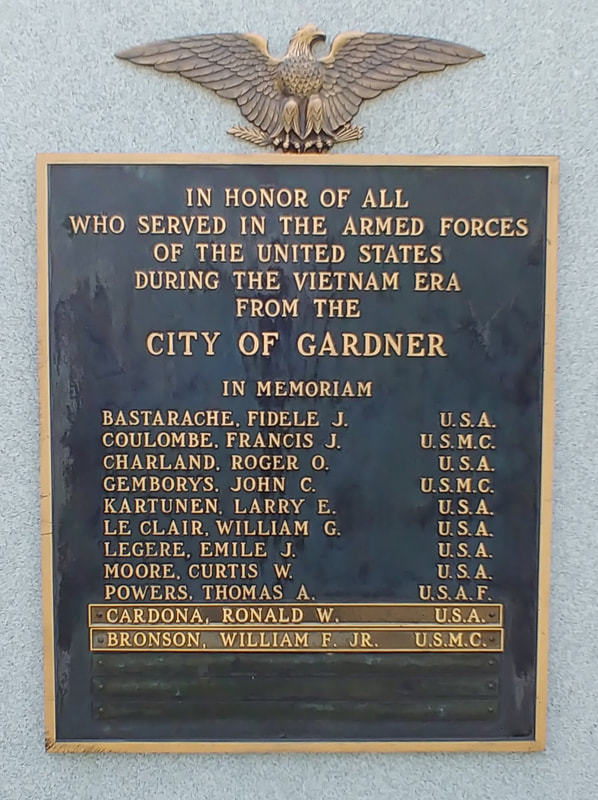
All of the above are in front of or near the City Hall.
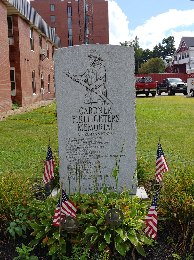
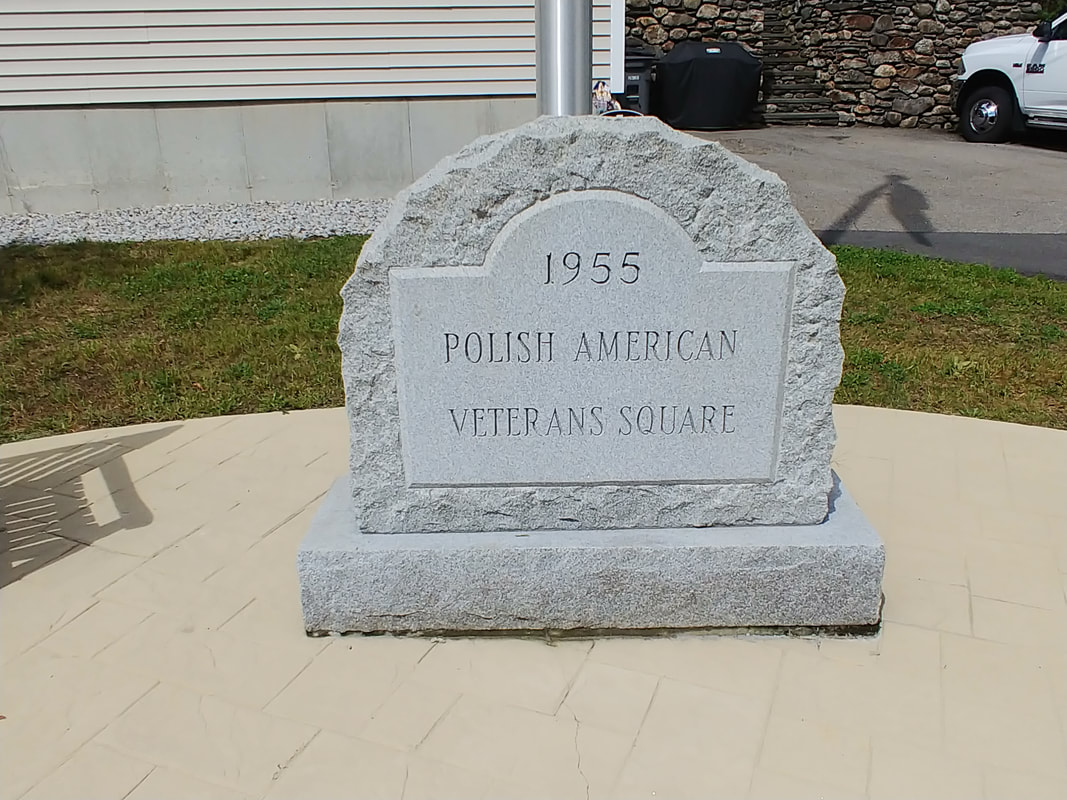
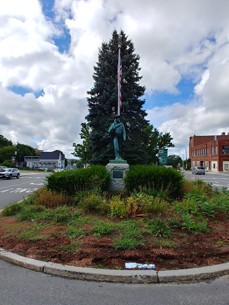
The Firefighters Memorial is in front of the Gardner Fire Headquarters at 70 City Hall Avenue. The Polish America Veteran's Square is on the corner of Greenwood and Pleasant Street. The Spanish-American War Monument is at Lafayette Square which is bordered by West, Oak, and Parker Streets. It is also referred to as the USS Maine and Veterans Monument. The statue was made from metal from the sunken USS Maine.

|
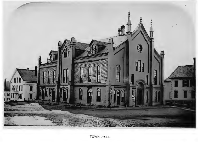
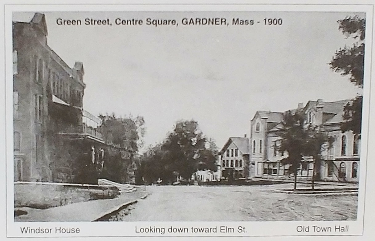
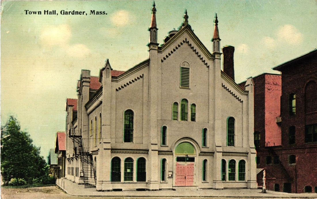
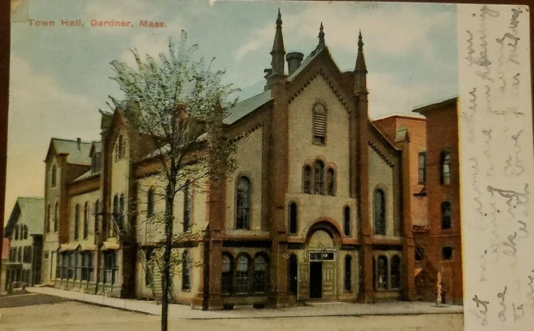
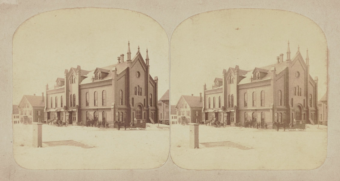
1. 1878 - The earliest image for the Town Hall is from 1878 (ref. 1) though it was built in 1859. Prior to this, business town was conducted in the Congregational church across the way.
2. 1889 - (ref. 22, page 10)
3. 1900 - The image (ref. 13, page42) doesn't show the town hall too well (right) but this image looking down Elm Street compares to the fourth one. You can see the Windsor Hotel on the left so the vantage point is from Green Street.
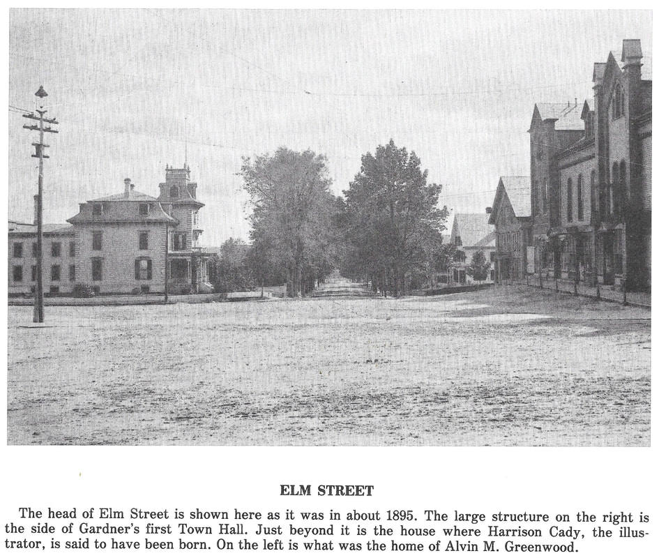
4. c1903 - The image is supposedly from c1895 (ref. 2, page 37) and it's taken from about the island you see in the third one. Although it also doesn't show too much of the Town Hall you get a good view of what's near it. The house is attributed to Alvin M Greenwood but it was originally his father-in-law Levi Heywood's place. The fact that there is a telephone pole on the corner leads me to believe the picture is closer to 1903.
4a. 1889 - (ref. 22, page 9) - Image 4a gives you a closer view of the Levi Heywood house.
5. c1903 - (ref 10).
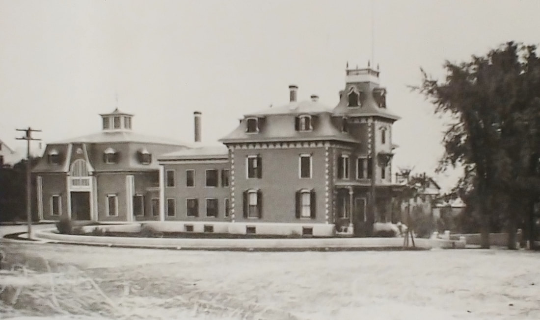
6. c1905 - Note that the Town Hall has a new red brick building next to it.
7. c1906
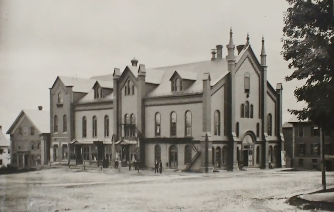
8. 1906 - This one shows the building from further away. This spot is located at the northern end of Elm Street where a Elm, Central, Pearl, and Green Street come together. The 1906 picture is likely taken from the lawn of the First Congregational Church. You can see the Windsor House all the way on the left.
9. 1907
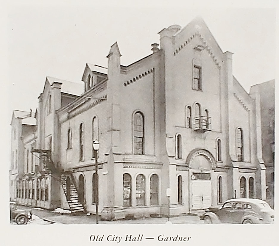
10. Early 1940s - At this point it was probably known as City Hall, Gardner having become a city in 1923. By this point the new City Hall was being used for city business and this building was not.
11. Stereoscopic View - Unknown date
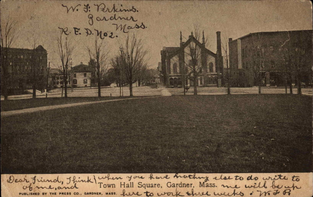
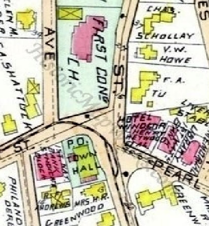
12. The area shown on the 1898 map used to be the "center" of Gardner. You can see the orientation of the various buildings. The Old Burial Ground where many of the original Gardner settlers are buried is just north of the First Congregational Church. The Town Hall is on the bottom and the Windsor House (Hotel Windsor) is to the right.
2. 1889 - (ref. 22, page 10)
3. 1900 - The image (ref. 13, page42) doesn't show the town hall too well (right) but this image looking down Elm Street compares to the fourth one. You can see the Windsor Hotel on the left so the vantage point is from Green Street.
4. c1903 - The image is supposedly from c1895 (ref. 2, page 37) and it's taken from about the island you see in the third one. Although it also doesn't show too much of the Town Hall you get a good view of what's near it. The house is attributed to Alvin M Greenwood but it was originally his father-in-law Levi Heywood's place. The fact that there is a telephone pole on the corner leads me to believe the picture is closer to 1903.
4a. 1889 - (ref. 22, page 9) - Image 4a gives you a closer view of the Levi Heywood house.
5. c1903 - (ref 10).
6. c1905 - Note that the Town Hall has a new red brick building next to it.
7. c1906
8. 1906 - This one shows the building from further away. This spot is located at the northern end of Elm Street where a Elm, Central, Pearl, and Green Street come together. The 1906 picture is likely taken from the lawn of the First Congregational Church. You can see the Windsor House all the way on the left.
9. 1907
10. Early 1940s - At this point it was probably known as City Hall, Gardner having become a city in 1923. By this point the new City Hall was being used for city business and this building was not.
11. Stereoscopic View - Unknown date
12. The area shown on the 1898 map used to be the "center" of Gardner. You can see the orientation of the various buildings. The Old Burial Ground where many of the original Gardner settlers are buried is just north of the First Congregational Church. The Town Hall is on the bottom and the Windsor House (Hotel Windsor) is to the right.
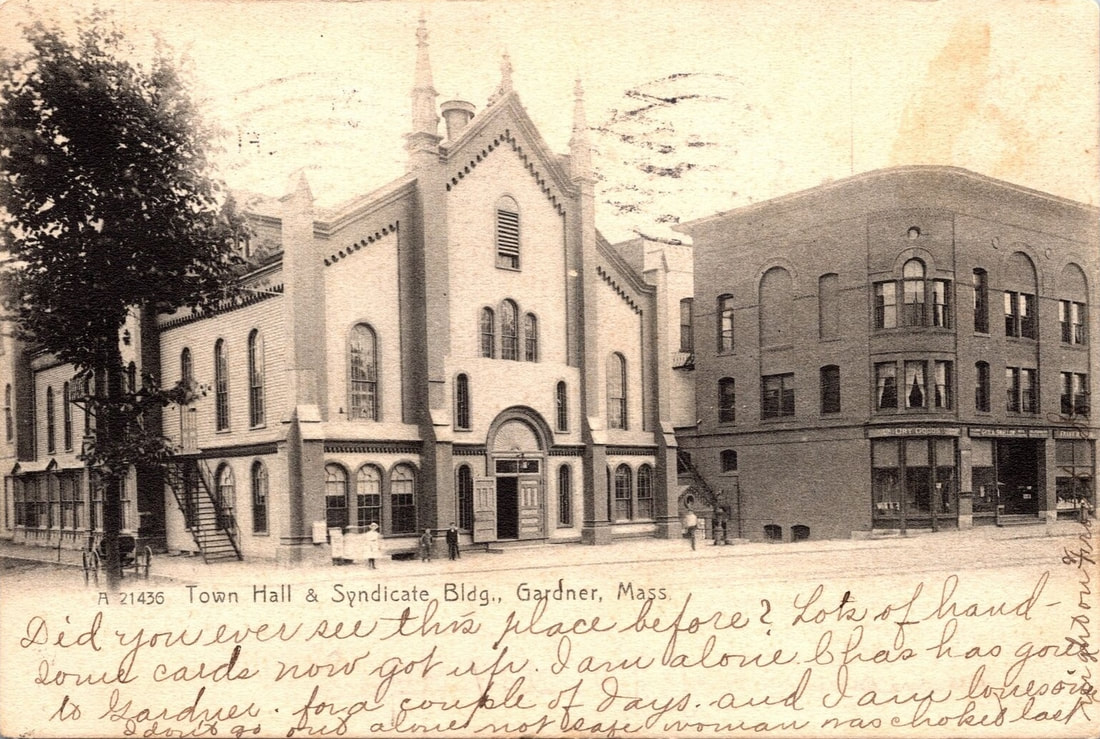 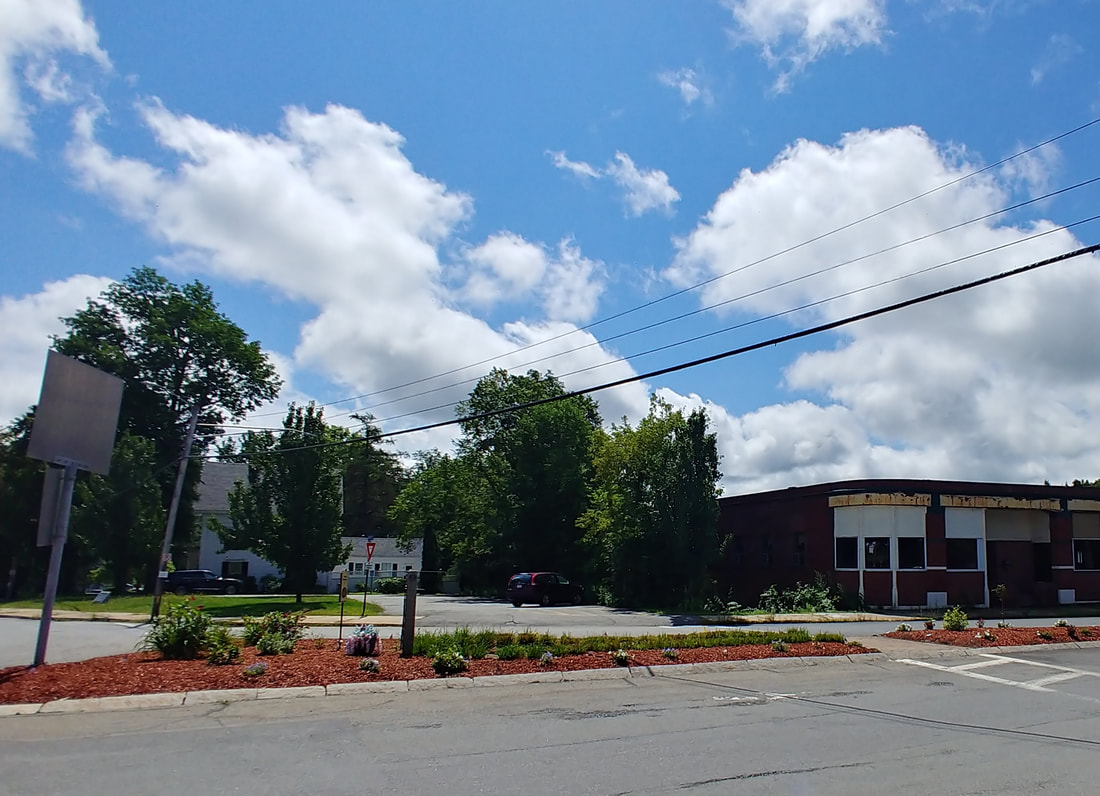 |
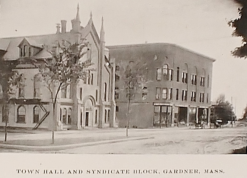
The Town Hall burned down and left an empty lot and the plaque below is now on that lot. Reference 2 has some history about the spot on page 38. The building next to it at 6 Chestnut Street, called the Syndicate Block, had a fire in 1982 and ended up becoming a single story establishment.
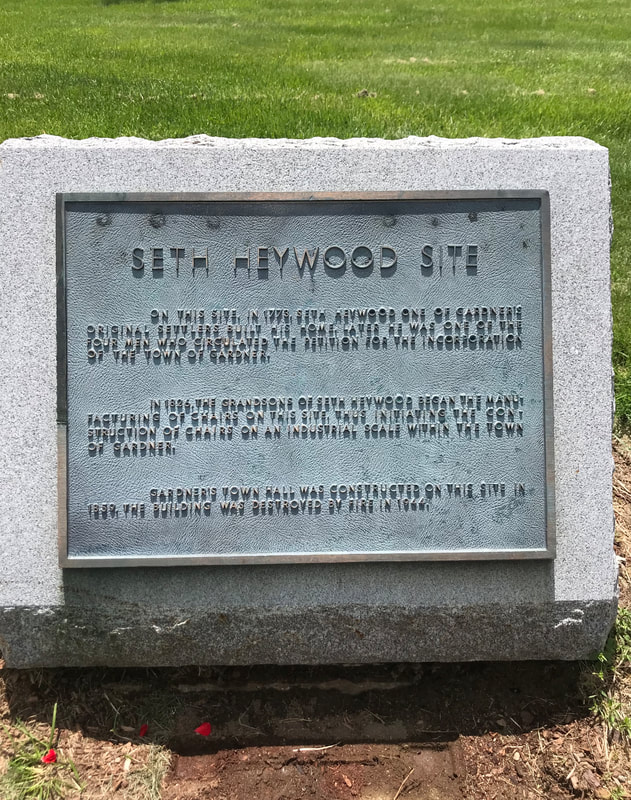

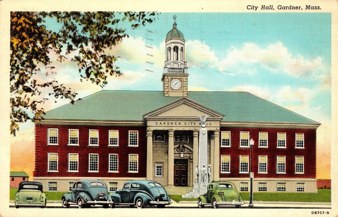
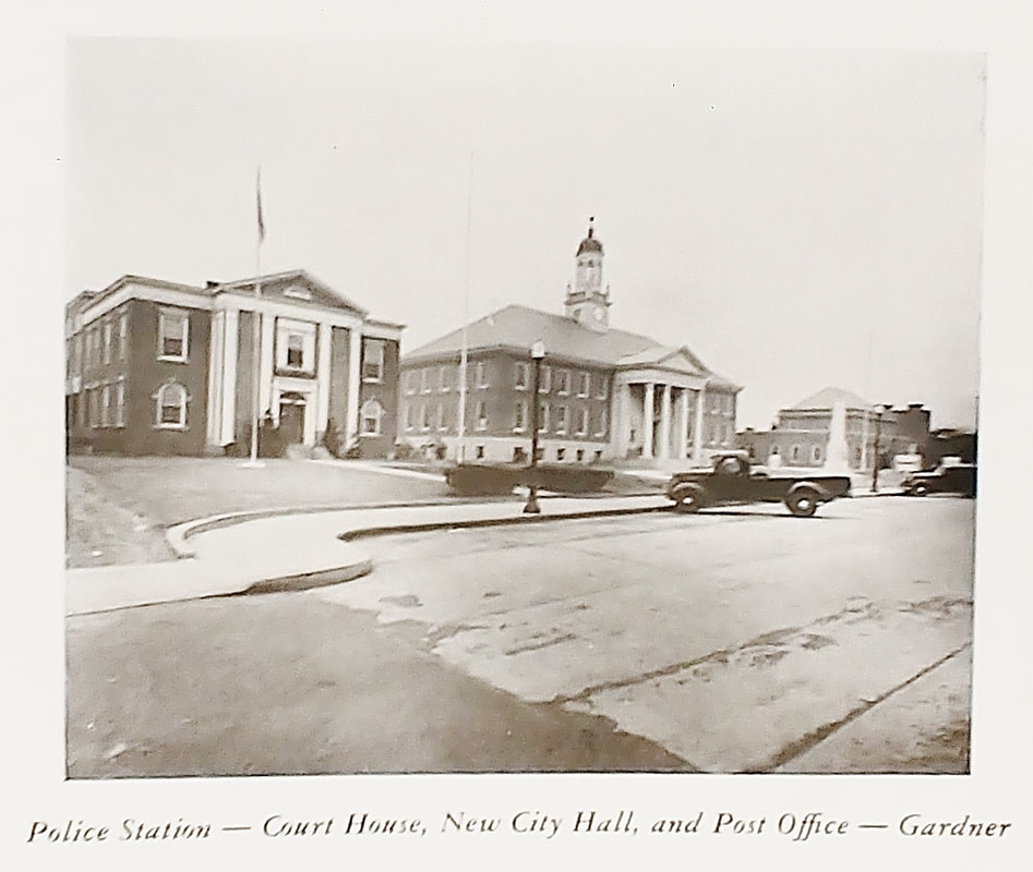
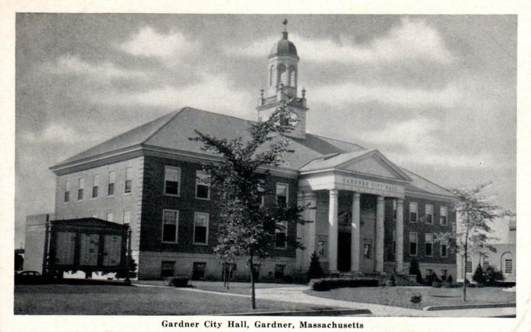
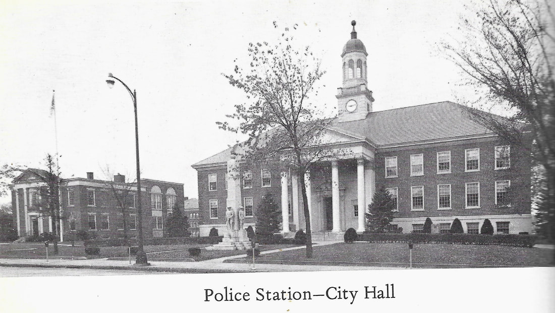
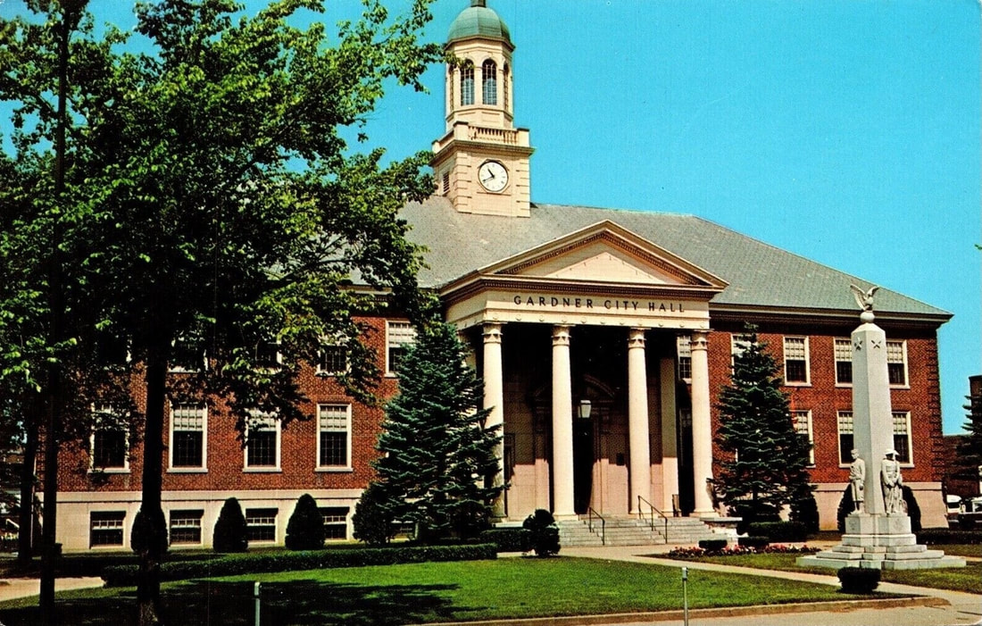
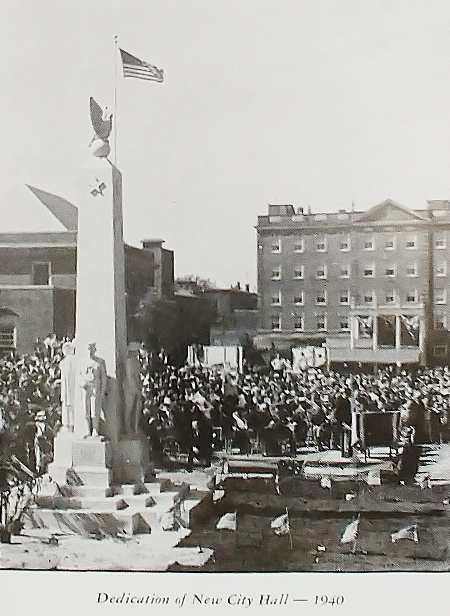
In 1923 Gardner became a City and the new City Hall was built in 1940 and the dedication is shown in the first photo (ref. 12). The second image, an artist's take on it, is from c1941. The third is from 1948 (ref. 12) and it also shows the Police Station/Court House (left) and Post Office (right). The others are from the 1950s (guess), 1967 (ref. 20), and the 1970s (guess).
 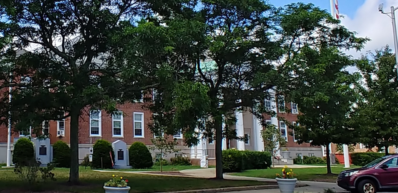 |
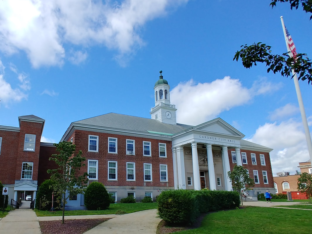
The picture from 2023 shows the City Hall is much the same although there is now quite the growth of trees in front of it. Although it may have been dedicated in 1940 its cornerstone says 1938. The location was being prepped for a new City Hall, Police, Station, and Post Office as far back as 1920. The alternate view below of City Hall was taken where there were no trees blocking the view.

|
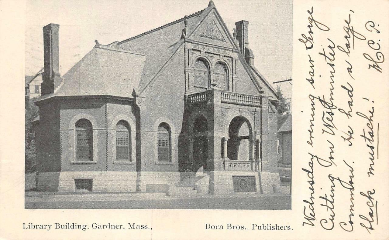
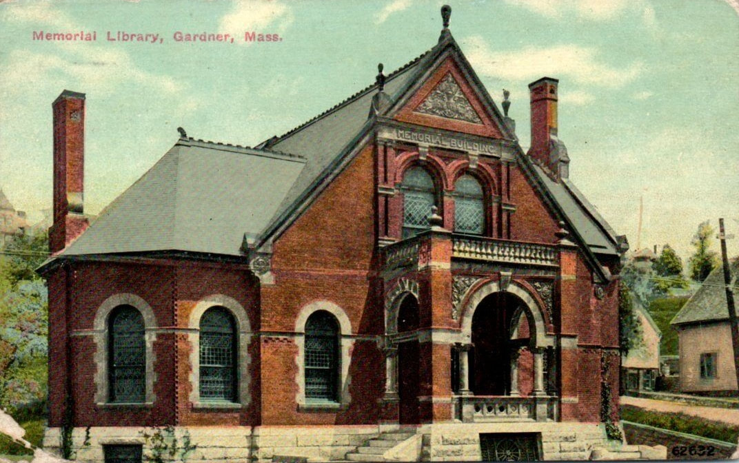
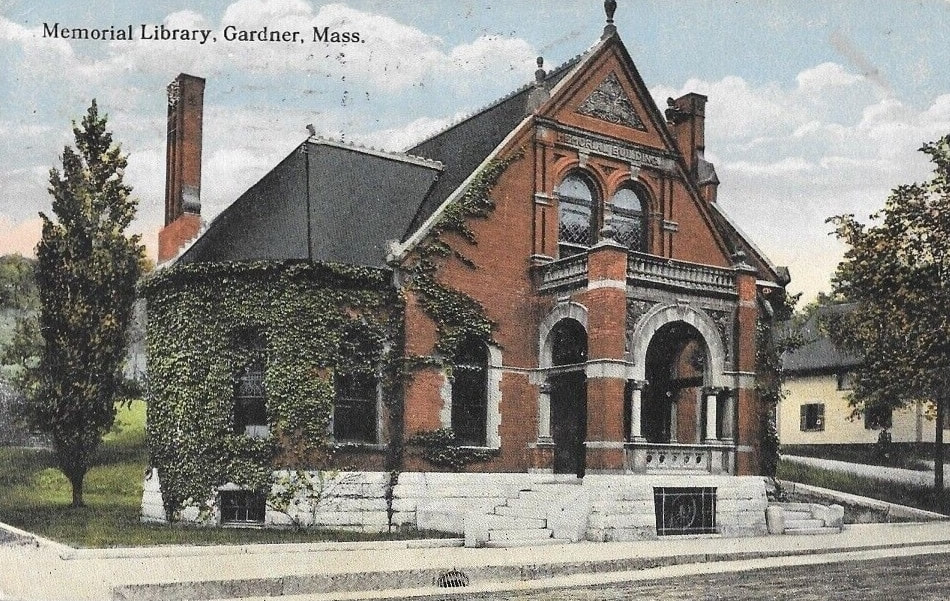
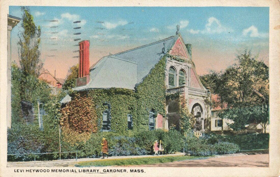
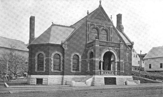
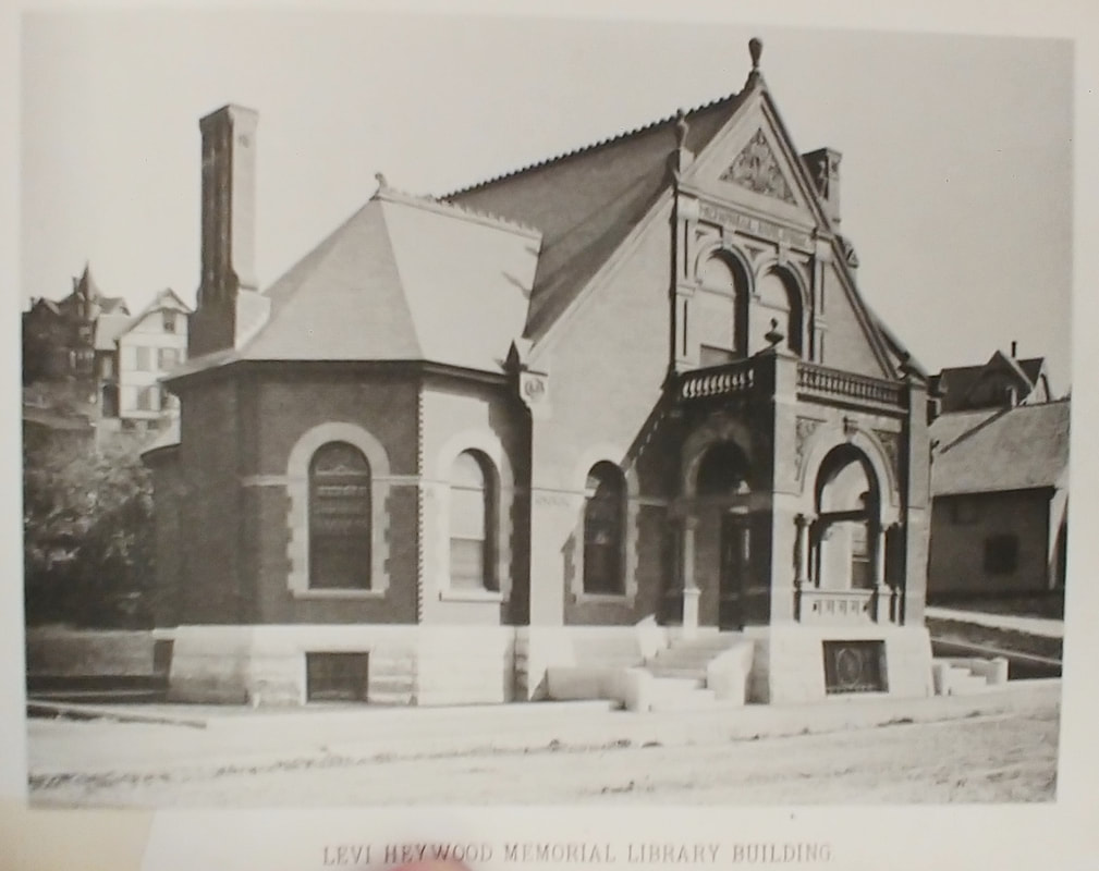
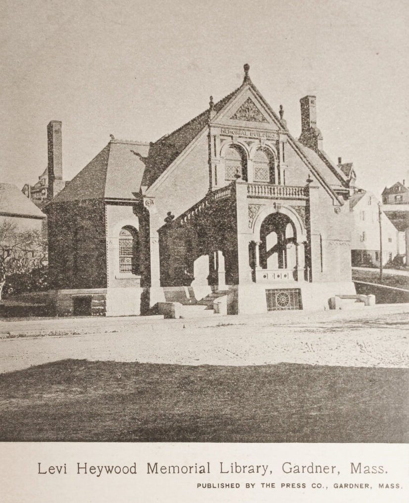
Originally known as the Heywood Memorial Library. The first photo is from 1906 although the library was finished in 1886. The next two are probably from about the same time. In the fourth one from 1916 you can see some ivy growing. The fifth one shows the ivy covering a lot of the building while there are bushes out front. The trees are not too much taller so this may be from the 1920s. It may be a bit enhanced by an artist as the vegetation is excessive. The sixth one is from an unknown time but probably from the same period as the 2nd and 3rd. Photo 7 is from 1889 (ref. 22, page 8).
 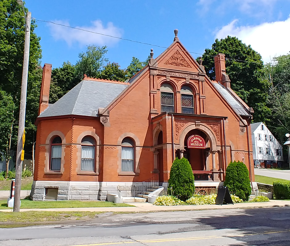 |
The 2023 photo shows that the building is now the Gardner Museum at 28 Pearl Street. It was used as a library until 1978. The new library below was built in 1998 at 55 West Lynde Street, near where the Heywood factory buildings are. At that time, the branches were consolidated into the one building.

|
|
|
Above text taken from ref. 1, pages 455-457.
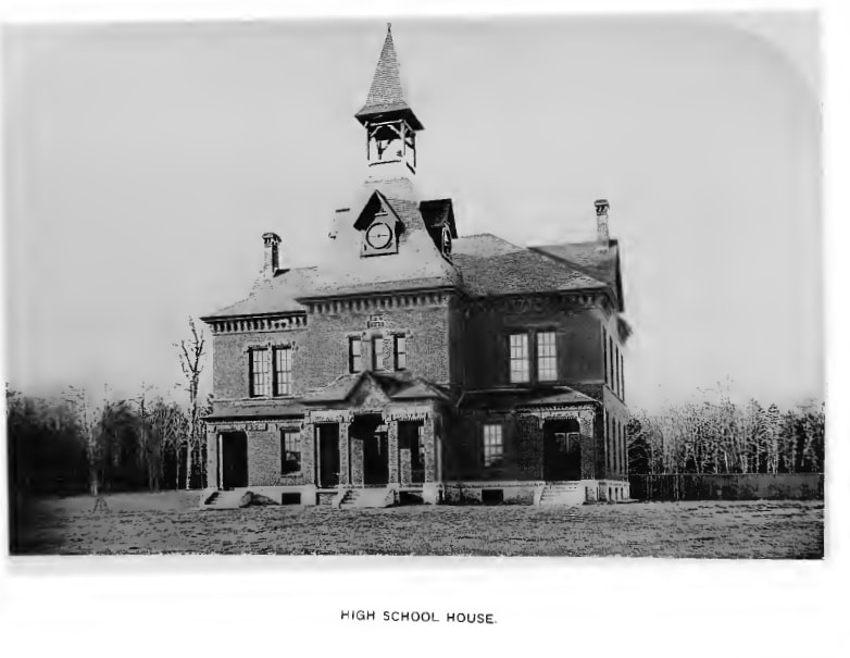 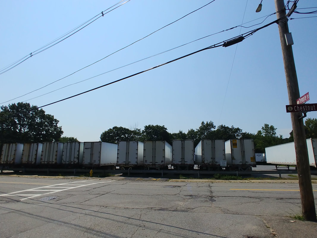 |
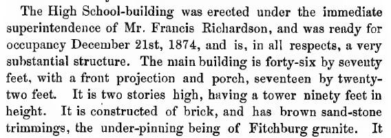
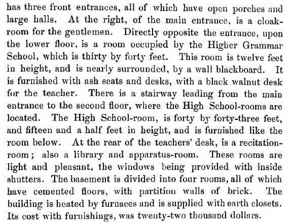
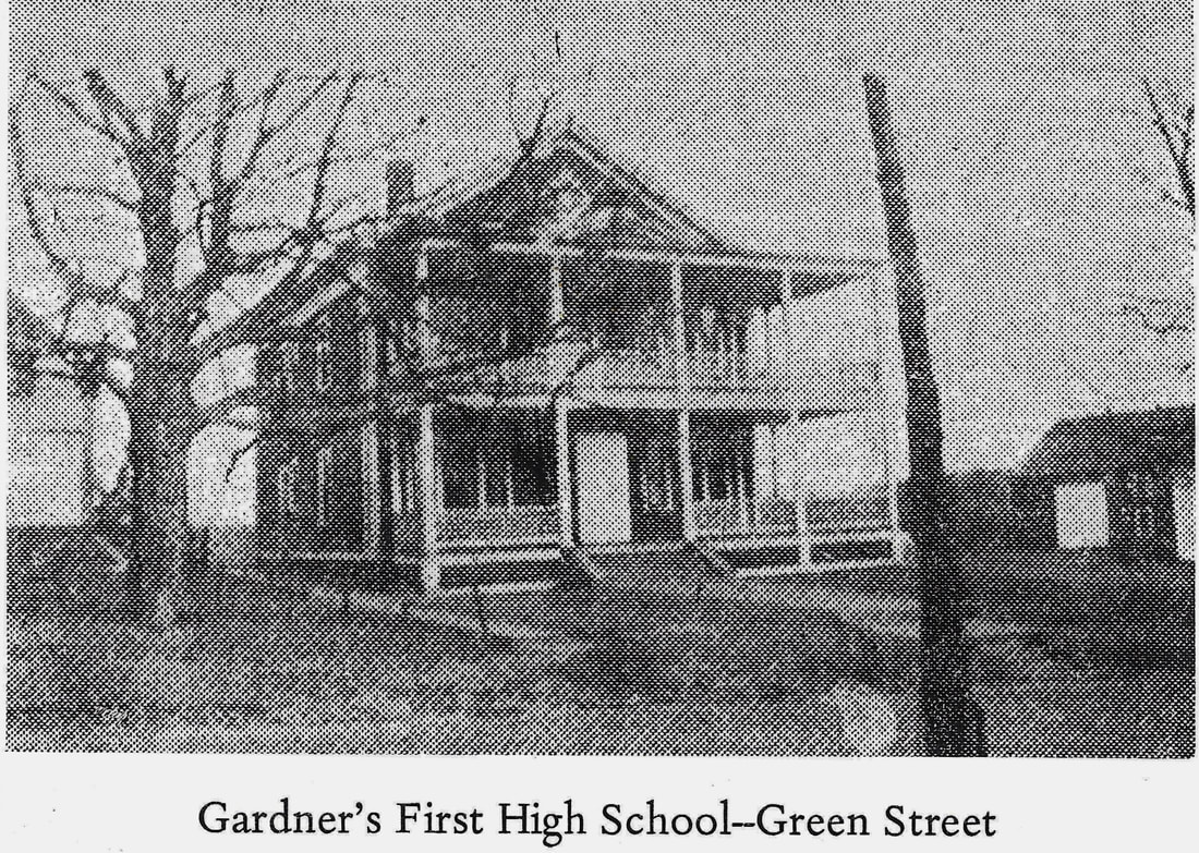
The original "High School House" was elaborate and house-like. It was built on land at the corner of Logan and Chestnut Street. The old picture is from 1878 (ref. 1). As can be seen by the 2023 picture, the building is no longer there and in its place is a parking lot filled with trailers. A "newer" photo from 1889 (ref 22., page 17) is shown below in the first picture and the second is from 1897 (ref. 29).
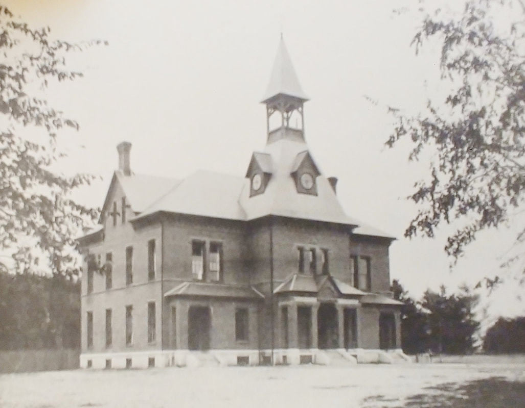
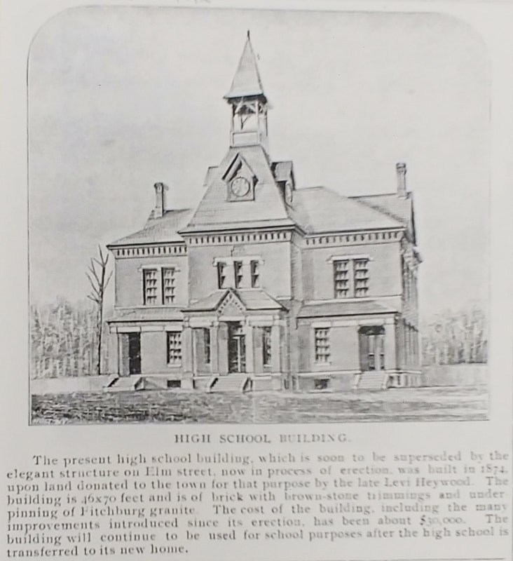
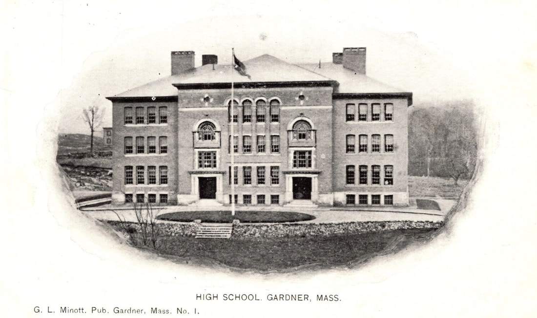
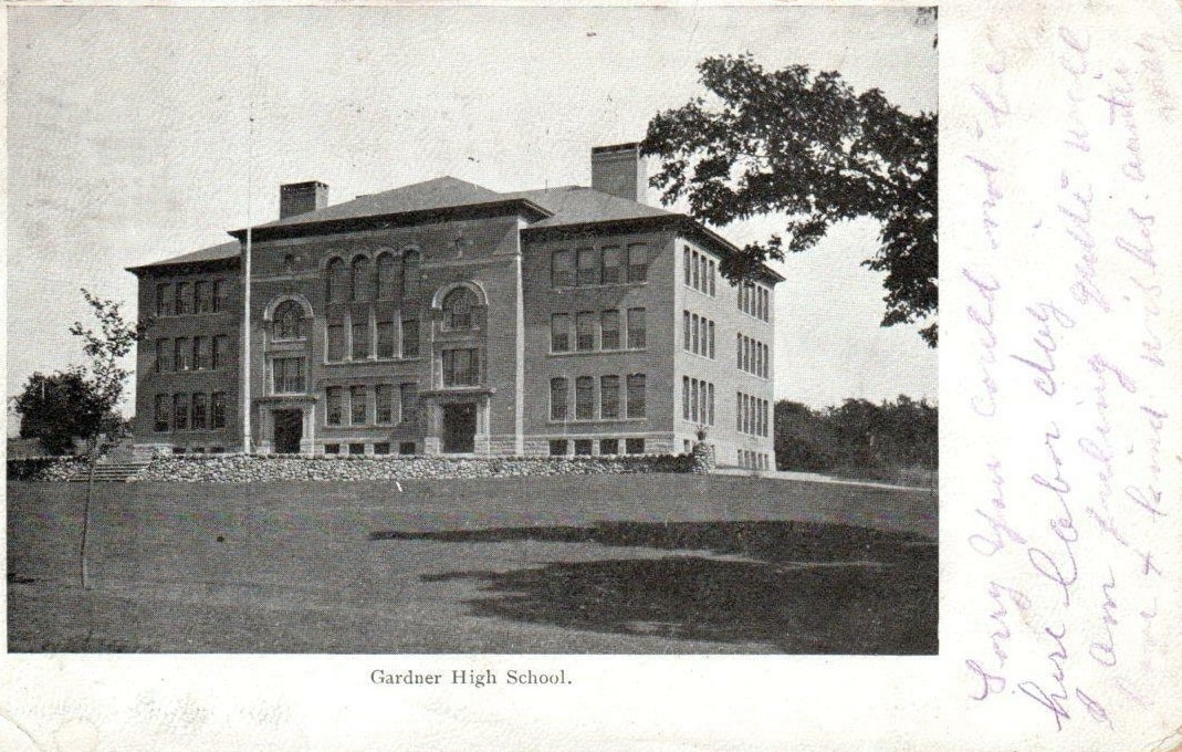
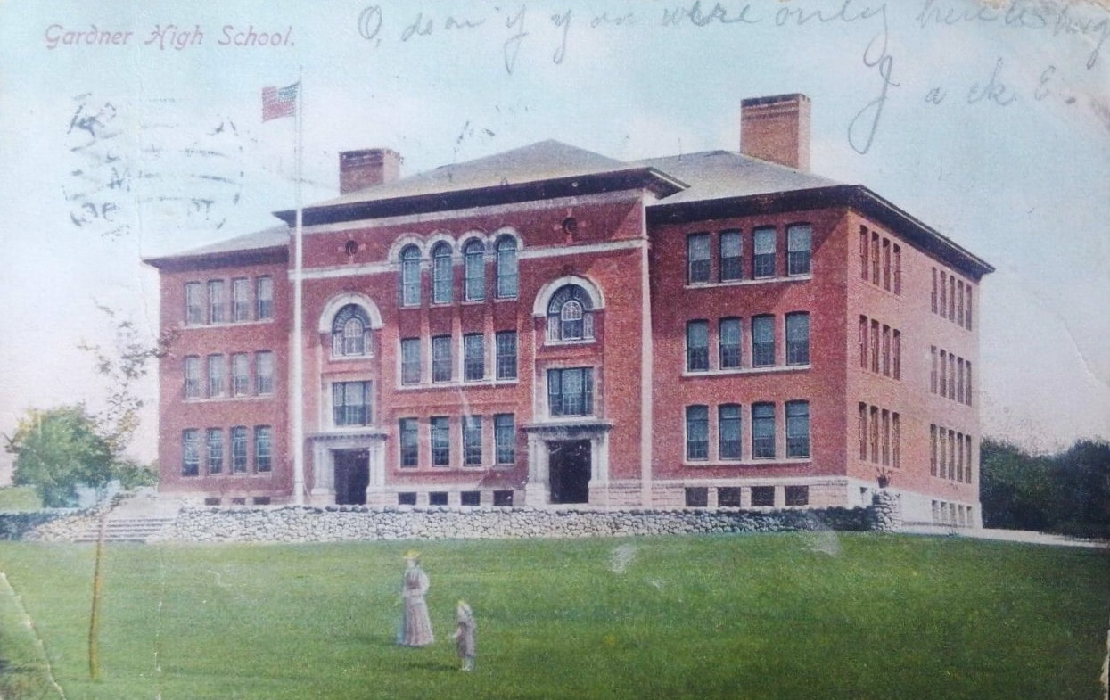
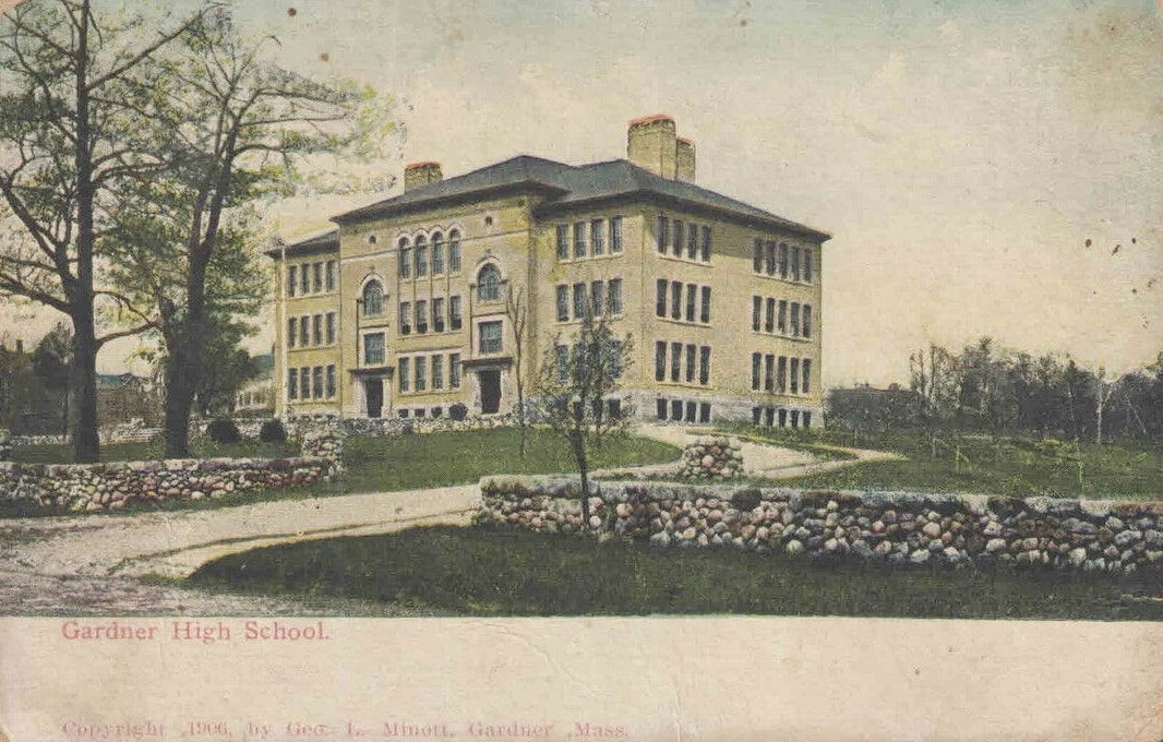
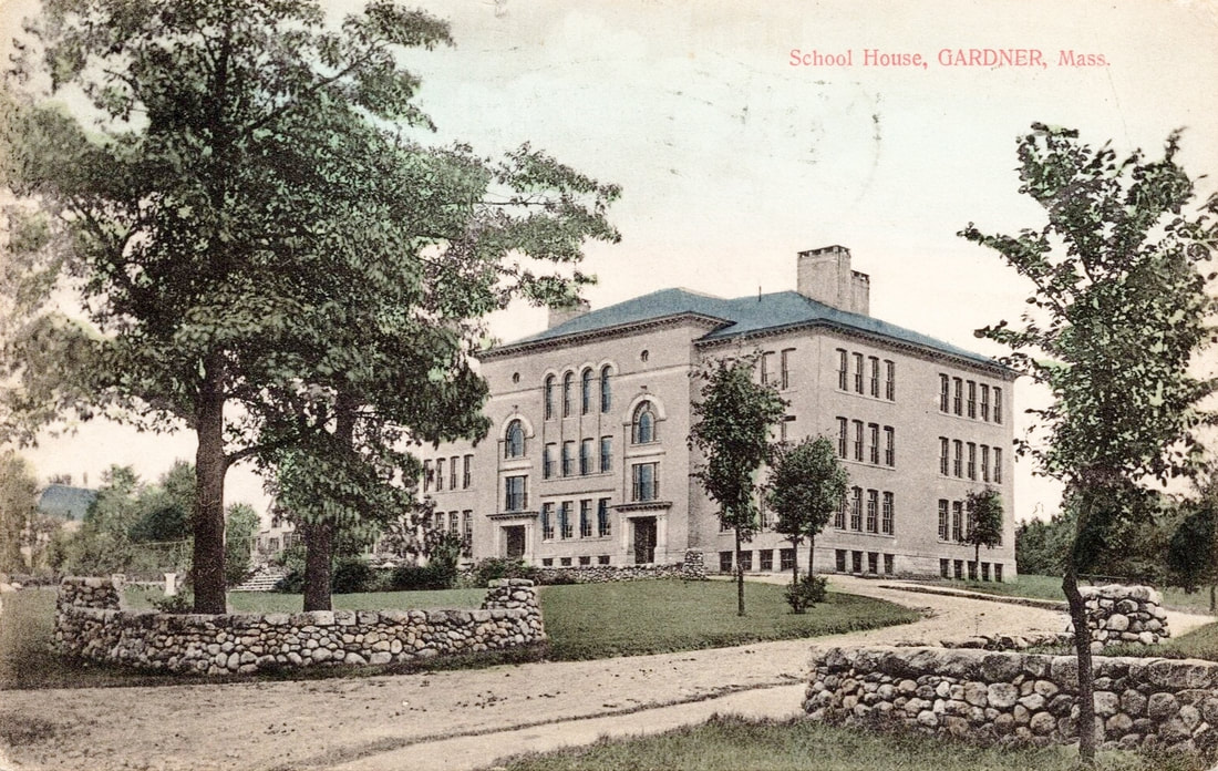
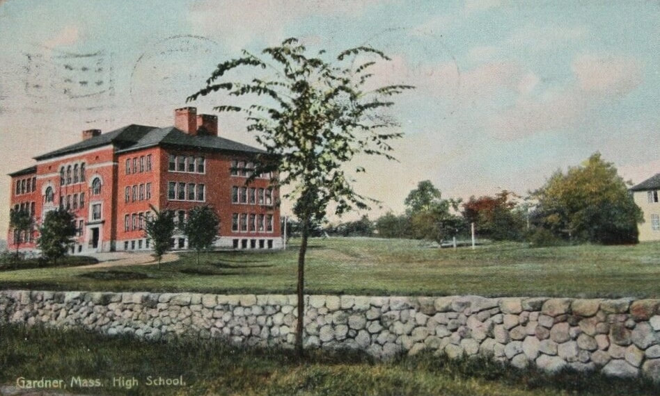
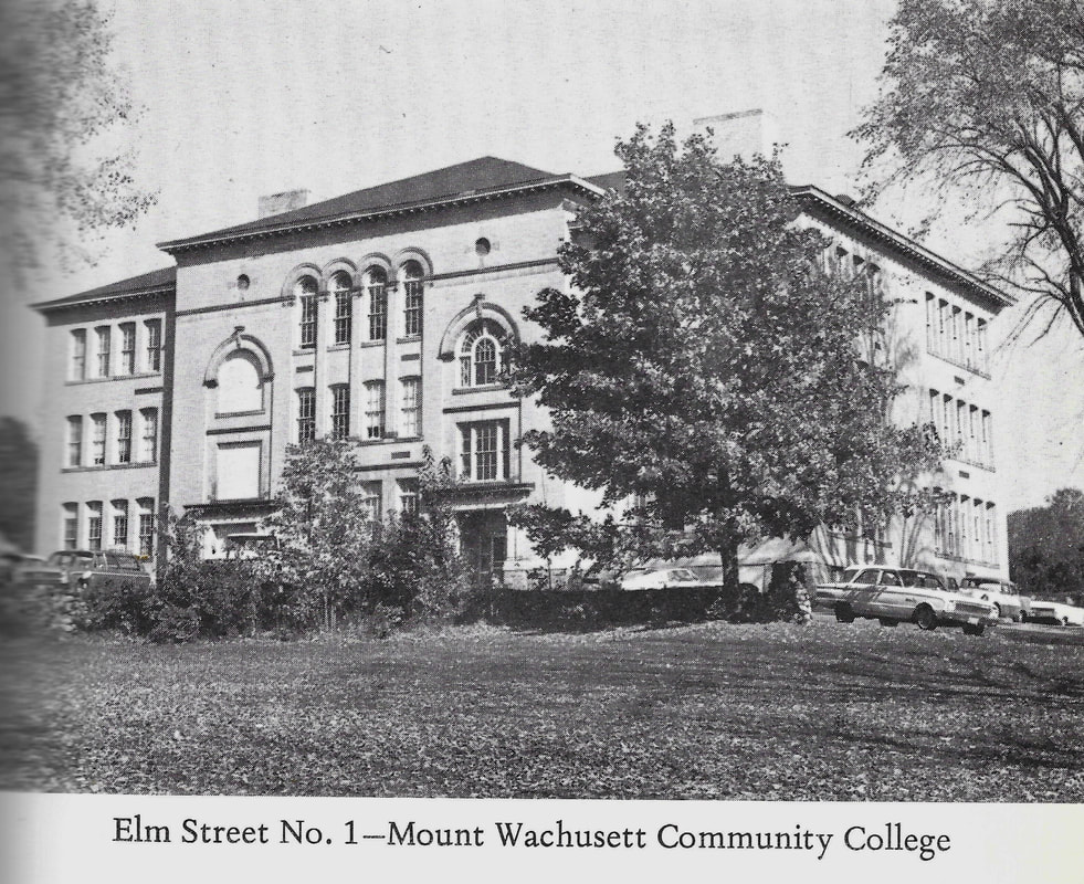
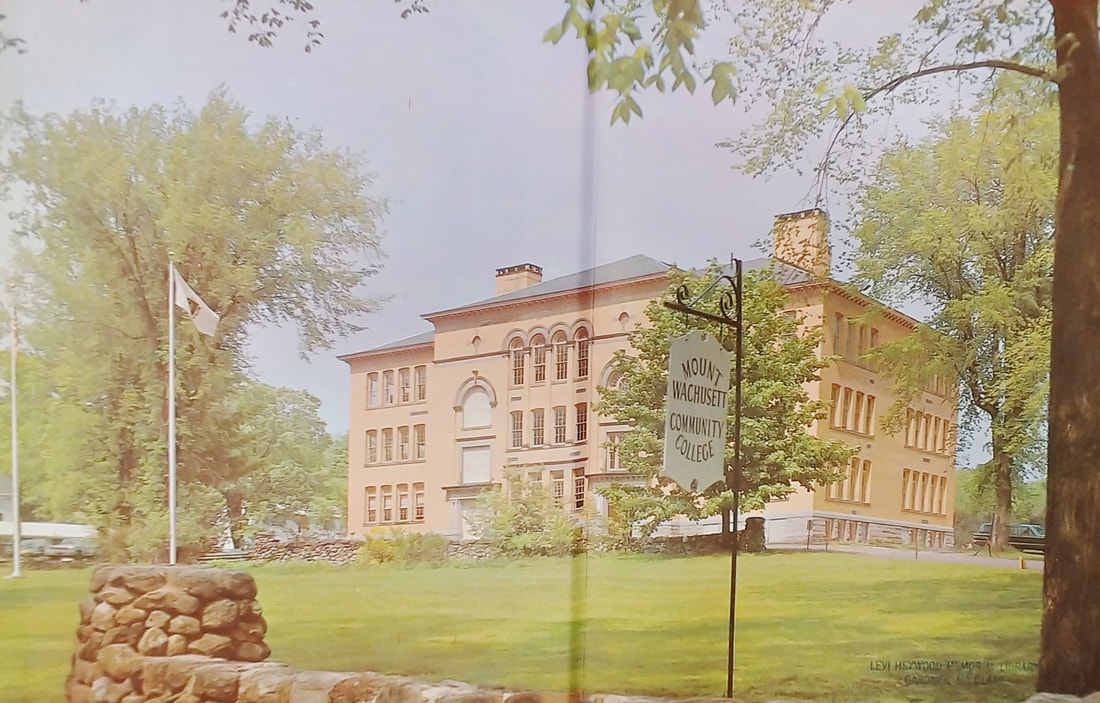

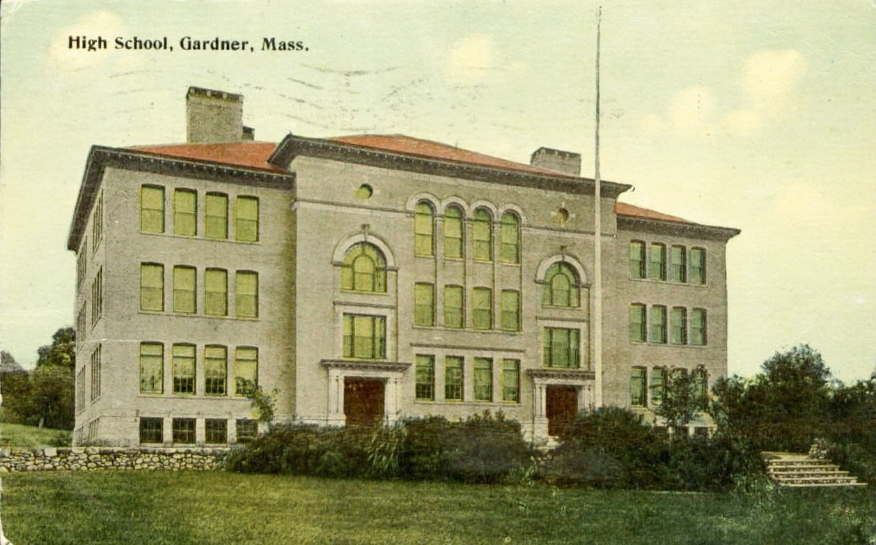
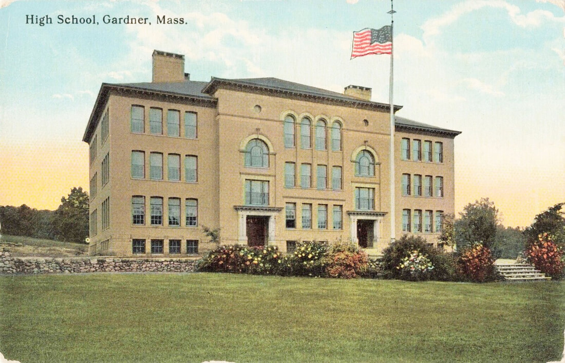
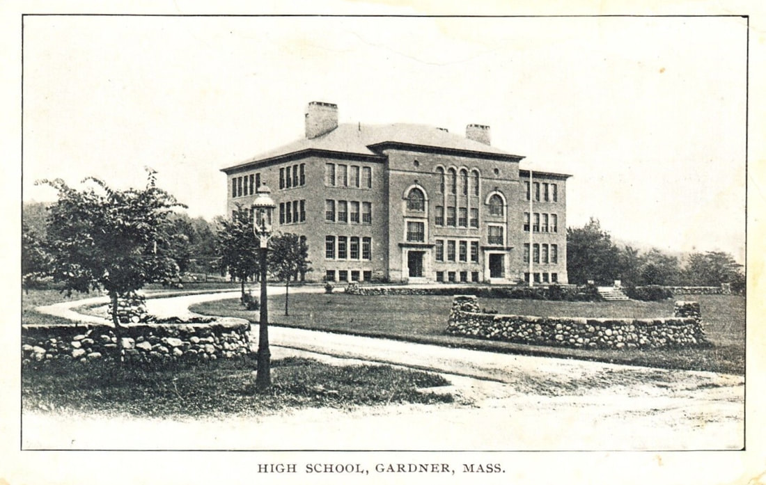
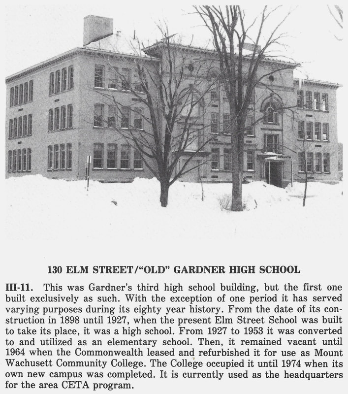
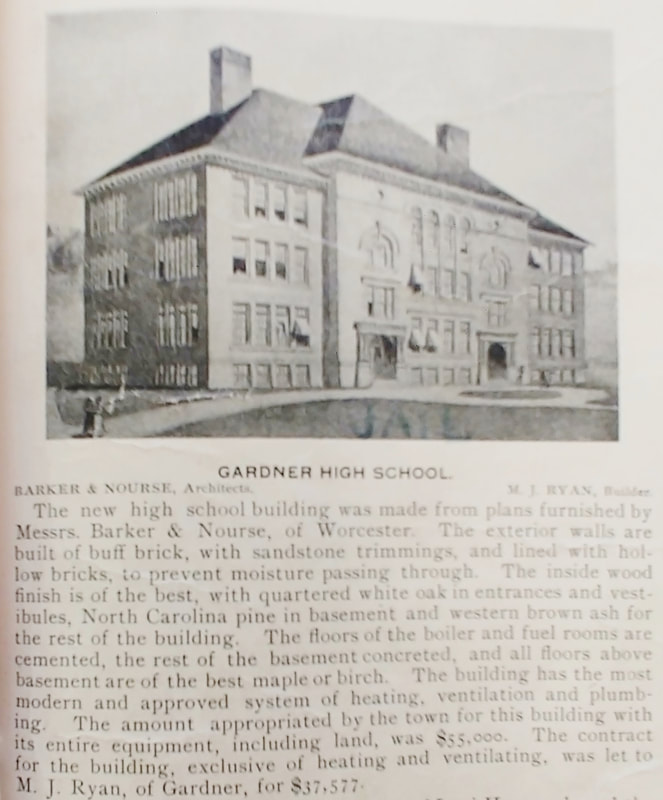
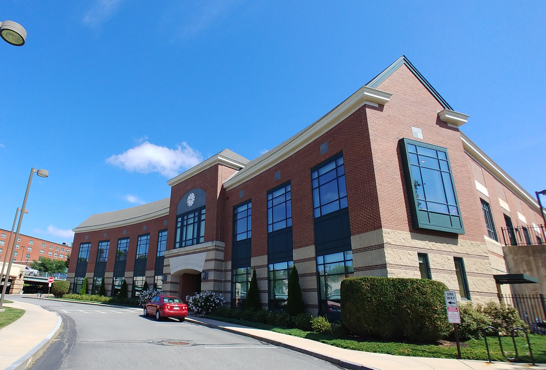
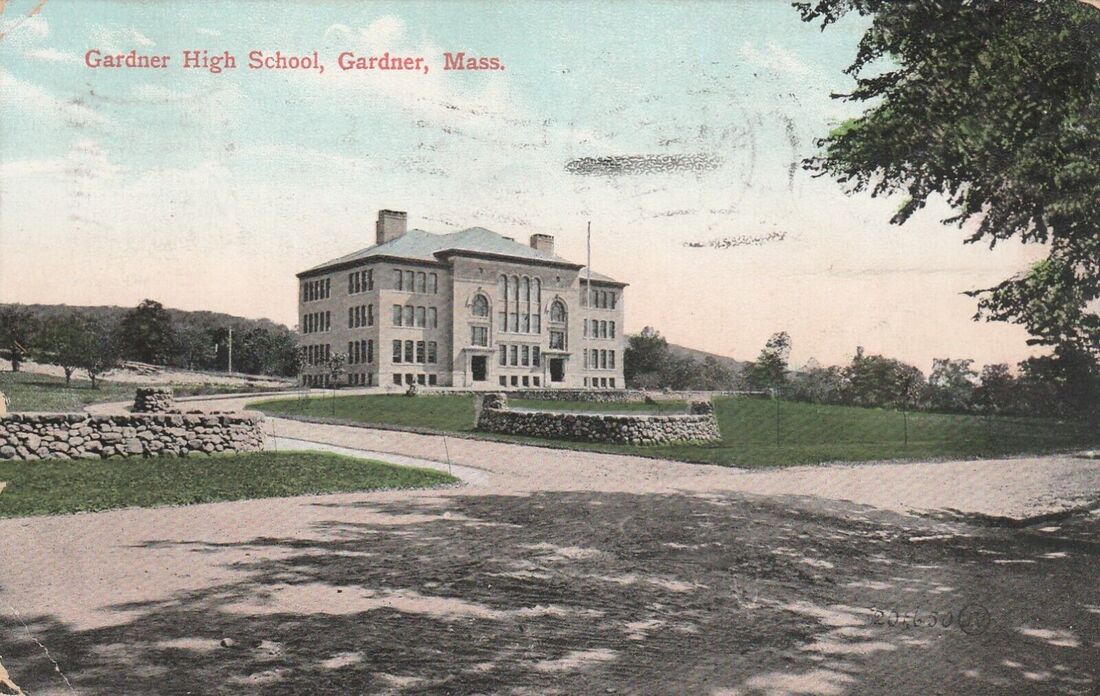
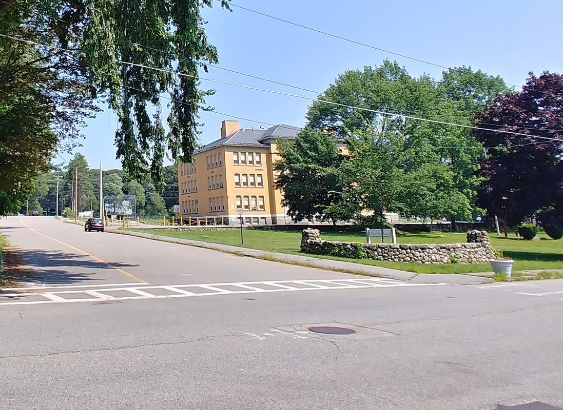
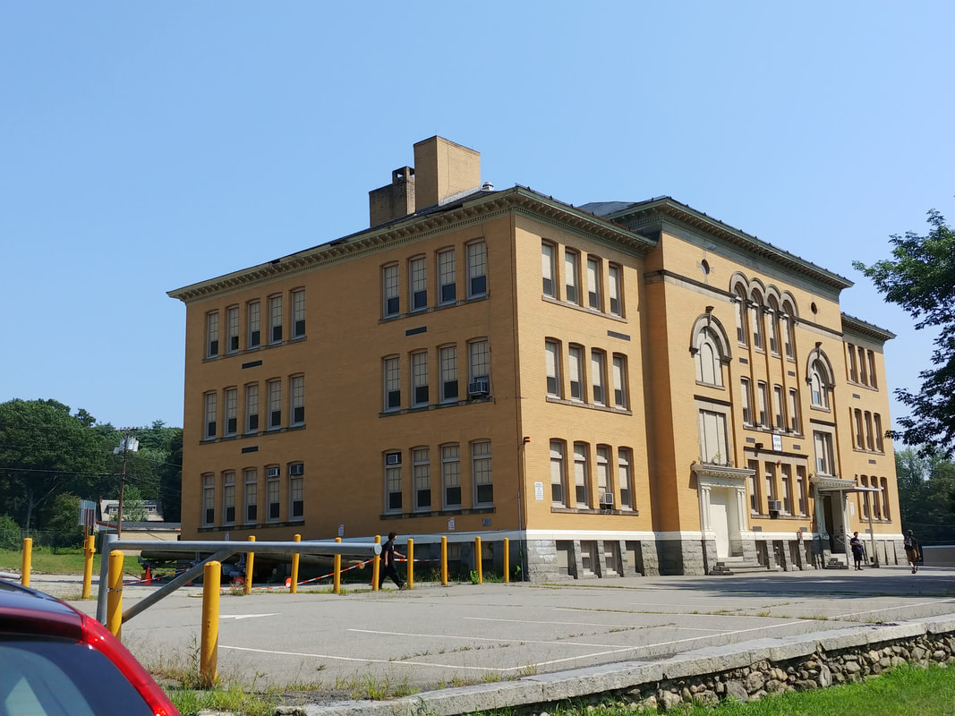
The next building to be called a High School was built in 1898 at 130 Elm Street. The artist's rendering is from 1905 while the second photo shows the actual building in 1905 from the right side. The third and fourth images are from 1906 and the fifth is probably c1908. The sixth image, shown from a little further down the road, is from 1909. The seventh photo shows that the building was known as Elm Street 1 and that it housed Mount Wachusett Community College in 1967. The eighth picture shows Mount Wachusett from their 1967 yearbook (ref. 6) - note the hanging sign.
In the ninth picture, the school is shown from the left side in 1905. The right wall remains today while the left is gone. The tenth and eleventh are from 1914 and the twelfth is from 1915. Note the electric lamp has been installed. That is no longer there but there is a telephone pole roughly in the same spot. The thirteenth image from 1978 (ref. 2, page 44) suggests the college was there until 1974. The school was recently an Elementary School called Helen Mae Sauter but now is used for Gardner school business. The final one provided in Rathbone's Gazeteer from 1899 (ref. 25) gives a nice description of its construction. Note that someone has scrawled "JAIL" under the picture.
In the ninth picture, the school is shown from the left side in 1905. The right wall remains today while the left is gone. The tenth and eleventh are from 1914 and the twelfth is from 1915. Note the electric lamp has been installed. That is no longer there but there is a telephone pole roughly in the same spot. The thirteenth image from 1978 (ref. 2, page 44) suggests the college was there until 1974. The school was recently an Elementary School called Helen Mae Sauter but now is used for Gardner school business. The final one provided in Rathbone's Gazeteer from 1899 (ref. 25) gives a nice description of its construction. Note that someone has scrawled "JAIL" under the picture.
 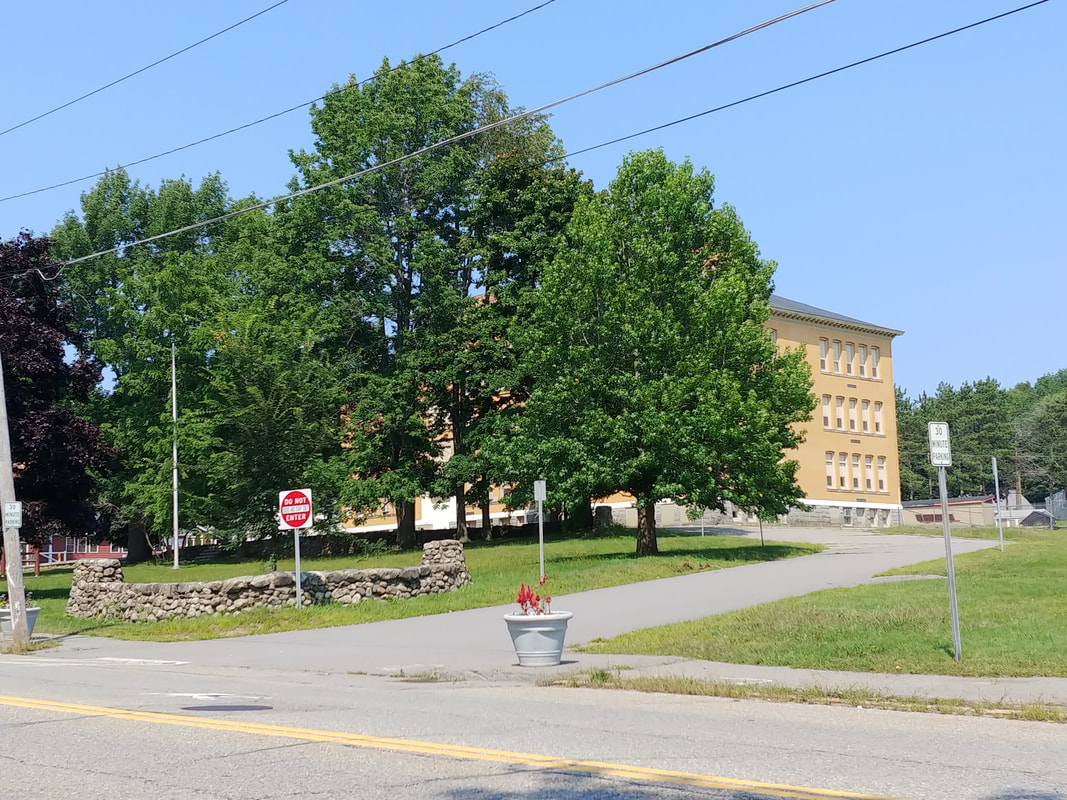   |
So much is obscured by the trees in 2023. In the right side photo you can see that the the right wall is gone - there is absolutely none of it left - but the left one is still there, mostly with rocks in the same place but it does look like some rebuilding has been done and cement added for stability. For the left side image, pretty much the same. Trees blocking the view, wall on left removed and the one on the right still exists. Below is a better view of the building today without the trees in the way.
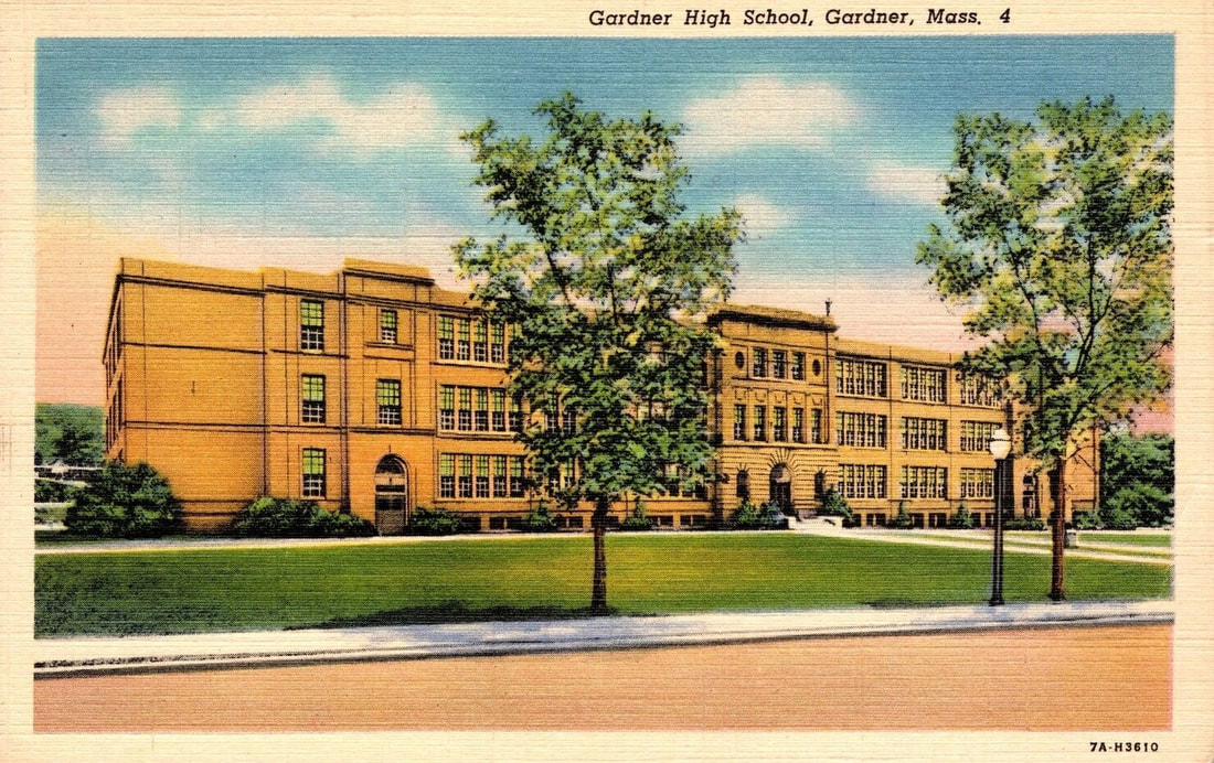

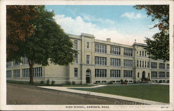
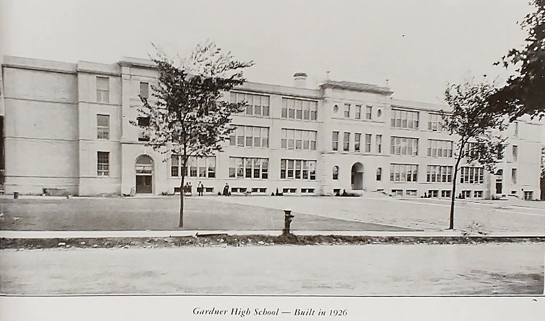
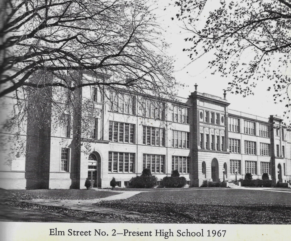
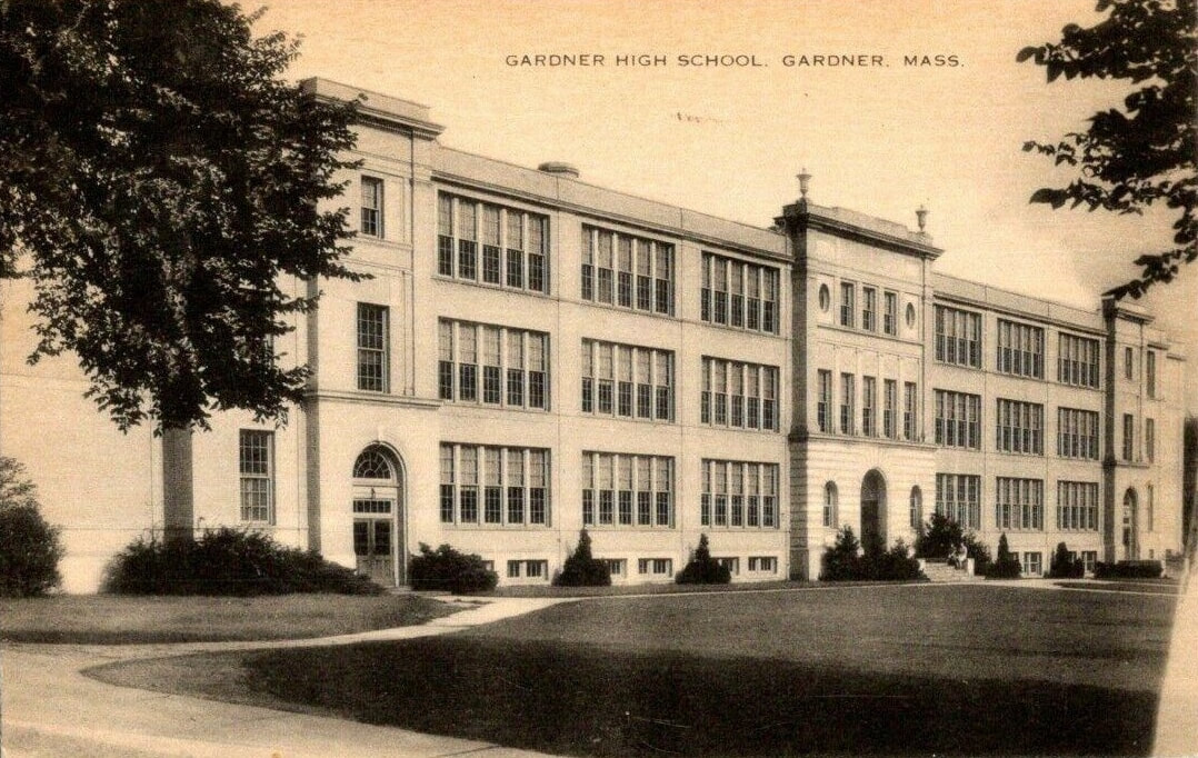
In 1927 a new high school was built right next to the previous one. This is probably when the rock wall came down. The first image is probably from the 1930s and the second one is from 1941. The third was taken at an unknown date but probably the 1940s. The fourth was from 1948 (ref. 12) - it is assumed that it was taken at the same time as publication of the reference book. The final picture from 1967 (ref. 20) shows the school to be named Elm Street 2 and still acting as a high school. After another new high school was built, this became an elementary school named Elm Street School but it recently became Gardner Academy.
  |
The 2023 photo shows the building unchanged but some of the paths seem to be grassed over. Even though it is now the Gardner Academy it still has Elm Street School above the main door.

1. The house at 55 Green Street was built in 1858 and used as a high school from 1866-1874. After this, the orthodox Congregational group moved their church to this spot where it still exists. This house was moved to 362 Elm Street where it remains today.
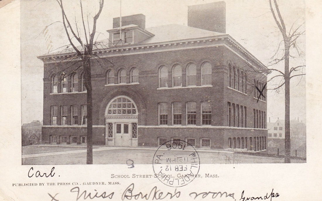
2. The School Street School is at 53 School Street. The photo is from 1906, the school having been built in 1903 to replace the old one that was originally built there in 1857 (see Ref. 3, page 90).
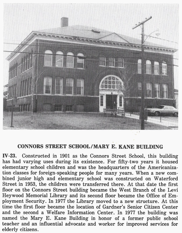
3. Connors Street School was built in 1901 but shown here from 1978 (ref. 2, page 69). It's had a varied life and still exists at 175 Connors Street. It was used as the West Branch Library from 1955-1976 after the elementary school students moved to Waterford Street School in 1953. After this it was used as a Senior Center and Welfare Information Center. In 1977 it was renamed the Mary E Kane building. It is now the Greater Gardner Community Health Center. Note how it is practically identical to the School Street School. I guess if you had a good design why not stick with it?
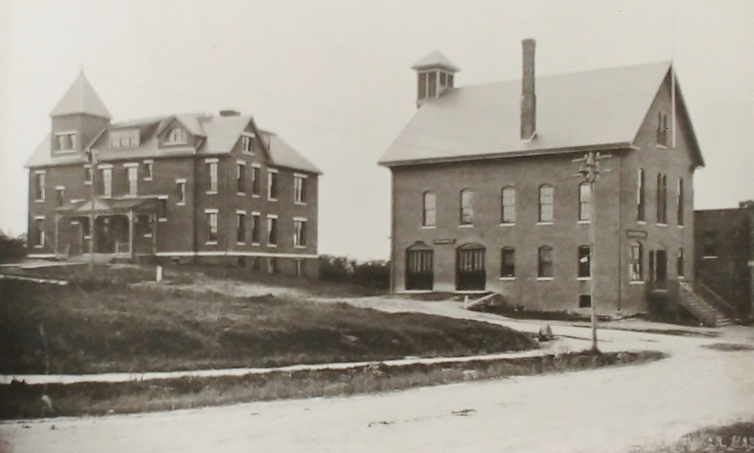
4. The picture focuses on Citizen's Hall which was where Station No 1 in South Gardner is today. The street branching to the left is Prospect Street and the original Prospect Street School is in back of the Hall. This school was built in 1887 and used until 1925. The picture of the school is from 1889 (ref. 22, page 13 & ref. 3, page 93). There is now a parking lot there.
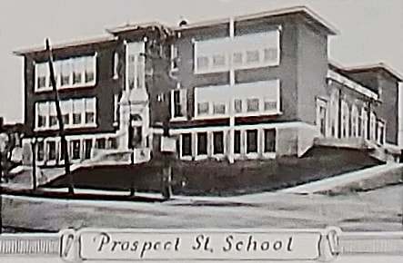
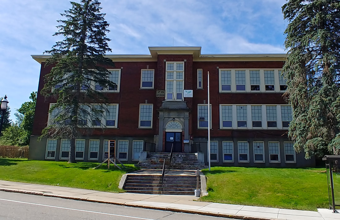
5 & 5a. This is Prospect Street School at 75 East Broadway as it appeared in 1948 (or thereabouts; ref 12). Before I found this picture, there were no old photos to be found online so I added a new picture, the sixth, for 2023. It originally opened in 1923. It is not currently being used as a school and is up for sale. Gardner Academy was here for a number of years before moving to its current site on Elm Street.
6. The next one is the old Sacred Heart School. It was where the parking lot is now for 100 Central Street and appears to have been razed c1961. Sacred Heart was formed in 1923.
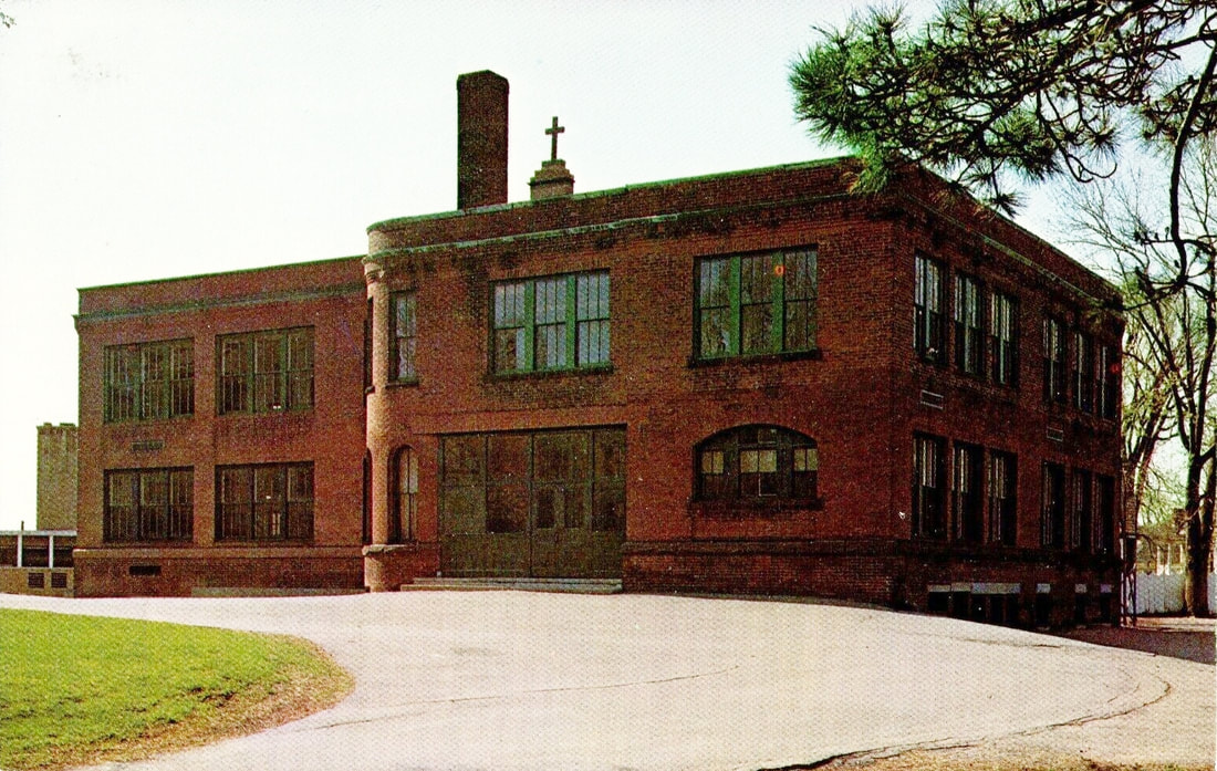
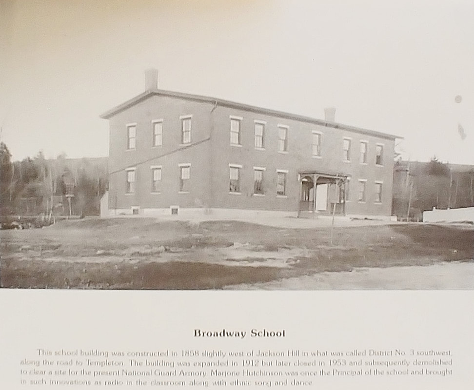
7. The final photo is of Broadway School (ref. 15). It was used from 1858 until 1953. The site was razed and the National Guard Building sits there now at 323 West Broadway.
2. The School Street School is at 53 School Street. The photo is from 1906, the school having been built in 1903 to replace the old one that was originally built there in 1857 (see Ref. 3, page 90).
3. Connors Street School was built in 1901 but shown here from 1978 (ref. 2, page 69). It's had a varied life and still exists at 175 Connors Street. It was used as the West Branch Library from 1955-1976 after the elementary school students moved to Waterford Street School in 1953. After this it was used as a Senior Center and Welfare Information Center. In 1977 it was renamed the Mary E Kane building. It is now the Greater Gardner Community Health Center. Note how it is practically identical to the School Street School. I guess if you had a good design why not stick with it?
4. The picture focuses on Citizen's Hall which was where Station No 1 in South Gardner is today. The street branching to the left is Prospect Street and the original Prospect Street School is in back of the Hall. This school was built in 1887 and used until 1925. The picture of the school is from 1889 (ref. 22, page 13 & ref. 3, page 93). There is now a parking lot there.
5 & 5a. This is Prospect Street School at 75 East Broadway as it appeared in 1948 (or thereabouts; ref 12). Before I found this picture, there were no old photos to be found online so I added a new picture, the sixth, for 2023. It originally opened in 1923. It is not currently being used as a school and is up for sale. Gardner Academy was here for a number of years before moving to its current site on Elm Street.
6. The next one is the old Sacred Heart School. It was where the parking lot is now for 100 Central Street and appears to have been razed c1961. Sacred Heart was formed in 1923.
7. The final photo is of Broadway School (ref. 15). It was used from 1858 until 1953. The site was razed and the National Guard Building sits there now at 323 West Broadway.
 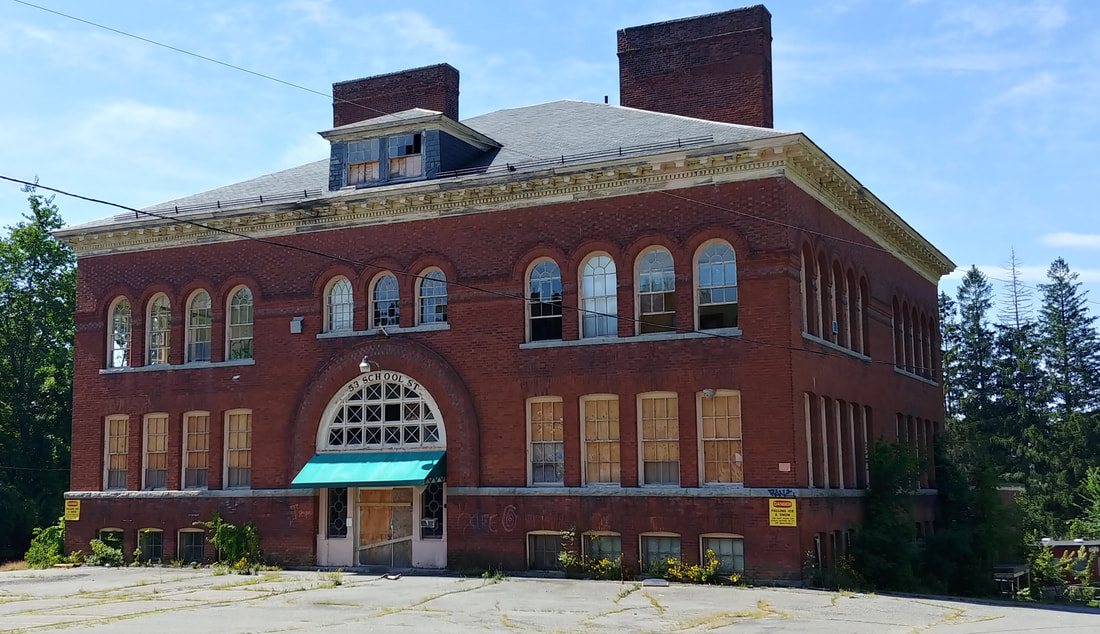 |
Although it is still there, the School Street School appears to be in disrepair and not in use.

|
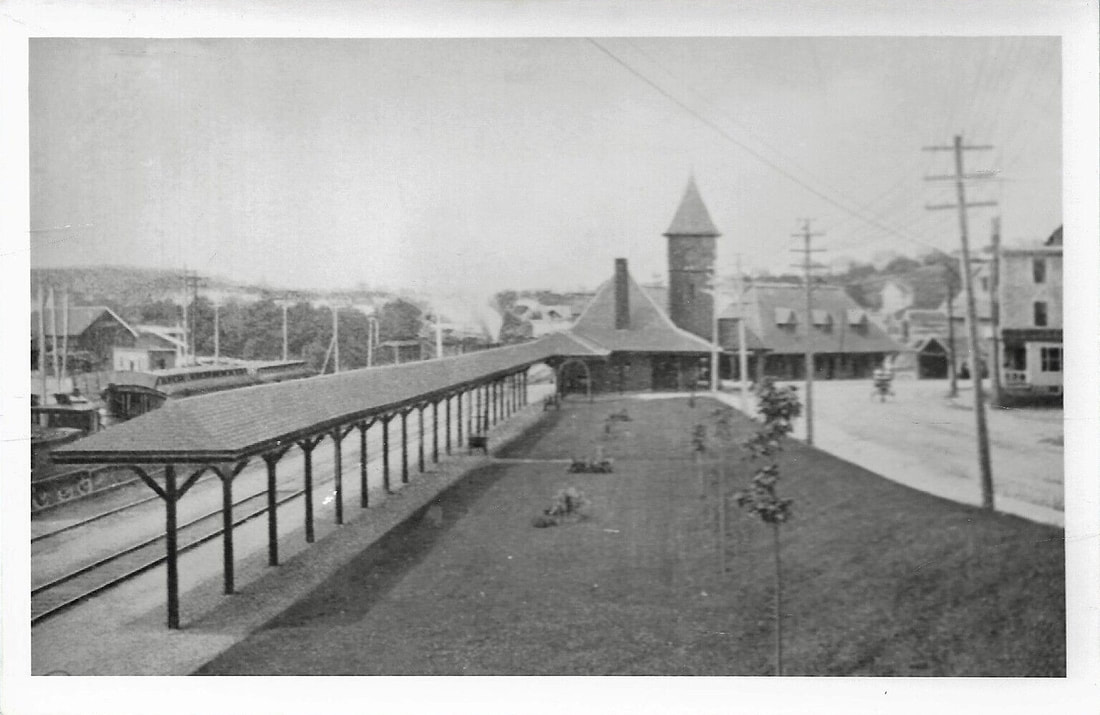
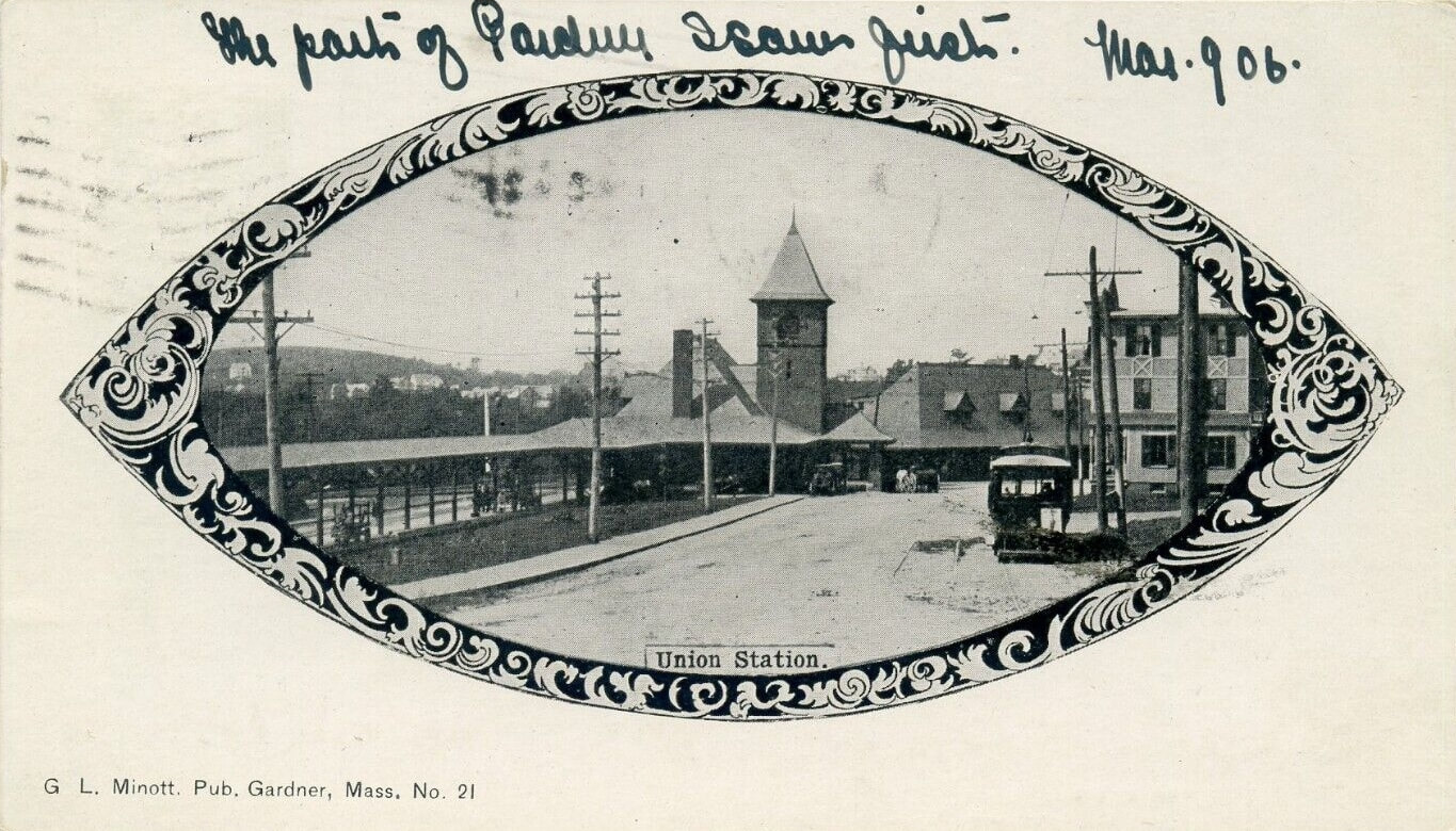
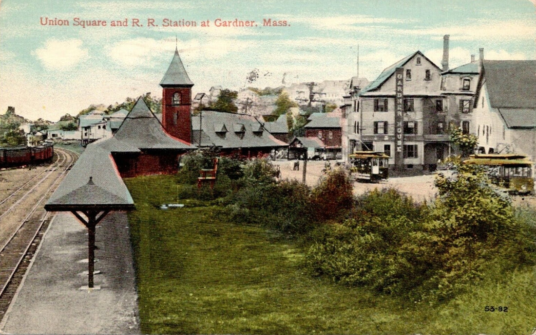
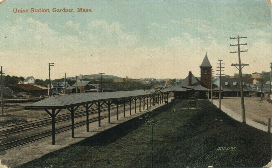
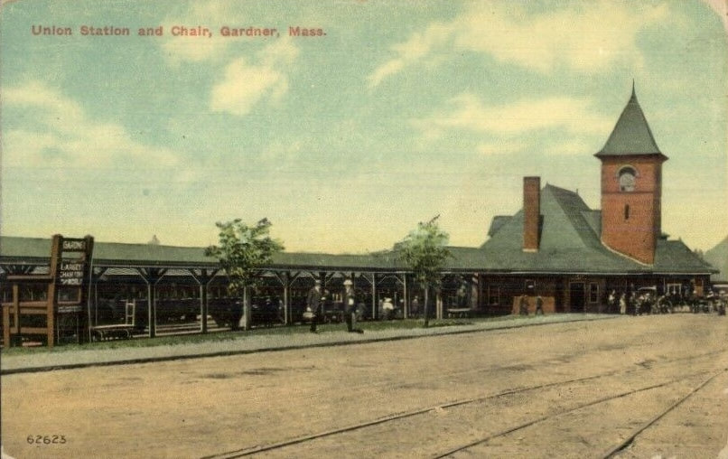
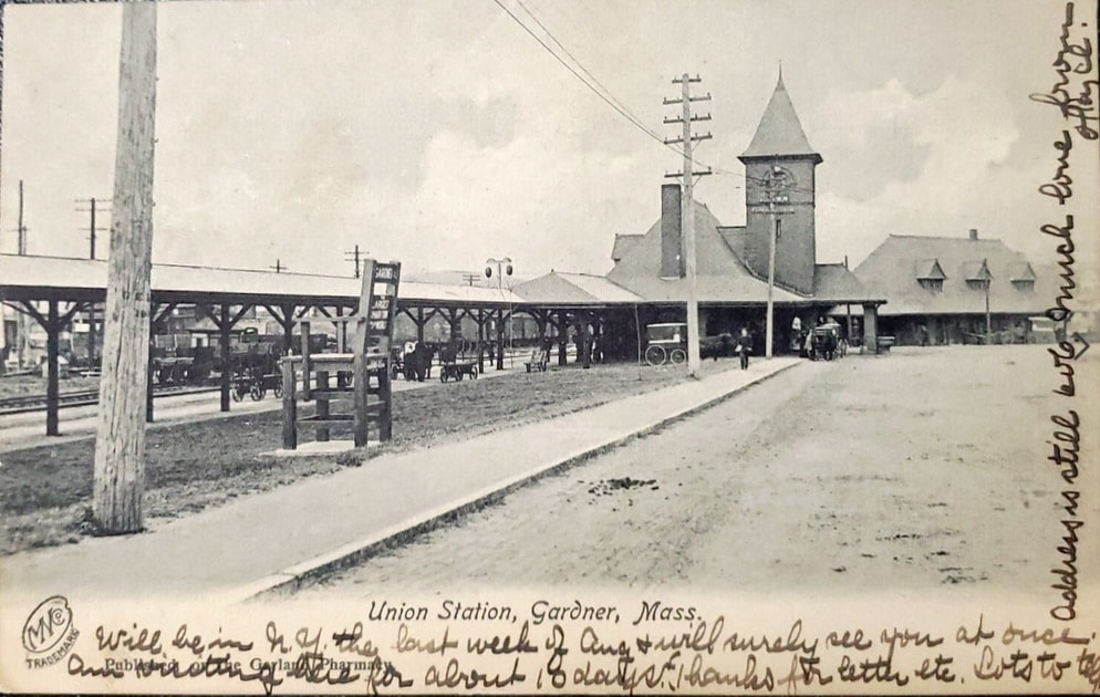
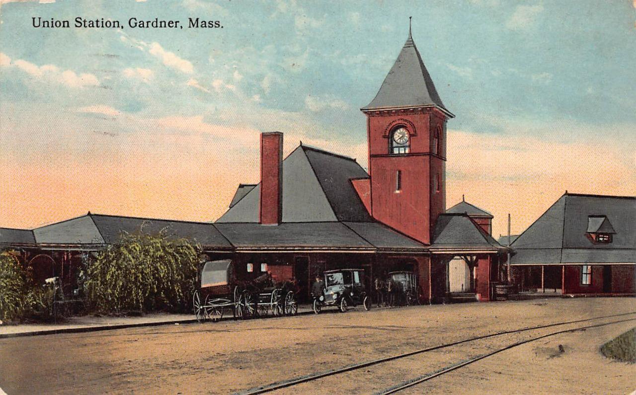
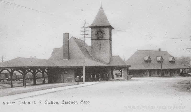
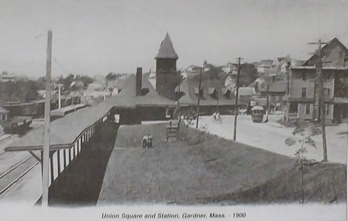
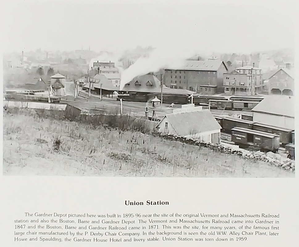
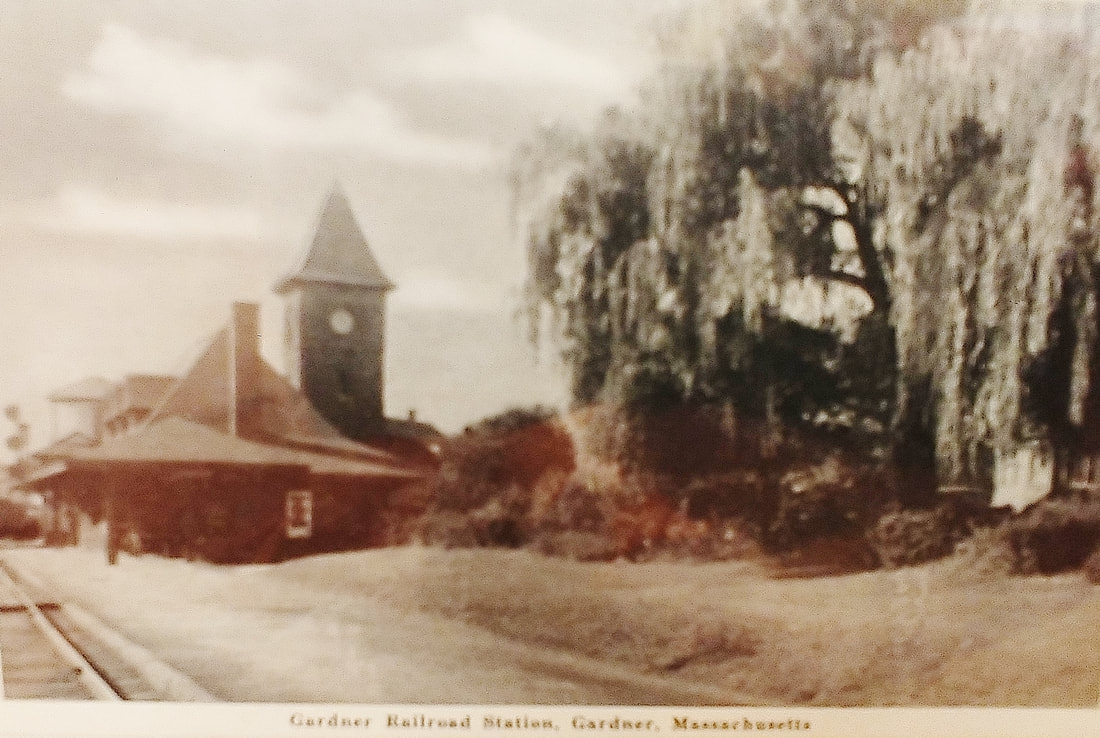
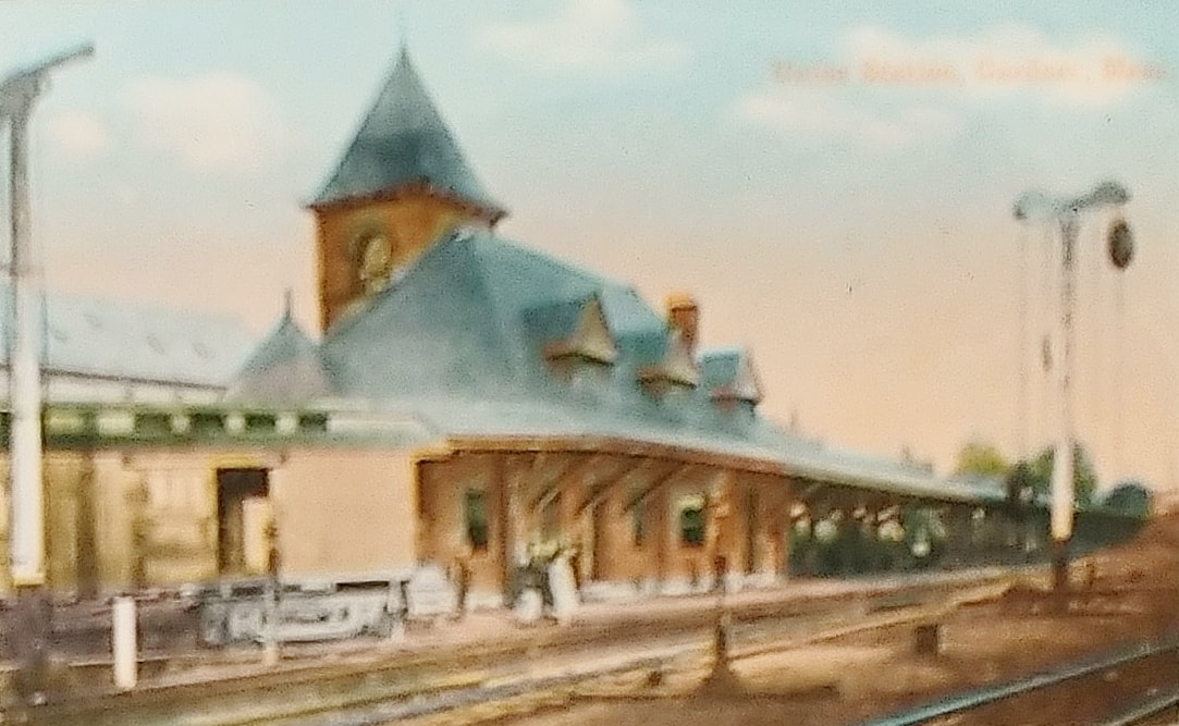
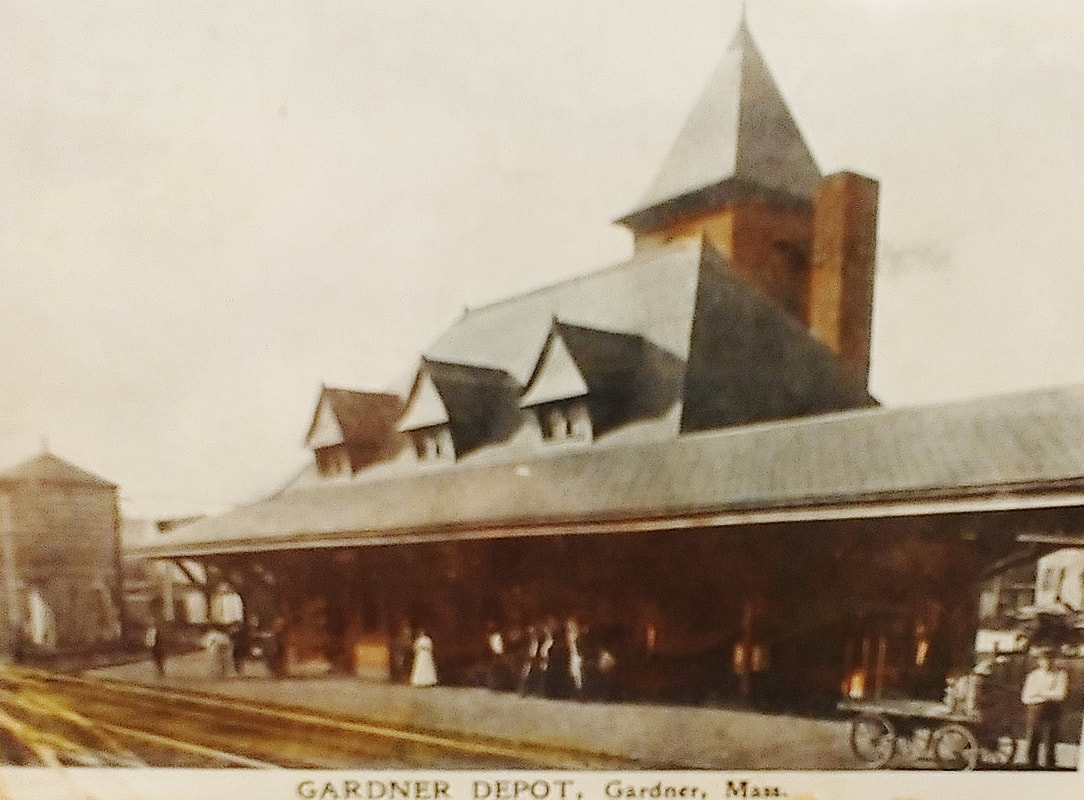
The Railroad Station or Depot was on the stretch of what is now Union Square and the beginning of Chestnut Street. The first photo is from 1905 and the second from 1906. The next two images from 1910 show the Derby Chair has been installed at the bottom of the incline. One picture has a lot of shrubbery and one does not so either there was some creative editing or the dates are little off. The fifth picture is from 1917 and the chair has been moved up the incline to near the sidewalk (note the telephone poles have been edited out). This can better be seen in the sixth image which I assume if from the same time. The seventh one shows the station in closeup in 1917 (no telephone poles again!). Note the contrasting horse & buggy with the early autos. The eighth one is from an unknown date and the ninth is from 1900 (ref. 13, page 58). The tenth picture is undated while giving a unique perspective. If you could see through the smoke you'd be looking north down Chestnut Street. The tracks that curve up behind the building (on the middle left) still exist and go behind Sorrento's and continue on behind Pricechopper and veer northwest past Gardner Woodware Corporation. The last three (ref. 27) also give a unique, if blurry, perspective of the station. All are undated.
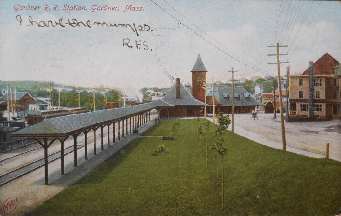 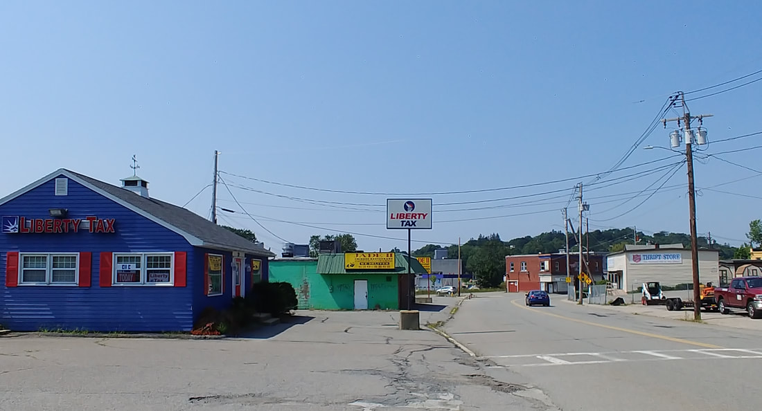 |
The Railroad Station platform was located roughly where the Jade II and Liberty Tax buildings are today and the main building was roughly on the curve of Chestnut Street across from the current Salvation Army building. Today, you can still see the tracks but there is no sign of the station as it was torn down in 1959. The only thing that remains from the pictures is the telephone pole seen in front of the tower of image 6 - not likely the same pole but its replacement. In the original picture you see the Gardner House on the right. The Salvation Army parking lot is about where it was.

|
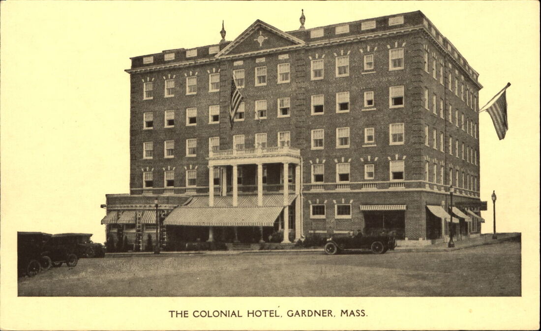
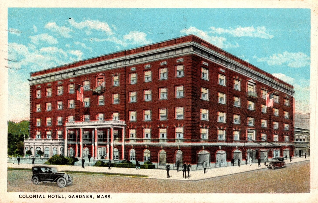
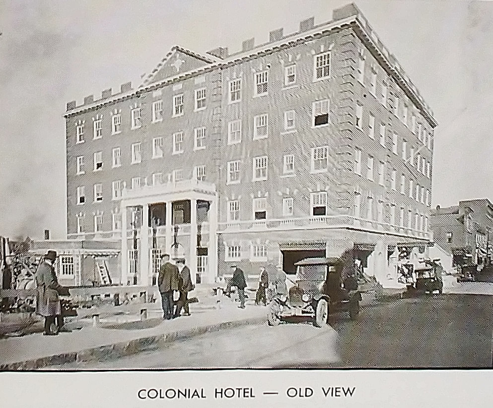
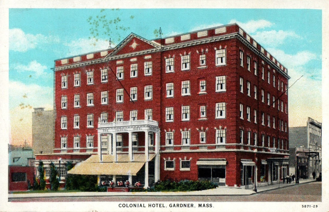
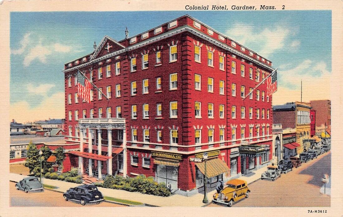
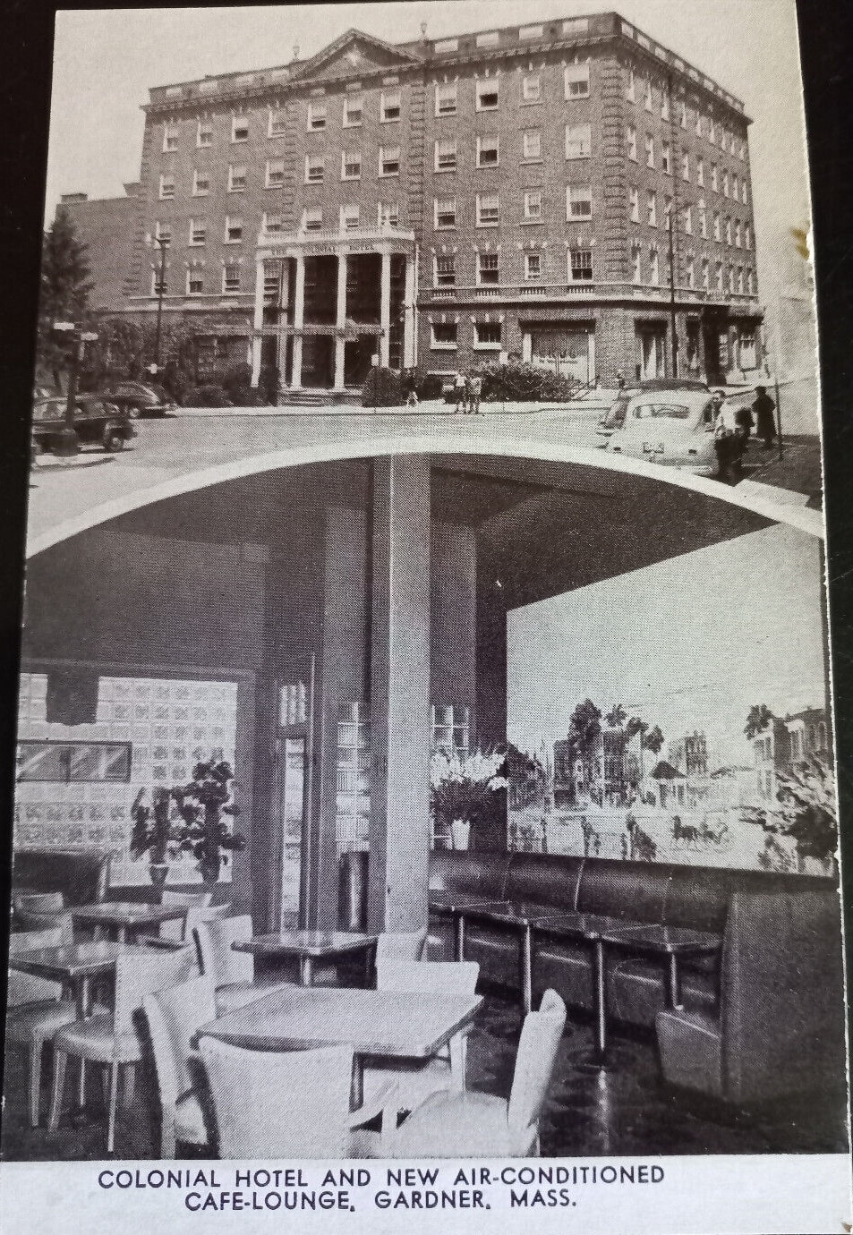
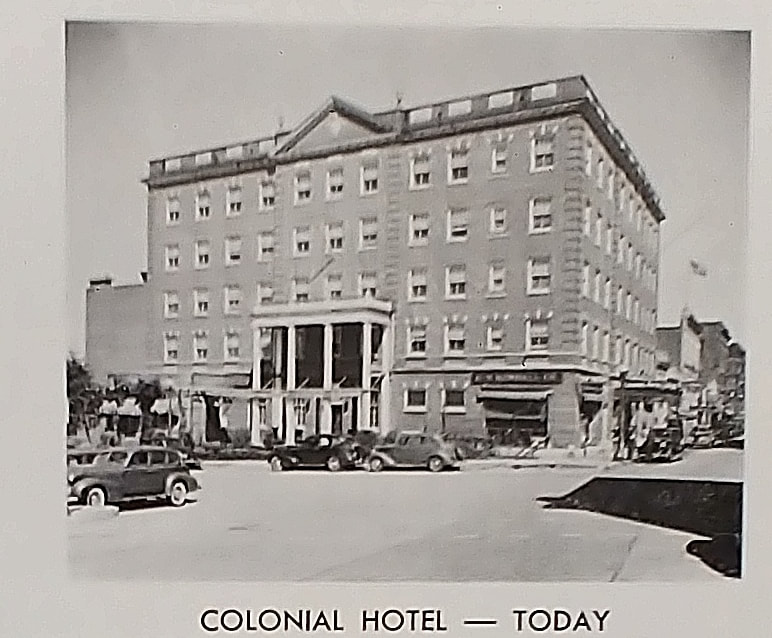
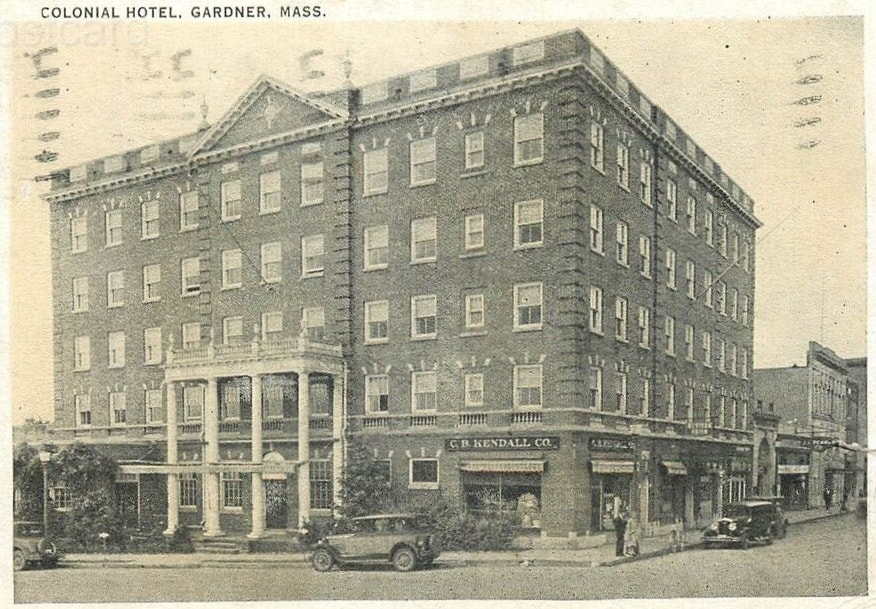
The first photo supposedly shows the original Colonial Hotel c1910 located on the current City Hall Ave. However, it was built in 1924 so the dating of the image is incorrect. It stands alone with some old cars out front and it appears the surrounding buildings have been edited out. The second image from 1924 shows a paved road and a building to the right. Note the artistic loss of the middle peak at the top - or this may have been a concept drawing. The third image (ref. 12) is probably from soon after it opened, c1925. The fourth image is dated 1930. On the corner is a lamppost which is still there today. We see some buildings to the left and two building to the right. The shorter structure is the J C Penney building, currently occupied by _____ while the taller one is the First National Bank, recently occupied by the Salem Coin Shop. Between the hotel and the shorter building is the gap that now houses the Gardner Cooperative Bank. The bank doesn't appear in the picture but it was built in 1927 so I place the picture closer to c1926. The sixth image from 1933 shows the Cooperative Bank now ensconced. Further down the road to the right, Pleasant Street, we see the addition of the buildings housing The Parker House of Pizza and Taco Rey Coliman, respectively, and the Garbose Building now on the corner of Pleasant and Parker Street. The seventh picture is from the celebration which was had for the dedication of the new City Hall which places this photo from 1940 (ref. 12). Judging by the cars, the eighth image is from the 1940s. Note the cool, new air conditioning in their lounge! The final picture shows a modern picture where "Today" is 1948 (ref. 12).
 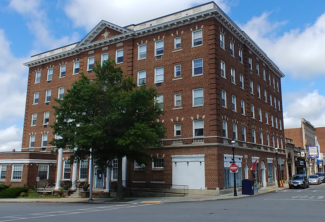 |
The Colonial building is remarkably unchanged. In 1974 the hotel became the Colonial Apartments. Today, it houses Turk's Barber Shop and up until recently, Suzette's Breakfast & Lunch Shoppe on the Pleasant Street side. A Colonial Hotel is on Betty Spring Road in 2023.
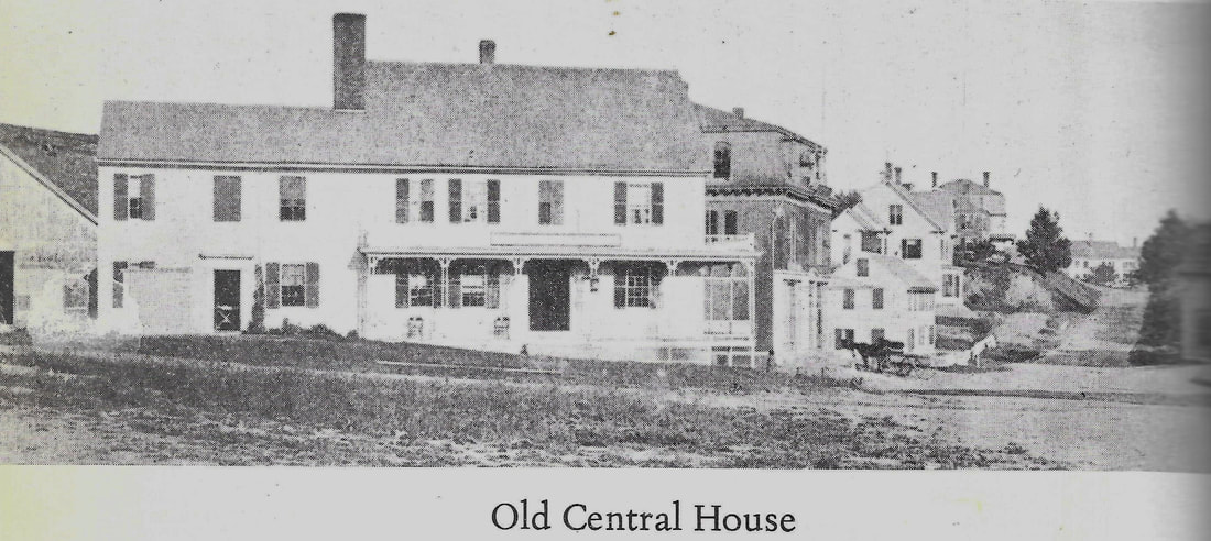
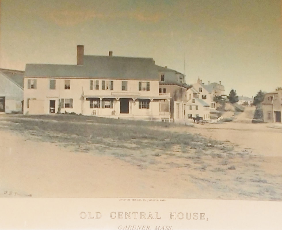
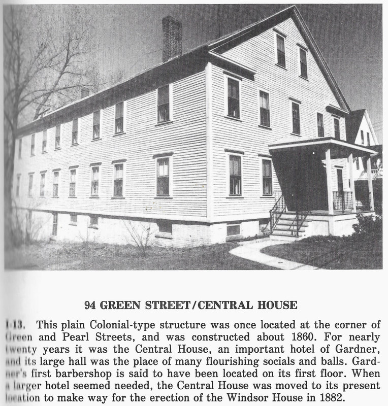
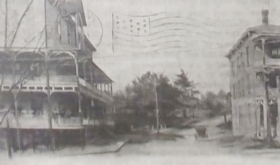
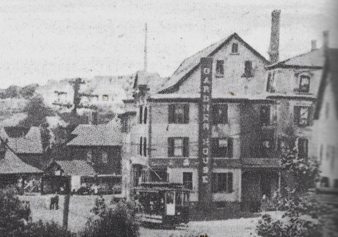
The Central House was originally located at the corner of Green and Pearl Streets and was built c1860 at what was once called the Gardner Center (the view is similar to the 2nd view of the Windsor House below). It was moved in 1883 to 94 Central Street to make room for the Windsor. Image 1a is a painted version of the photo in image 1. It is displayed in the library's Local History Room. The third photo is the building at its new location in 1978 (ref. 2, page 15).
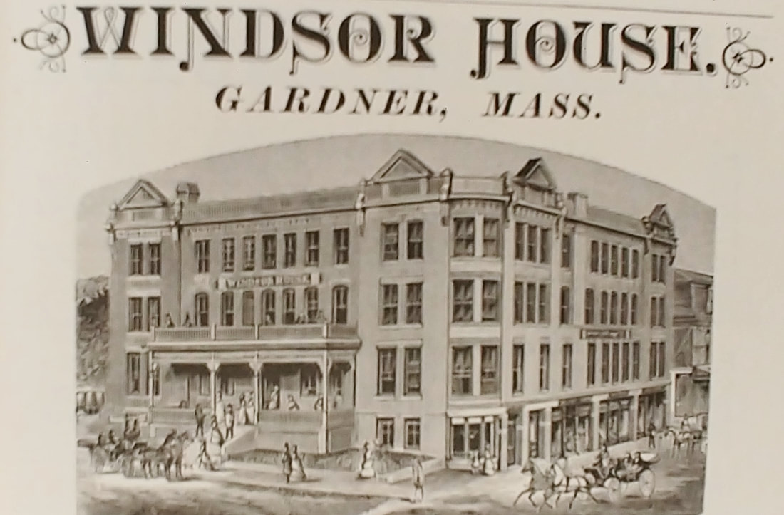
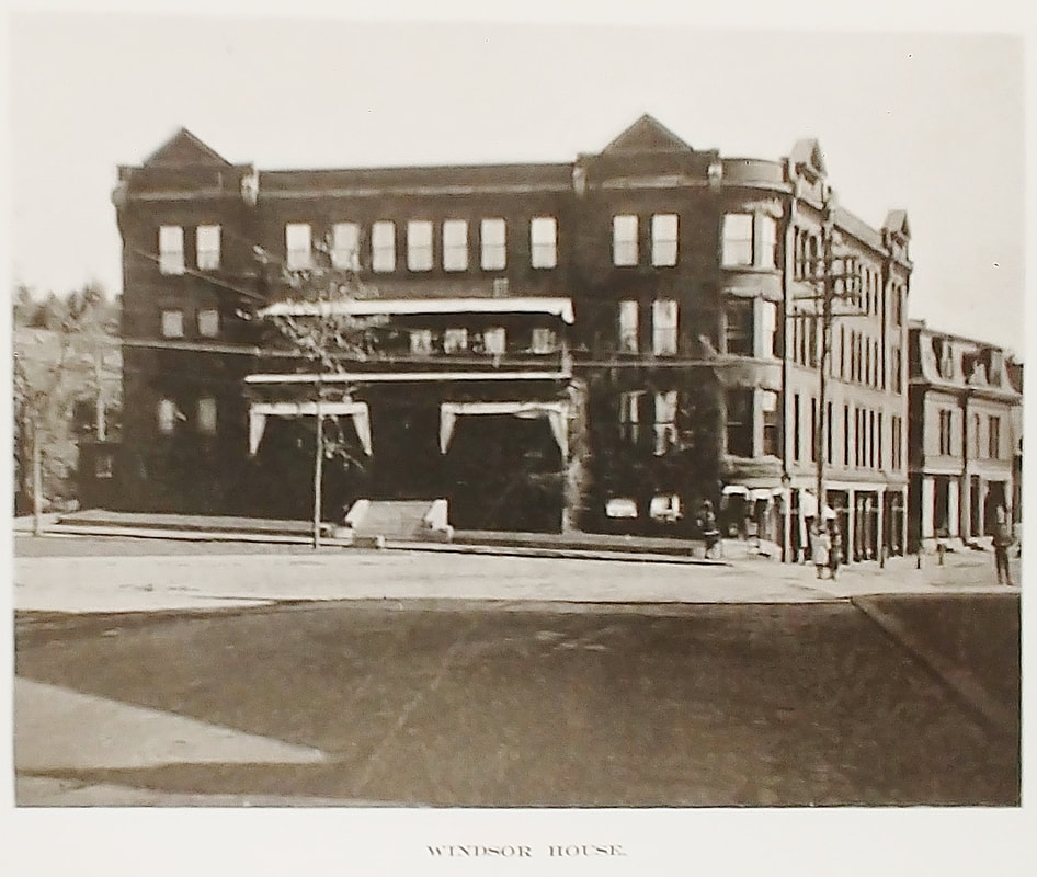
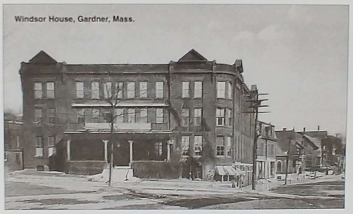
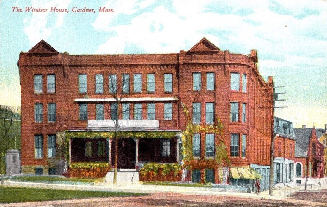

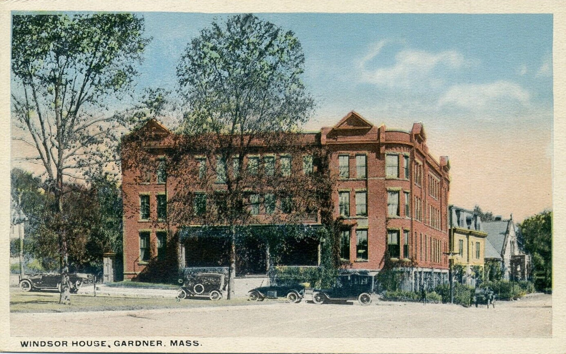
The Windsor House replaced the Central house on this corner.
1. 1885-1886
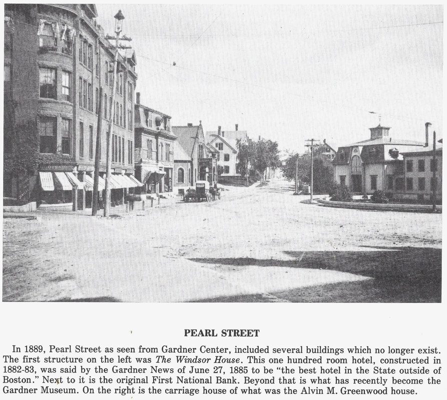
2. 1889 - Looking east down Pearl Street (ref. 2, page 21)
3. 1889 - (ref. 22, page 7)
4. c1903 - (ref. 10)
5. c1903 - (ref. 10)
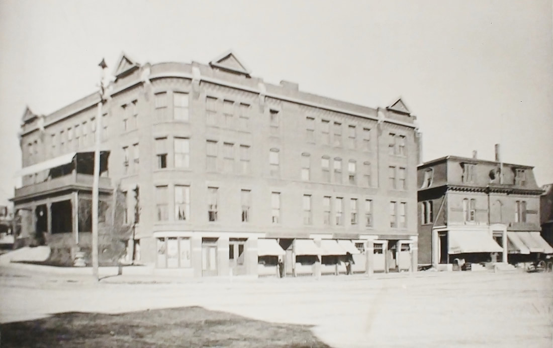
6. Unknown date - (ref. 13) - Compare to 7th picture which is a colorized version of the photo
7. Unknown date
8. 1906 - Looking east down Pearl Street
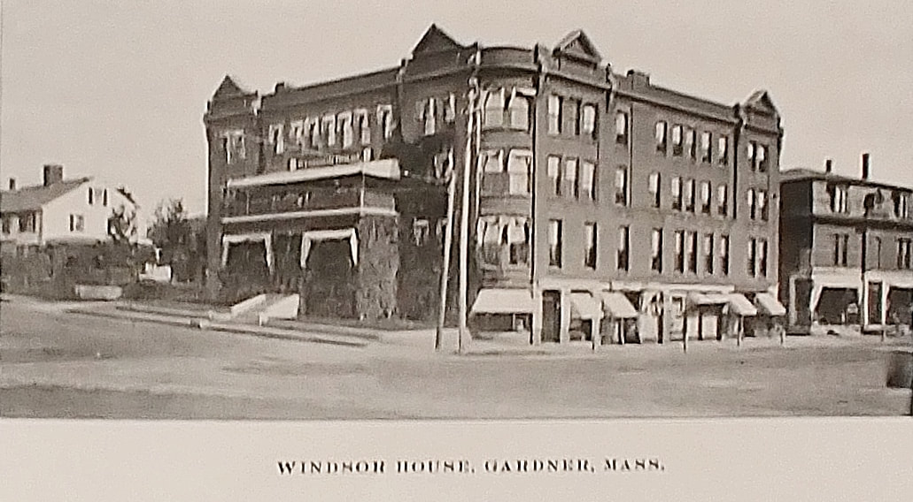
9. 1910
10. Unknown date
1. 1885-1886
2. 1889 - Looking east down Pearl Street (ref. 2, page 21)
3. 1889 - (ref. 22, page 7)
4. c1903 - (ref. 10)
5. c1903 - (ref. 10)
6. Unknown date - (ref. 13) - Compare to 7th picture which is a colorized version of the photo
7. Unknown date
8. 1906 - Looking east down Pearl Street
9. 1910
10. Unknown date
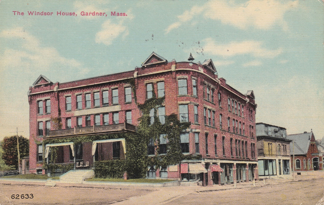 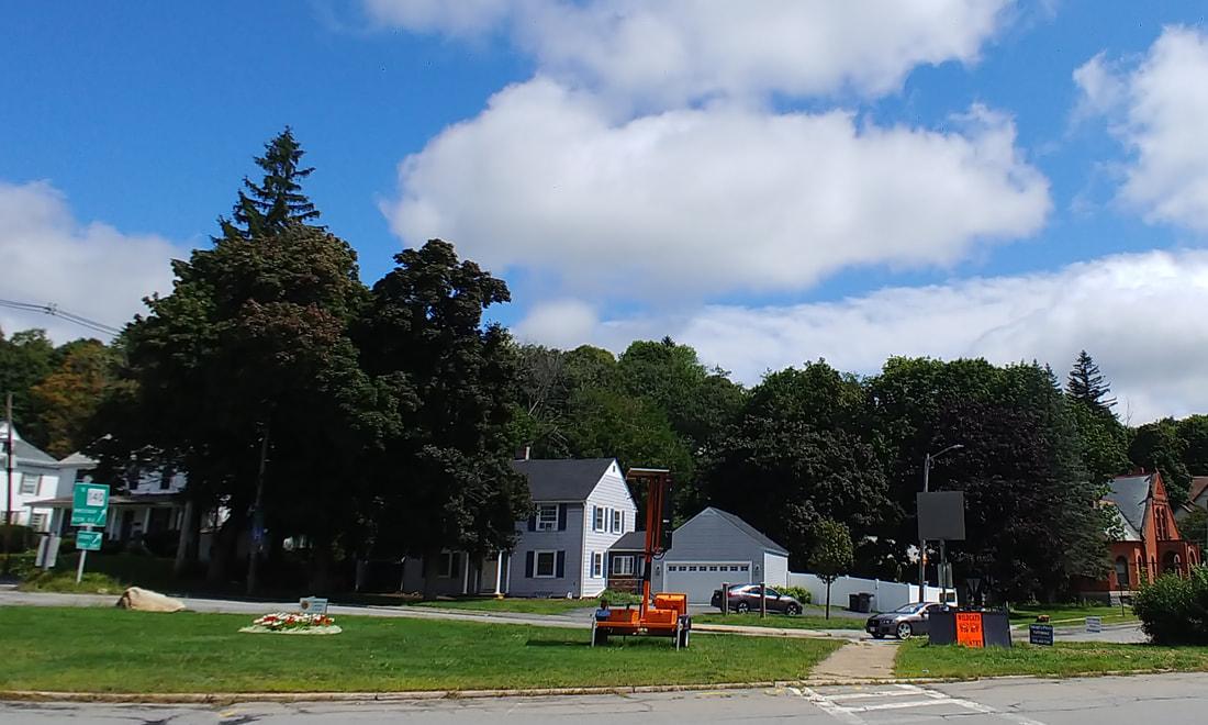 |
The Windsor house was built in 1883 and the 100 room hotel burned down on March, 1, 1917. The First National Bank (yellow building) between the hotel and the Levi Heywood Memorial Library (now the Gardner Museum) was demolished in 1939. Today, there is a house and an insurance company at 9 Green Street where the hotel used to be.
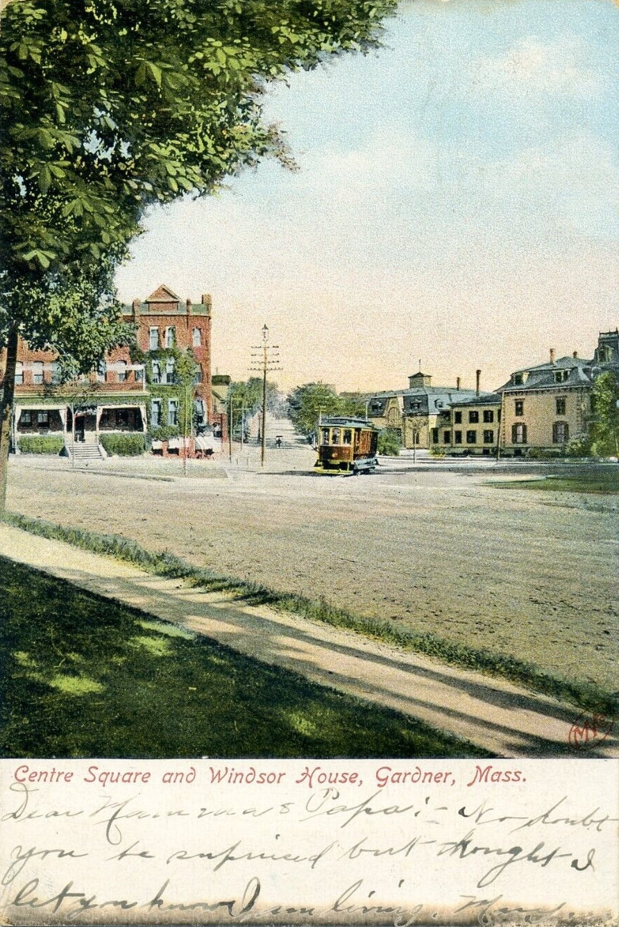  |
In the second comparison image you can see the Levi Heywood house on the right (see the Houses section below).
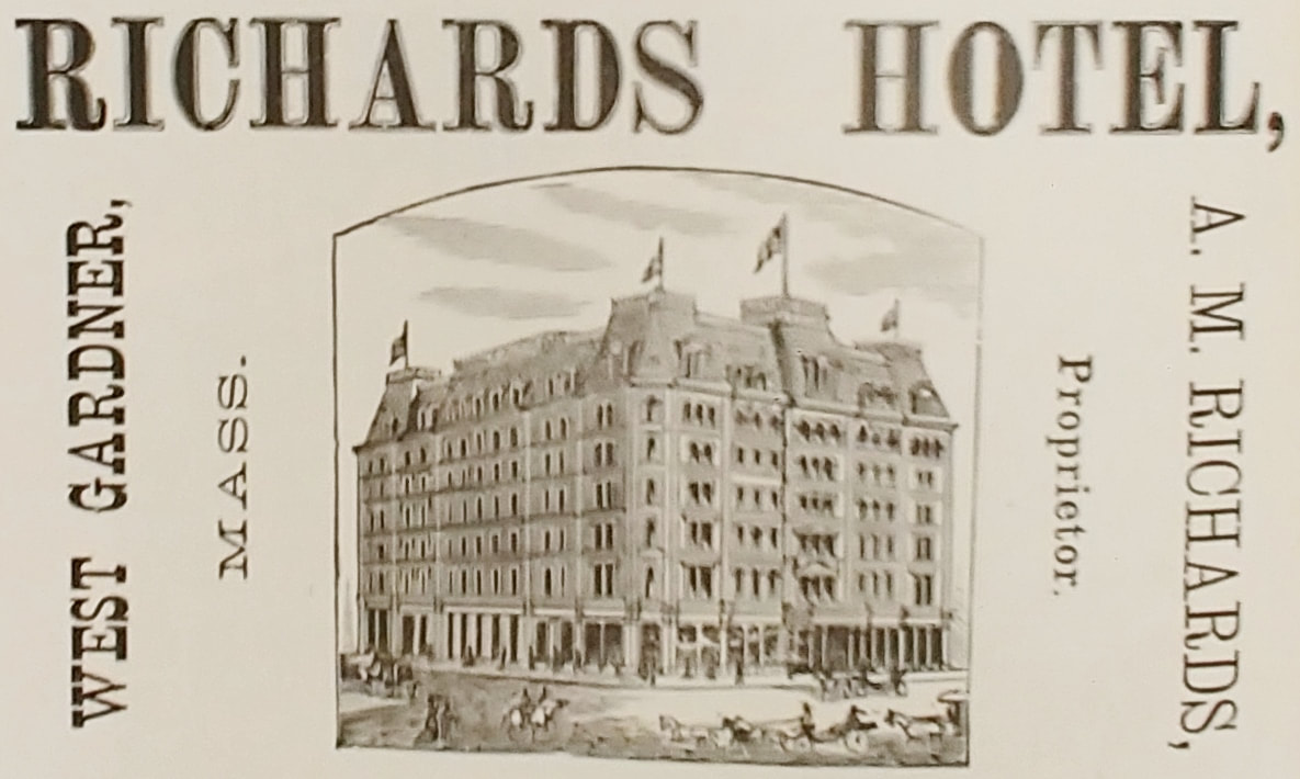
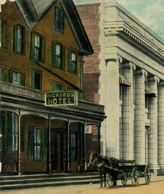
The Richards Hotel popped up in the history books and on the maps and only in a partial image (second) from a Parker Street view. By accident I ran across the early drawing (first picture) in an advertisement from the 1904-1905 Gardner Directory. I was excited until I got home and looked at it closer. The image does not agree with where the hotel was located on the 1886 and 1898 maps - it was only on Parker Street and not on a corner. Also, other Parker Street views, actual photos, don't indicate anything so massive was there. Seven stories. Hah! The second image shows what it really looked like while the first is a fantasy version. Those were the ethics of advertising in those days! Ref. 3 shows a better picture on Page 55.
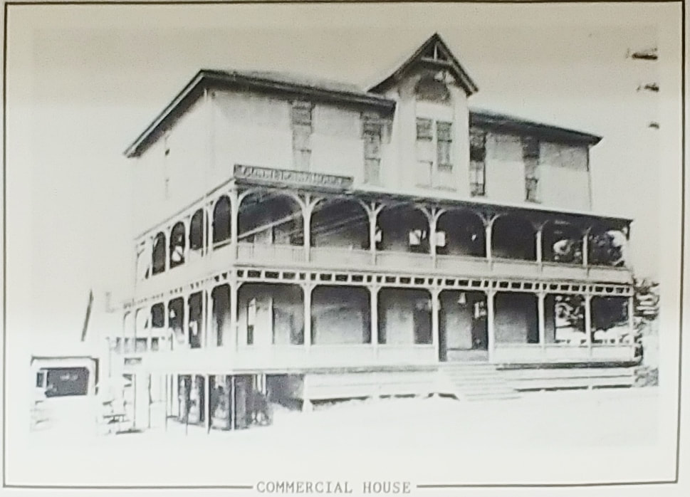
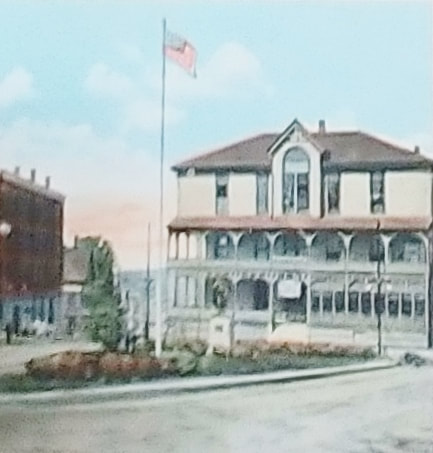
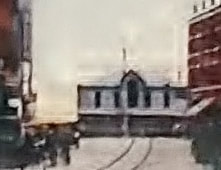
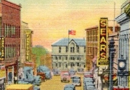
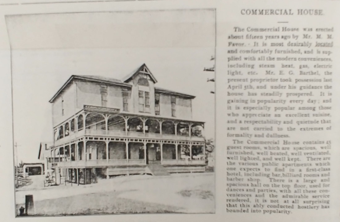
Commercial House - This hotel was located where the Shell station is now at the intersection of West, Oak, and Parker Streets. It was built in 1884 and taken down in 1953. The first three images come from a display that was in the Gardner Museum. Page 57 of ref. 3 also has the first two pictures. There are no dates associated with any of them. The fourth is a blowup from a postcard without a date. The cars suggest it's from the 1920s. The fifth one is also a blowup. The cars date to the 1940s. Note that Sears was there at least by 1948. A note on the perspective. For the first three you see a three-floored hotel but in the fourth it's two. This is because the first three were taken closer to the hotel, perhaps from in front of the Ale House or closer. The fourth was taken at street level from the end of Parker Street where it intersects with Central. Since the road drops at about Connors Street (the cross street) as it goes west you only see two levels of it. So why doesn't the fifth have the same issue? This is because it looks to have been taken from an upper level of the Stevens Block so the camera is elevated a story or two and not at street level. The name Commercial House first appears in the 1894 directory and its last occurrence is in 1910 - in 1920 it was called the Commercial Hall and in 1930 & 1940 it was Forester's Hall (at 46 Parker Street).
I added the next three a little later in the game (ref. 29). The sixth one is from an 1897 article which gives the hotels' construction year as c1882 and tells you about the hotel itself. The seventh may be from the 1910s or so and is looking up West Street. The building on the right is no longer there. The eighth is fr0m the 1940s.
I added the next three a little later in the game (ref. 29). The sixth one is from an 1897 article which gives the hotels' construction year as c1882 and tells you about the hotel itself. The seventh may be from the 1910s or so and is looking up West Street. The building on the right is no longer there. The eighth is fr0m the 1940s.
Gardner House - Images from 1900 (ref. 13), c1910, and undated - The Gardner House was run by the owners of the South Gardner Hotel from 1881 to 1915 and was sometimes referred to as the Gardner Hotel. It was located about where the left side of Taylor Rental is today and conveniently across from the train station (see Railroad Station section above). Its last listing in the Gardner directories was in 1962. Presumably, it was torn down since the rail station across the street had been razed in 1959 and business was slow.
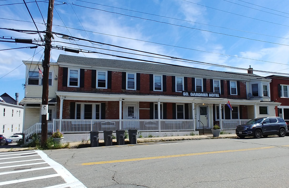
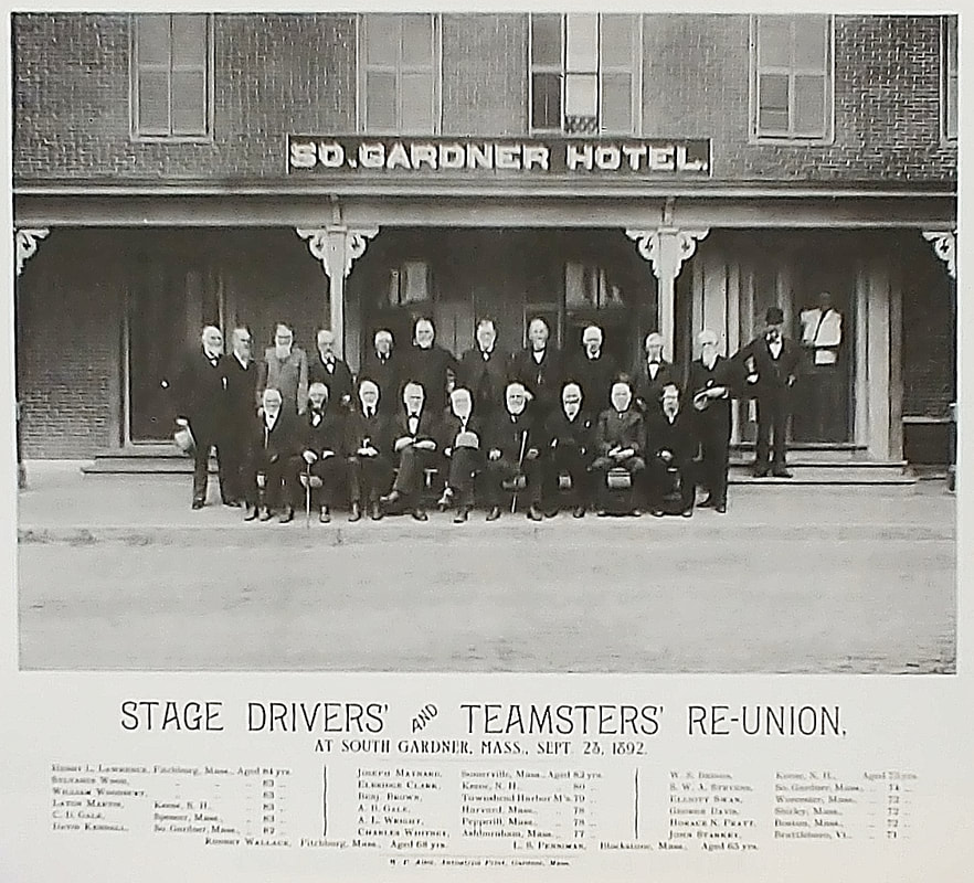
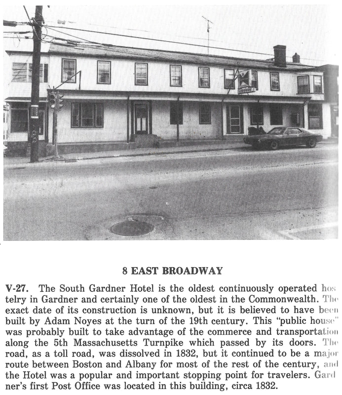
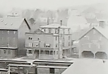
Remarkably, there seemed to be no old drawings or really early photographs of the South Gardner Hotel located at 8 East Broadway. This establishment was supposedly erected in 1799! I eventually found the reunion phot0 from 1892. The best I could find online was the photo from 1965 (third, ref. 19). The final one is from 1978 (ref. 2, pg. 92). There have been a few changes in these photos that span over a hundred years. Who knows how it looked even longer ago.

|
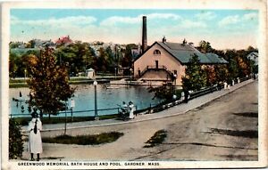
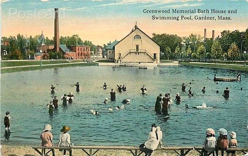
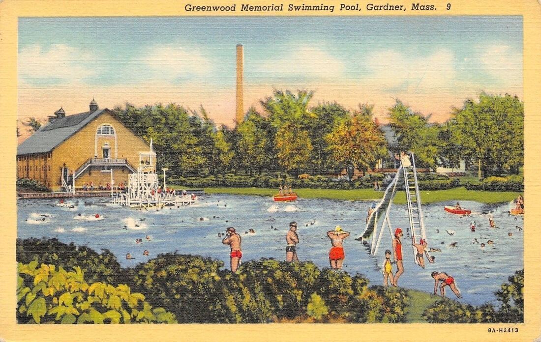
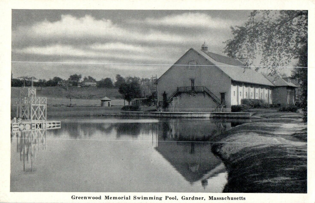
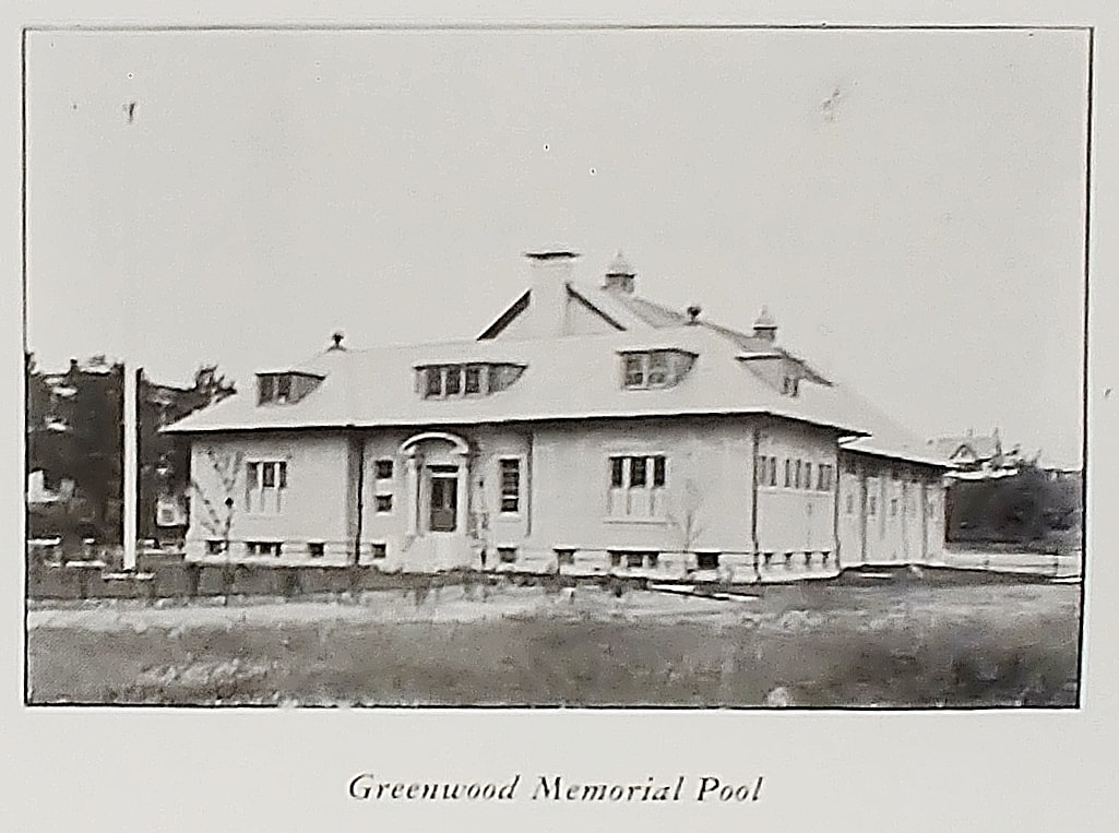
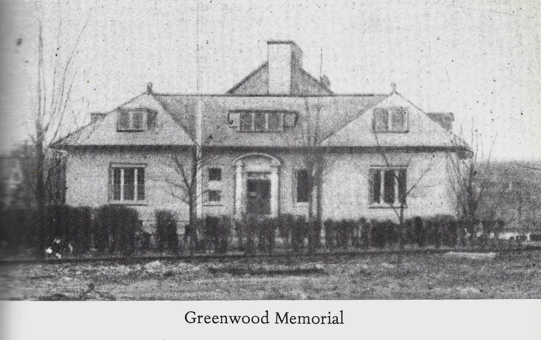
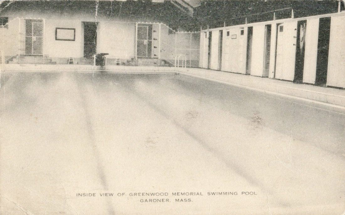
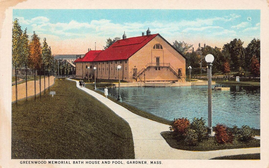
The pool opened in 1915 and is located at the corner of Park Street and Crystal Lake Drive. The first image is from the 1920s while the second is from 1924. The next one seems to be from the 1920s or 1930s while the fourth one is from 1938. The fifth exterior shot is from the 1940s. Note that the outdoor pool was essentially a pond. The sixth photo is from a reference book from 1948 (ref. 12) and so the photo is assumed to be from then. It is taken from the southeast side of the building. The seventh undated photo looks to be after the sixth one.
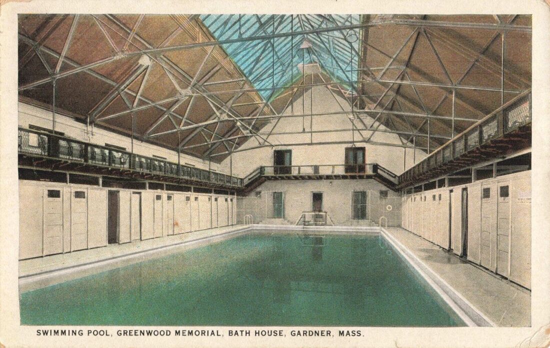
The first interior image shows how the pool looked c1920 and the second is from 1940. The 1920s one shows a skylight but in all of the exterior shots it looks like the skylight windows were covered.
The first interior image shows how the pool looked c1920 and the second is from 1940. The 1920s one shows a skylight but in all of the exterior shots it looks like the skylight windows were covered.
 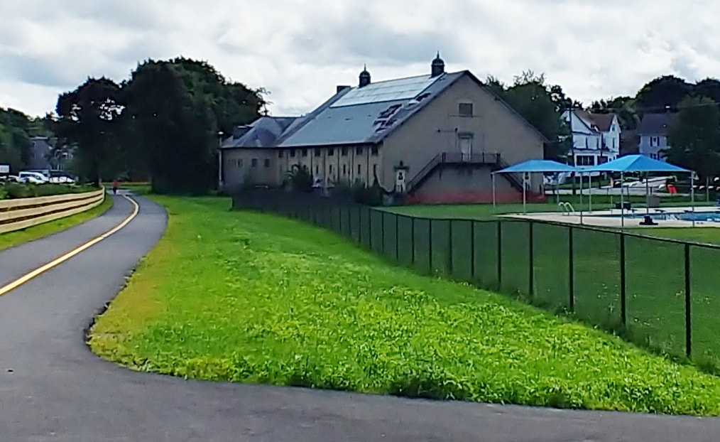 |
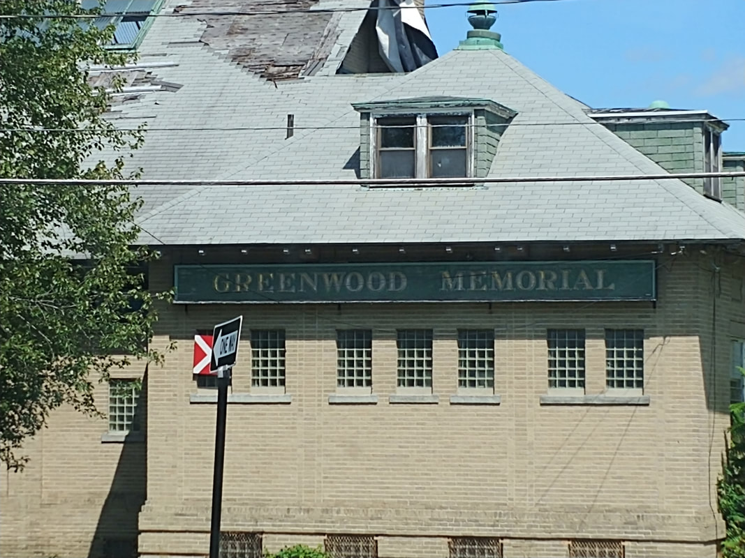
Today, there are definitely windows on top of the building and some panes are broken. The building is no longer used for swimming but you can see that in 2023 an outdoor pool is still in use. You can also see where the edges of the original pond were so the pool area used to be vast. Below is a photo from 2023 showing the Park Street side of the building.
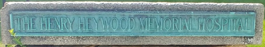
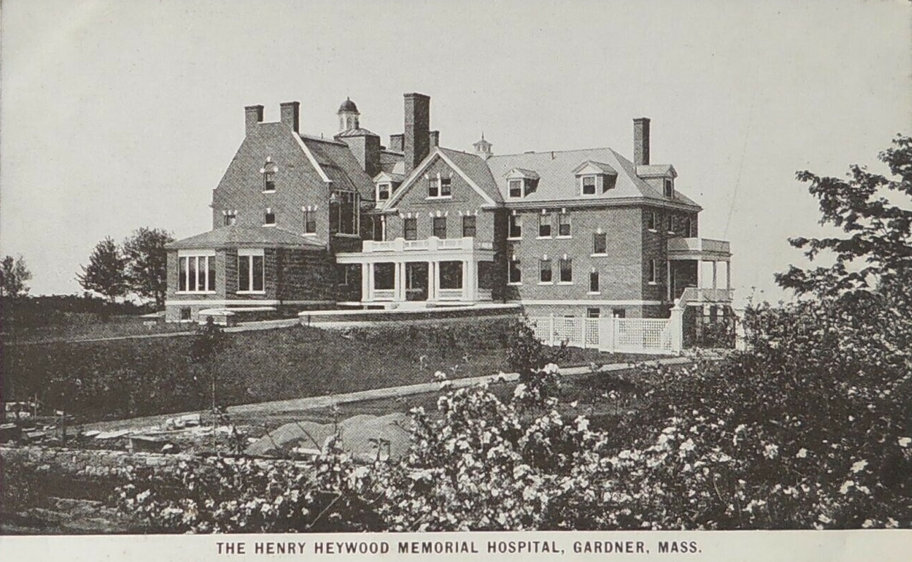
See image 8 for an early picture of the plaque which is still at the hospital today.
|

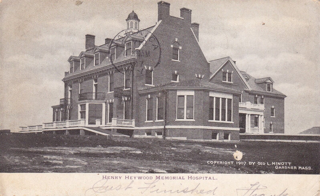
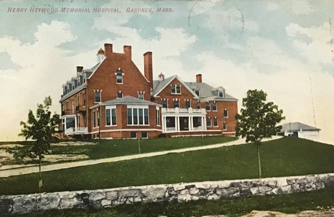
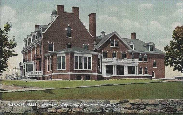
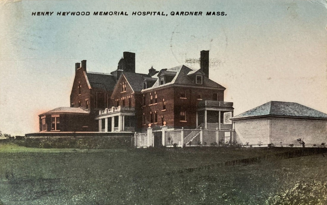
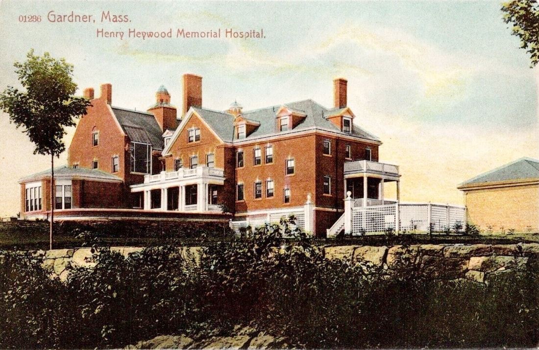
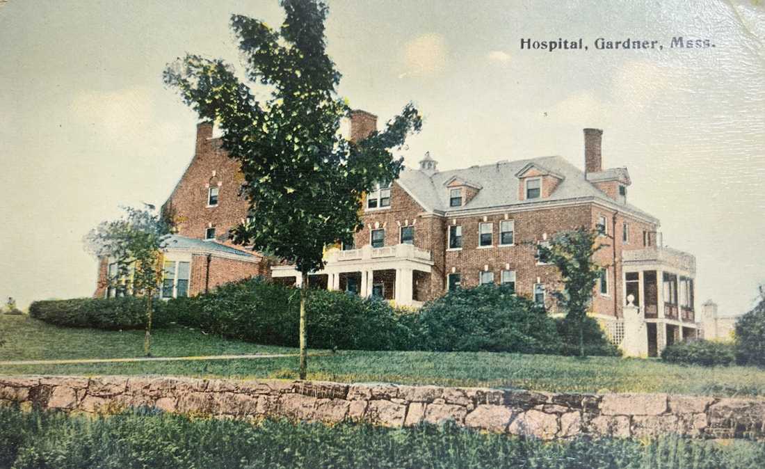
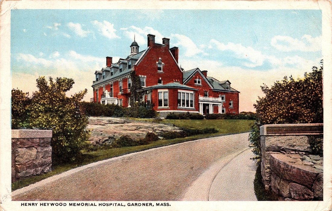
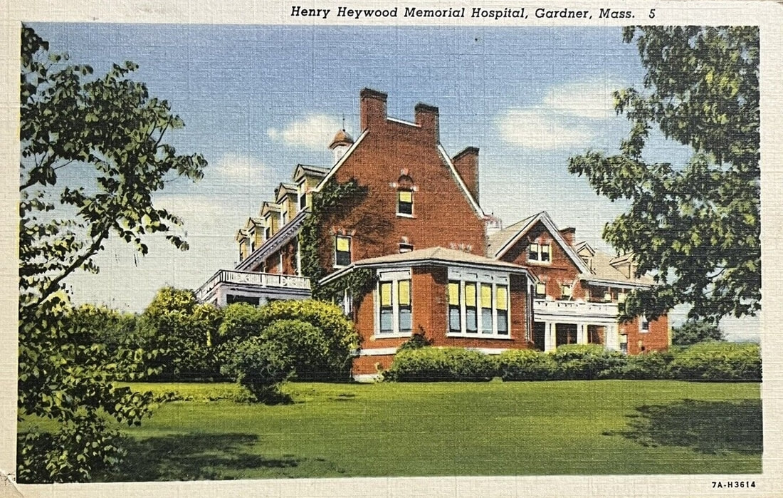
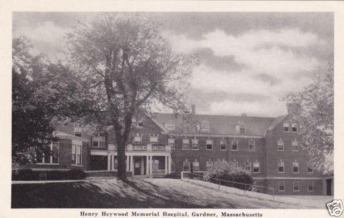
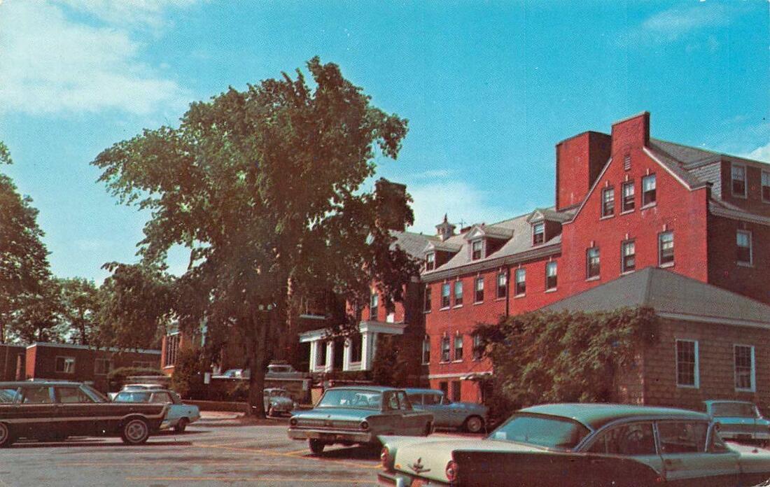
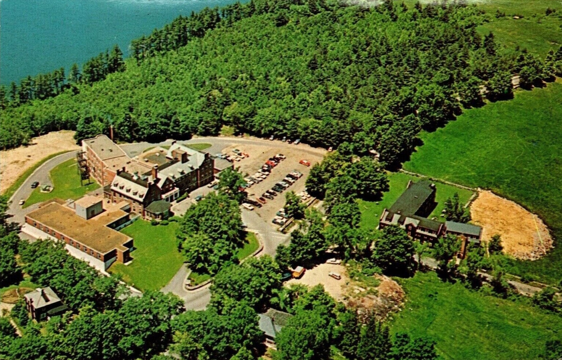
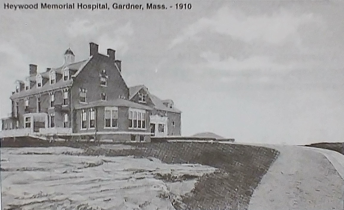
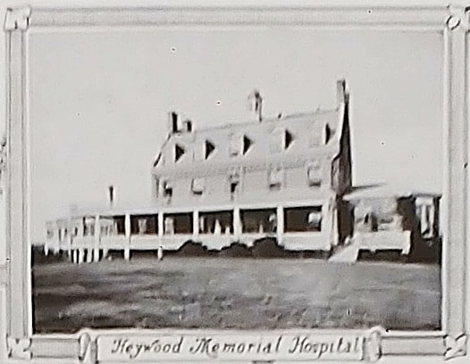
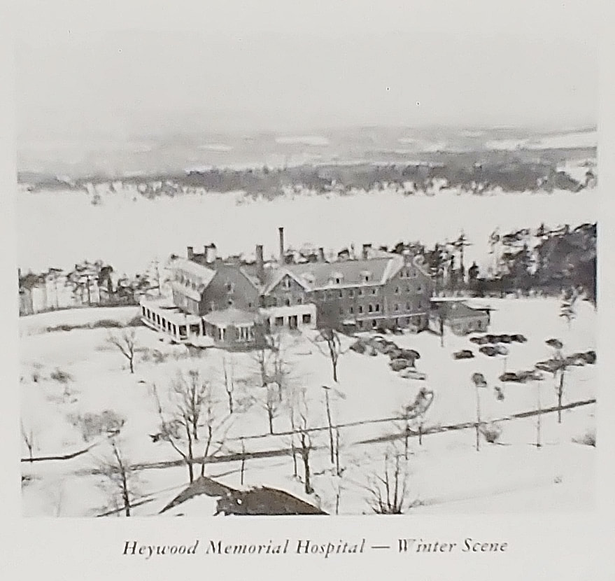
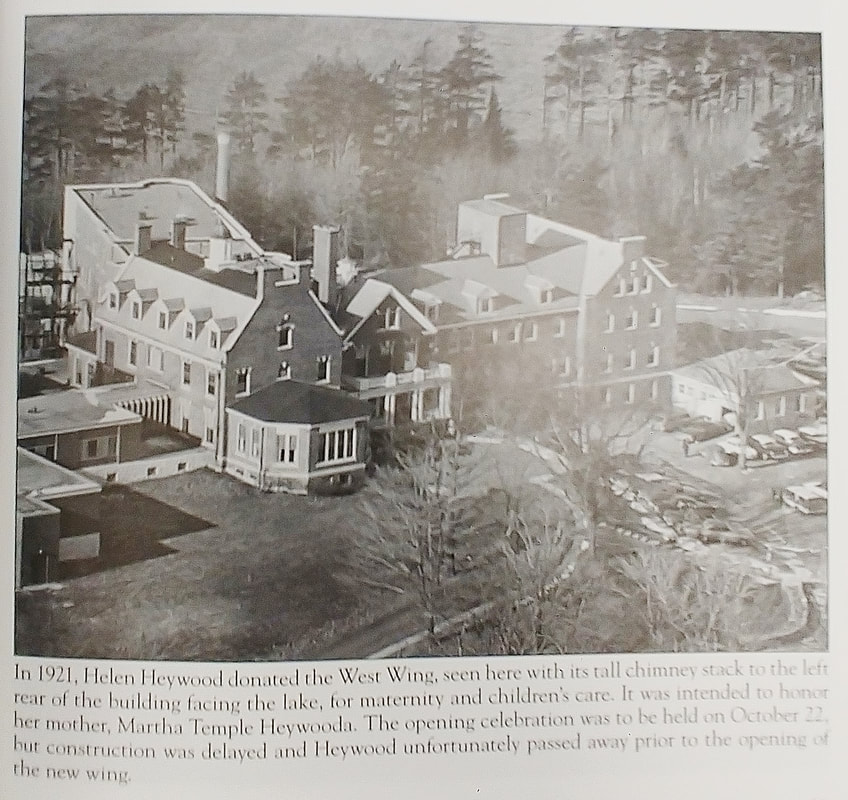
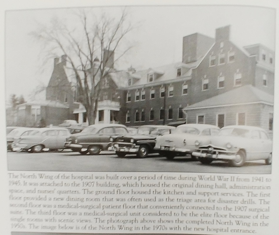
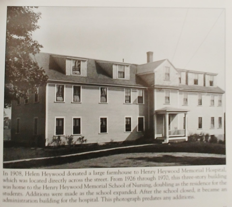
The first three images of the hospital are from 1907 and the fourth is probably from the same time. The fifth is from 1910 and the sixth is assumed to be from about then, too. The seventh image starts to show the shrubbery a little more advanced in 1913. The eighth one shows the drive going towards the hospital. This is not Green Street but a driveway. The big stone structures to the left and right still exist but look to have been rebuilt and may not be in the same place. The plaque on the right one still exists today (see above). The ninth image is from 1942. The tenth image shows the addition to the right. The eleventh one is from the 1950-60s and the parking lot is still out front. The bird's eye view looks to be from the 1950s by the looks of the cars. You can see that the driveway to a parking lot and the wall still exists and a couple of additions have been made to the left and in the back.
13. 1910 - Reference 13, page 27
14. 1948 - date assumes image was taken when reference book was published (ref. 12)
15. 1948 - date assumes image was taken when reference book was published (ref. 12)
16. Unknown date
17. 1950s
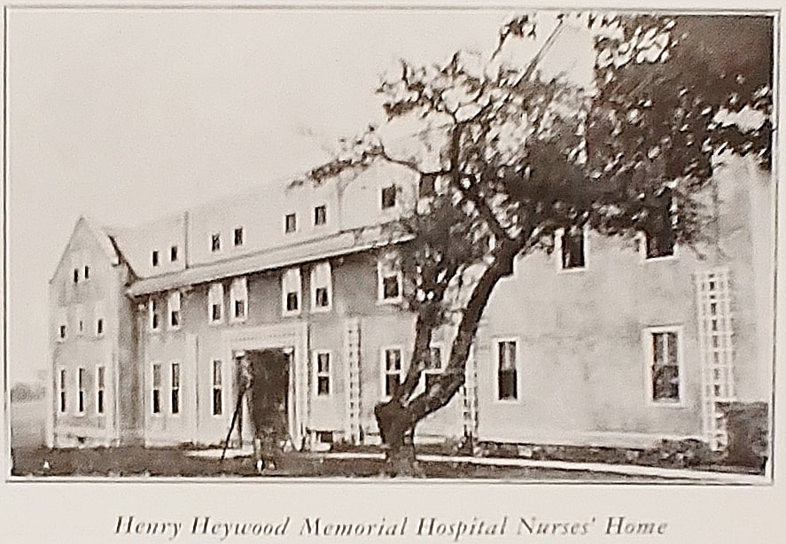
18. Unknown date - Henry Heywood Memorial Hospital Nurses' Home - Before additions and modifications. Seems to have been used as a nurse's home until at least 1967.
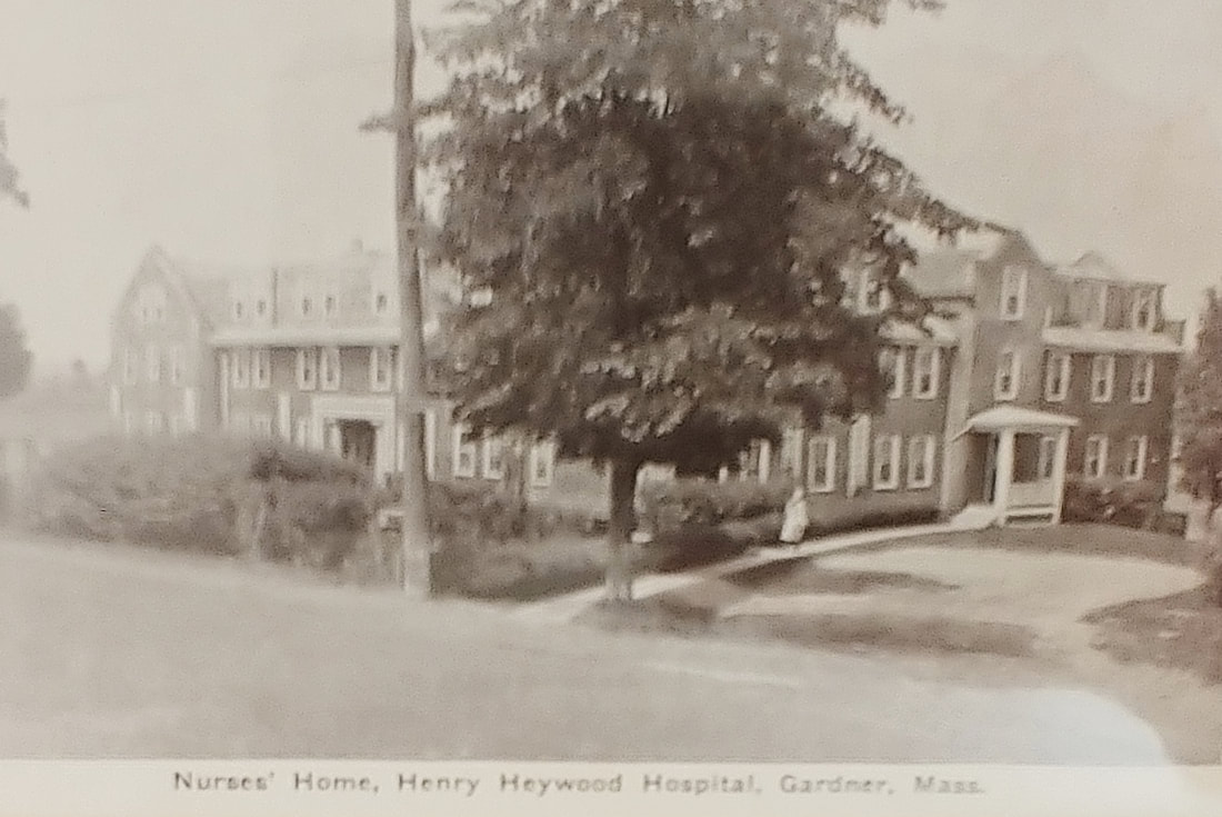
19. 1948 - date assumes image was taken when reference book was published (ref. 12) - Henry Heywood Memorial Hospital Nurses' Home - Still exists at 239 Green Street and used for administration, looking much like this picture.
20. Unknown date - (ref. 27)
13. 1910 - Reference 13, page 27
14. 1948 - date assumes image was taken when reference book was published (ref. 12)
15. 1948 - date assumes image was taken when reference book was published (ref. 12)
16. Unknown date
17. 1950s
18. Unknown date - Henry Heywood Memorial Hospital Nurses' Home - Before additions and modifications. Seems to have been used as a nurse's home until at least 1967.
19. 1948 - date assumes image was taken when reference book was published (ref. 12) - Henry Heywood Memorial Hospital Nurses' Home - Still exists at 239 Green Street and used for administration, looking much like this picture.
20. Unknown date - (ref. 27)
 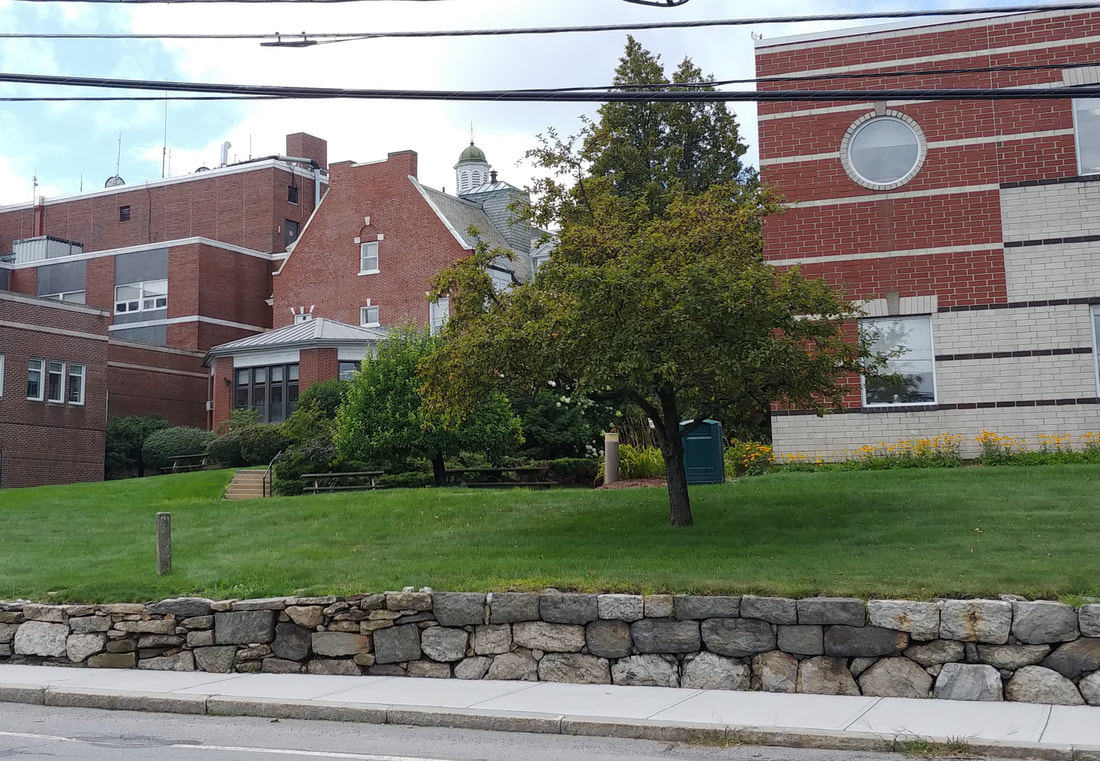 |
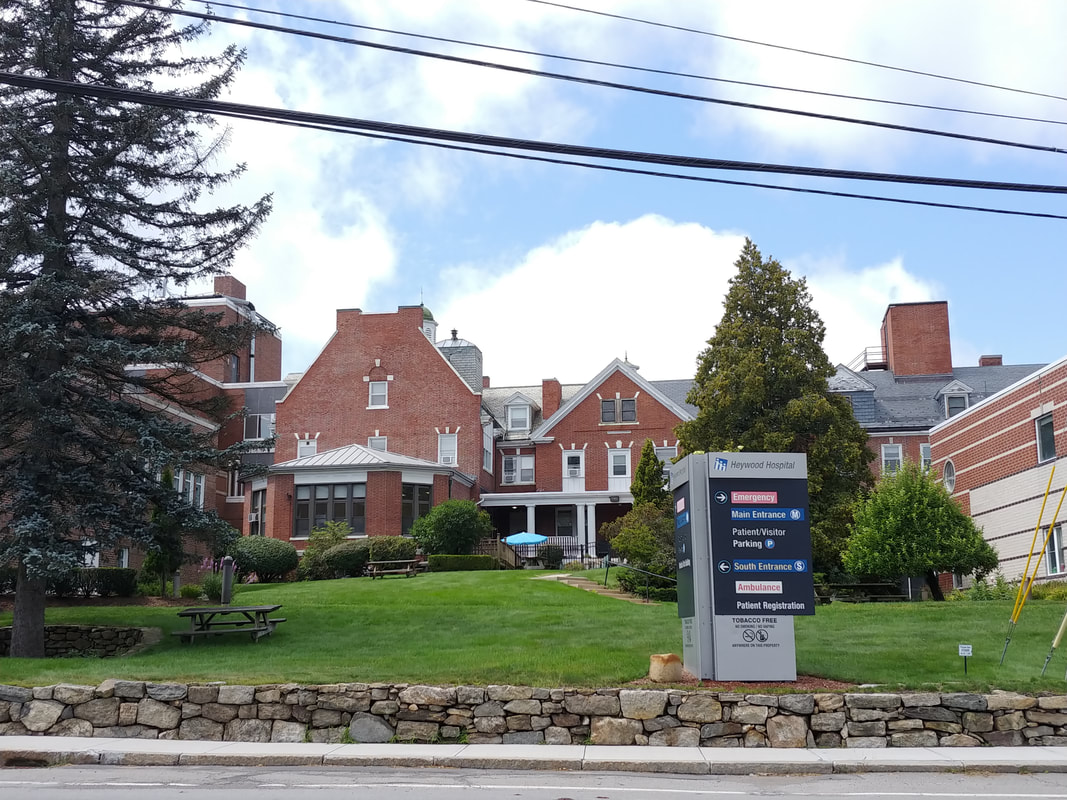
With all of the additions it was pretty impossible to match the old shot because of new structures and trees. I added the second 2023 image below just so you could see it better. Still not great but you can see the original building is still there. Walking through that section of the hospital I never knew that was the old part. You certainly can't tell from the inside because it's been revamped. There is a curious half-visible door on the way to the blood draw lab and now I have a better idea of why that weird door is there. Must lead to the 2nd floor - someday I'll try that door to see where it goes! Also, clearly, there is no more parking lot in front of the old section.

|
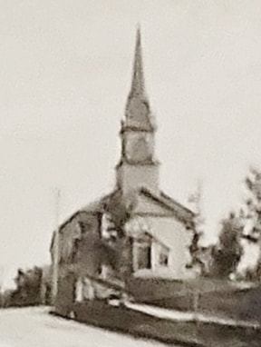

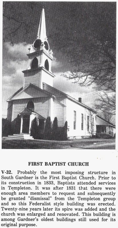
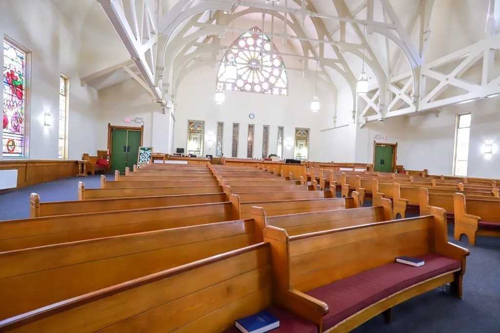
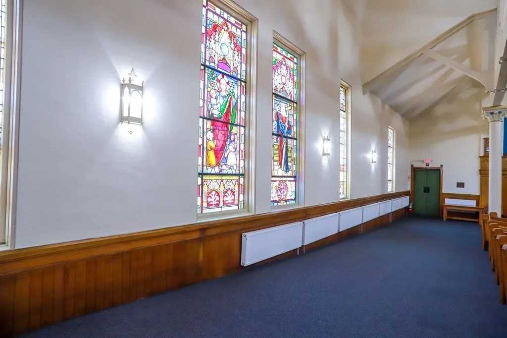
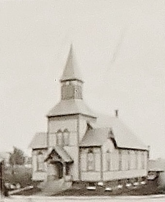
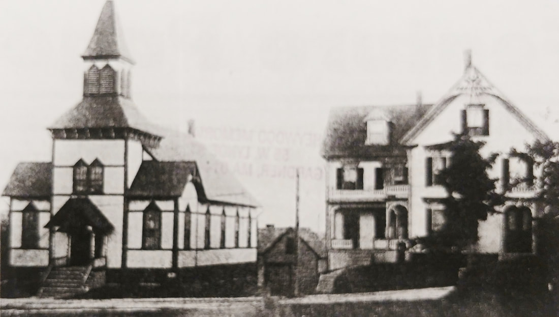
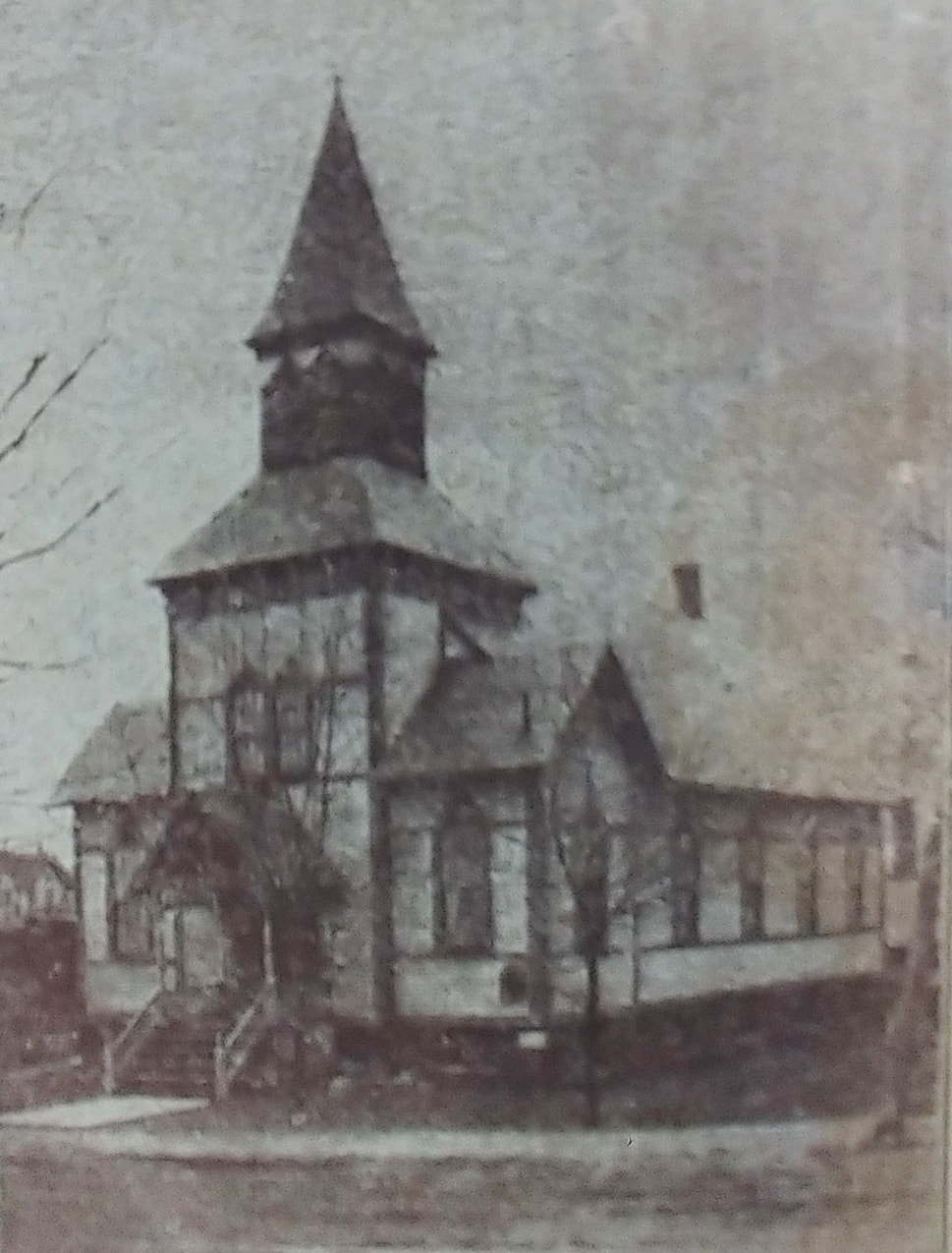
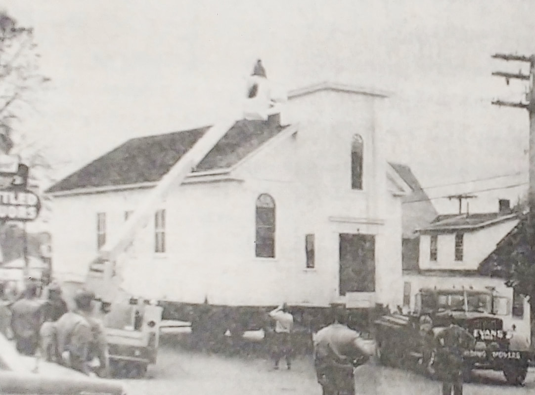
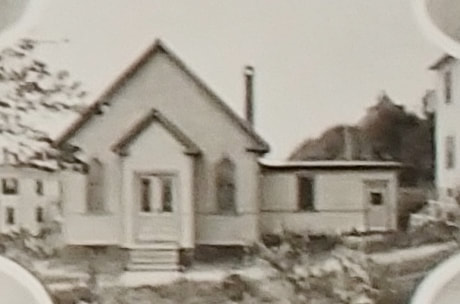
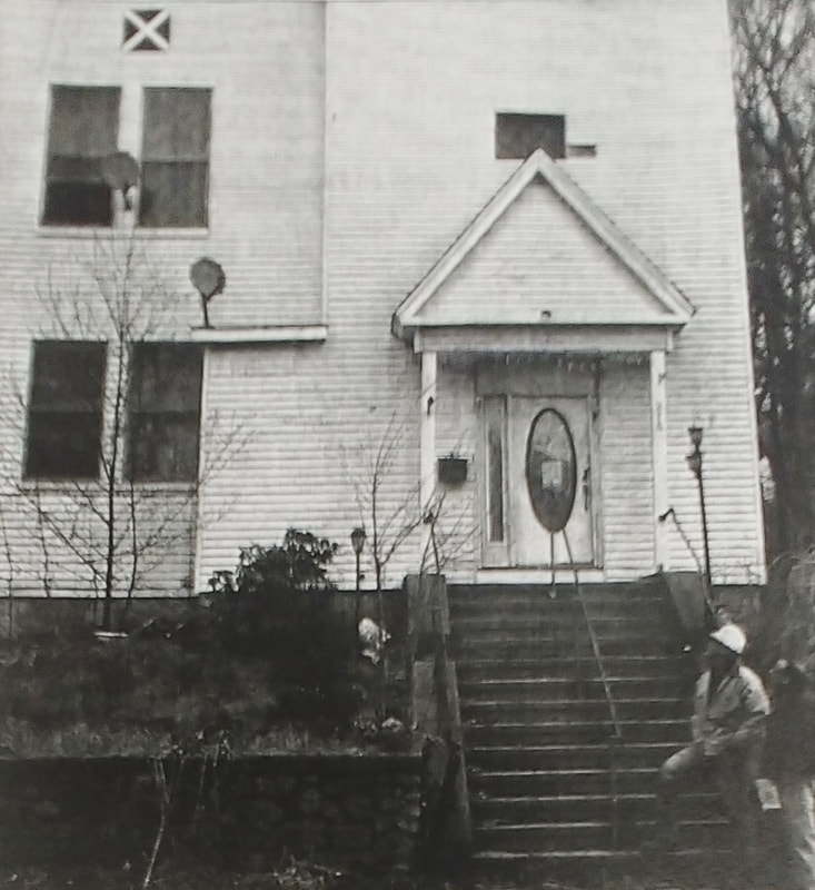
First Baptist Church - First photo is from 1889 (ref. 22, page 33), second is from c1903 (ref. 10), the third from 1906, and the fourth from 1978 (ref. 2, page 95).
|
|
Above text taken from ref. 1, pages 521-522.
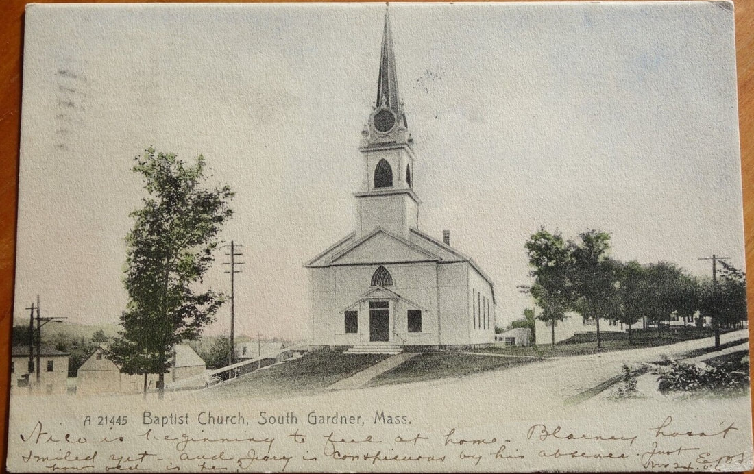 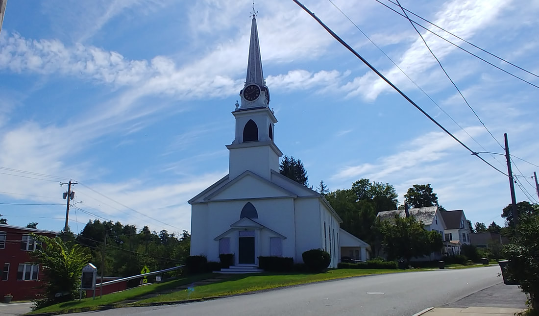 |
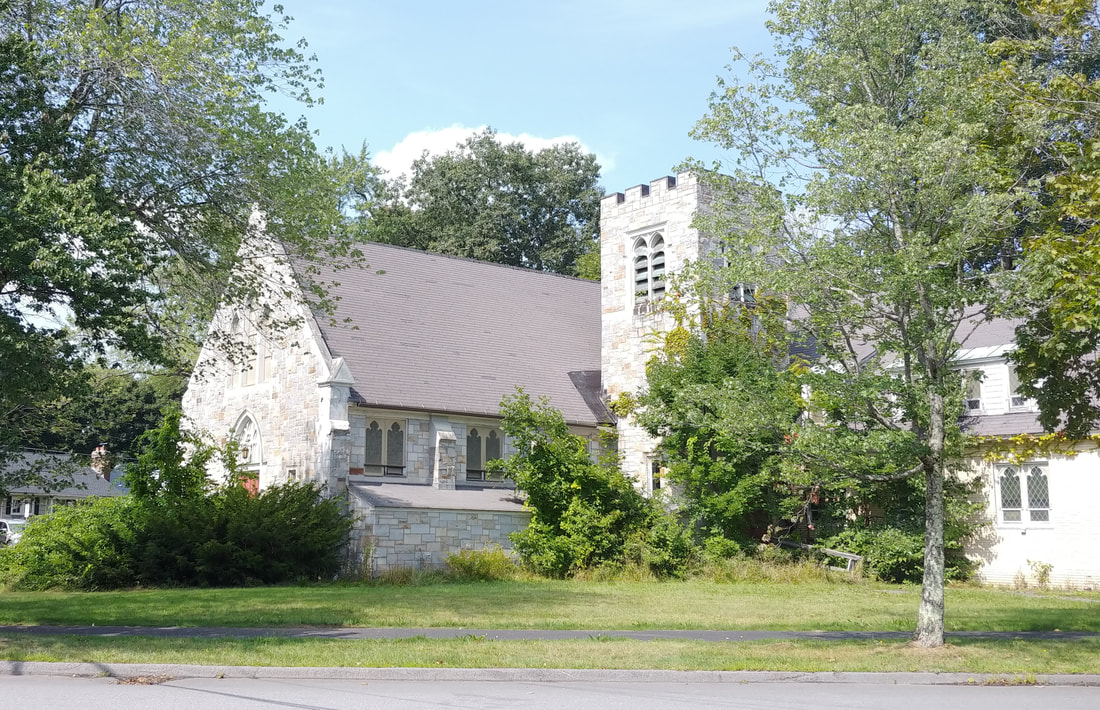
First Baptist Church - Built 1833 for $3,000 and redesigned in 1872 for $7,500. The church has clearly been well maintained throughout the years. Sometimes referred to as the South Gardner Baptist Church. Somewhere along the line the two entryways (figure 1) were converted to windows while one door apparently sufficed.
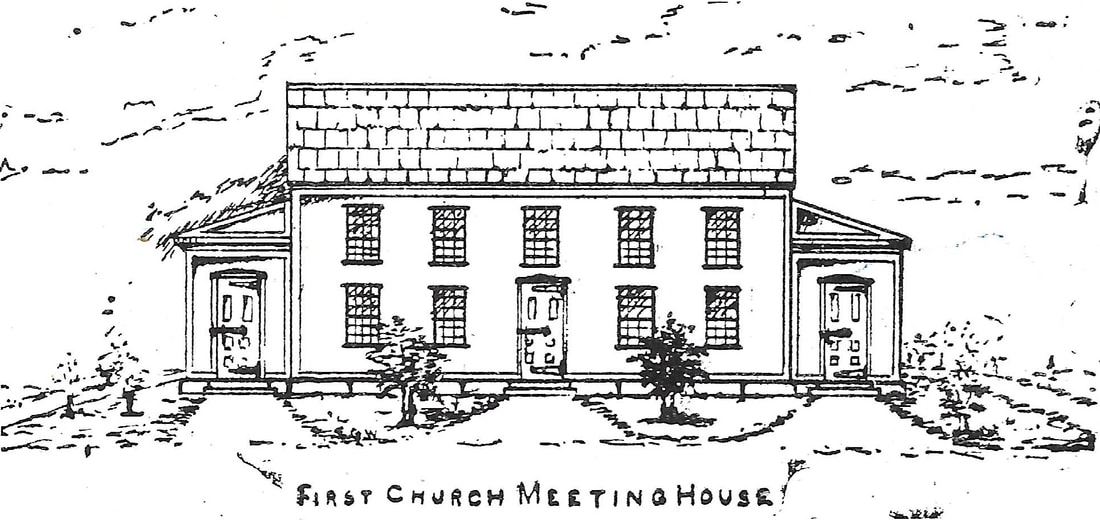
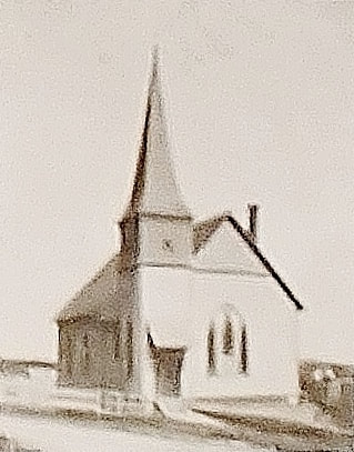
This is a drawing of the "First Church Meeting House" as described by Edward G Watkins (1865-1942). The image comes from Reference 20, the 1967 History, but it is not mentioned in the 1878 History (ref. 1) so it's a bit confusing. The best I can figure is that this is where people met prior to the actual church being built. Since Mr. Watkins wasn't born until 1865 I am not sure how he would know what it looked like.
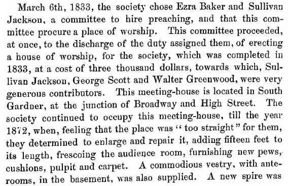
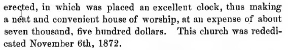
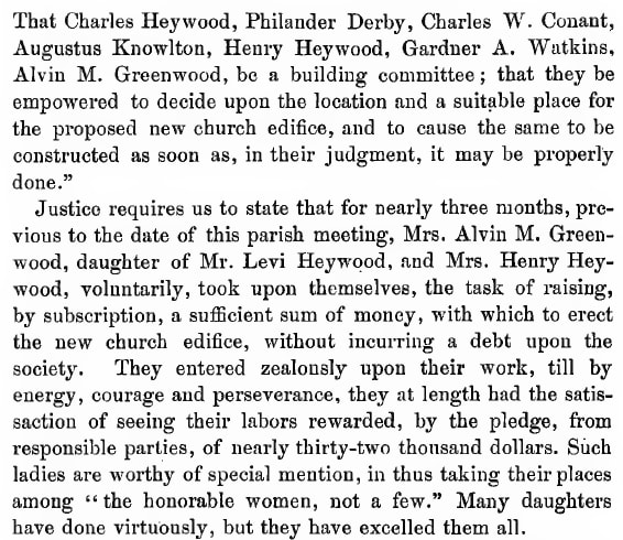
The Congregational history related in the 1878 History (ref. 1) goes like this. In 1785 a vote was made for a Meeting House construction and the establishment of the Burial Grounds. The Meeting House was initially planned to be 40' x 65' but later changed to 45' x 60'. It was built in 1787 on the land where the current Congregational Church is now at 28 Green Street. In 1845 it was modified and known as the Bell Meeting House afterwards. It was used as the 1st Town Hall until 1859, sold to Universalist Society in 1867, and then to Charles Heywood (1831-1882) who used it for his business. He moved it to 32 Chestnut Street. Although Charles had property there on the 1878 map he was no longer the owner in 1886 as he had passed. Reference 3 has a picture of what it used to look like on page 37. The original Congregationalist group joined with the Evangelical Group in 1867 (they had split in 1831) and they used their church (below) until the new one was built.
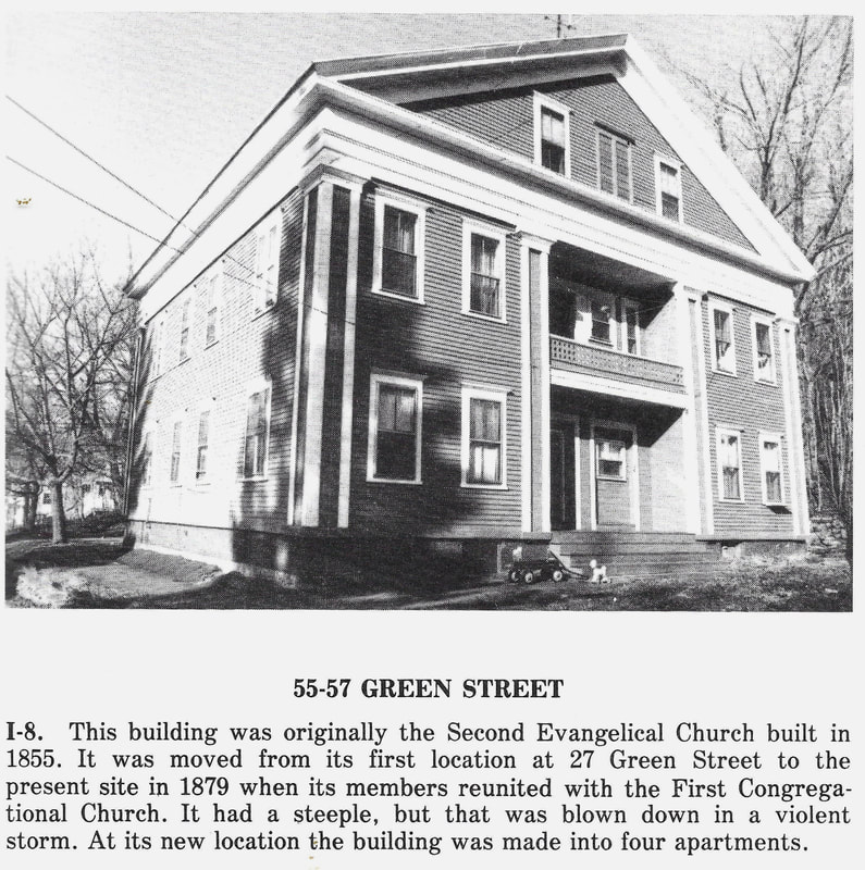
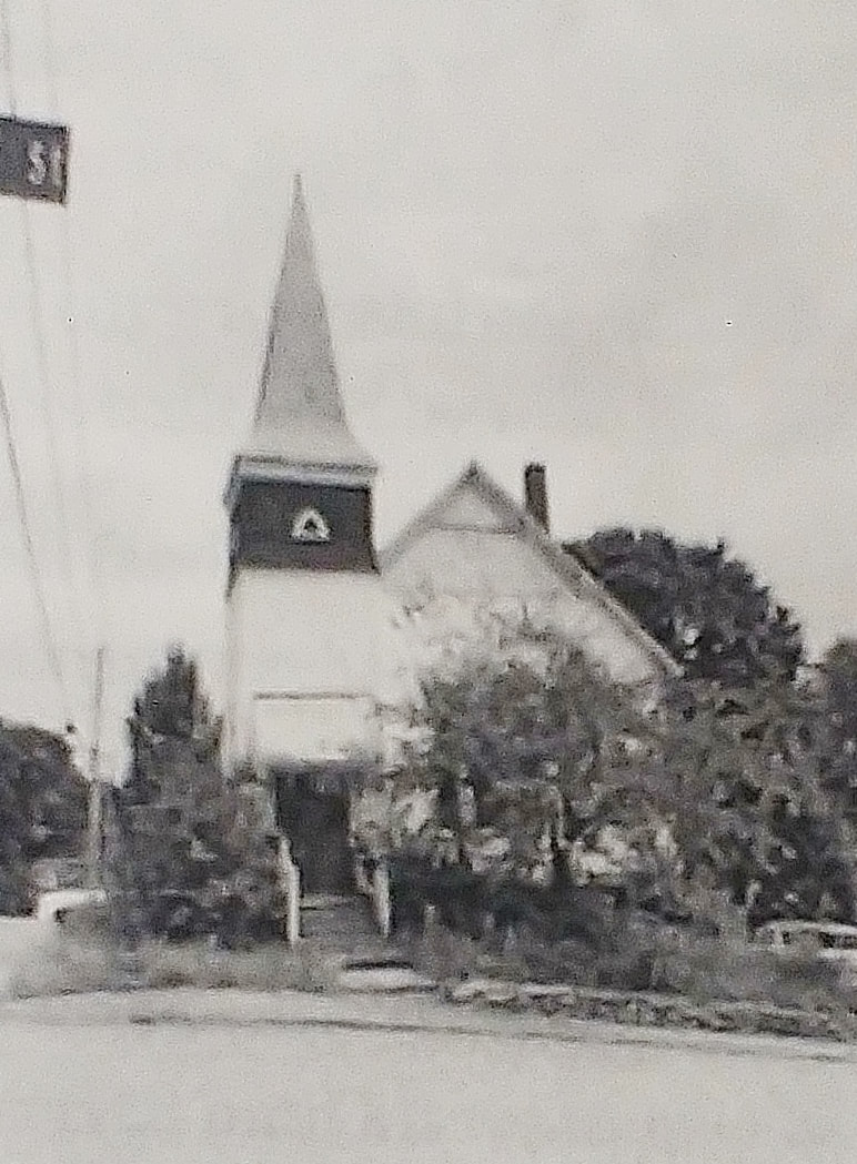
When the Evangelical Congregationalists broke off to form their own group, they built a church on the east side of Green Street near Heywood Street. They sold their church to Calvin Greenwood and built the one seen in the picture above (but with a steeple that later blew down) at 27 Green Street. It was moved to 55 Green Street in 1879 where it currently resides as apartments - the picture above is from 1978 (ref. 2. page 11). Reference 3 also has an early picture of it with its steeple on page 37. It looked remarkably like the original Congregational Church (aka Bell Meeting House). With the two groups now happily one, they proceeded to think about building a new Church.
|
|
|
|
Above text taken from ref. 1, pages 517-519.
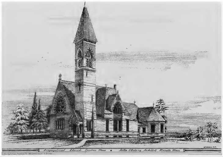
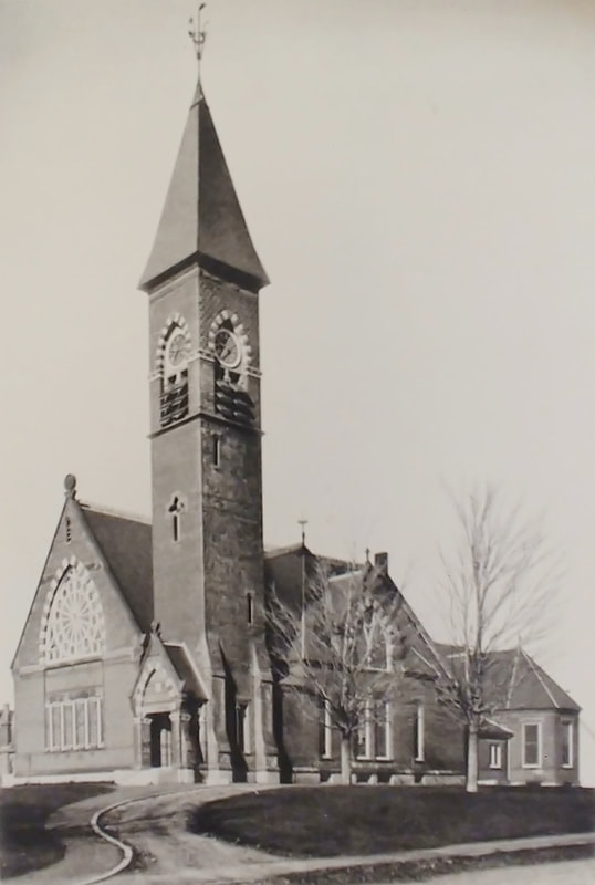
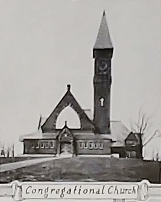
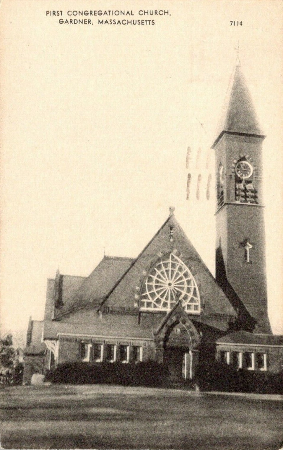
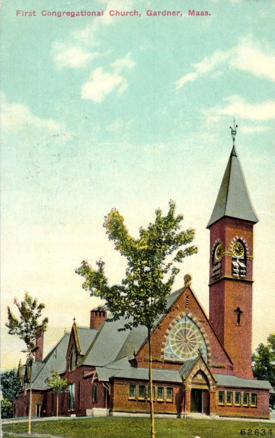
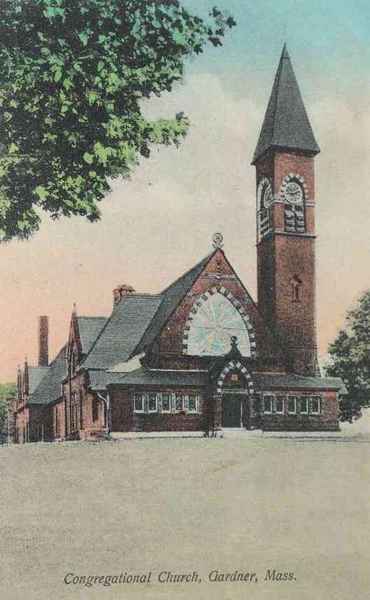
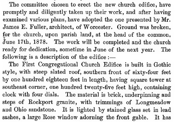
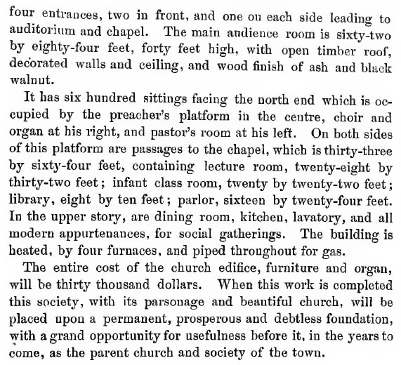
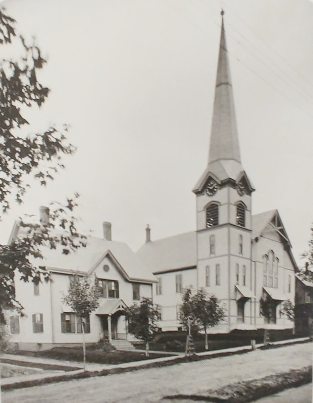
First Congregational Church - Built 1879 for a mere $30,000 and later modified.
1. 1878 - perhaps a concept drawing (ref. 1)
1a. 1889 - Reference 22, page 22
2. c1905
3. 1948 (ref. 12)
4. 1957
5. Unknown date
6. Unknown date
1. 1878 - perhaps a concept drawing (ref. 1)
1a. 1889 - Reference 22, page 22
2. c1905
3. 1948 (ref. 12)
4. 1957
5. Unknown date
6. Unknown date
 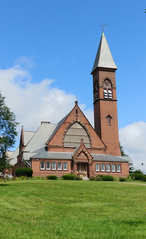 |
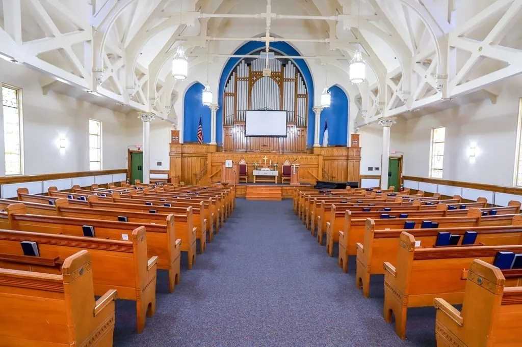

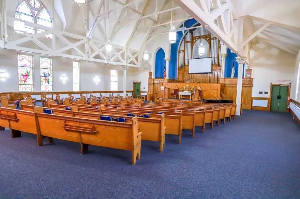
The First Congregational Church seems to have been well maintained. Alas, on January 29 of 2023, the congregation voted to sell their church. These excellent interior images were downloaded from a site which is responsible for the sale.
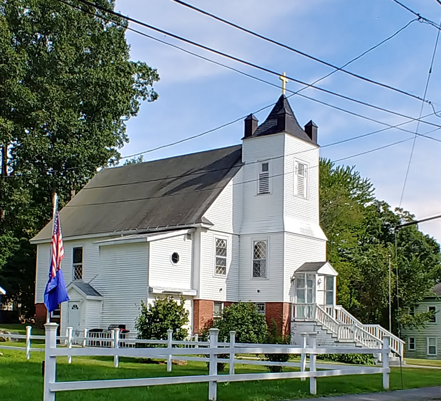
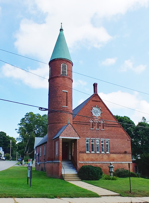
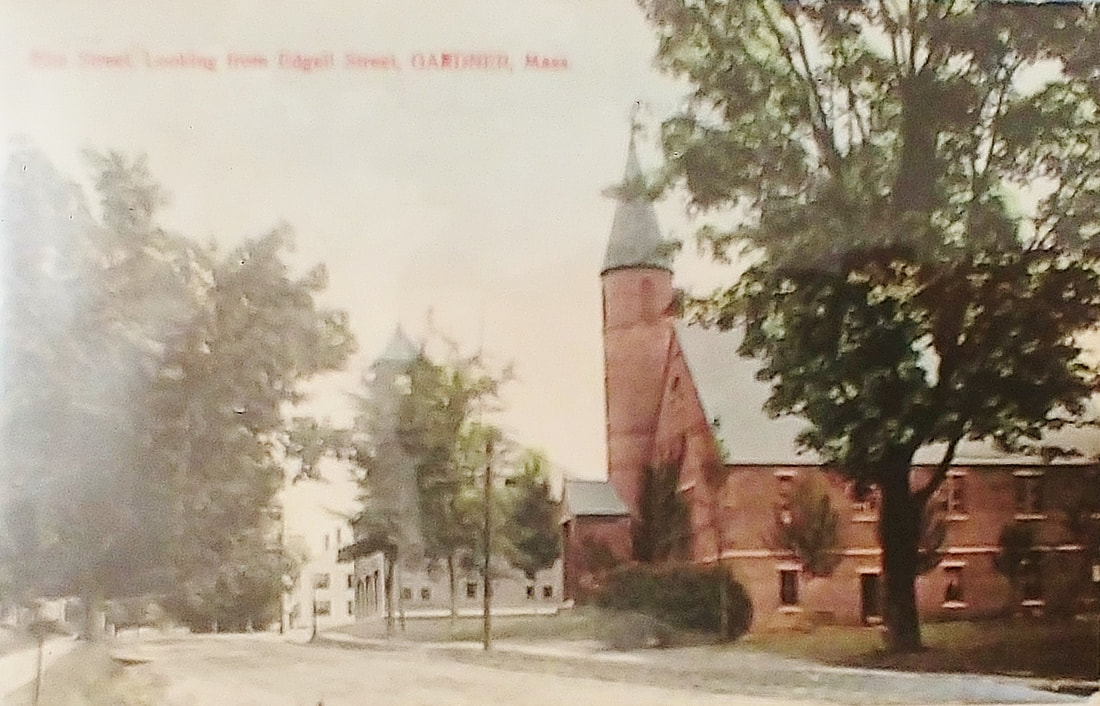
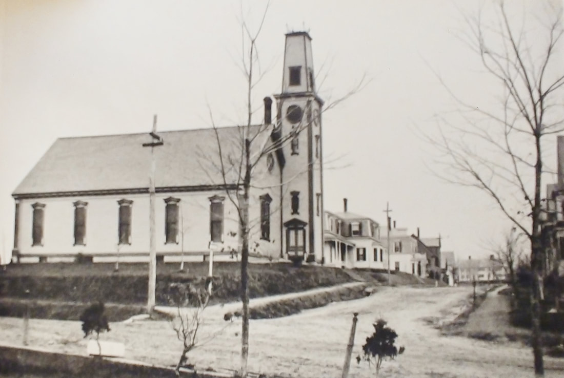
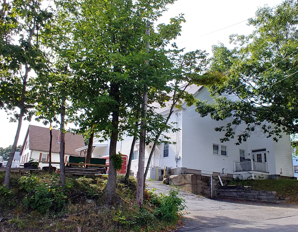
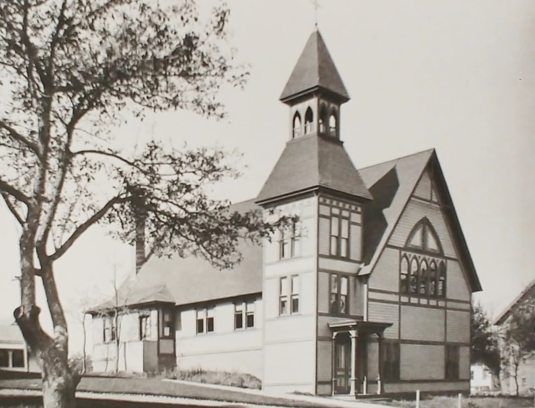
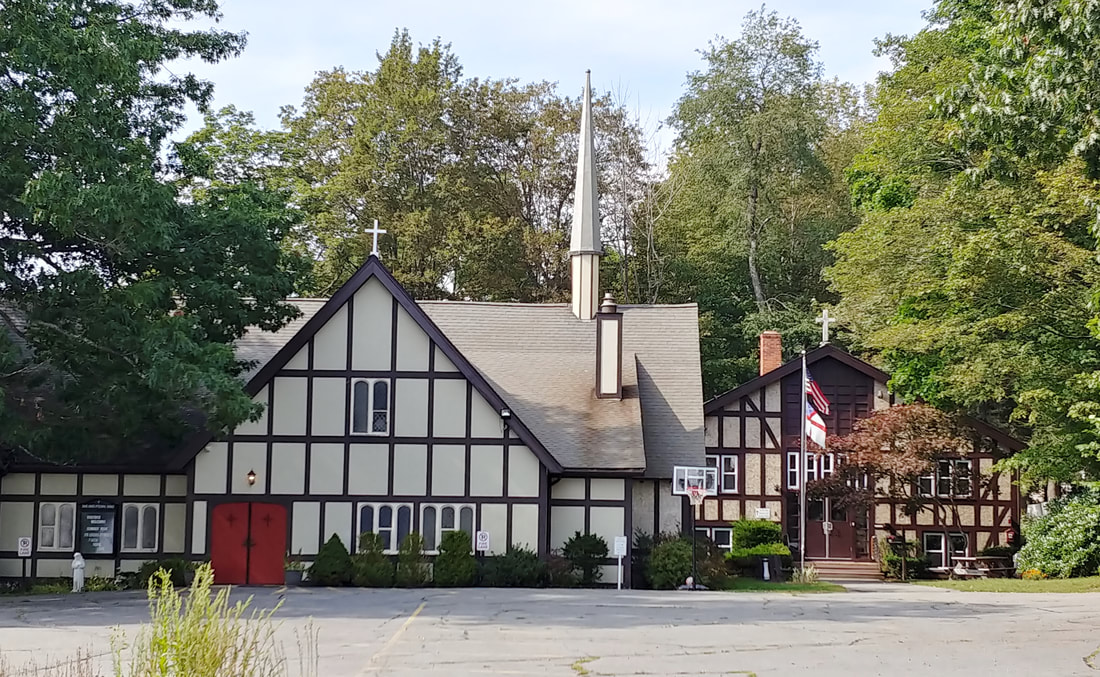
Finnish Congregational Church - Built in 1914 at 15 Mission Street, the church housed the Congregationalists at least until c1983. It now houses Iglesia Cristiana Siquem Inc.
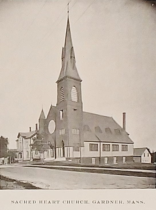
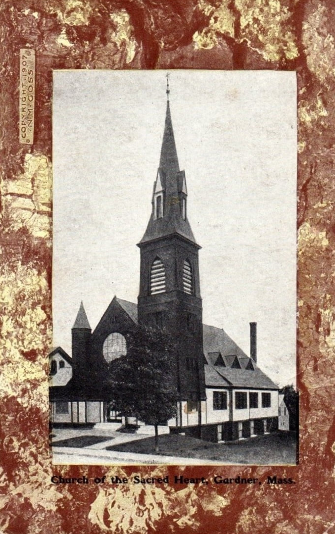
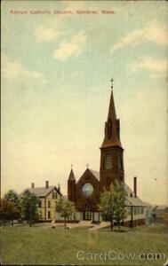
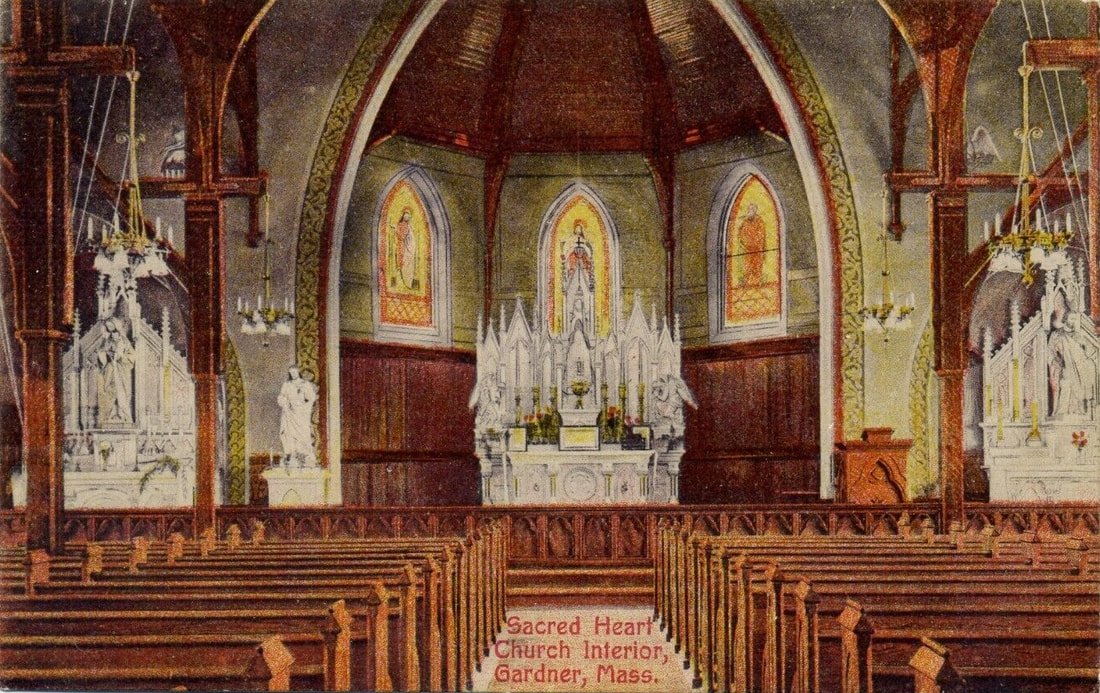
Sacred Heart Church
1. c1903
2. 1907.
3. Unknown date.
4. Unknown date.
5. Interior - 1910.
1. c1903
2. 1907.
3. Unknown date.
4. Unknown date.
5. Interior - 1910.
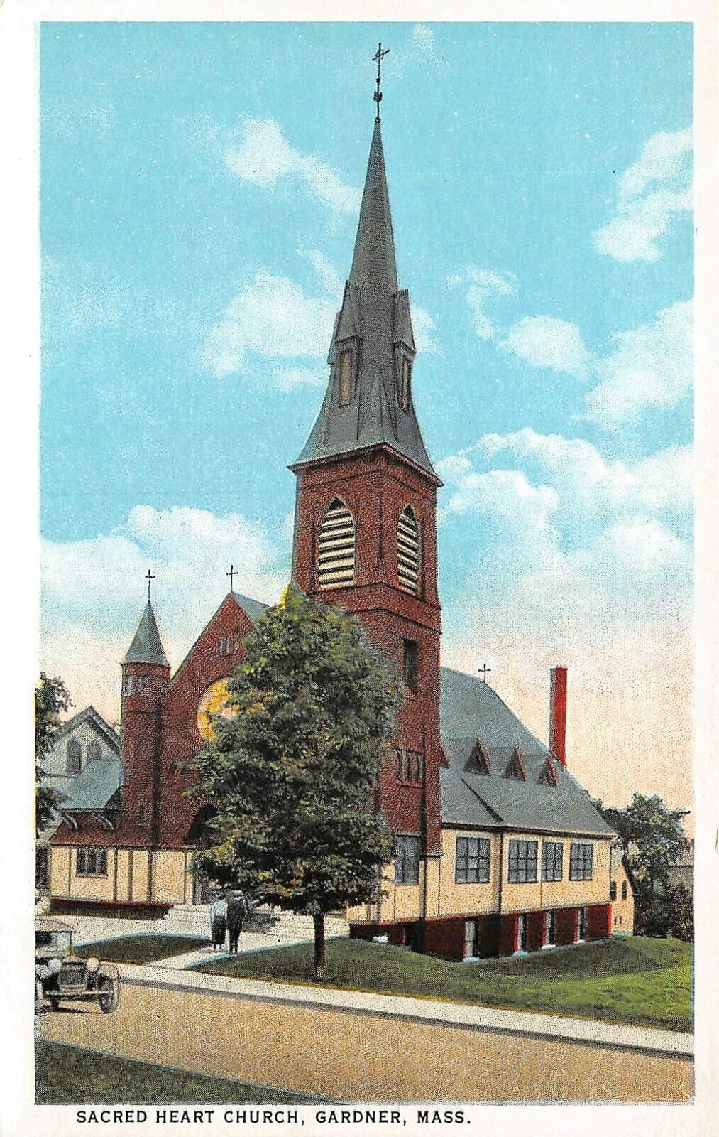 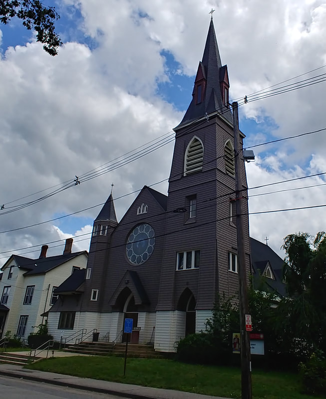 |
There was a church on the same spot at 182 Cross Street that was completed in December of 1874 but burned down in 1882. Reference 3 has a picture of it, a bird's eye view, on page 46 along with an interior shot. I have a picture from an early newspaper article but it's so terrible it wasn't worth posting here. The current Sacred Heart Church, built 1893, was its replacement. The church looks like it has not even changed a bit.
Unitarian Church - The first old picture is from 1889 (ref. 22, page 14). The next old photo came from a book published in 1903 (ref. 10) but the image might be older. The Unitarian Church that is at 66 Elm Street today was built in 1887 and looks pretty much the same although it did have some additions and work done because of a fire. Reference 2 talks about it on page 41. The view looking north up Elm Street in image 4 (ref. 27) is undated but shows the church along with the Elm Street Fire Station.
Universalist Church - The church was built in 1878. The congregation closed its doors in 1950. This old picture is from 1889 (ref. 22, page 16) and it is looking north on Lincoln Street. The building still exists on the west corner of Cross and Lincoln Streets but with the upper 2/3 of the spire gone. The house next to it also is still around. The parsonage, erected a year earlier, was to the left on the corner or Cross and Maple Streets (185 Cross Street). The second image shows that the Church and Parsonage still exist though the trees really obscure things. The Parsonage was lengthened somewhat from its original size.
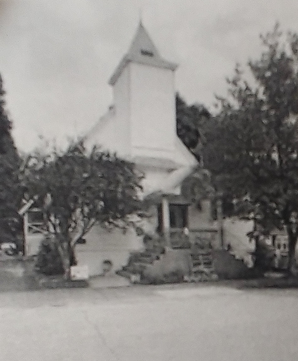
Scandinavian Evangelical Lutheran Church - The first picture is from c1903 (ref. 10) and the second is undated (ref. 29) but shows the parsonage next door. The third (ref. 21) was on the cover of a Finnish magazine from 1925 - this is clearly later than the first two. The church was at about 140 Cross Street from 1897 to 1946 but there is a large CubeSmart building there today as the church was demolished in 1962. It's successor, the First Lutheran Church, was built at the corner of Elm and Lawrence Street in 1943. The 2023 photo attests to the fact that the building is still there but it went on sale c2020 and its status is unknown although the "For Sale" sign is gone.
St Paul's Episcopal Church - The first picture is from 1889 (ref. 22, page 30) and the second is from c1903 (ref. 10). It was built in 1885 between Pleasant & Main Streets about where Fidelity Bank is. The church was sold to the Lutherans and it became the Finnish Lutheran Church (see below). In 1923, the Lutherans were kicked out and the church was demolished to make way for the City Hall...built 17 years later. After the sale, St Paul's moved to their new church at 94 Cross Street in 1909. Their rectory was built in 1930. The third photo is how it looks in 2023.
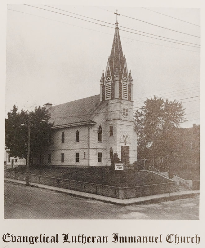
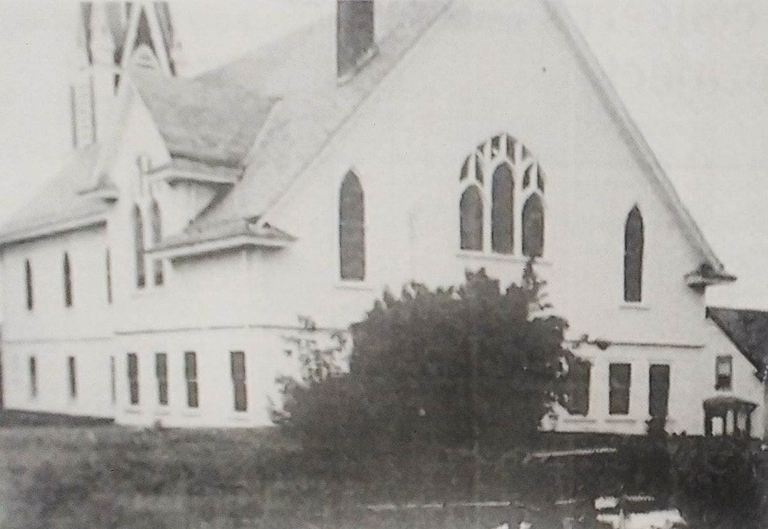
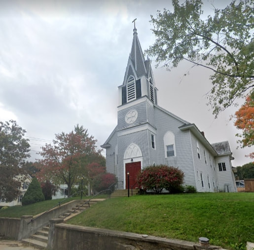
Finnish Swedish Lutheran Church - Established in 1894, this church at 1 Church Street was their first building. The old image of the church was published in 1903 (ref. 10) but it seems by 1902 they had built a new church in its place so the image is likely older than 1903. The new church is seen in image 2 from 1944 (ref. 29) and image 2a is an early but undated picture (ref. 29) showing it from the back. Today's picture from a Googlemaps snapshot shows it in good condition but it is now owned by First Bible Baptist Gardner. In 1928 they changed their name to the Evangelical Immanuel Lutheran Church and in 1974 they merged with the group below.
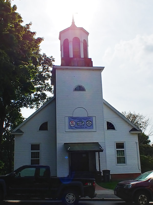
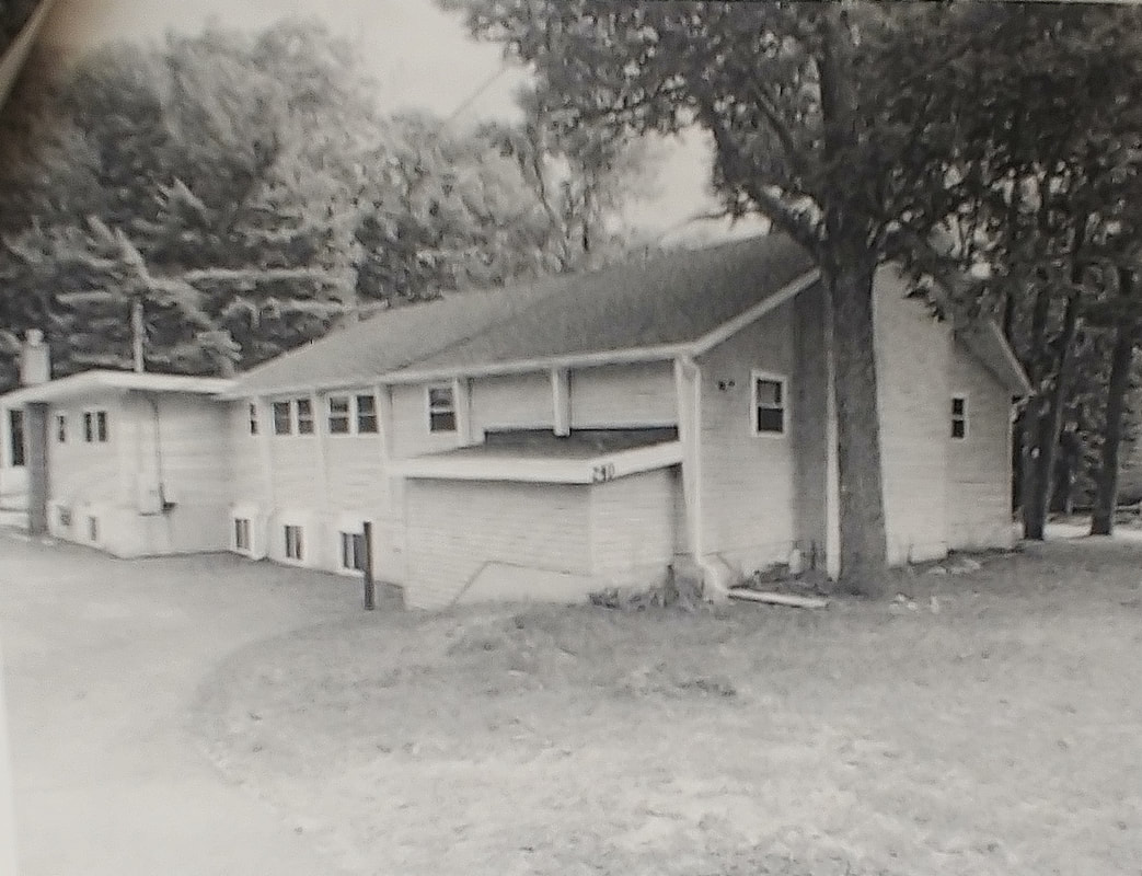
Finnish Lutheran Church - The church was built in 1927 on the 116-122 West Street property. They initially worshiped at 175 Nichols St but then bought St Paul's Episcopal Church. When it was learned they would have to move to make way for City Hall, they constructed this church. In 1954 they became the Bethel Evangelical Church and then the Covenant Lutheran Church after merging with Immanuel Lutheran Church in 1974. The church is now used for martial arts. There is a picture of it in its former glory in Reference 3, page 58. Covenant Lutheran Church eventually became Faith Lutheran Church and relocated to 627 Green Street where they are still situated today. Reference 21 was quite helpful in figuring all of this moving and merging!
Finnish Lutheran Church - The church was built in 1927 on the 116-122 West Street property. They initially worshiped at 175 Nichols St but then bought St Paul's Episcopal Church. When it was learned they would have to move to make way for City Hall, they constructed this church. In 1954 they became the Bethel Evangelical Church and then the Covenant Lutheran Church after merging with Immanuel Lutheran Church in 1974. The church is now used for martial arts. There is a picture of it in its former glory in Reference 3, page 58. Covenant Lutheran Church eventually became Faith Lutheran Church and relocated to 627 Green Street where they are still situated today. Reference 21 was quite helpful in figuring all of this moving and merging!
This is Trinity Lutheran Church on its way to Westminster in 1961 (ref. 29). It's original home was at 39 East Broadway. In 1940 it was referred to as the Trinity English Lutheran Church but later as the Trinity Lutheran Church. I do not know where it went or if it still exists.

Swedish Methodist Church - Built 1892. It was renamed the Hillside Methodist Church in 1957. The church merged with the Chestnut Street Methodist Church (below) and stopped using this one in 1966. The first old image is from c1903 (ref. 10) and the second is undated (ref. 29). The church still exists at 162 Peabody Street but it seems to be unused.
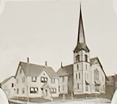
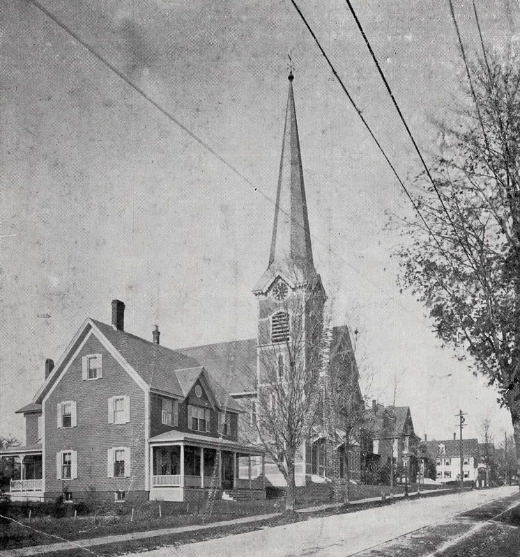
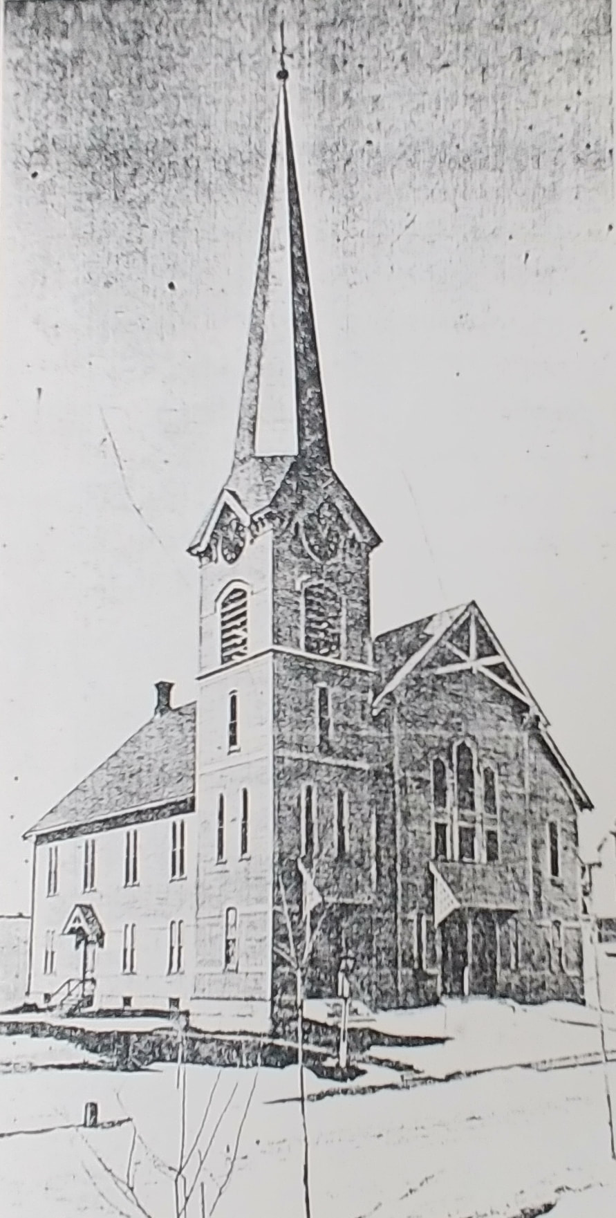
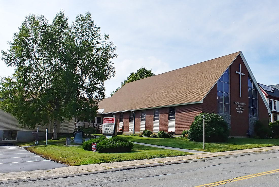
United Methodist Church - This church, built in 1876, was on the lot where the current Methodist Church is at 161 Chestnut Street. The building next to it is the parsonage which was on the lot just south of the church. The first image is from 1889 (ref.22, page 35) and the second was from Reference 10, published in 1903 but with no date. As there seem to be no trees out front the picture may be earlier than the first. The third undated one comes from the church's website, https://gardnerumc.org/our-history/. The fourth one is undated (ref. 29). The fifth is a 2023 photo of the current Methodist Church, built in 1960.
Swedish Baptist Church. This first picture is from c1903 or earlier (ref. 10). It is actually the Chapel built at 276 Pine Street in 1892. The Church at that location was not built until 1907. In 1898 the map shows the building toward the back of the lot and the shape/orientation for the building suggests that what we are looking at would be the right side of the church if we were on the street. The slant of the walkway up to the right would give credence to this thought. The 1909 & 1914 maps show the new Swedish Baptist Church on the street side of the property with the "Finnish Church" located behind it. In 1923 & 1932 there is a structure in the same spot which may or may not be the chapel. The new church was still there in 1932 and appears to have been there up until at least 1968. The name was changed in the 1940s to the Pine Street Baptist Church and then again in 1967 to the Bethany Baptist Church. The best picture I have of the new church (ref. 29) is undated and is from just before it was slated for demolition. The first 9 steps and the wall from the photo still exist but the rest is a parking lot.
The Assembly of God Church was erected at 9 Wasa Street as the Calvary Baptist Church. The Assembly of God organized in 1952 and was at 72 Central Street prior to their move to this church in 1962. They were there up until at least 1990. Per the article from which the undated picture was taken (ref. 29), the church is now a private home.
This undated picture (ref. 29) shows the Grace Evangelical Free Church at 240 Pearl Street. This group was originally at 19 West Lynde Street (behind Priscilla's) but was at Pearl Street from 1962-1970. I do not know what happened to the group after that and this building does not seem to be the one at this lot today.
Seventh Day Adventist Church - In 2023 this church at 310 Chestnut is the Sacred Church of the Living God. Built in 1956 for the Adventists, they were there at least until 1990 but probably much longer.
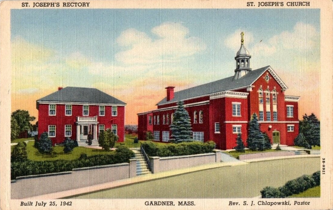 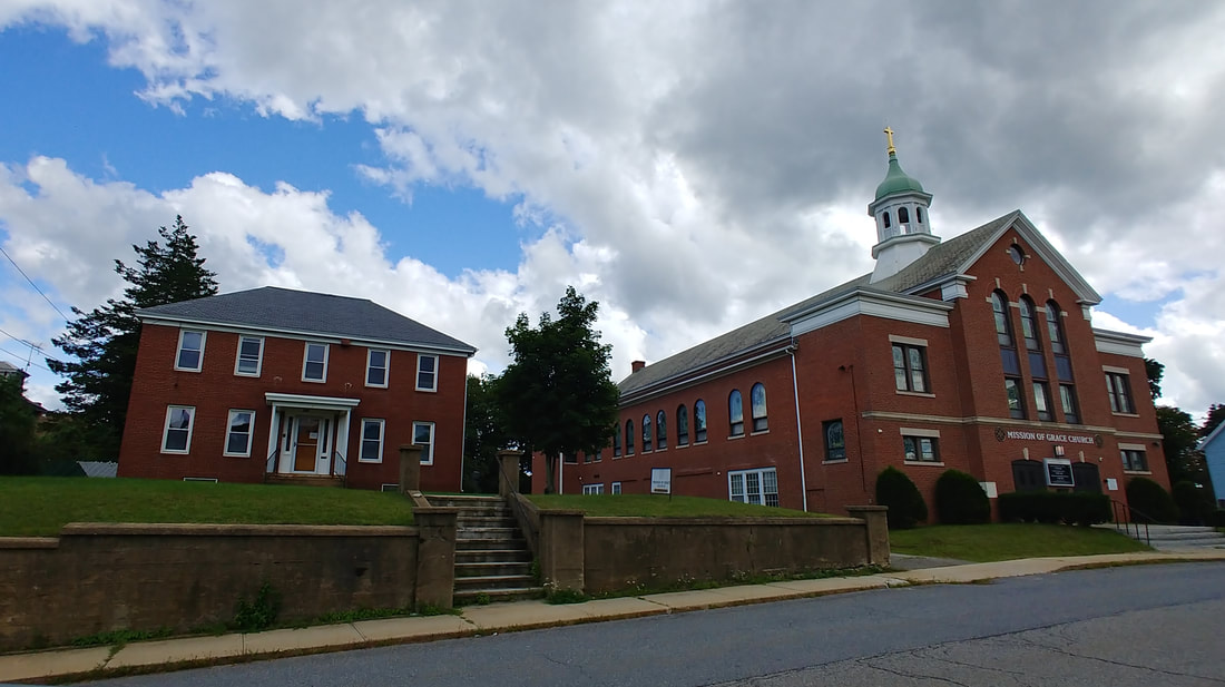 |
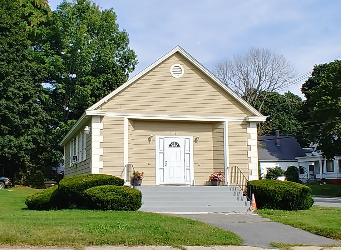
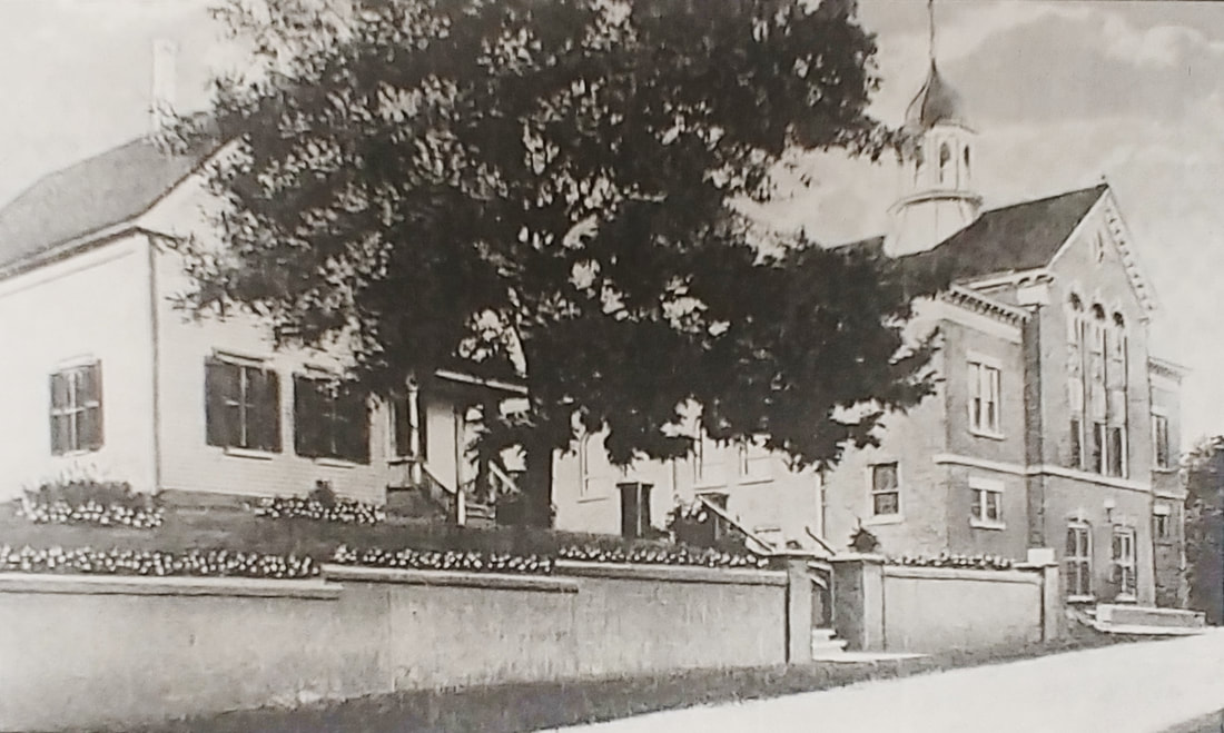
St Joseph's Church - Built c1913. The early picture is from an unknown date although it says "Built July 25, 1942" and that would suggest it's after that. However, the year of 1942 is incorrect so maybe it should say 1912 which would make more sense. The St Joseph rectory and church are very similar to those seen in the old picture. It now houses the Mission of Grace Church as it was sold by the Catholic Diocese in 2018. The postcard below shows that there was a different rectory at one point so maybe the 1942 date refers to the new rectory.

|
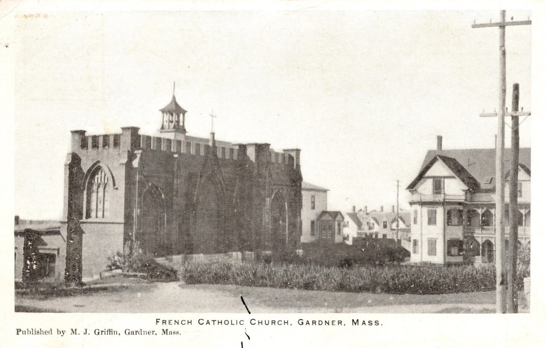
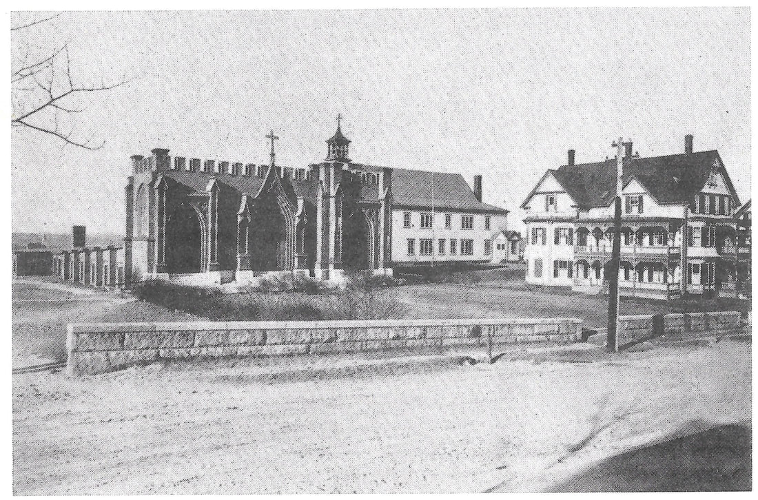
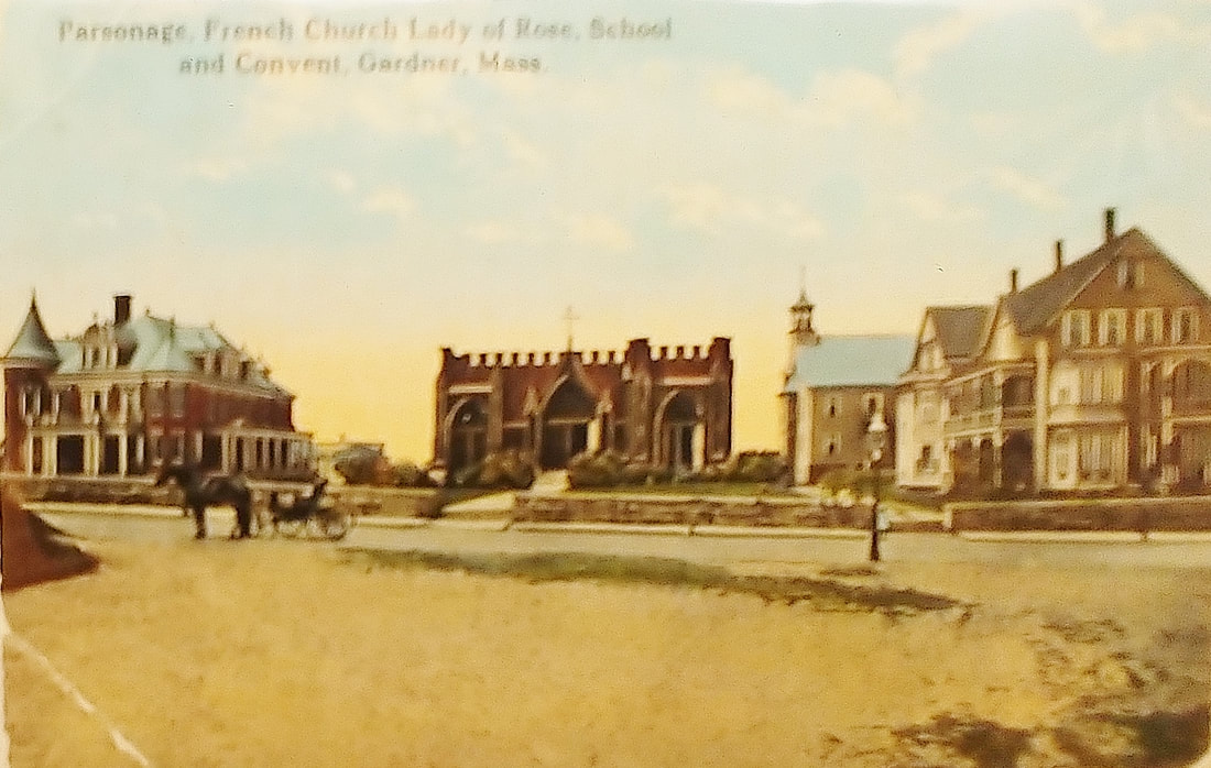
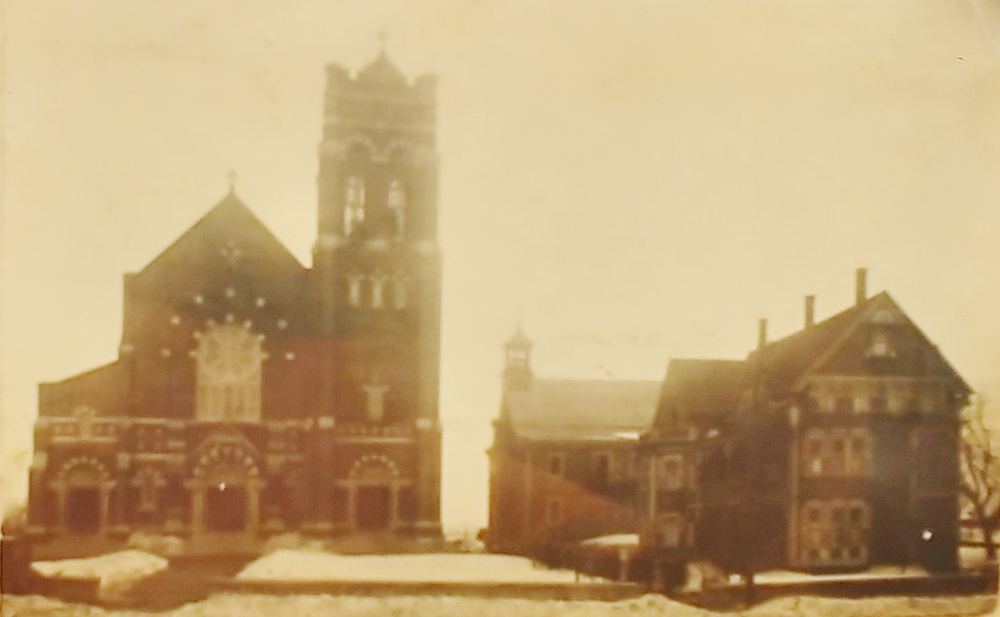
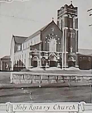
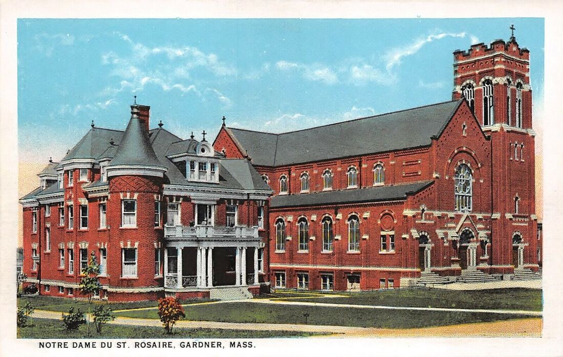
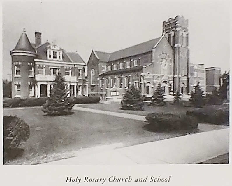
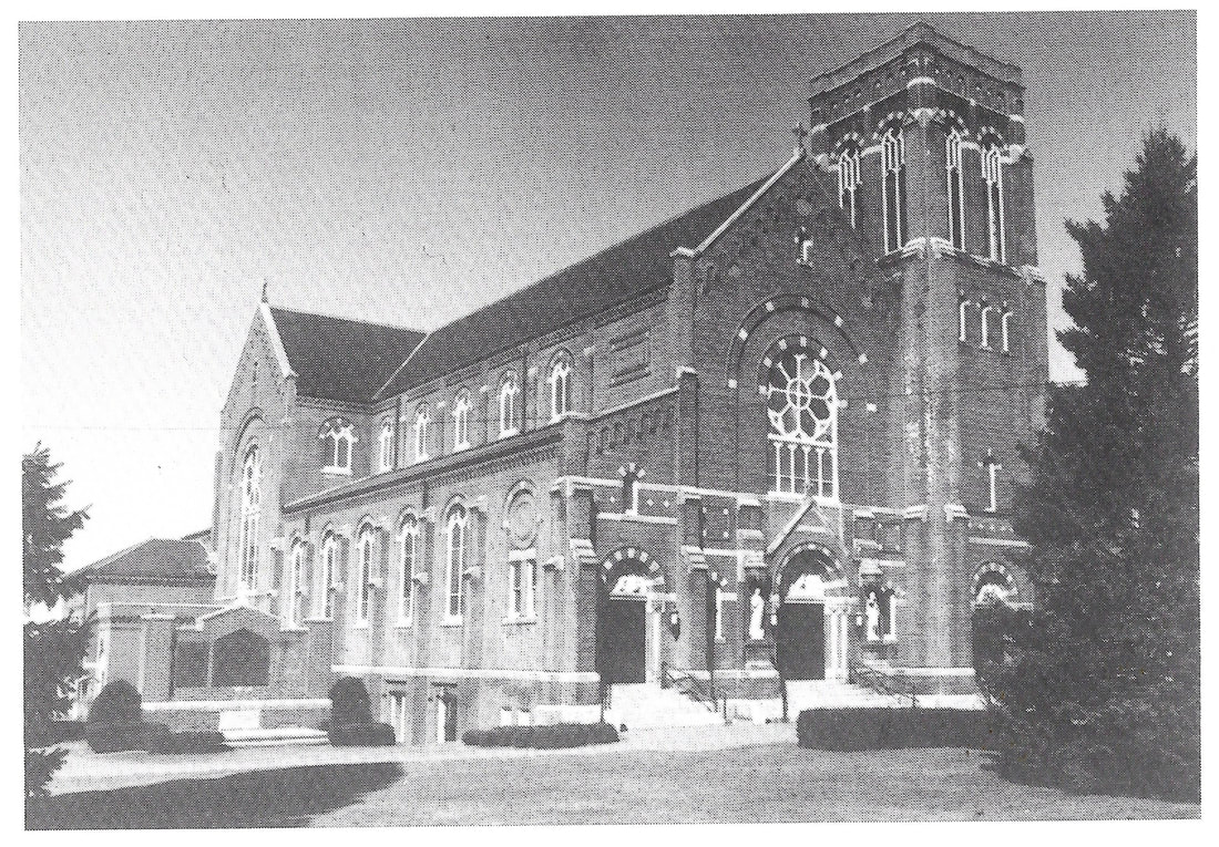
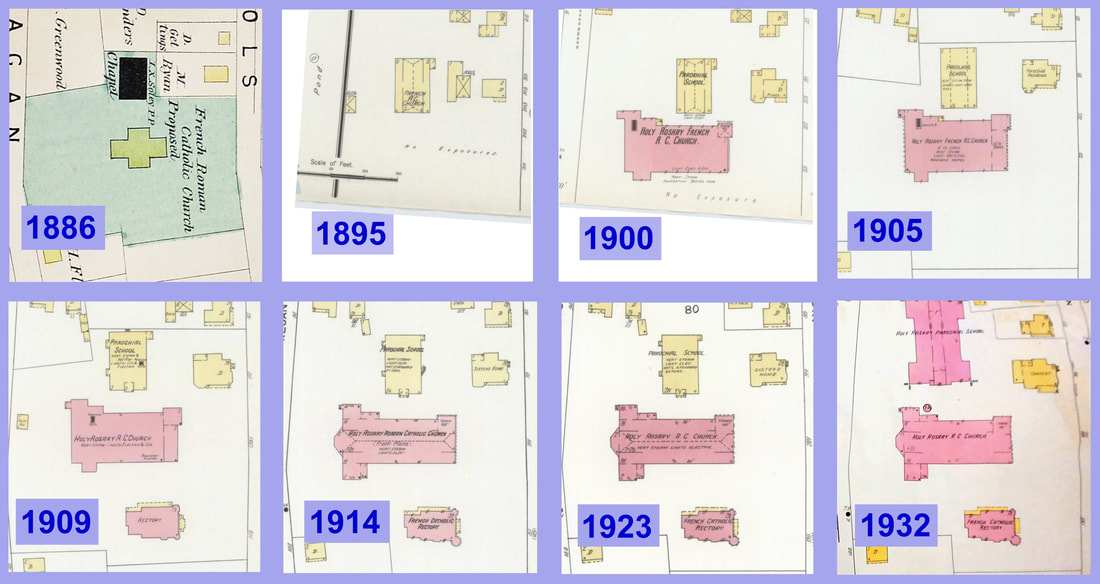
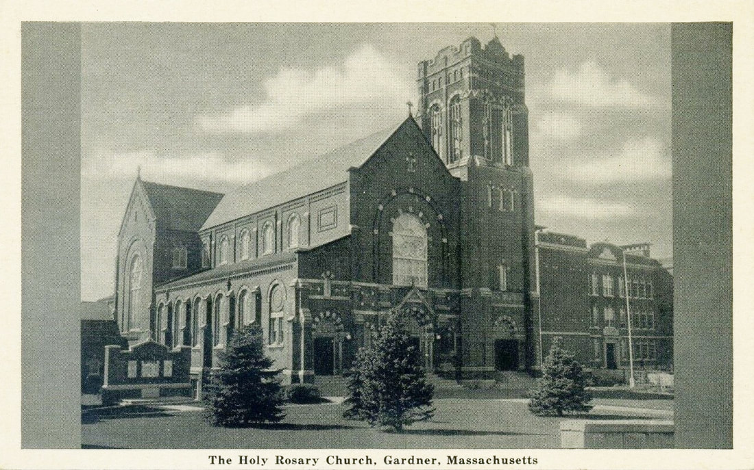
Holy Rosary Church - aka French Catholic Church - The histories that I've read don't seem to jive with what the various maps indicate about what was built when so I put together the sequence of maps above so you can see how things progressed. Here is the story as I see it. A wooden building was built c1885 which was called the Chapel. In the 1886 map you see the Chapel, the proposed large church and a small yellow rectangle that isn't necessarily part of Church property but is probably an existing house to the right of the Chapel. By 1895 you see that the Chapel is now referred to as a church and another structure is in between the church and the house. It is probable that the Chapel underwent some renovations or a different building was constructed and it looked like image 1. The histories say that the larger church began construction in 1895 and that it started as the small stone church seen in various pictures above. So by the 1900 map we see the outline of what will become the final version but it's not quite there yet. What will become the tower is only 25' tall. Also note that the other small structure has disappeared and that our house has been enlarged and now says "Priests" on it. The wooden church now says "Parochial School". By 1905 our small house now says "Parochial Residence". On the 1909 map we see that the house has no writing on it but now there is a Rectory. Presumably, the priests had moved over to that building. In 1914 the large church tower is now 105' tall and the church seems to be in its final stages. The house now says "Sisters Home" on it. By 1923 it looks like the church is complete. The histories say that it was completed in 1915 so this agrees well. In 1932 the house is labeled "Convent" and there is a new, larger school. That school was built in 1925. Some time after 1932 the convent was demolished and the school now has a lawn out front.
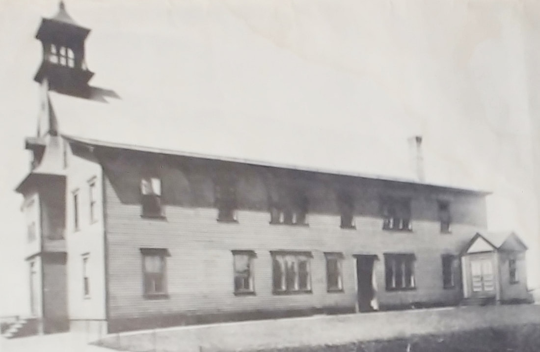
1. Unknown date - (ref. 29) - This is the Chapel that existed prior to even the Church. It was also used as a school.
2. 1909 - Although the postcard may have said 1909 this image is probably from earlier - est. 1895-1900
3. Unknown date - (ref. 2, page 68) - est. 1895-1900
4. Unknown date - (ref. 27) - est. 1905-1910
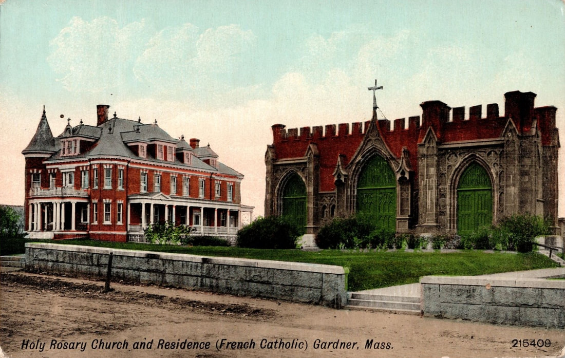
5. c1910 - Residence & Church
6. Unknown date - (ref. 27) - est. 1915-1925
7. Unknown date - image from 1948 reference (ref. 12) but note the new school, built in 1927, has not yet been built - est. 1915-1925
8. Unknown date - Church and New School
9. Unknown date - Residence & Church
10. 1948 - Residence, Church, and New School - date assumes image was taken when reference book was published (ref. 12)
11. 1978 - (ref. 2, page 68)
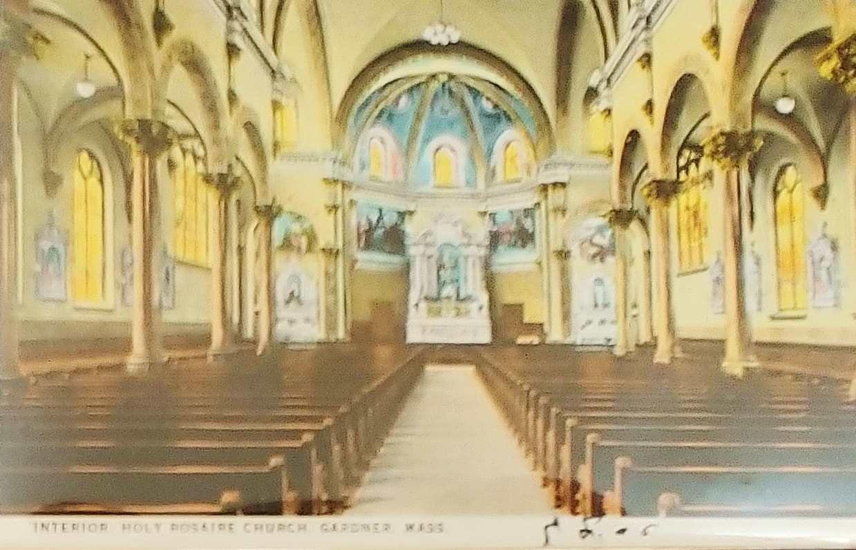
12. Unknown date - (ref. 27) - Interior after 1915
1. Unknown date - (ref. 29) - This is the Chapel that existed prior to even the Church. It was also used as a school.
2. 1909 - Although the postcard may have said 1909 this image is probably from earlier - est. 1895-1900
3. Unknown date - (ref. 2, page 68) - est. 1895-1900
4. Unknown date - (ref. 27) - est. 1905-1910
5. c1910 - Residence & Church
6. Unknown date - (ref. 27) - est. 1915-1925
7. Unknown date - image from 1948 reference (ref. 12) but note the new school, built in 1927, has not yet been built - est. 1915-1925
8. Unknown date - Church and New School
9. Unknown date - Residence & Church
10. 1948 - Residence, Church, and New School - date assumes image was taken when reference book was published (ref. 12)
11. 1978 - (ref. 2, page 68)
12. Unknown date - (ref. 27) - Interior after 1915
  |
These two images shows how much larger the new Holy Rosary Church became after it was started.
 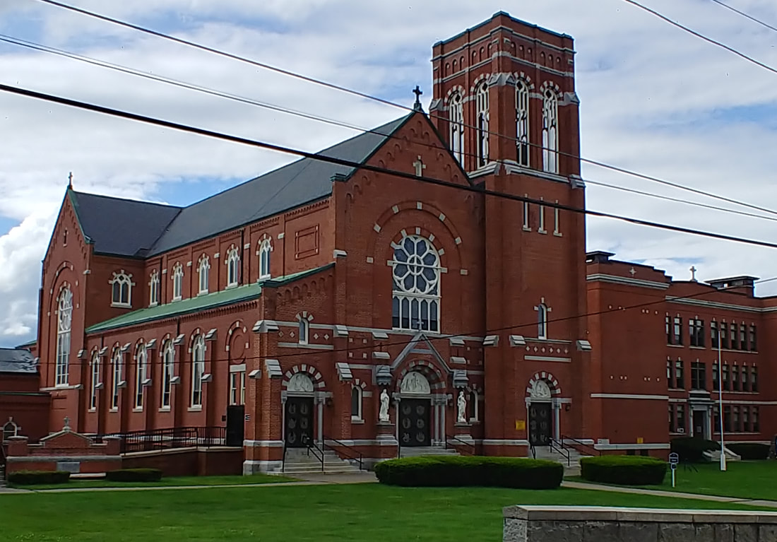 |
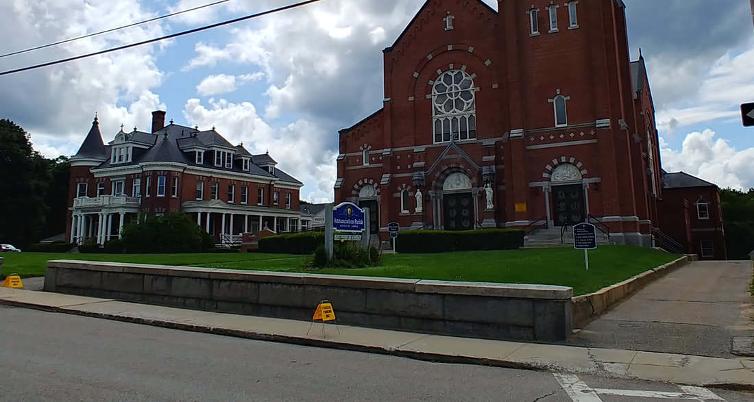
The new church hasn't changed too much but an obvious change was done to the stonework at the top.
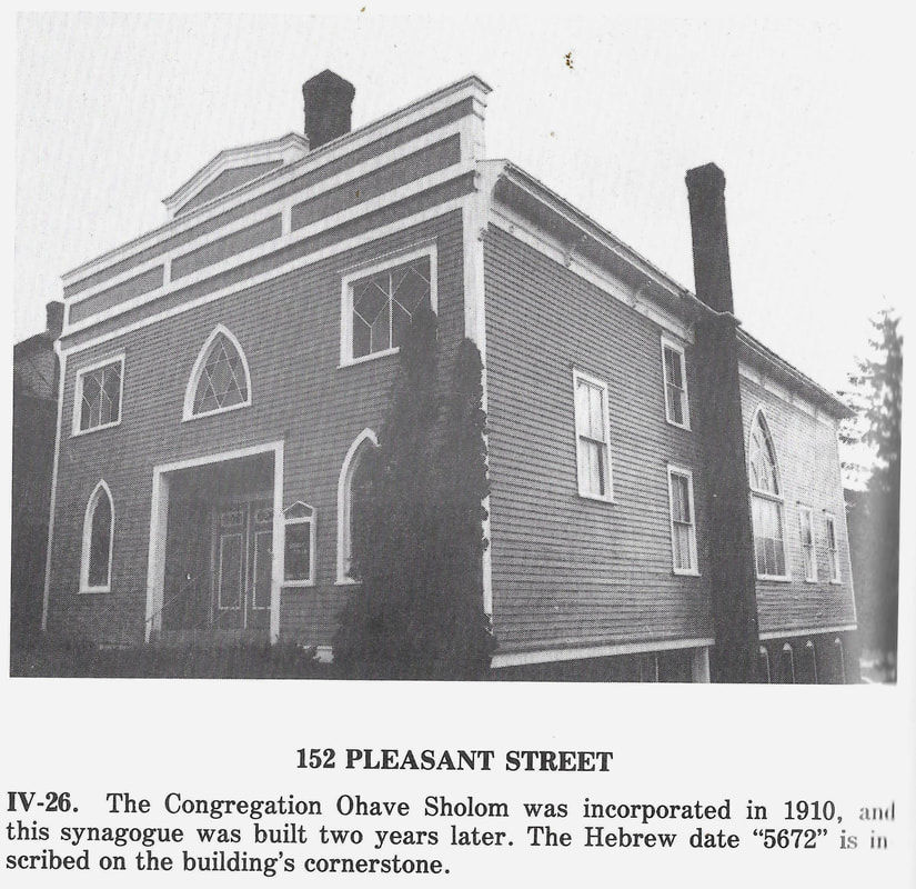
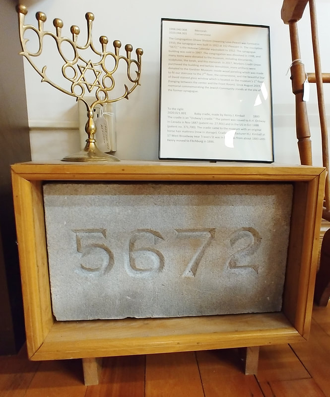
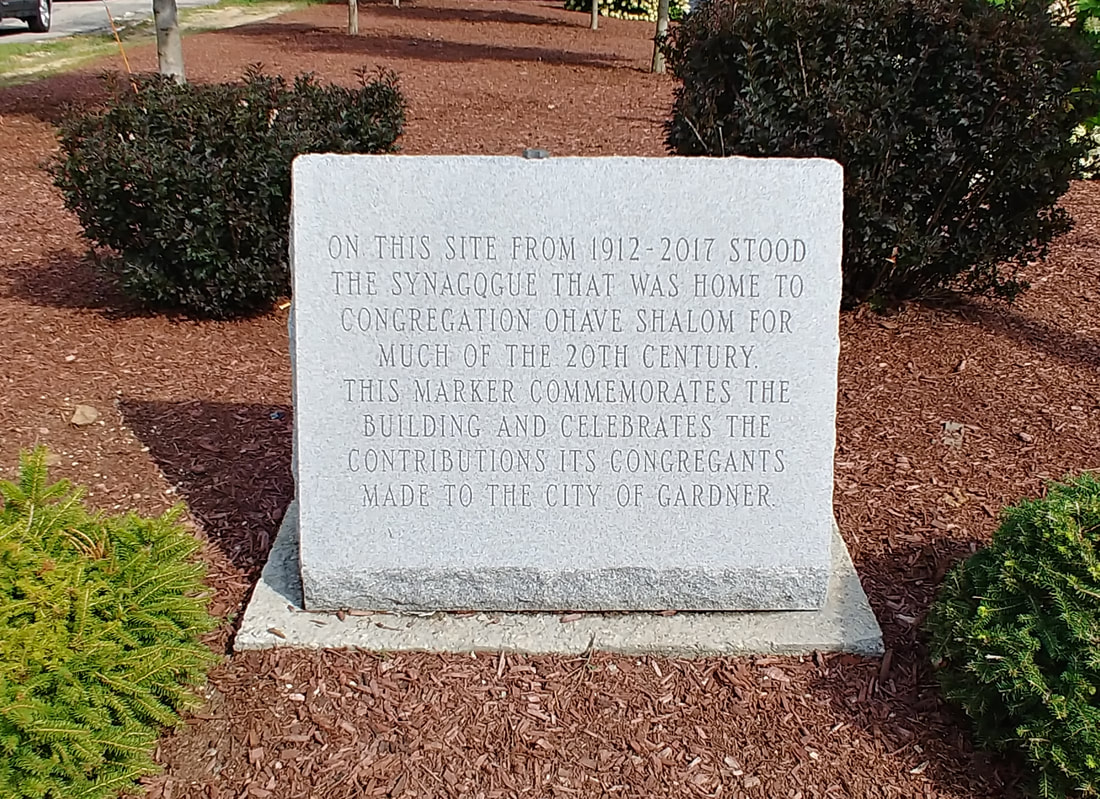
The building at 152 Pleasant Street was erected in 1912 by the Jewish Congregation Ohave Shalom of Gardner, two years after their incorporation. Sadly, the membership had dwindled and the group was dissolved in 1998. The cornerstone which was carved using the Jewish year of 5672 is at the Gardner Museum because the synagogue burned down in 2017. There is a plaque commemorating the group and the Synagogue at the building's site. The picture of the synagogue is from 1978 (ref. 2, page 72).

|
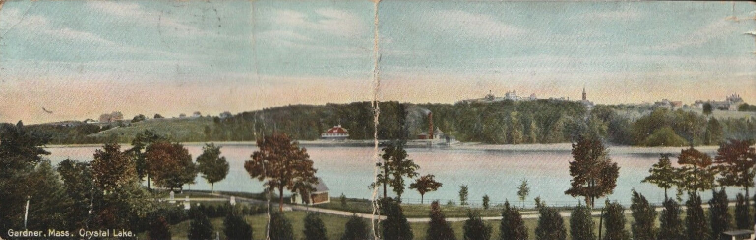
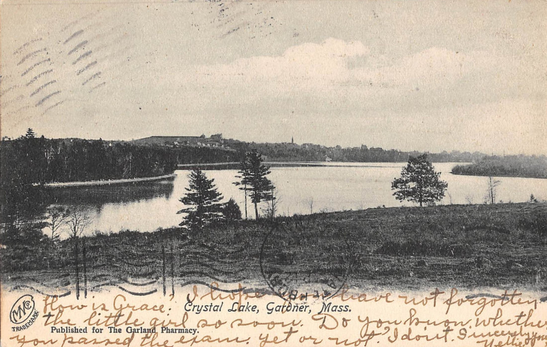
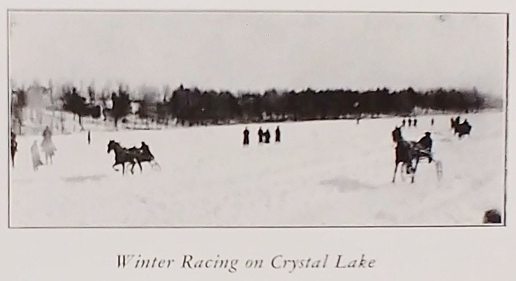
Crystal Lake Panorama
|
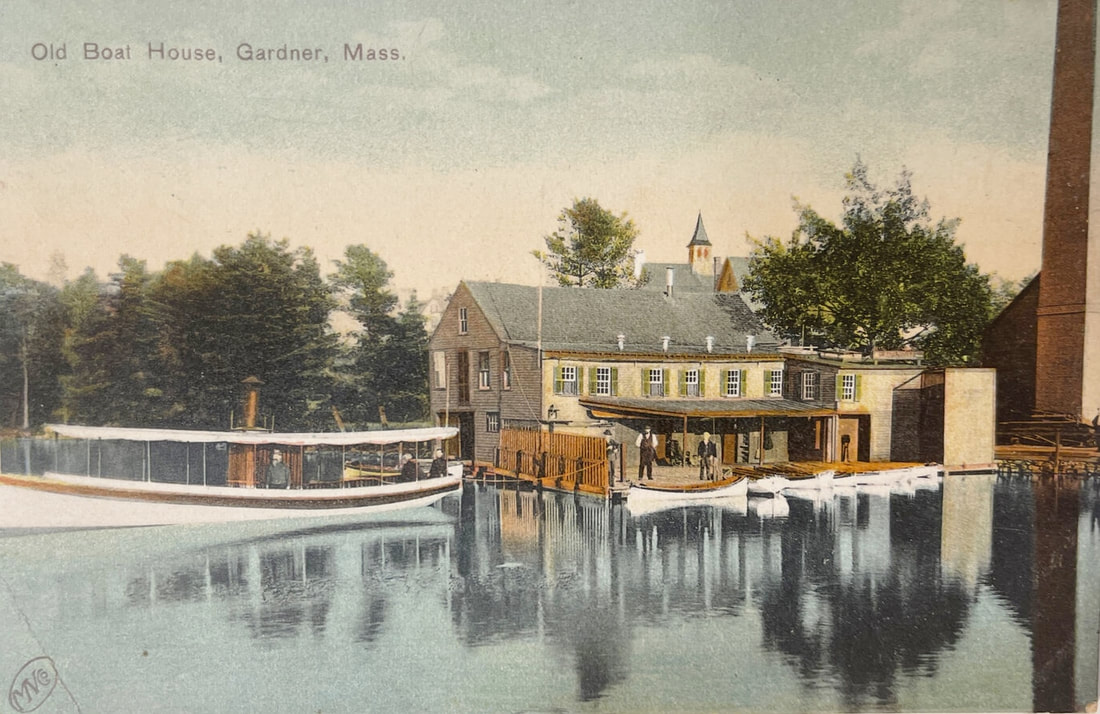
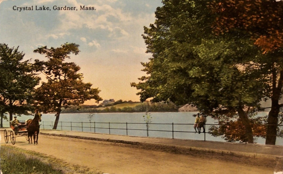
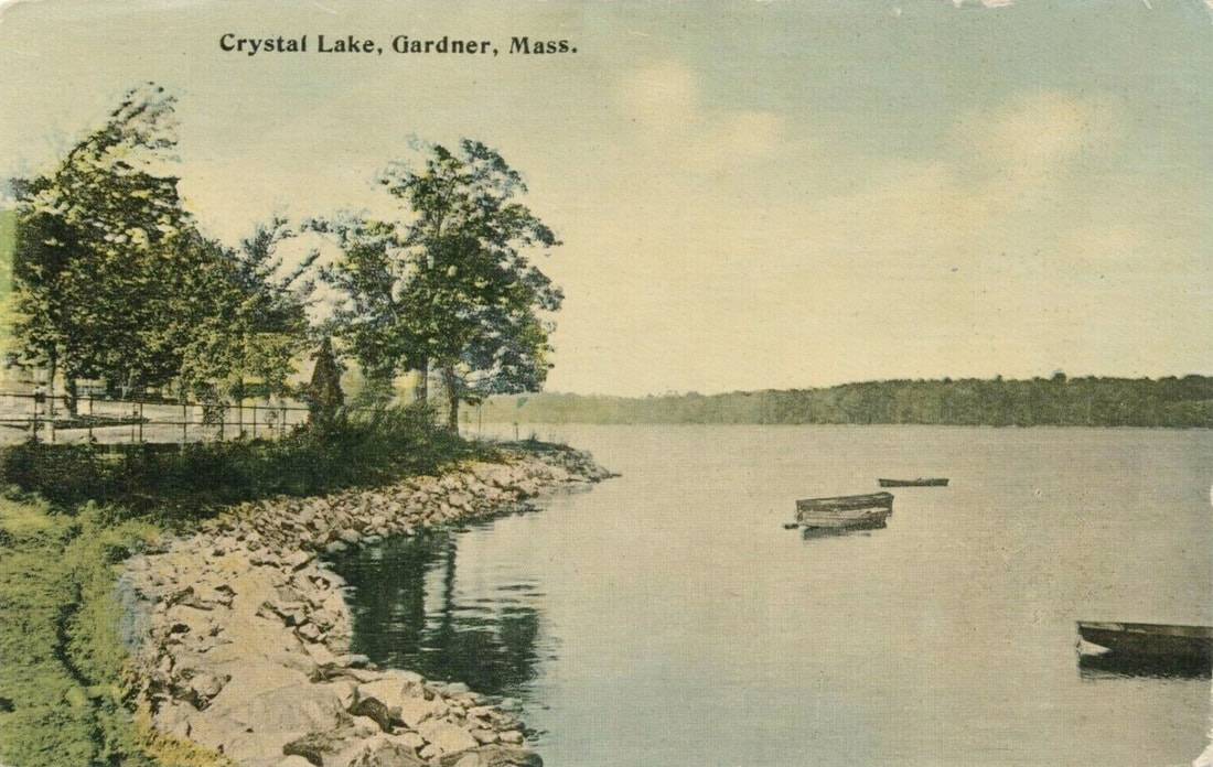
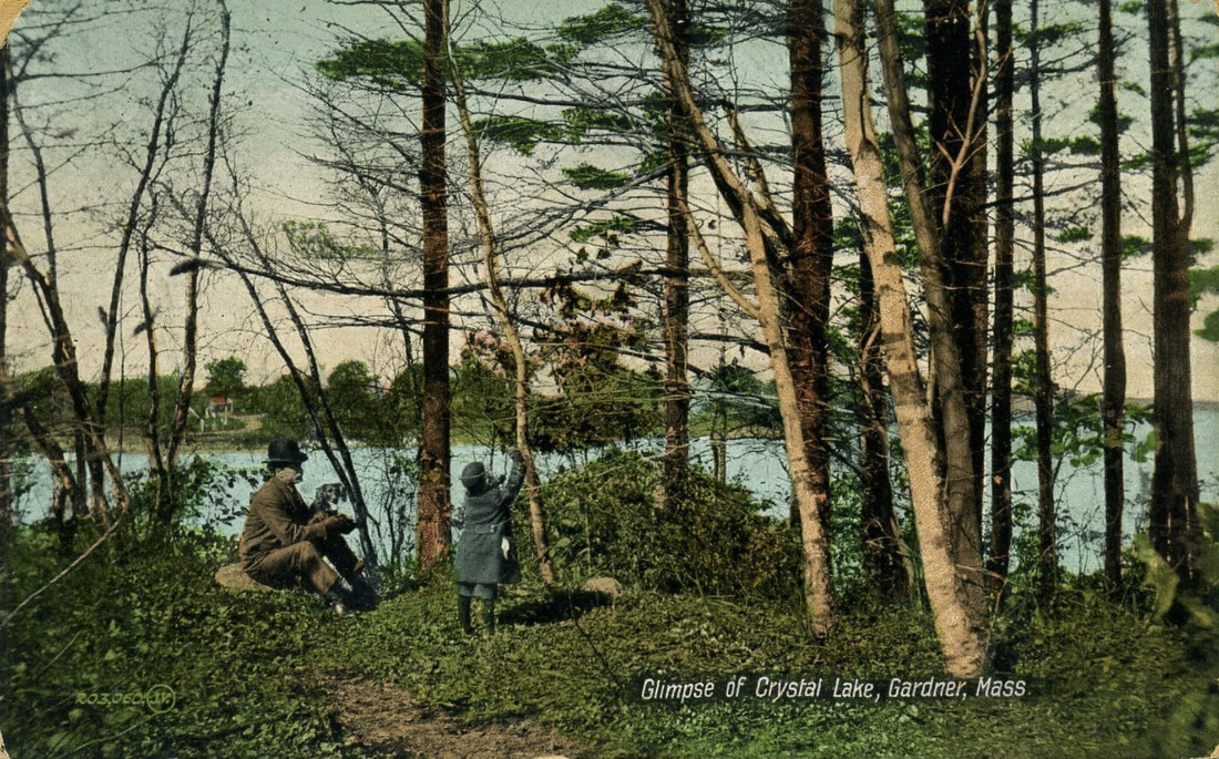
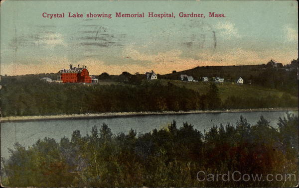
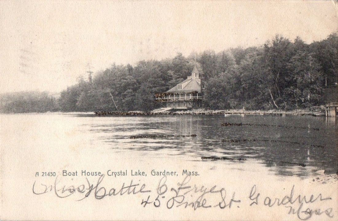
Crystal Lake - Most of the postcards are for Crystal Lake, originally called Gardner Pond. It has been used for boating (early on), fishing, sightseeing, etc. The reservoir supplies Gardner's water. This panorama is from 1909. The Gardner Boat Club Boathouse with its red roof is seen toward the middle with pumping station to its right. Off to the right in the distance you can see the spire of the First Congregational Church. The George H Heywood house at the top of Glazier Street can be seen to the left of the church (larger white house). The larger buildings to the right are likely the large mansions that were on Central Street and the larger building off to the left would be Henry Heywood Hospital.
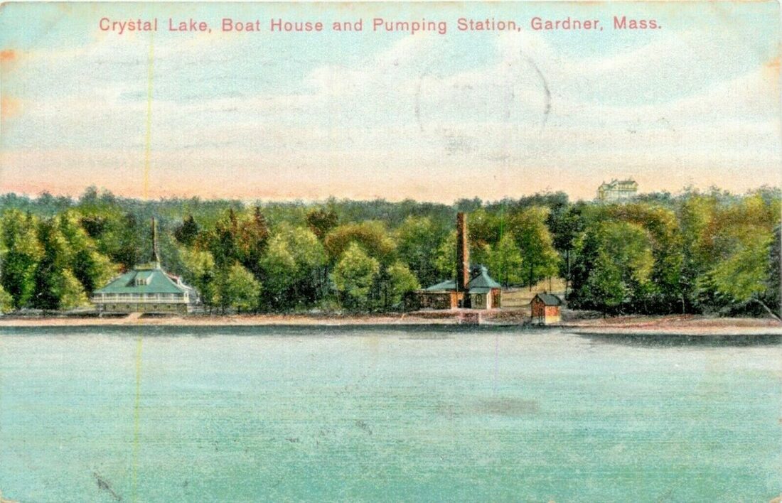
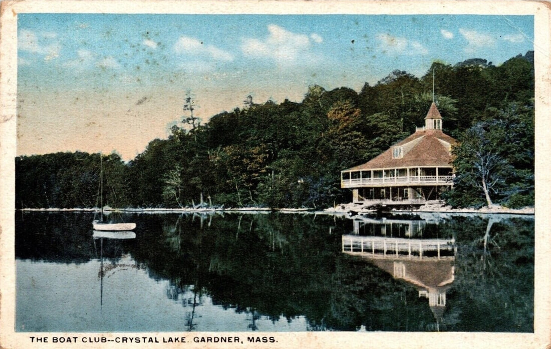
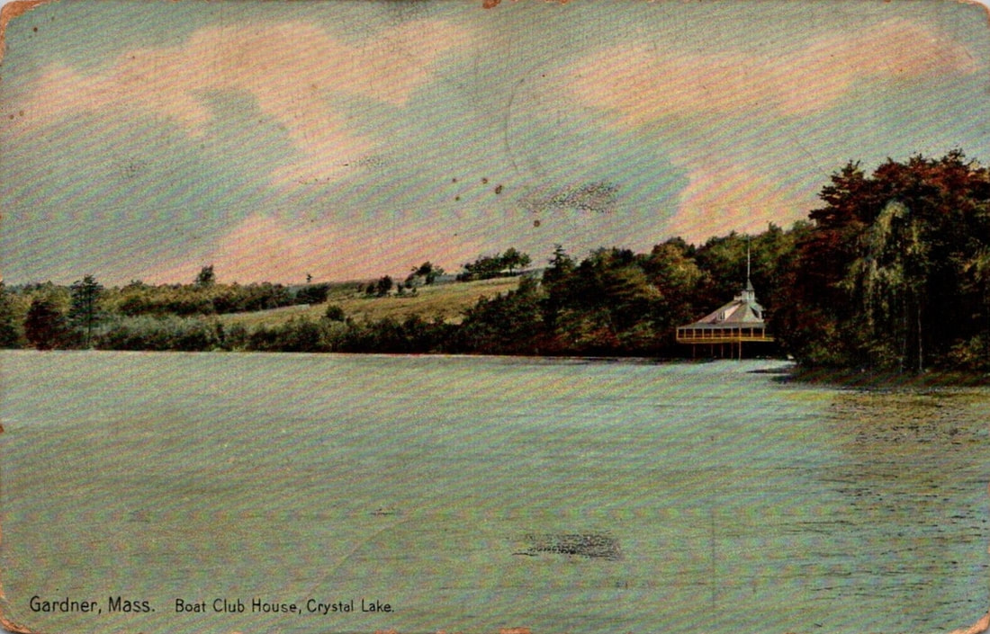
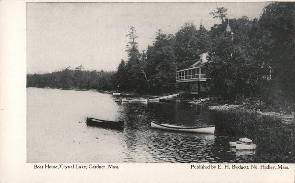

1. Unknown date - Gardner Boat Club Boat House (1890-1923) and Pumping Station
2. 1907
3. 1906 - Gardner Boat Club Boat House
4. Unknown date - Gardner Boat Club Boat House
5. 1906 - Gardner Boat Club Boat House
6. Unknown Date - Gardner Boat Club Boat House
7. 1907 - This looks to be the boat house that was right near the train tracks that crossed over the southern part of the lake and that had Gardner Electric Light Company in back of it.
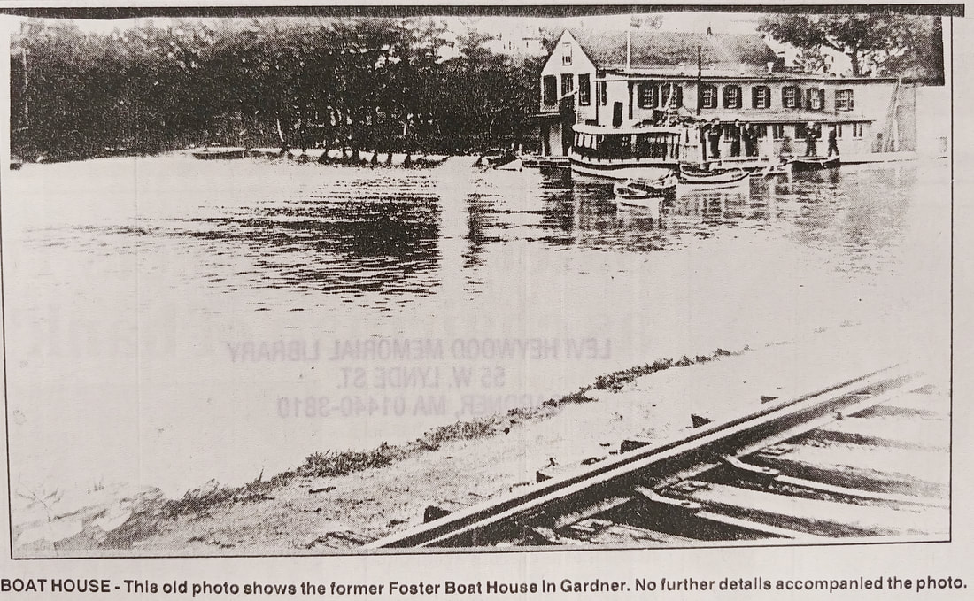
7a. Undated - Same boat house as in number 7 but called Foster Boat House. Shows the tracks.
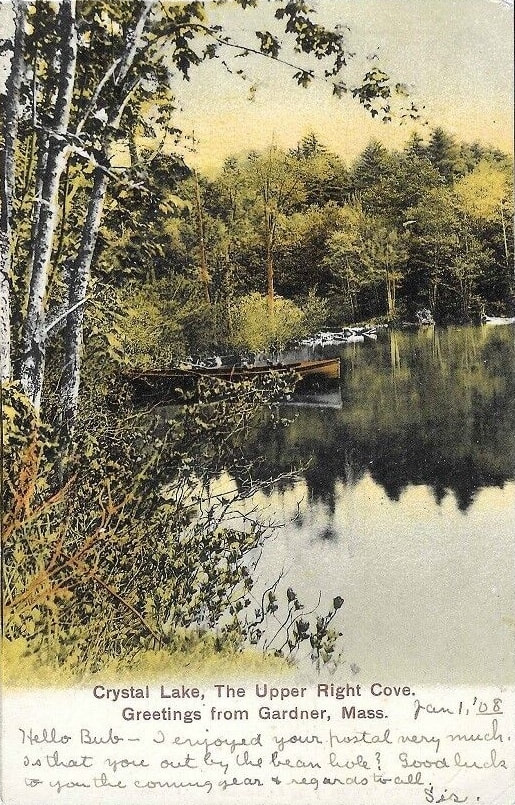
8. 1908 - Upper Right Cove - Presumably this is the cove near the southern part of the golf course on Green Street.
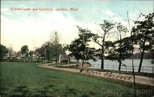
9. 1909 - Crystal Lake & Cemetery
10. Unknown date
11. Unknown date
12. 1915 - A train crosses the tracks over the southern part of the lake. The Gardner Electric Light Company is to the far left.
13. Unknown date
14. Unknown date - Crystal Lake and Heywood Memorial Hospital.
15. The image is taken from a 1948 reference (ref. 12) but is likely older.
2. 1907
3. 1906 - Gardner Boat Club Boat House
4. Unknown date - Gardner Boat Club Boat House
5. 1906 - Gardner Boat Club Boat House
6. Unknown Date - Gardner Boat Club Boat House
7. 1907 - This looks to be the boat house that was right near the train tracks that crossed over the southern part of the lake and that had Gardner Electric Light Company in back of it.
7a. Undated - Same boat house as in number 7 but called Foster Boat House. Shows the tracks.
8. 1908 - Upper Right Cove - Presumably this is the cove near the southern part of the golf course on Green Street.
9. 1909 - Crystal Lake & Cemetery
10. Unknown date
11. Unknown date
12. 1915 - A train crosses the tracks over the southern part of the lake. The Gardner Electric Light Company is to the far left.
13. Unknown date
14. Unknown date - Crystal Lake and Heywood Memorial Hospital.
15. The image is taken from a 1948 reference (ref. 12) but is likely older.
 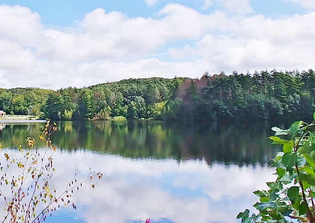 |
The boat house is gone from Crystal Lake and I wasn't absolutely sure of its position on the shore but I think I got it correct.
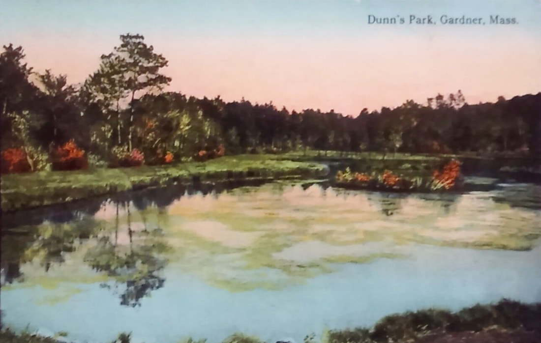
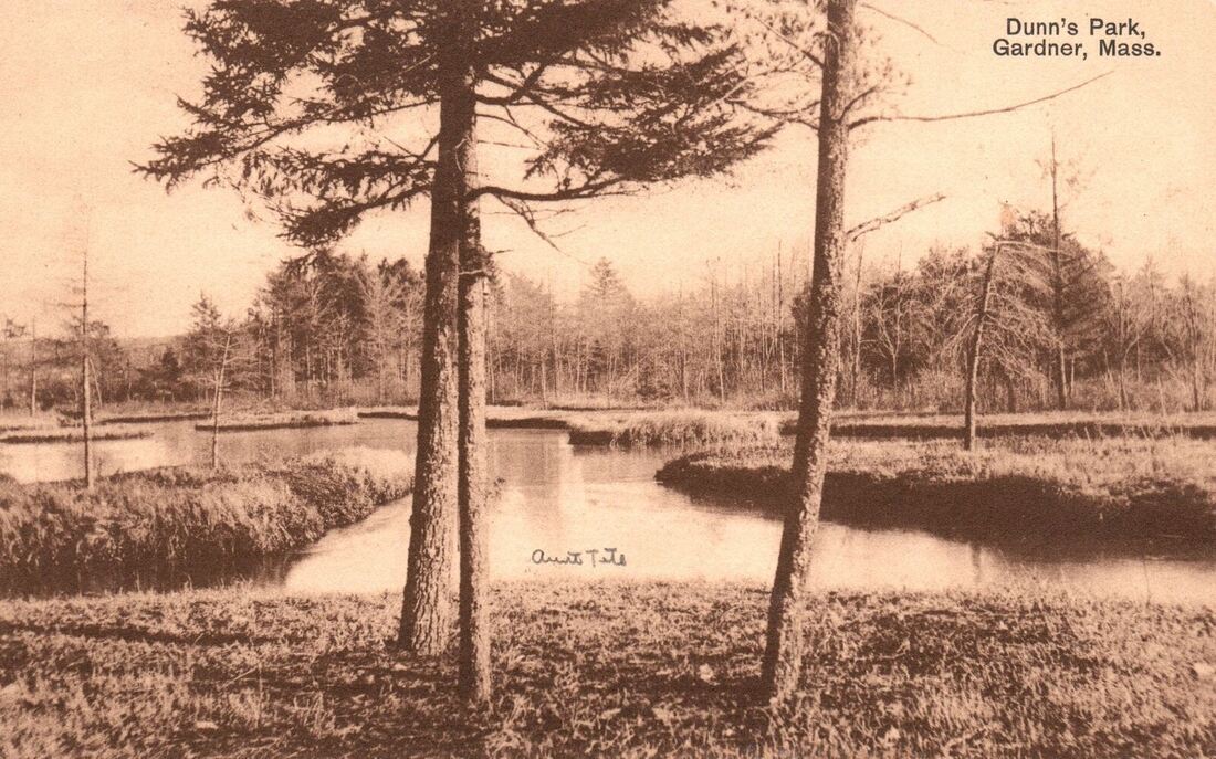
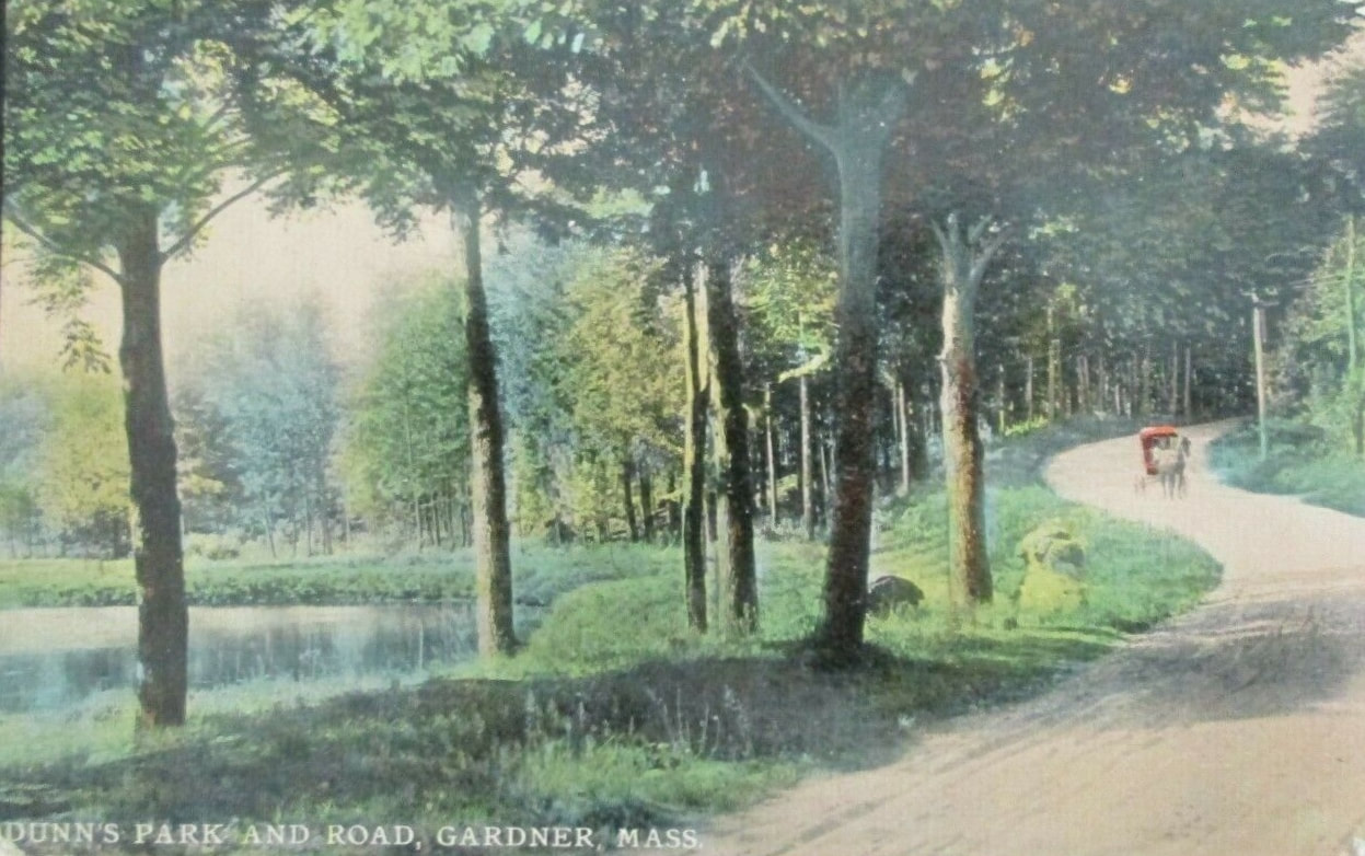
Dunn's Park - Dunn's Pond is a man-made pond created by the damming of Foster Brook. It was made some time between 1890 (when it doesn't exist on a map) and 1946 (when it does appear). According to a project report from 1994 a map from 1934 showed that a small pond did exist. The land was granted by John A Dunn but it is unknown whether he did the initial damming but he had thought that it could be done. He did create a park on the land for the people of Gardner to enjoy. He died in 1915 and willed the land to Gardner. Although the first image is undated, the 1913 postcard suggests some sort of shallow pond existed then so we can narrow the time-frame down to 1896-1913. The postcard had a one cent stamp on it and was postmarked 5/27/1913. One cent was required for postcards from at least 1898 until 1952 so the stamp would be correct for 1913. I wondered if the 1913 could be read 1943 but it really just did not look like that was a possibility. The third undated image is labeled Dunn's Park And Road. The road could be Betty Spring Road but it could be a road "in" the park that doesn't technically exists today.
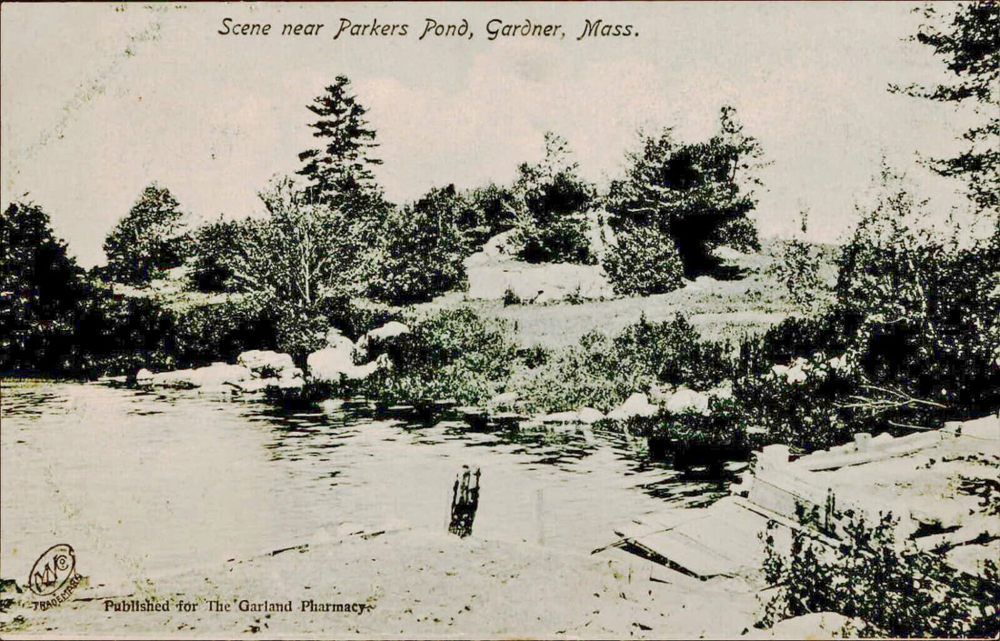
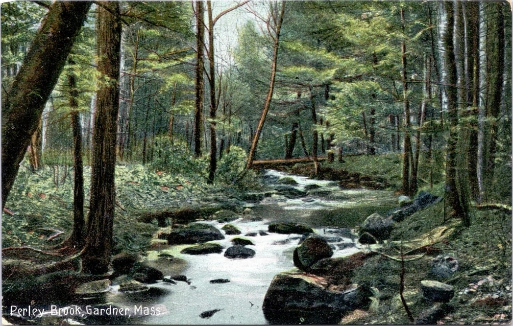
The first picture is of Parker Pond (labeled as Parkers Pond) and the date is unknown. The second is of 1908 Perley Brook which runs into and out of Parker Pond.

|
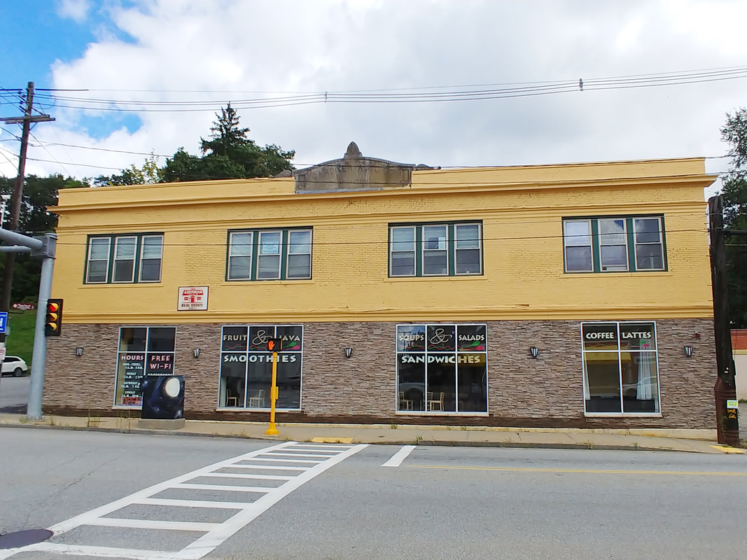
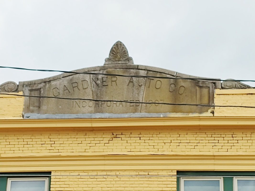
Quite a while back I'd noticed the engraved sign above where Cafe Edesia is today. It says "Gardner Auto Co Incorporated 1907". I imagined that where I sat and drank coffee and ate my sandwiches there used to be a display of old-time cars for sale. The Images of America Gardner book says that soon after the company was incorporated it moved across the street to, presumably, the building's address of 486 Chestnut Street. I guess they needed more space. The Gardner Auto Company was at this spot until 1937. By 1938 Gardner Motor Sales was at this location.
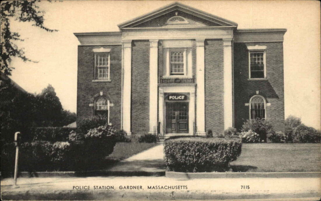 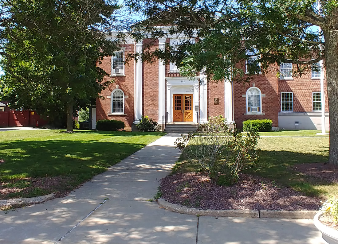 |
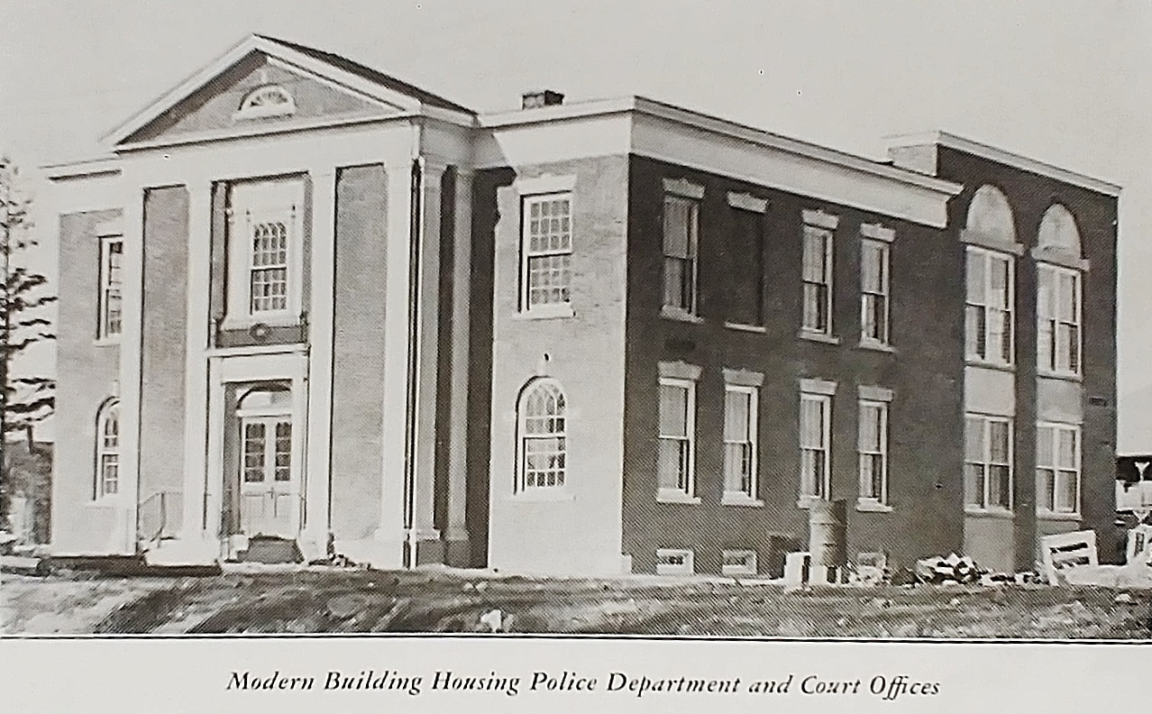
The Police station - Built 1928 - This may have been a police station at one time but the words "Gardner Court House" are engraved across the top above the columns. Below is a picture from 1948 (ref. 12) and one from 2023 that is a less obscured by the trees seen in the above comparison picture. The building looks much the same but it is now attached to the City Hall.

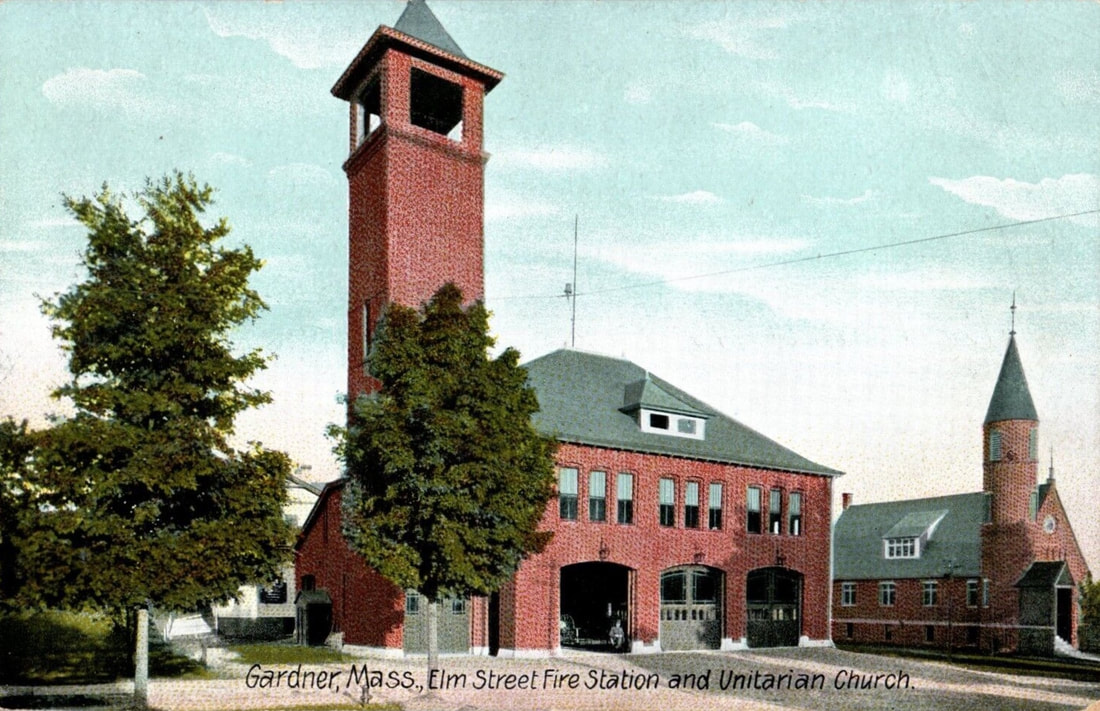 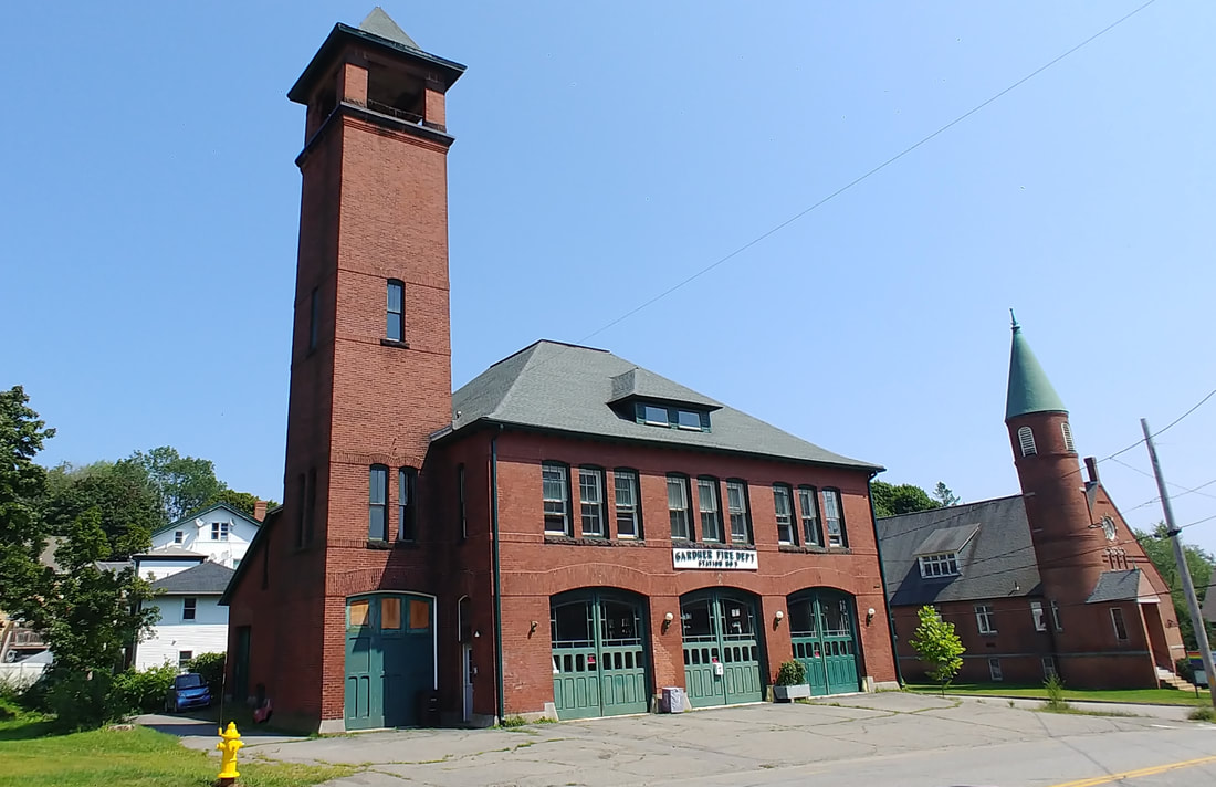 |
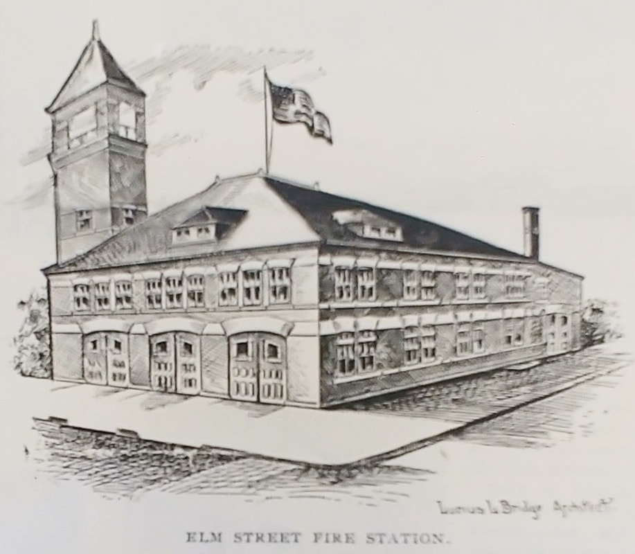
Elm Street Fire Station and Unitarian Church - Station built 1897 and still standing. The picture is from c1903. Note the fire hydrant is in the same place. The station is at 58 Elm Street and the church at 66 Elm Street (see Churches section above). Reference 2 talks about the station on page 41. Below is what was likely a concept drawing. It was published in an 1897 news article (ref. 29) and even gives the name of the architect as Lucius L[add] Bridge (1869-1921).
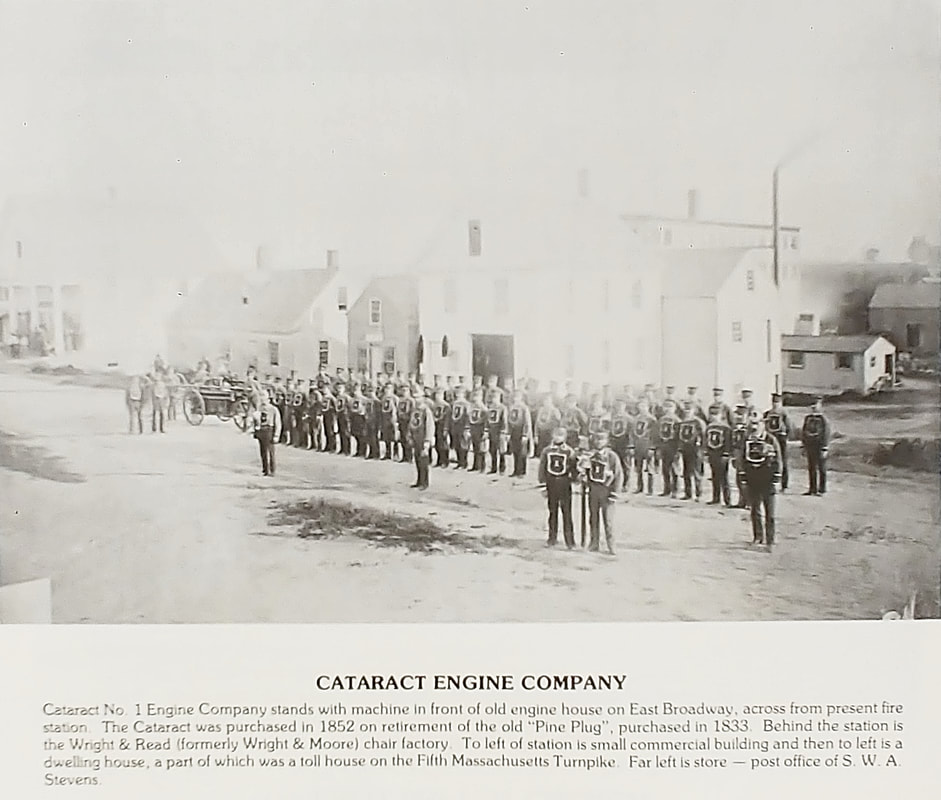

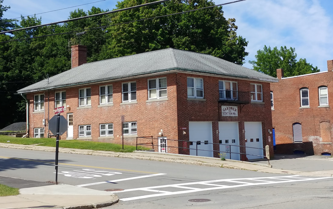
The initial Gardner Station 1 can be seen in the first picture from July 4, 1878 (ref. 3, page 25) but it was better known as the Cataract No. 1 Engine Company. Their fire station was across the street from the current one at about 64 East Broadway. A better copy of this picture is displayed at the library in the Local History Room. The second image from 1889 shows what was known as Citizen's Hall (ref. 2, page 13). It housed the second Gardner Station 1 at 61 East Broadway. After Citizen's Hall came down in 1934 the current Gardner Station 1 was built in 1935 by the WPA. The 2023 picture shows how it looks today.
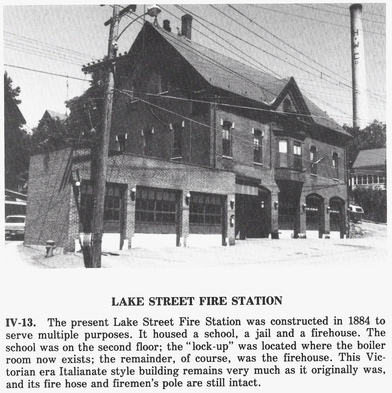
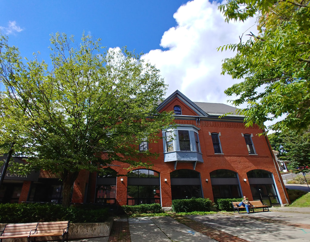
The Lake Street Fire Station had many purposes in addition to being a fire station. It currently houses the Gardner Visitor Center. Since Lake Street is blocked off where this building is located its address is more aptly described as sandwiched between Richmond and Central Streets but its official address is 26 Lake Street. The older picture is from 1978 (ref. 2, page 62). In the new one you can see the station among the bushes and trees.
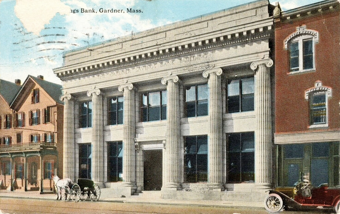 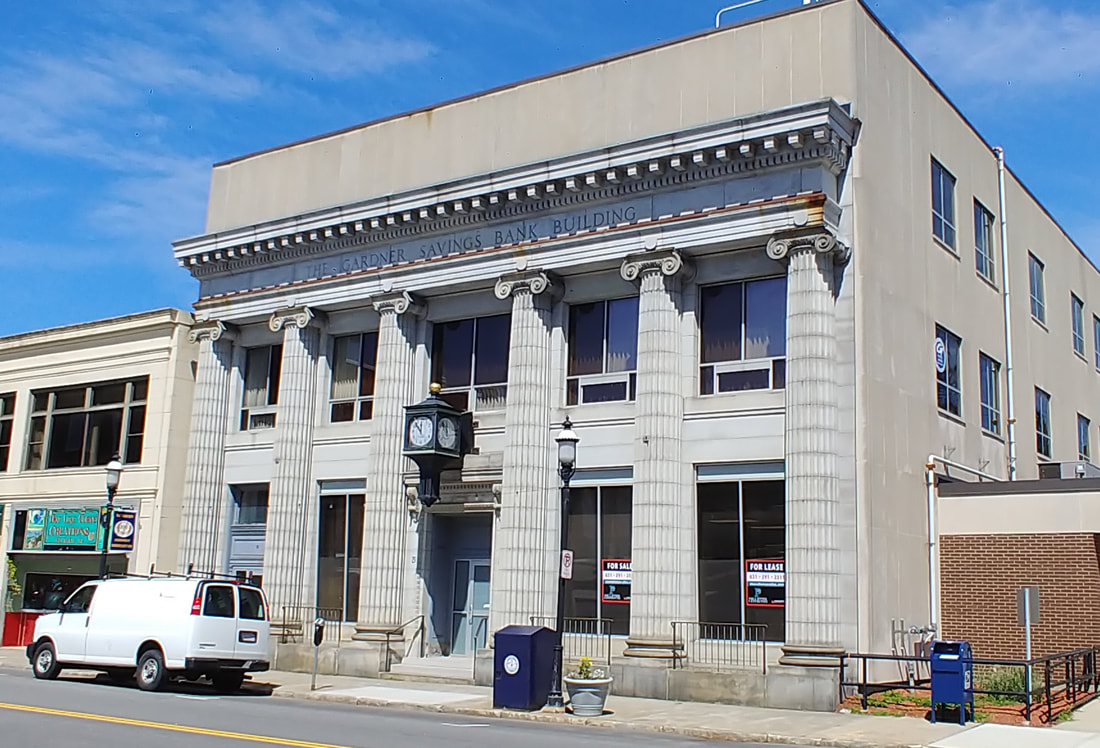 |
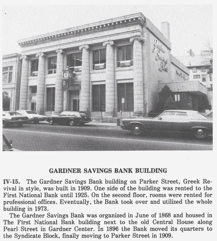
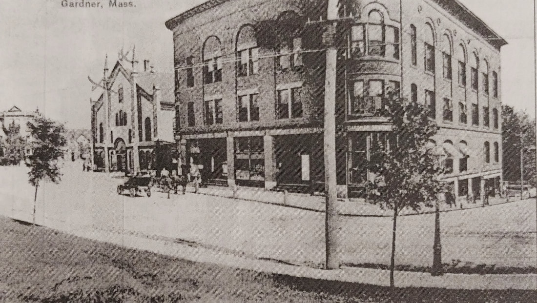
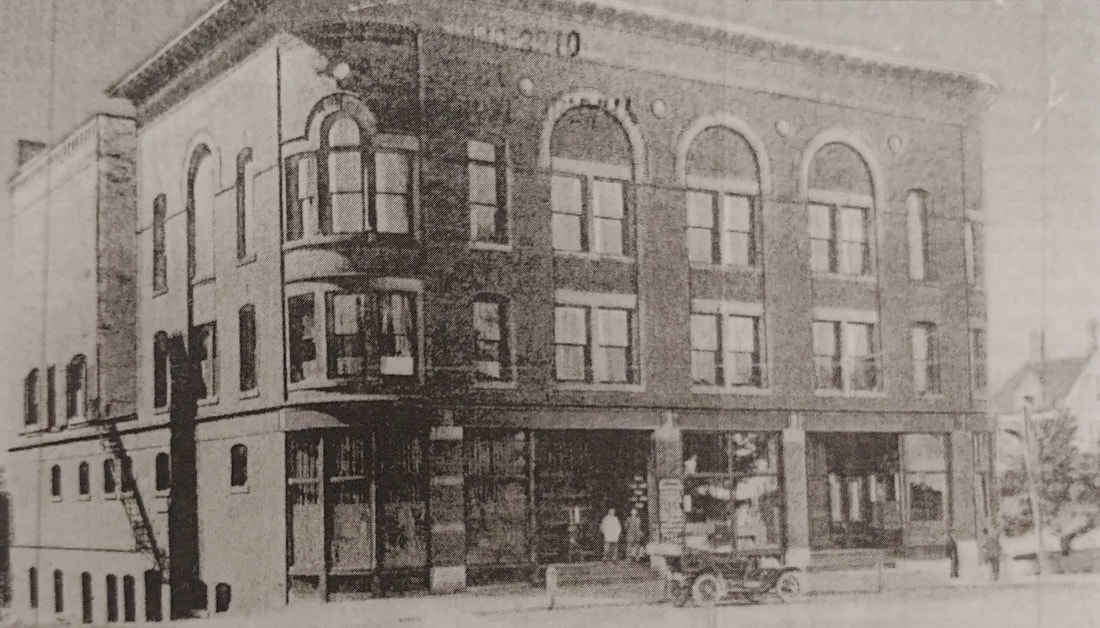
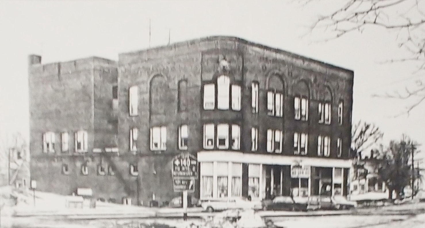
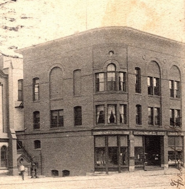
The top of Gardner Savings Bank has changed a little and the buildings left and right are different. Note the Richard's Hotel is on the left in the old picture. The picture is undated but the bank building was built in 1909. I love how the van is in the same spot as the horse and buggy - just a serendipitous shot. The first photo below from 1978 (ref. 2, page 64) shows "Gardner Savings Bank" written in script on the side of the building. Looks like the top and side were remodeled aft 1978. For a period of 15 years from 1909-1925, First National Bank also resided here. Picture 2 is from the library's collection (ref. 27).
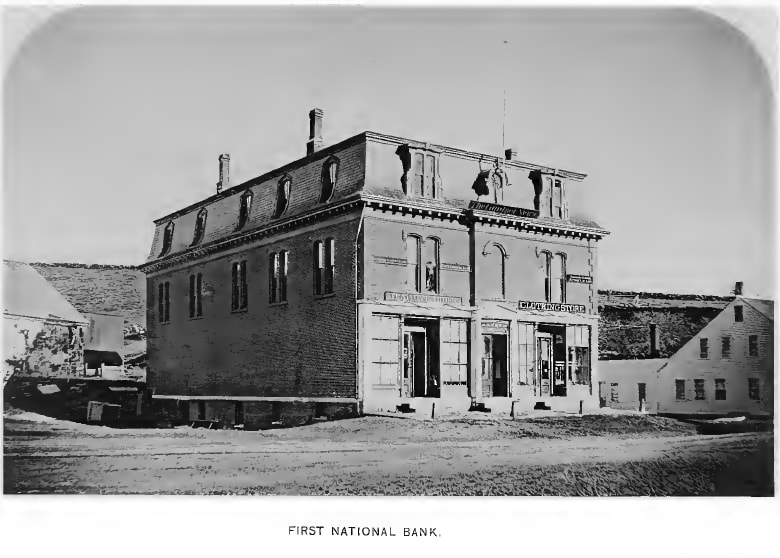
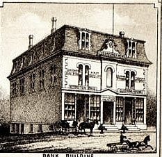
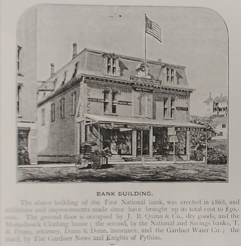
The first First National Bank - Built 1868 at what is now 12 Pearl Street. From 1868 until 1896 the building also housed the Gardner Savings Bank. In 1896 both banks moved to the Syndicate Block. The first photo is from 1878 (ref. 1) while the drawing is from an 1880 map (see below in the Manufacturing section). The third (ref. 29) shows it in full swing and tells which companies are housed in 1885. It does show up in some later 1900s images of its next door neighbor, the Windsor House (see Hotels section) and you will note the walkway from the bank to what must be the back of the hotel in the third picture. It survived the fire that took down its neighbor the Windsor House but was torn down in 1939. In a nice turn, the Gardner Savings Bank, which had moved to Parker Street, housed the First National Bank from 1909-1925.
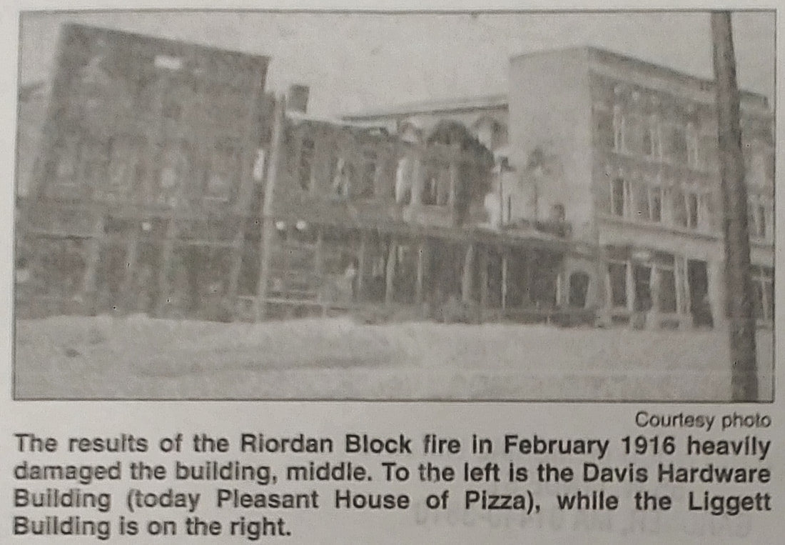
Around 1920-23 the houses that used to be on Pleasant Street (see Street Views below) from the city's center to the Police Station/Court House (1928) were razed to make way for that building, City Hall (1940), the Colonial Hotel (1924), and the following group of businesses closer to the center. In addition to some houses, there was what was known as Riordan's Block that had burned down in 1916 - see Reference 3, page 67. The spot was ripe for building new structures.
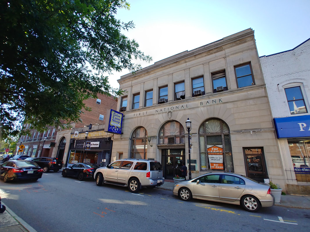
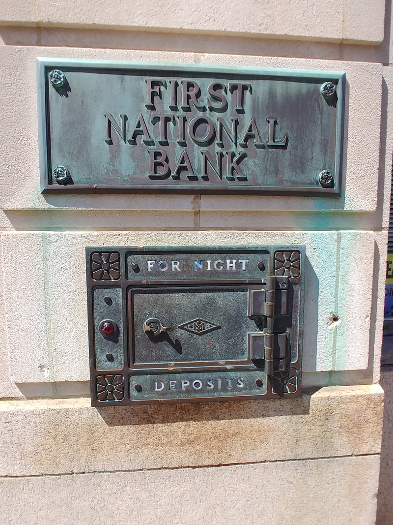
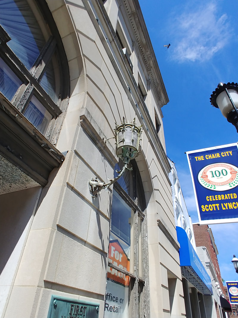
The new First National Bank was built in 1924. The plaque and sconce are on the outside of the bank located at 25 Pleasant Street. The Salem Coin Shop (est. 1980) was a recent occupant.
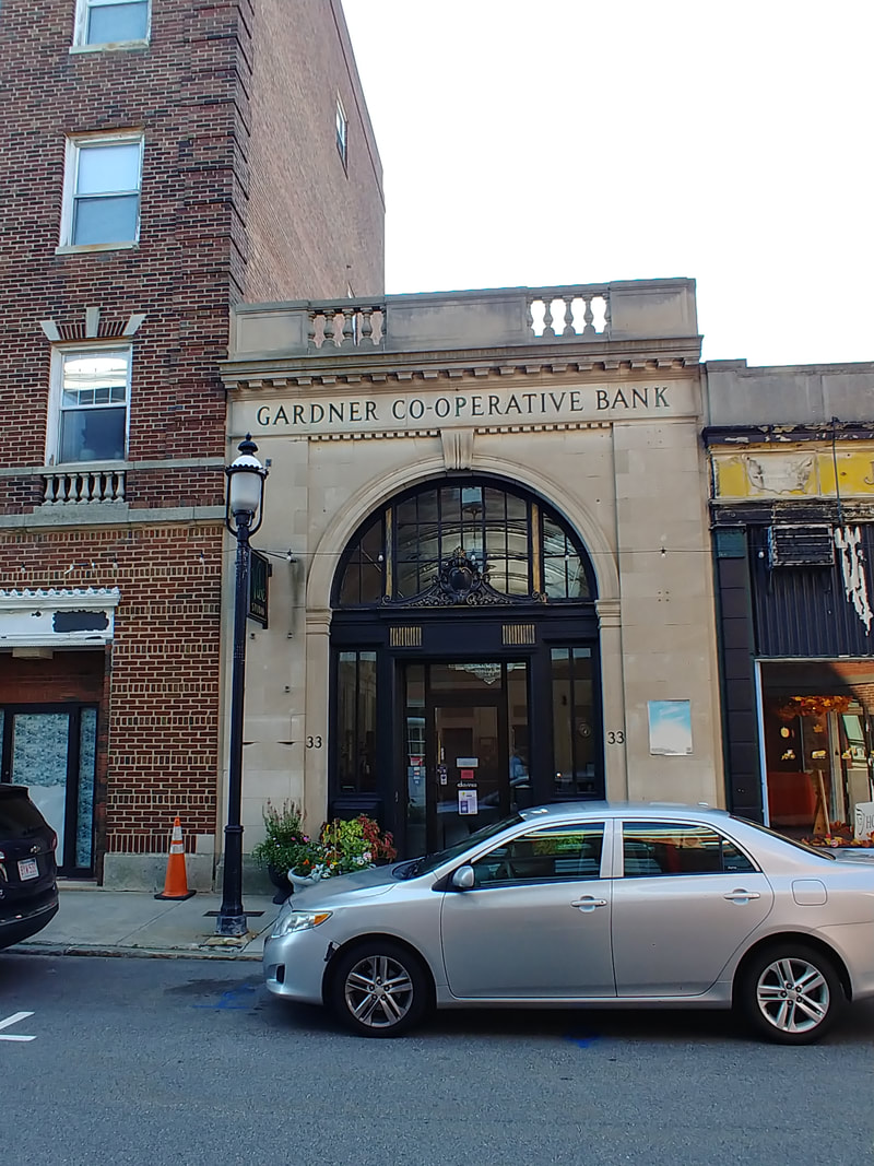
The Gardner Cooperative Bank was built in 1927. It currently houses Vibe Salon. It is sandwiched between the Colonial Hotel (see Hotels section) and the J C Penney building (below). The bank was organized in 1889 but floated around Gardner until they built their own place.
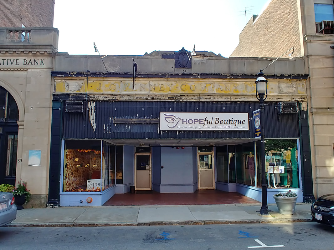
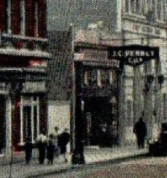
1 & 1a. J C Penney Building - 25-29 Pleasant Street - Built at an unknown date but probably c1925 when J C Penney set up shop in Gardner. The second image is a blowup from a 1930 picture of the Colonial Hotel showing the J C Penney sign hanging over the sidewalk. Similar images from the 1940s show the sign. The building actually says J C Penney across the top and there is a "P" at the top center. The United States images are inscribed with "A National Institution" (i.e. a chain store). It is currently occupied by the Hopeful Boutique.
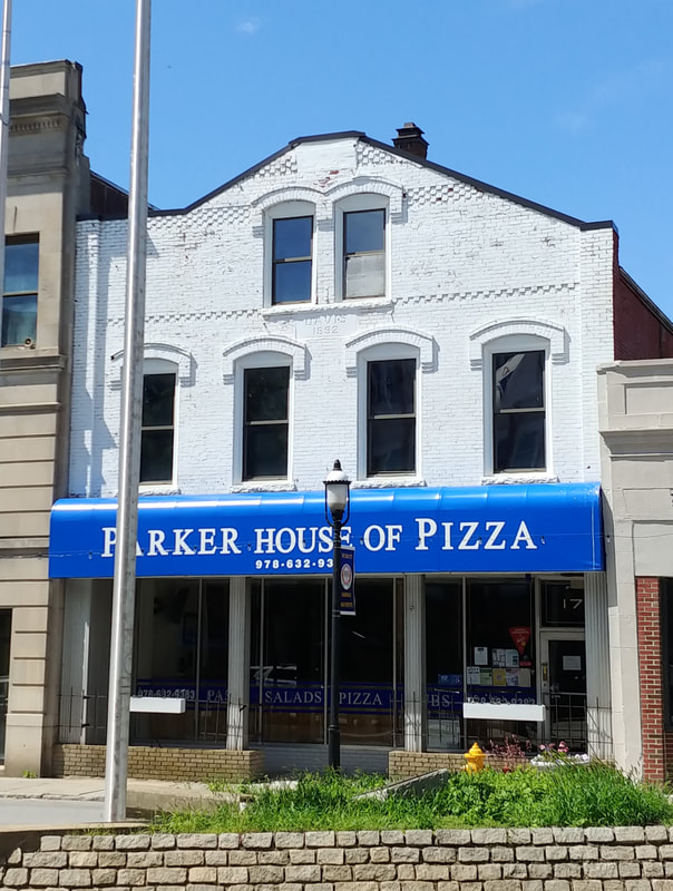
2. Davis Building - Built 1892 - 17 Pleasant Street - Houses the Parker House of Pizza today and is next to the First National Bank (above). This one survived the great change of the times.
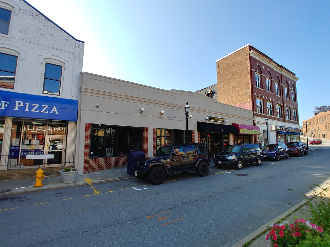
3. The third image is where Taco Rey Coliman has set up shop for about 10 years, 7-13 Pleasant Street. This is where Riordan's Block burned down and this was likely its replacement.
4. This is a picture of the aftermath of the Riordan's Block fire in 1916 (ref. 29). It matches up pretty well to the picture of image 3. You'll note that the Davis building was once squared on the top.
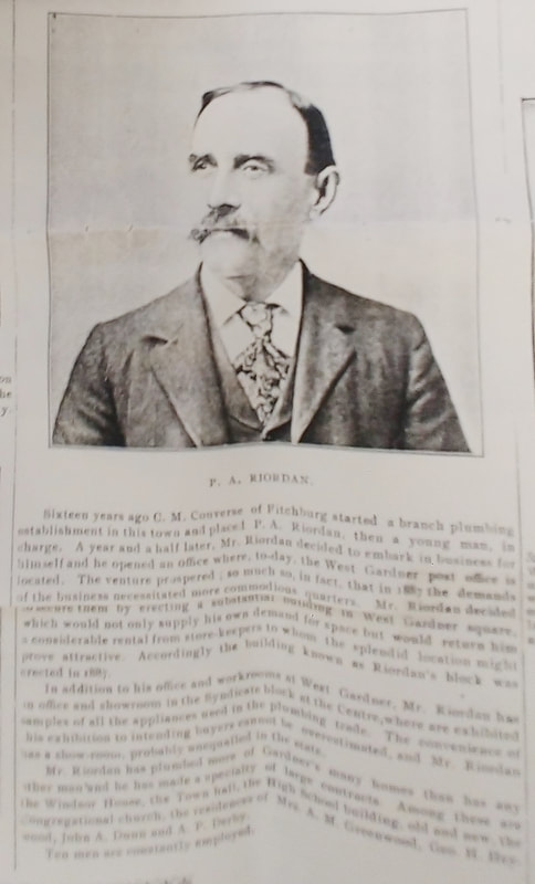
5. Image 5 (ref. 29) gives some perspective on the man Patrick A Riordan (1853-1942). Sorry it's a bit blurry. The original Riordan's Block was built in 1887.
2. Davis Building - Built 1892 - 17 Pleasant Street - Houses the Parker House of Pizza today and is next to the First National Bank (above). This one survived the great change of the times.
3. The third image is where Taco Rey Coliman has set up shop for about 10 years, 7-13 Pleasant Street. This is where Riordan's Block burned down and this was likely its replacement.
4. This is a picture of the aftermath of the Riordan's Block fire in 1916 (ref. 29). It matches up pretty well to the picture of image 3. You'll note that the Davis building was once squared on the top.
5. Image 5 (ref. 29) gives some perspective on the man Patrick A Riordan (1853-1942). Sorry it's a bit blurry. The original Riordan's Block was built in 1887.
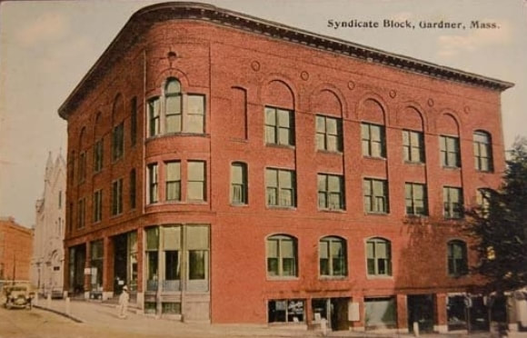
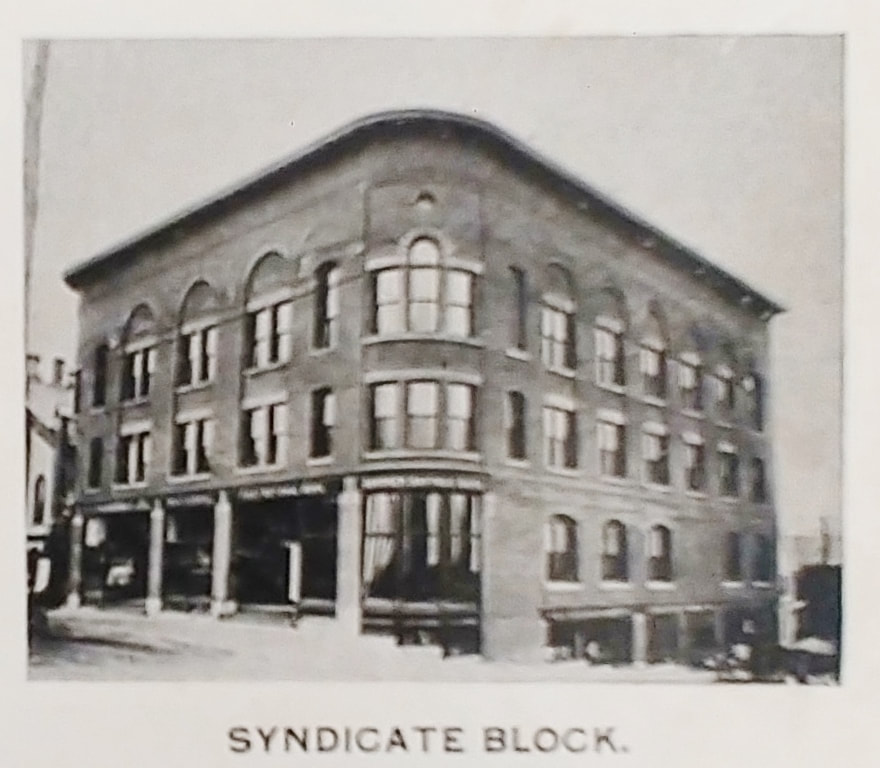
The so-called Syndicate Block is on the corner of Central and Chestnut Streets. The first image is actually a blowup of a Town Hall image from 1907. The second is from c1914 showing it from the other side - Chestnut Street goes off to the right. The third one is undated and the fourth is from c1903 (ref. 10). In both of those you see the Town hall next to the Syndicate Block building. The fifth one is from 1899 (ref. 25). All from Reference 29, numbers 6, 7, and 8 are from 1908, the 1920s, and the 1970s.
  |
The comparison photos show how the Syndicate building lost a couple of stories. This was due to a fire in 1982. In the photo below you can see how the Chestnut Street side looks today.
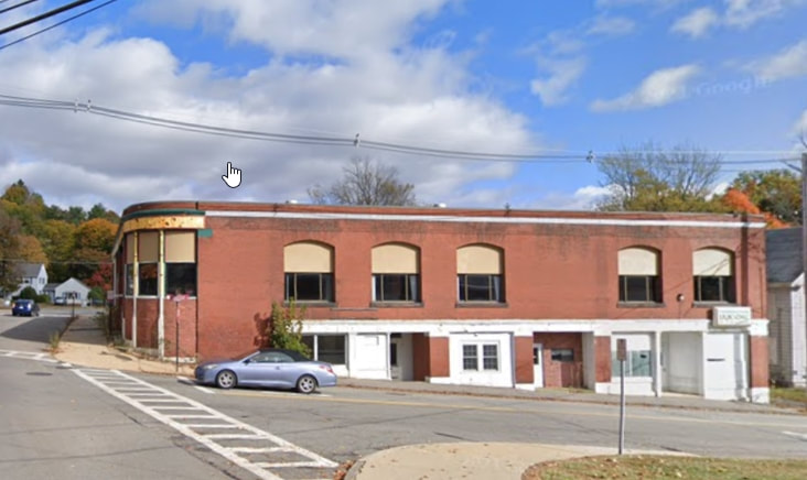
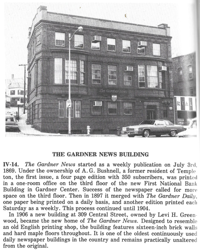
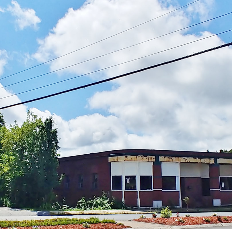
The local newspaper occupied the Gardner News Building at 309 Central Street from 1906 until 2019 when it moved operations to 300 Main Street. For a period of time the West Branch Library was housed in this building too. The first picture is from 1978 (ref. 2, page 62). The last three are undated and from the library's collection (ref. 27).
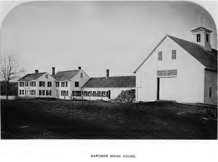
This is the Work House set up on the town farm for the poor to live on (and work). The picture is from 1878 (ref. 1). Supposedly, it was on Town Farm Road but I can find no map that has that name on a Gardner Map. It was located where a farm now sits at 1263 Green Street (aka 140). I guess part of Route 140 used to be Town Farm Road. This building burned down in 1892 and a new one was built across the street. In 1870 it was the Poor House on an unnamed road; In 1878 & 1886 it was the Alms House on Winchendon Street. In 1946 it was on a map on the other side of Winchendon Road (aka 140) as "Infirmary" but it was gone from the 1954 map.
This is the Greenwood at 299 Central Street. I took a photo because it looked cool, had a name, and an early date. It was built in 1898. The building to the right didn't have a name but is likely from the same time. These two can be seen in the Street Views section below in the photo labeled "Central Street - Looking north".
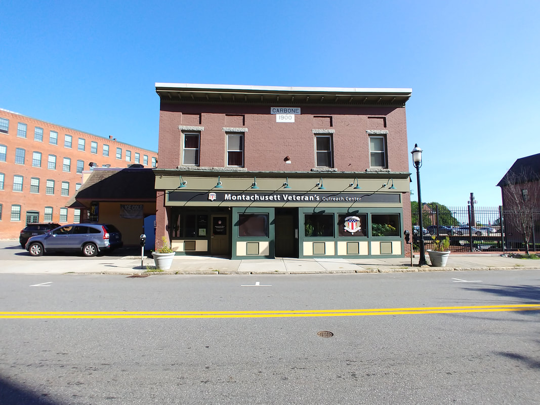
The Carbone Block at 246 Central Street was built in 1900. It was known as that from 1910 until at least 1978. It was owned by Luigi (aka Louis) P Carbone, born c1860, who immigrated to the US in 1884 and his brother Michael under Carbone & Carbone. The 1900 census indicates that Louis and Michael were fruit dealers. They lived at 118 Vernon Street, not too far from this building. In a 1968 photo there was a J B Carbone, Inc. at 44 Main Street (in a building that is now one story shorter!). J B Was Jovani (aka John) B Carbone, Michael's son.
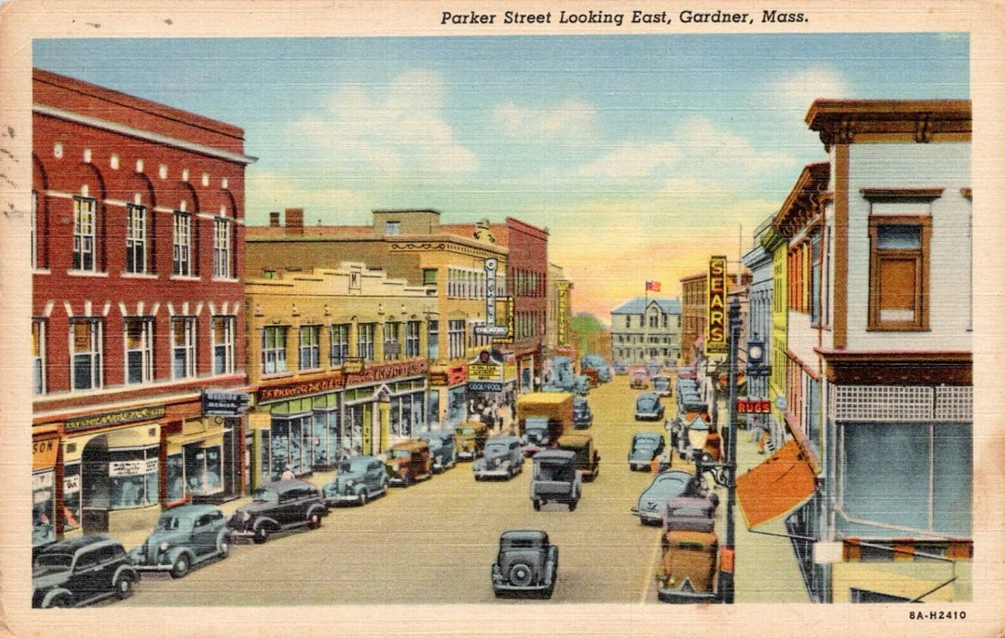
I did some extra investigating for Parker Street to get some building names. As it happened, I learned that many businesses were staples in the busy downtown in the 1920s, 1930s, and 1940s. They included the familiar F W Woolworth (aka the Five & Ten) and the A &P as well as many others you probably never heard about.
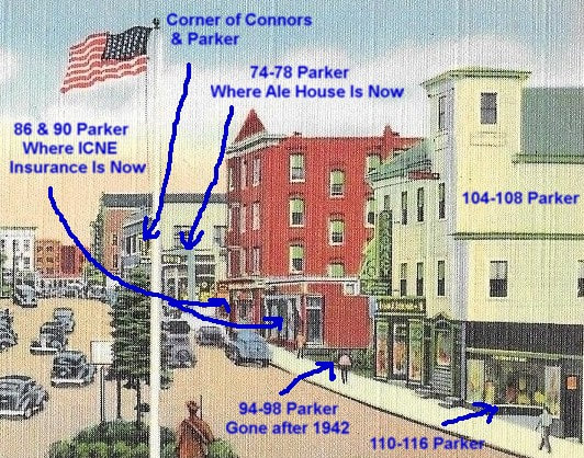

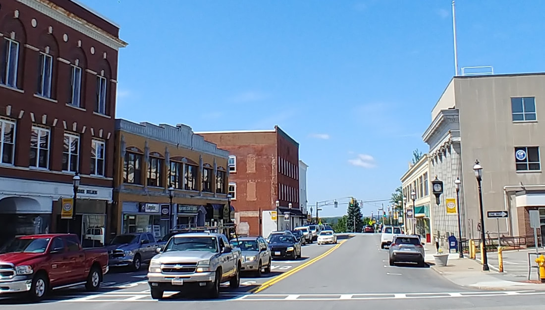
This section of Parker is not well photographed. There is one early photo I found from the opposite direction that shows this section in such an extreme profile that it's hard to ascertain what was what. The best I have is the postcard above from the 1940s. The modern view is a screengrab from Googlemaps. Left to right starting from Connors Street you have the Robichaud Building (60-70 Parker) which is documented in the next section. Then the building with the Garner Ale House in it is 74-78 Parker. Up next is a 4 story building which is now where 86 Parker is. The building there now may be a shortened version of what's in the postcard or possibly a whole new building. At 90 Parker Street the building there now looks to be the same one. The two side by side, 86 & 90, appear to be the same building but you can tell they were once separate. They currently house HUB International Insurance. The gap is where 94-98 Parker was and there were establishments there at least up until 1942 (need more research). The tall yellow (now white) building is 102-108 Parker and the shorter one next to it is 110-116 Parker. Unseen next to that is the building that Kenny's Chinese is in, the address formerly being 120-134. During the 1920s and 30s the following businesses were at these locations.
74-78; The building had three different names early on - Murray's Block (1924 or earlier - 1925) Gerzog's Block (1926-1930), and Levine Block (1931-1942 or after). It housed The Elite Restaurant, the Hollywood Cafe, grocery stores, Gardner Gas Fuel and Light Company, Goodrich Silvertown Stores auto supplies, Levine Clothier, and, notably, W E Aubuchon Company dealer of hardware.
86; The four story building appears to have been the replacement for whatever was there before. It is difficult to say when the tall building was in place but perhaps by 1939 when it was home to the A & P. The earlier building was built some time between 1900-1905 but something was on the lot prior to that.
90; By 1905 this building was in place. Prior to that there was a small building there. Canadian born Eugene E Barthel (c1861-1937 or later) owned the establishment and rented it to a number of people. The business that was there was his own and it was a grocery store.
94-98; Technically, there were two buildings here but they looked like they were attached. Arthur Joseph Lamoureaux (1890-1963) and his Funeral Home was a long-time resident at 98 Parker. This part was built by 1900. The other side at 94 & 96 was there by 1905. Mr Lamoureaux occupied 94 too and Marie Louise Courchesne (1886-1967) was at 96 selling church goods.
102-108; Longtime residents were Louis Emile Robillard (1858-1932) and his son the druggist Emilien Ones Roderique Robillard (1898-1959), and tailor John Edwin Sundholm (1878-1945). Also, there was Robillard Hall and Red Man's Hall and its sequel Improved Order of Red Man's Hall. The image below from 1915 (ref. 29) shows Robillard block and the buildings west of it but, again, not terribly well. At least you can tell that the Robillard building used to have a higher tower. The Googlemaps screenshot essentially shows the same view.
110-116; It looks like Edouard G Barthel (c1860-1930 or later) occupied 116 Parker for a number of years, then Arthur Joseph Pariseau (1897-1985) and Clinton David Provencher (1892-1950 or later) & Henry P Cormier (1896-1975). Around 1939 Louis J A LeBlanc started selling clothes at 110 Parker.
120-134; Now 120-130 because the section of the building on the end is gone. Various business were in this building complex, most notably W E Aubuchon from 1925-1930. Also Max Lintz (1894-1967) clothing, real estate agent Joseph Laberge (c1874-1940 or after), music teacher Adelard Stanislas Gagnon (1883-1928 or after), and barber Lucien Joseph Dupuis (1876-1964), among others.

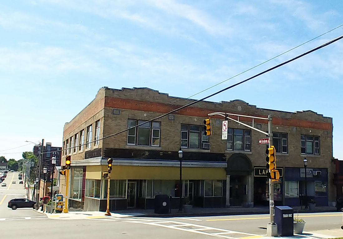
This building is on the corner of Connors and Parker Streets at 60-70 Parker Street. The view is from Graham Street looking south. The building has some interesting design work and inlays you just don't see today. In the 1920s it was known as the Robichaud & Mountain Block. By 1928 it was just the Robichaud Block and still later the Robichaud Building. In addition to various businesses in its upstairs, the firms of Mountain Clothiers, J J Newberry Department Stores, Smith & Levitt Inc, Winchester Sportswear Inc (later Winchester Specialty Shop), and T T Greenwood & Son took up the spots on the ground floor. The building was erected some time from 1914-1923. There was supposedly a fire in 1929 but the directories of the time suggest that the fire couldn't have been too bad as the businesses kept chugging along. The current Lakin's Children's Fine Apparel moved into this place c1945.
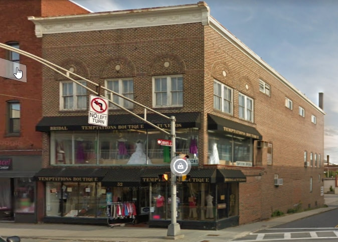
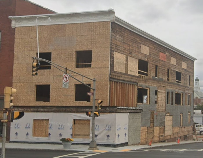
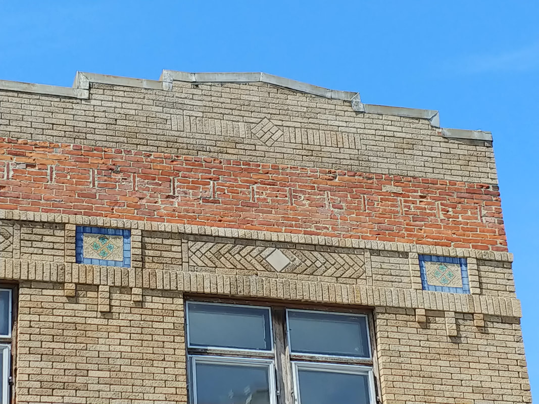
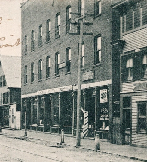
50-52 Parker Street housed the long term resident Rose's Clothing and Furniture Store. Later occupants included the Worcester Telegram Gazette and Leslie's which sold greeting cards. This building seems to have been built some time between 1889 and 1895. The maps have a form which matches today's shape. There are no great old pictures of the building. In any case, there is a building there today (image 1 above) and its recent tenant was Temptations Boutique. The first image below shows the building next to the Ryan Brother's Block but it looks a bit different and even a little shorter. Currently, it is undergoing a redo and a Googlemaps snapshot (image 2 above) shows that the brick was a veneer and that there is an old wood structure underneath.
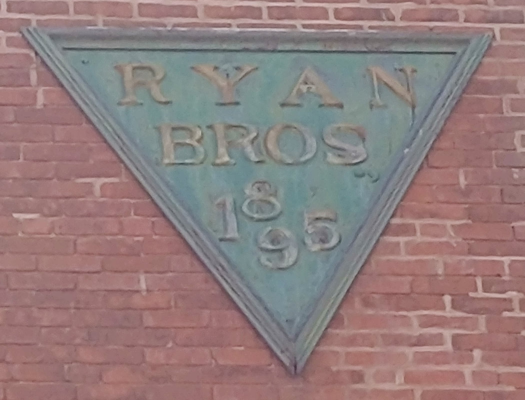
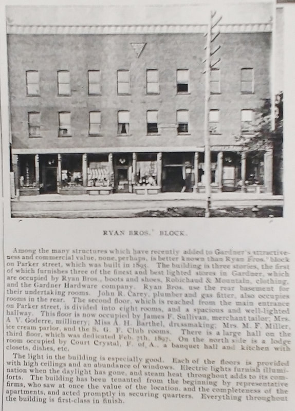
Ryan Brother's Block - 42-48 Parker St - This building was erected in 1895 and it still exists today with its original triangular sign near the top. In the 1920s and 1930 it once housed the Olympia Candy Company, the Great A & P Tea Company, Samuel Kaplan Jr's clothing store, Forester's Hall (before it moved), various clubs, the National 5-10-25 and Up Store, Markson Brothers Inc clothing, Student Brothers shoes, and the clothing store called the Betty Jane Shops. Image 3 is undated (ref. 29) but is likely from c1900 but I think I can get a better date with some more research. It describes the building's interior spaces nicely.
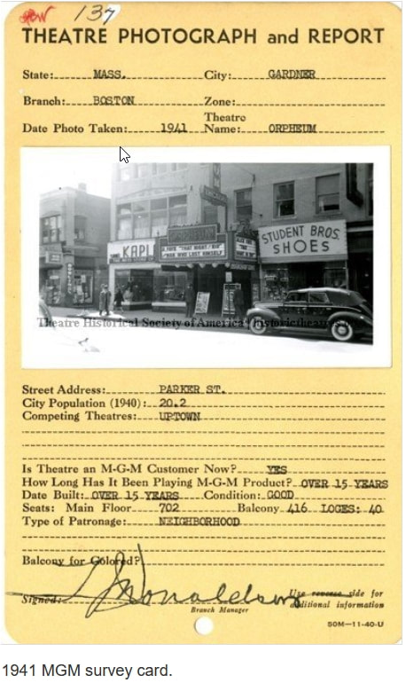

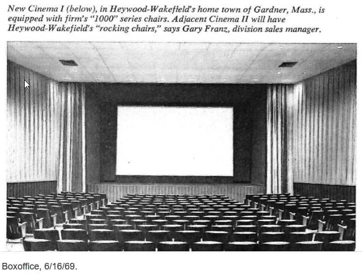
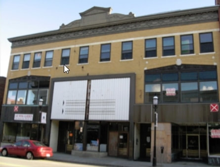
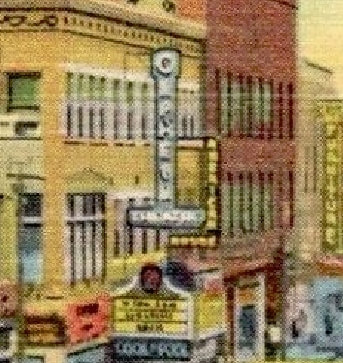
The Orpheum Theater was built at least by 1914. The "Report Card" shows the outside in 1941. The second picture is from 1964 (ref. 19). By 1968 it was known as Cinema I and Cinema II. The inside view of Cinema I is from 1969. The theaters showed movies until 1999. The final photo is more recent and shows how the building was no longer being used. Below you see that in the 1940s the Orpheum Marquee is on the 2nd yellow building. I blew it up for you to see better. Today, the entire building is gone, knocked down in 2017. So, 32-40 Parker Street is no more. It once housed the Bay State Tea & Butter Co, the American House (you can see the "American" marquee in the middle picture below), the Clarksonian Hotel, and The Vogue clothing store.
   |
There was mysterious pool hall called Leamy & Gilhooly which was supposedly at 26 Parker Street in the 1920s and 1930s. Trouble is, number 26 didn't show on the maps. It would have been in the alley between the Michelman's Block (14-22 Parker) and the Orpheum Theater building (32-40 Parker). Since Leamy & Gilhooly was listed as a bowling alley the place would have taken up some space. The only clue I could find was in the 1932 map which said "Bowling" on the Michelman building. I can only assume that 26 was in the basement and not on the second floor. What a racket that would have been above the shoppers!
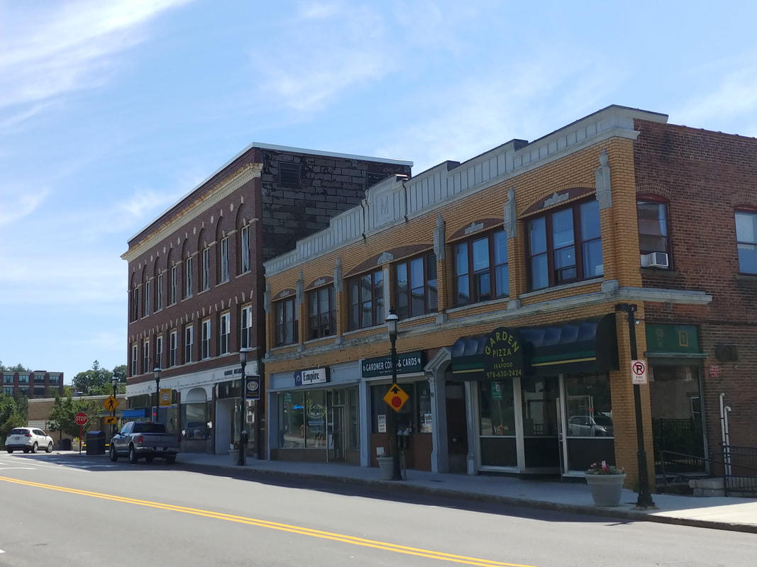
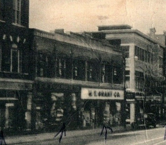
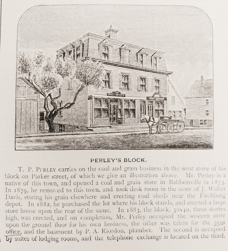
Michelman's Block - 14-22 Parker Street. In the early 1900s Barney Nathan Michelman (1874-1951) was working out of 7 and 9 Pleasant Street but by 1916 he operated his own building at 16-22 Parker Street (later listed as 14-22). Today, the addresses in this yellow building are 14-24 Parker Street. There is an "M" at the top of the building. In the 1920s and 1930s you could find F W Woolworth Company and the W T Grant department store occupying the larger storefronts while many other people and businesses rented above. In the second image, probably from the 1950-1960s, you can see the W T Grant Co sign. Below in the first picture you will see what was there before. The third picture (ref. 29) from 1885 shows what was called Perley's Block which was built in 1883 and there until the Michelman building was built. It was built by Theophilus Parsons Perley (1838-1901). You can see Perley Block sitting to the right of the Garbose building in the first picture below.
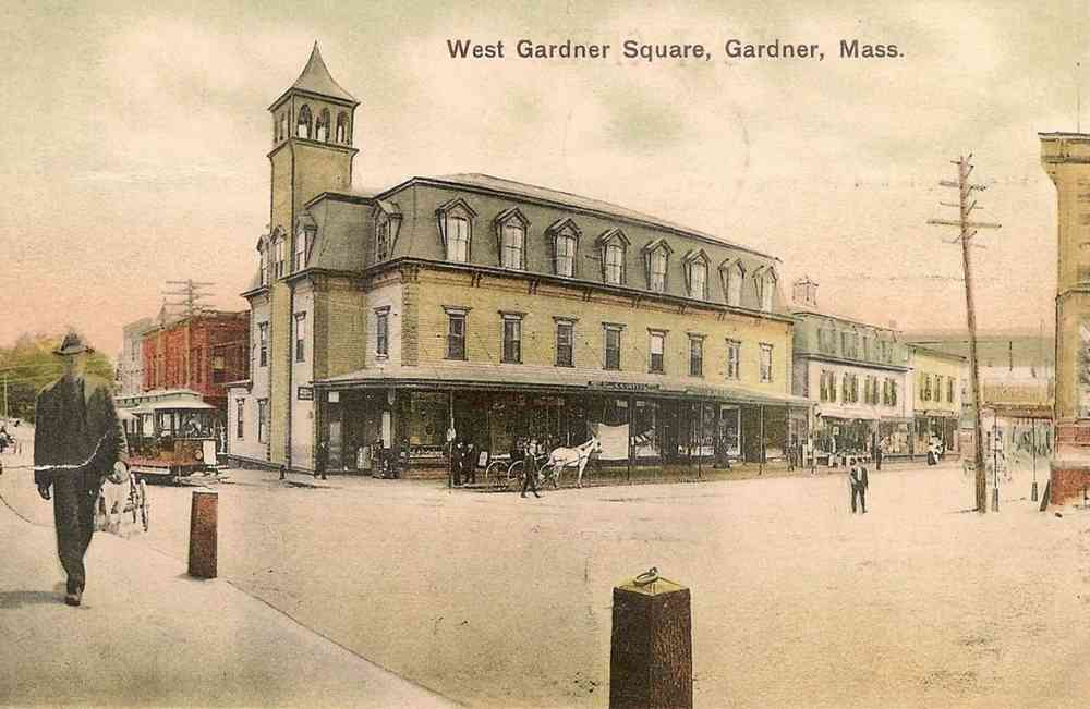
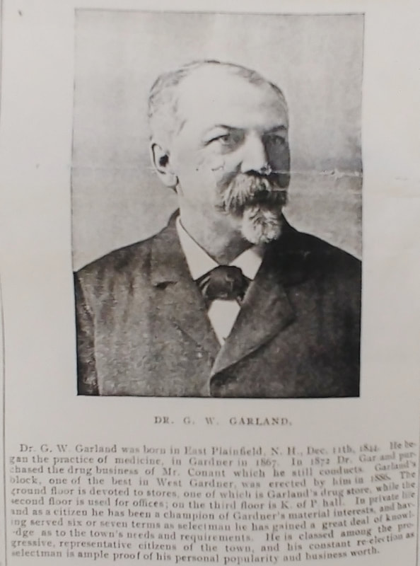
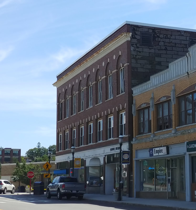
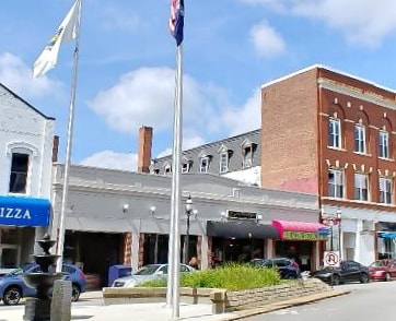
Garbose Building - 2-12 Parker Street & 4-12 Pleasant Street. In 1886 Guy W Garland (1844-1920) built the original structure of image 1 so it was originally called Garland Block up until at least 1905. Picture 2 shows Dr Garland (ref. 29) and talks a little about him. Afterwards it was called the Garbose Building until 1927 and then it was referred to as the Liggett Building with Liggett's Pharmacy on the corner (see second picture below). It received a brick facelift (picture 3) some time between 1907 and 1927. As can be seen in a photo from the rear, iamge 4, it has retained some its old personality. In addition to Liggett's there were the Garbose Brothers clothiers, Wachusett Dental Laboratory, shoe sales of John Kuczynski and Merit Shoe Company, dentist J C Hughes, and Luxcraft photography through the 20s and 30s. Also in the building for a short while was the Bon Ton Restaurant. The fact that it was listed in the Gardner directories from 1926-29 helped me date the postcard from which the first image below was taken. To date I have only investigated the Parker Street side of the building's residents.

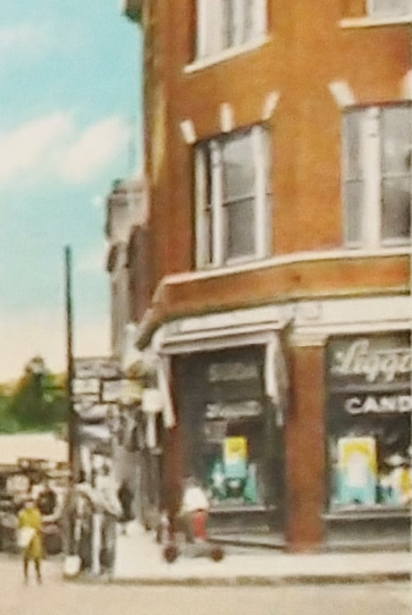
Now to the other side of the street...
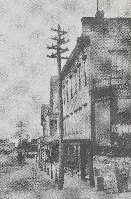
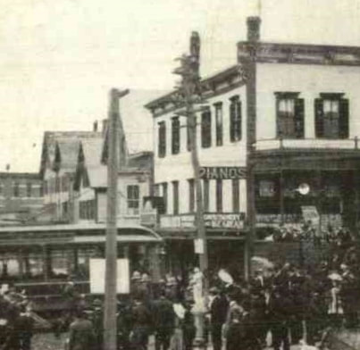
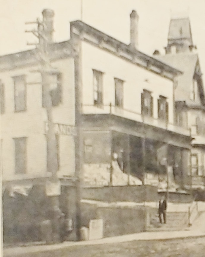
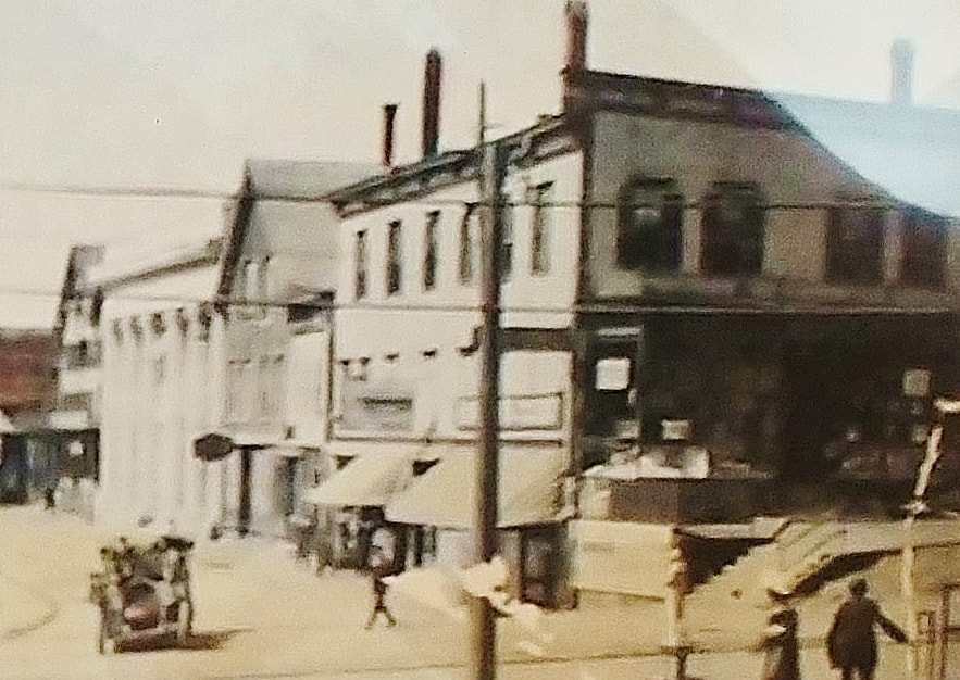
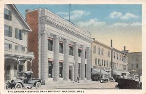
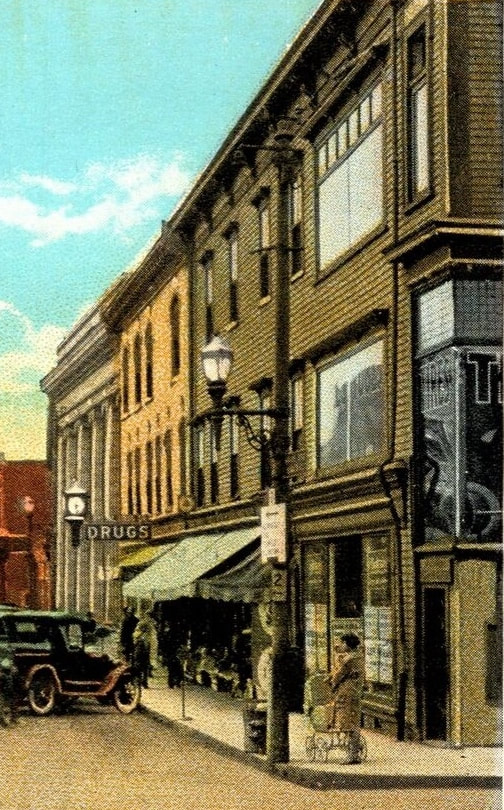
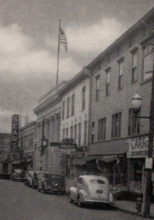
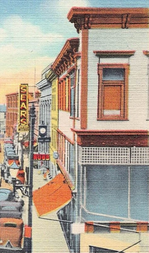
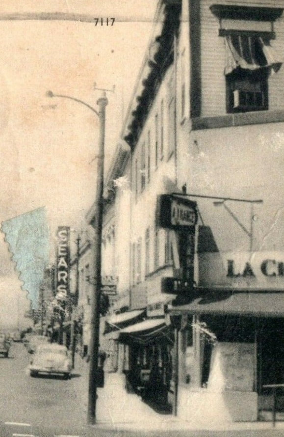
The two buildings to the right of Gardner Savings Bank at 1-21 Parker Street have not been well photographed but I have included what I have. The first two images are from before the bank was built in 1909, the first being from 1895 and the second from 1907. The third picture shows the building on the corner c1910. Figure 4 is from 1915ish. Images 5 & 6 are probably the 1920s. By the pictures, somewhere in there the building next to the bank was rebuilt to match the roof line of the corner building. Pictures 7 & 8 are from the 1940s and the ninth is from about 1960. All of these images give you the same basic view except for the third and fifth. The corner building was numbered 1-13 and it was there at least by 1889 and up until 1968 or later. Its consistent occupant through the 1920s and into the 1930s was the fruit store of Carbone & Carbone. Yes, the same brothers who owned the Carbone Block on Central Street. The 1967 history referred to this building as the Carbone Building. The next one was numbered 17-21 and was there by 1895 and lasted up to c1960 but probably later. Crystal Drug Company, Plain View Bakery, and optician H W Eames were there in the 20s and 30s but I do not have a specific name for the building. Both buildings are gone and in their place is a parking lot.
The next building on Parker Street is the Gardner Savings Bank at 29 & 31. I already talked about it and did a comparison shot above.
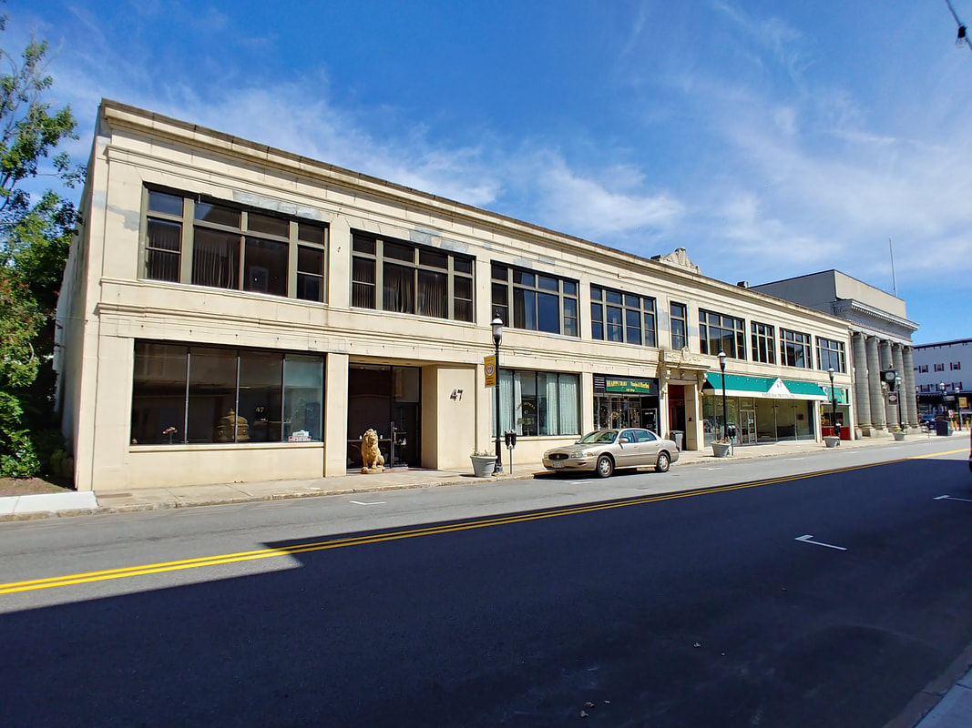
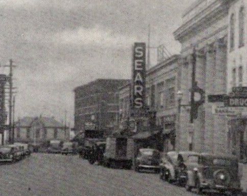
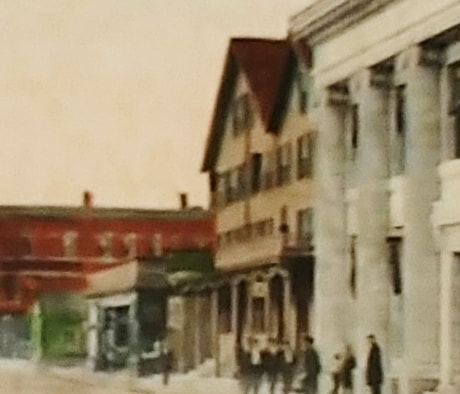
Sears Building - The long yellow building now occupying 33-49 Parker only appears on the 1932 map but it may have been there as early as 1927 when we see the name Gardner Realty Corp Building start popping up in the directories. I call it the Sears Building only because I saw the Sears sign sticking out prominently in some early street views like in picture 2 from the 1940s. Technically, I should call it the Gardner Realty Corp Building. During the 1920s and 1930s it housed People's Store (clothing), Myers Radio Shop, N E Tel & Tel Co, A Cohen & Sons clothing store, and, of course, Gardner Realty Corp. Prior to this being built there was the Richard's Hotel which was next to the bank and them some other buildings. There really aren't any great pictures showing what was there before. The best I have is picture number 3 showing the stretch of buildings next to the bank which I figure is from about 1915.
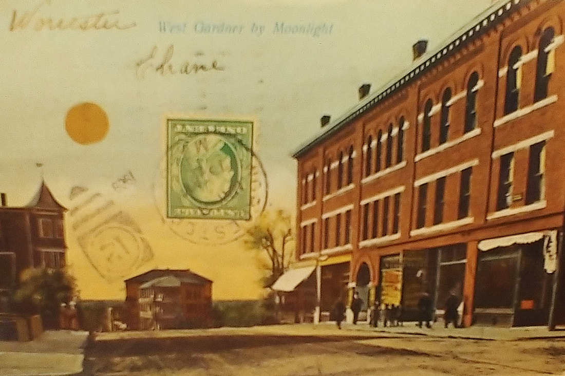
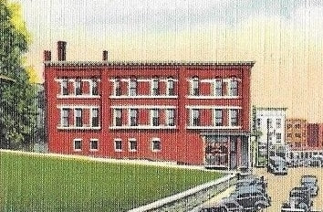
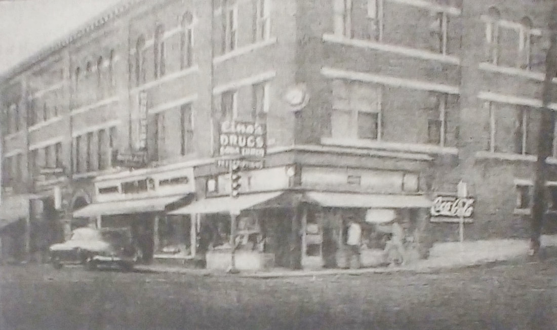
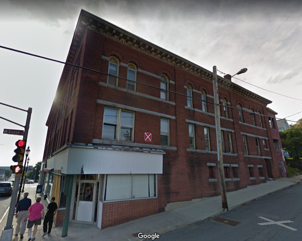
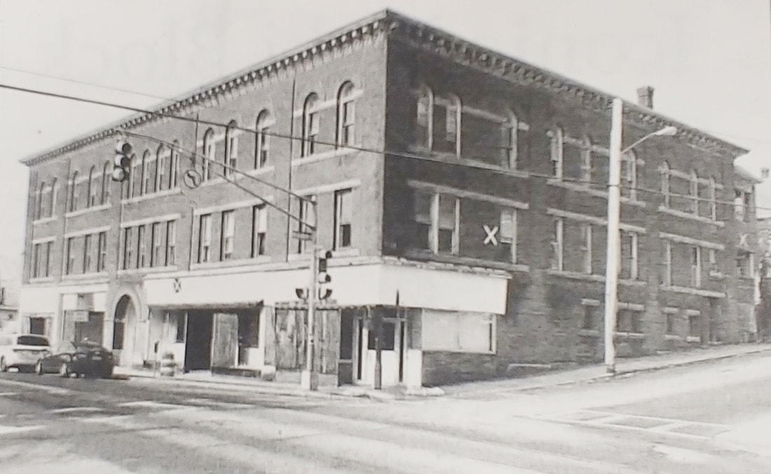
Rome Block & Studio Block - 57-71 Parker Street. Prior to 1924 this building was called Rome's Block. After that it was listed as Studio Block. Still later it was known as the Maki Block. It was built some time between 1898 and 1905 and lasted to c2020. The first picture shows the red brick building in a 1909 postcard and the second view, looking from the opposite direction, is likely from the 1940s. In the 1920s and 1930s you could find The Great A & P Tea Company (having moved from Ryan's Block across the street), Chaffetz & Kessler furniture, Walkonen Brothers clothing, the jeweler William Laitinen, contractor P J Loughlin, photographer Nestor Maki, and a whole slew of business people and tenants. The third picture (ref. 29) is from the early 1950s. you see Graham Street going off to the left. The Googlemaps screengrab of image 4 and the newspaper image 5 (ref. 29) show the building near its end. The lot is currently just grass.
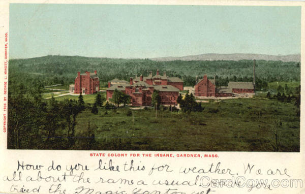
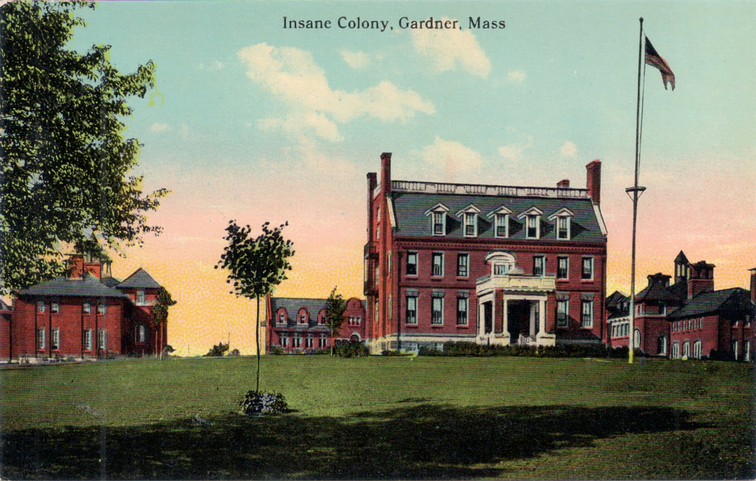
State Colony For The Insane - First, who would think an insane asylum would warrant a postcard...but I found two! What? Having a good time - wish you were here. Yikes. Now, I have no dates for the first two images but it was clearly is big place. It was open from 1902-1975. Check out the Asylum Project for more information. Currently used as a jail on Chapel Street.
I took the aerial image from Googlemaps using the 3D view and it's a bit squished looking. However, you can see that the four main buildings still are in use. For orientation the flat-topped building in the old photos is the building on the bottom.
I took the aerial image from Googlemaps using the 3D view and it's a bit squished looking. However, you can see that the four main buildings still are in use. For orientation the flat-topped building in the old photos is the building on the bottom.

|
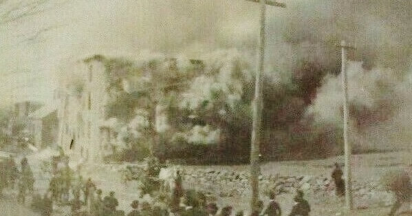
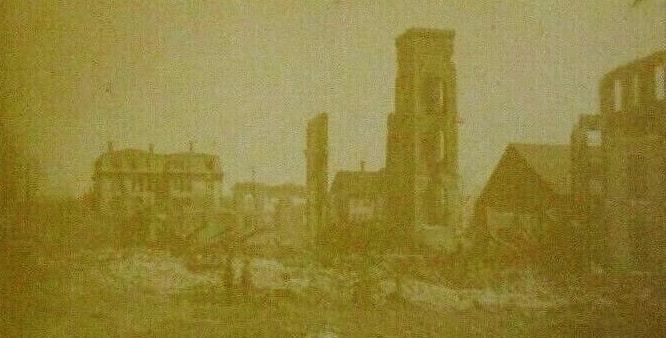
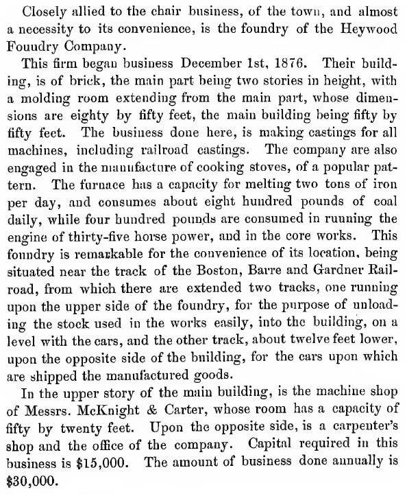
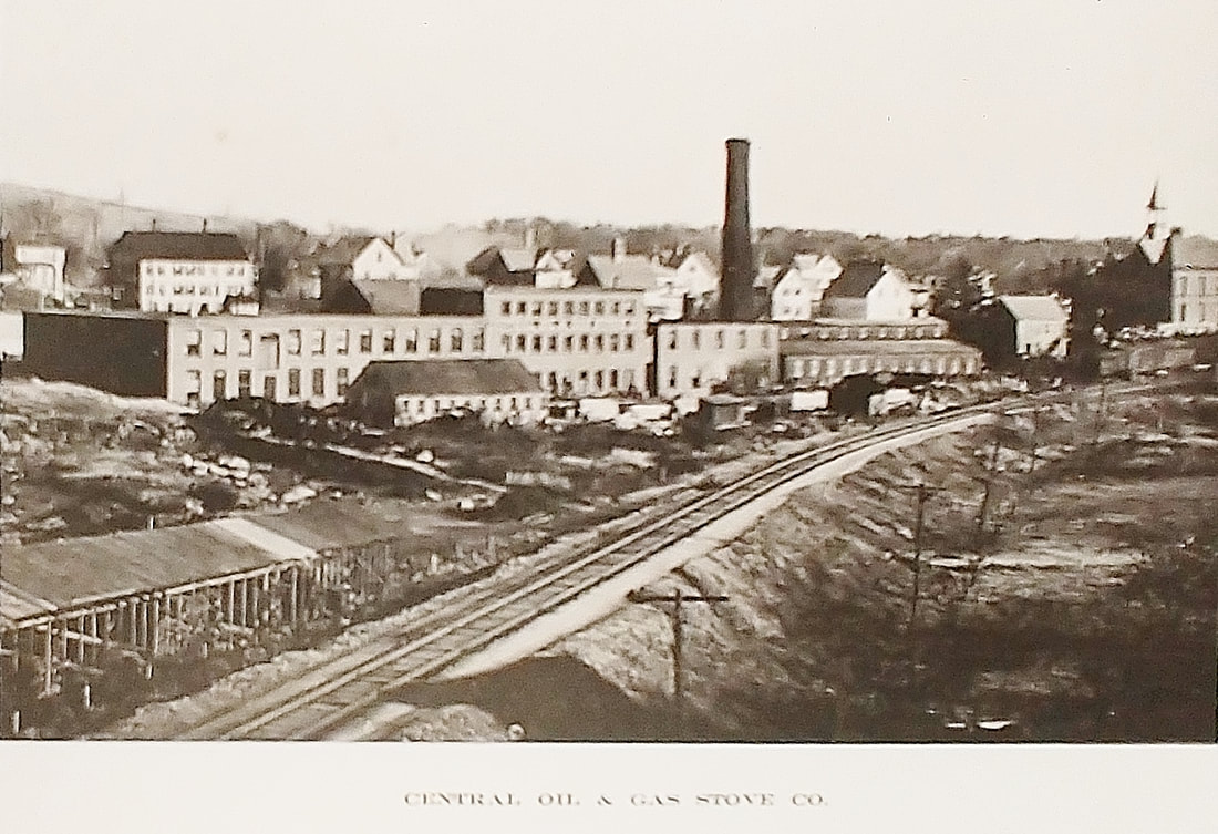
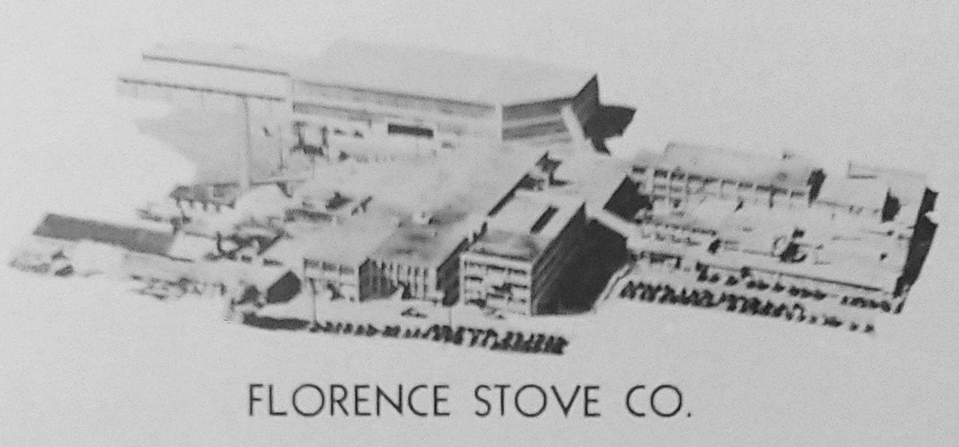
Florence Stove Factory - This is an interesting picture of one of these old buildings burning down. The first shows the fire and the second the aftermath. The factory had been in the business of making stoves in Gardner since 1884 or so. In 1884 the American Oil Stove Company took over the Heywood Foundry (image 3, ref. 1, page 185) and produced Florence Stoves. In 1890 Central Oil & Gas Stove Company took over the place and in 1899 there was a big fire. They rebuilt on the spot. Image 4 shows the factory c1903 (ref. 10). In 1924 the company name became the Florence Stove Company and they continued making, you guessed it, Florence Stoves. Image 5 (ref. 29) shows the company in 1950 from the air. The factory at 205 School Street closed in 1957 and was sold and most (or all) of the buildings for the Florence Stove Company still exist. I do not know if the original foundry survived the fire. The buildings in the upper part of picture 5 are part of New England Wooden Ware Corporation today.
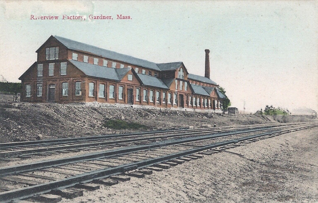
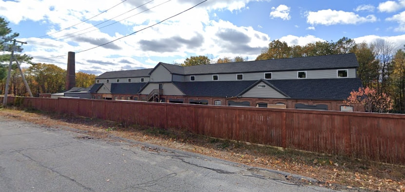
Riverview Factory - c1910 - In a 1932 map this was listed as the Gardner Woolen Mills. This building still exists to the east of the tracks on Baker St across from Jenn's Tack & Blanket Service. Since the view above is from the tracks you probably wouldn't get a good look at it because of trees in the way today. So, from Baker Street you'll see the factory, image 2, with the smokestack on the left instead of on the right. It is apparently used or going to be used as office space.
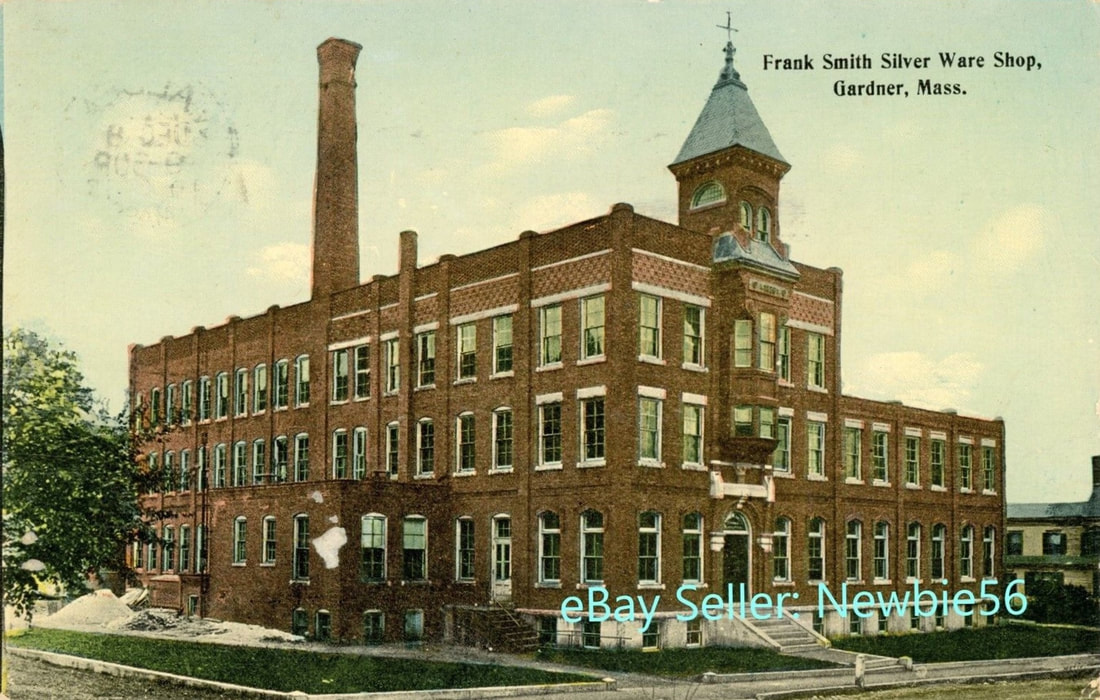 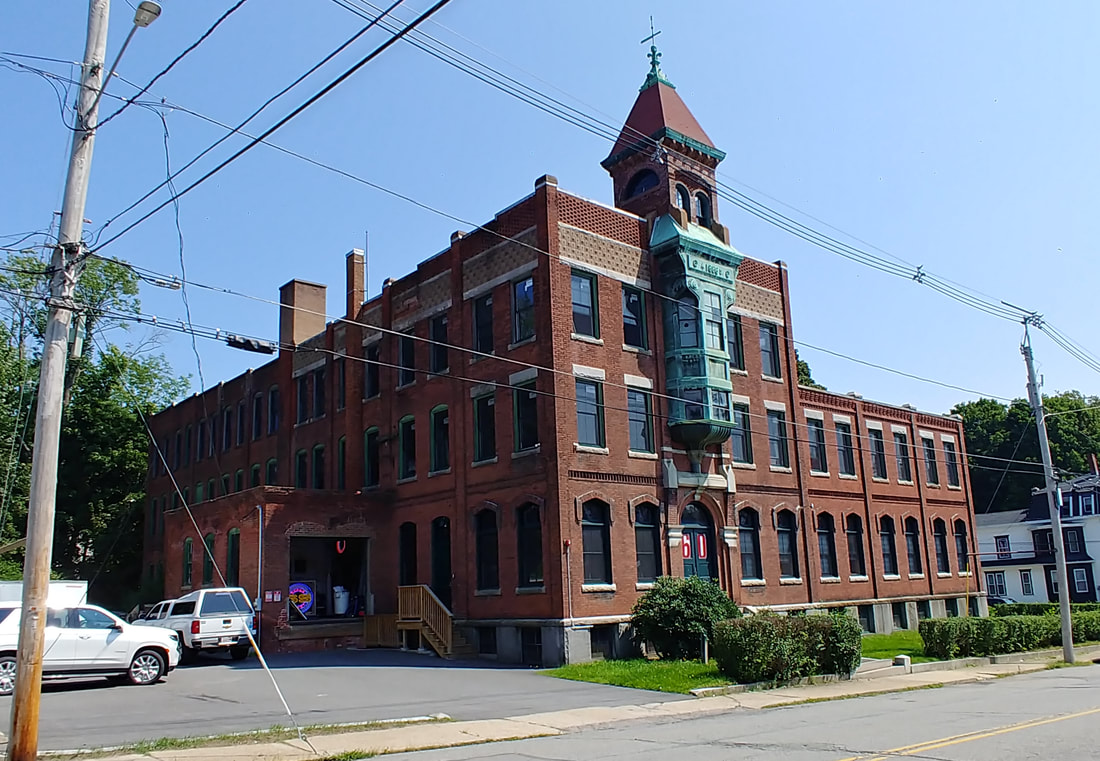 |
Frank Smith's Silver Ware Shop - Built 1886 and located at 60 Chestnut Street. The old picture is from 1915. The closeup photos below of Frank's building from 2023 show the magnificence of the exterior design and the stained glass detail above the first floor windows. Reference 2 has a short history and an alternate view of the shop on page 49. The picture of Mr. Smith below and the accompanying article from 1897 (ref. 29) offer some insight into the man.
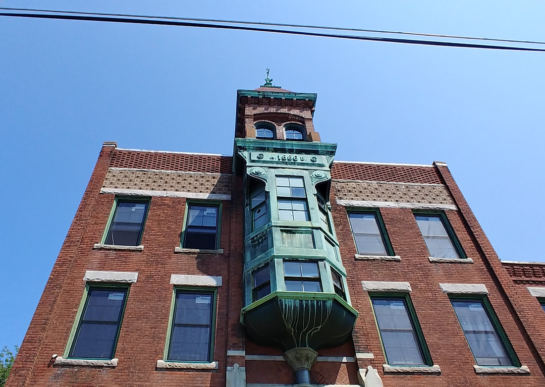
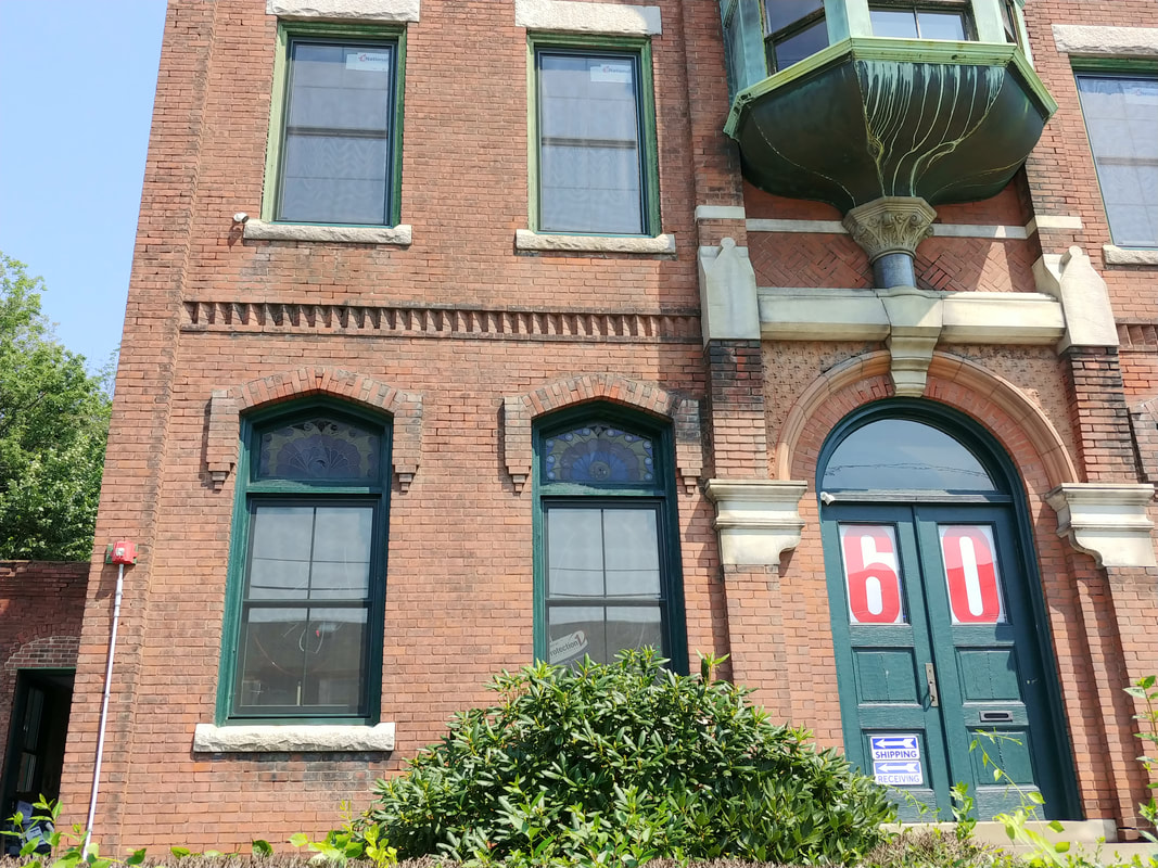
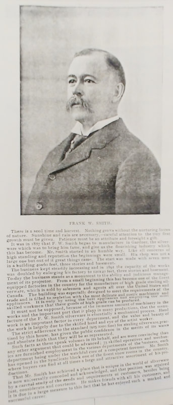
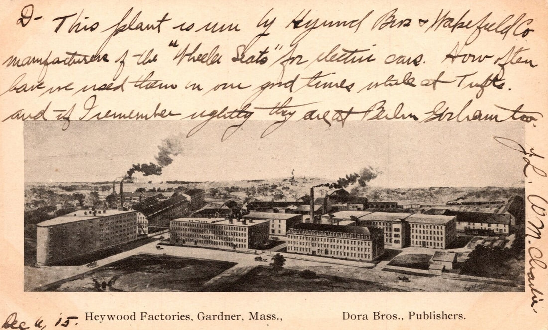
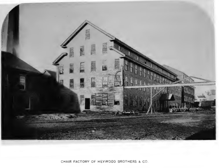
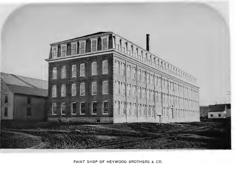
A bird's eye view of the Heywood Brothers' Chair Factory complex from c1905. Central Street is the road coming into the picture from the lower left and the nearly horizontal one is Pine Street.
Images 2 & 3 are from Reference 1 and are from 1878.
Check out the bird's eye view from c1905 to see where these two building were and are. The 1870 map shows a lot of buildings belonging to the Heywood Brothers. It is difficult to determine if some or all of the "Chair Factory" still exists today. It may be the long building that is currently behind what is now called Heywood Place (the triangular building on Central Street - see below). The Paint Shop is the same building that is currently the Heywood Wakefield Commons building on Pine Street with some exterior modifications (and interior, I'm sure). Front the front the building looks very different, plain brick all the way up, but in the back you can still see the interesting bank of windows at the top (below).
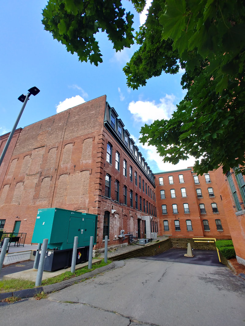
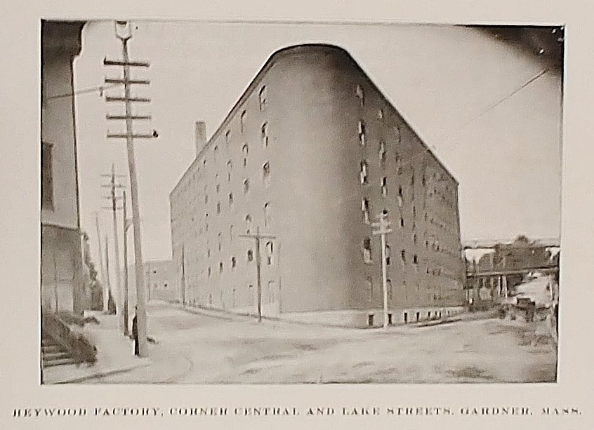
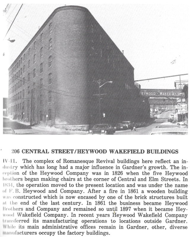
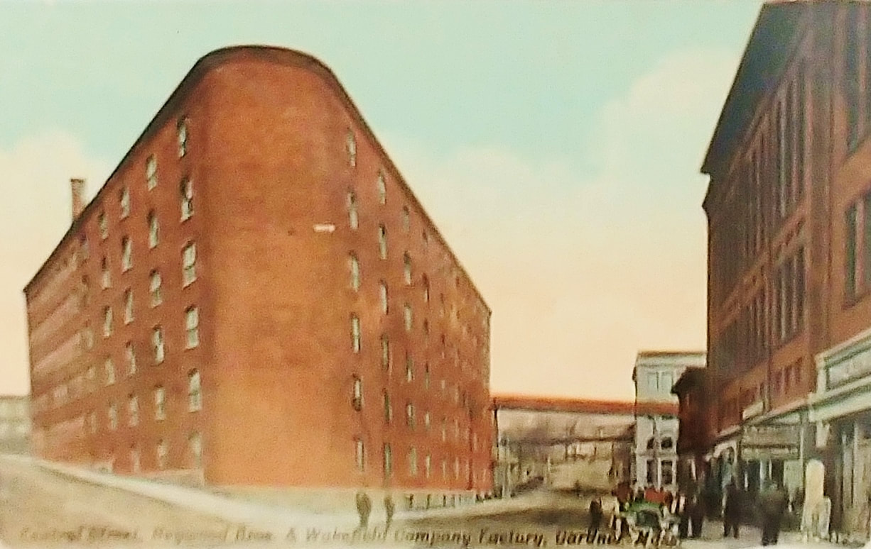
Heywood Factory - This uniquely shaped building is on the corner of Lake and Central Street. One vertex of this triangle is curved. The first photo, c1903, looks to be the photograph from which the above colored version was created. The third photo shows it in 1978 (ref. 2, page 61). The fourth (ref. 27) is undated but may be from the 1920s based on what looks like an automobile in the picture.
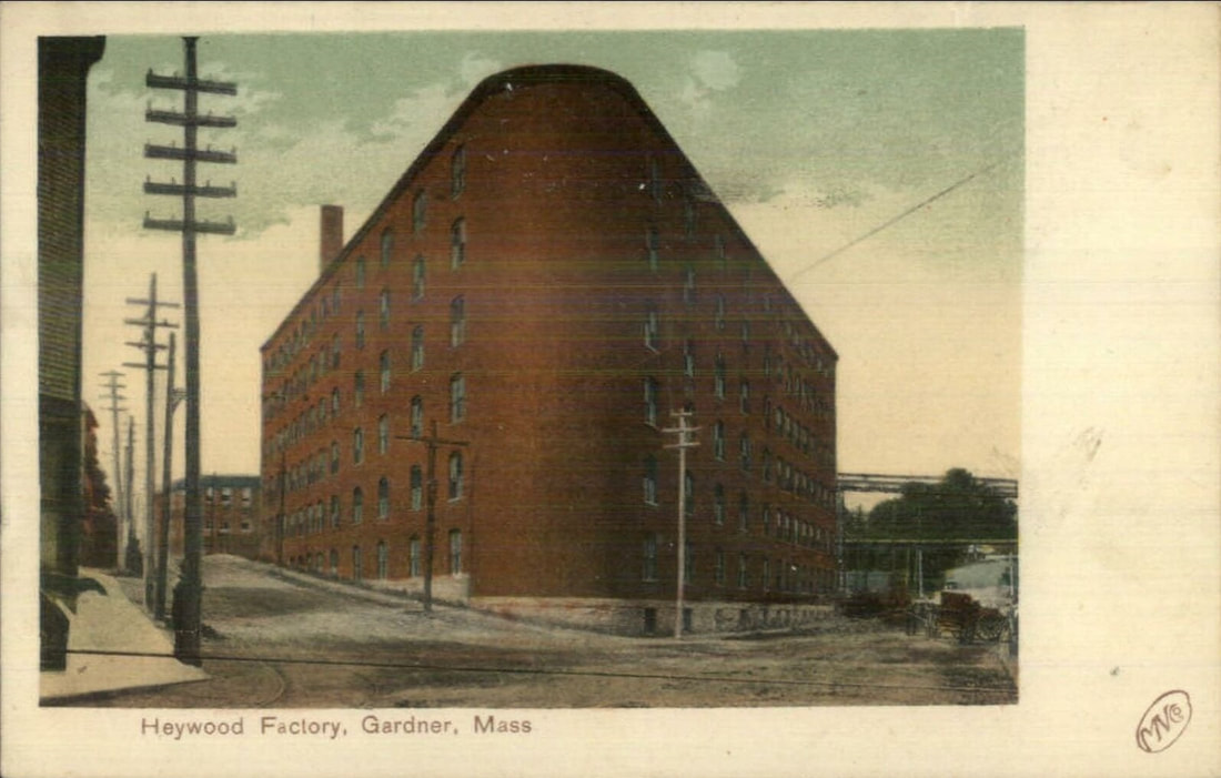 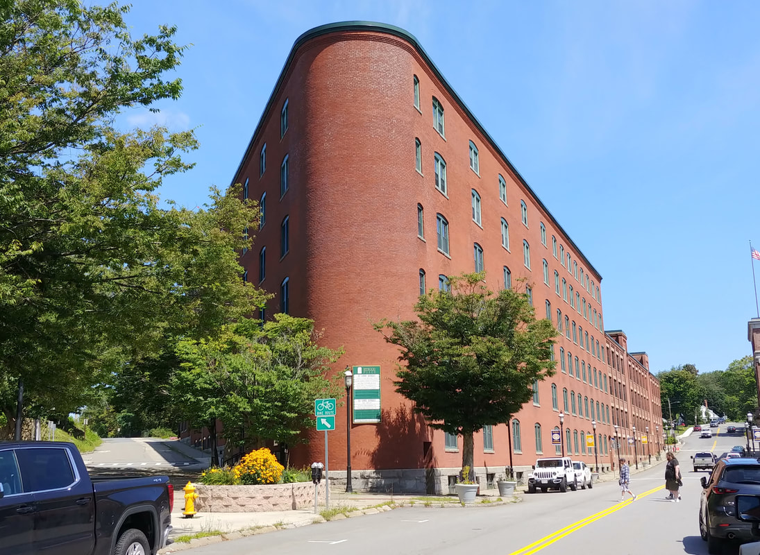 |
Heywood Factory - It remains in great shape and is now used as an office complex called Heywood Place. The view below is just a closeup of the curved edge.
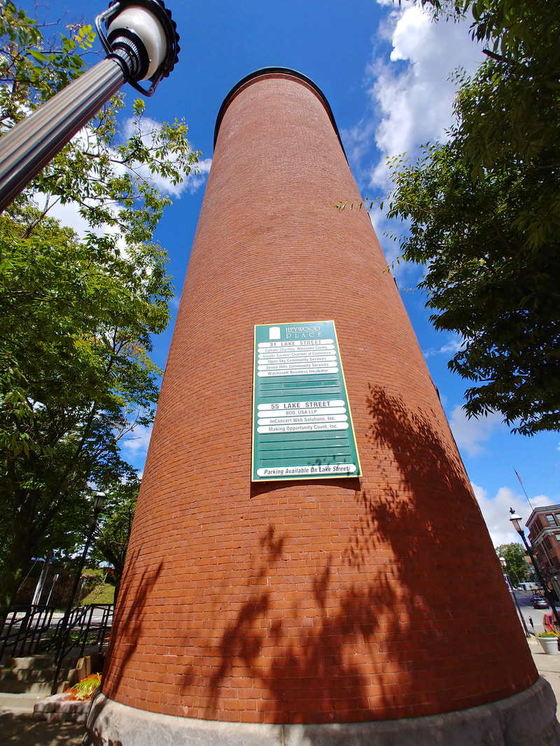
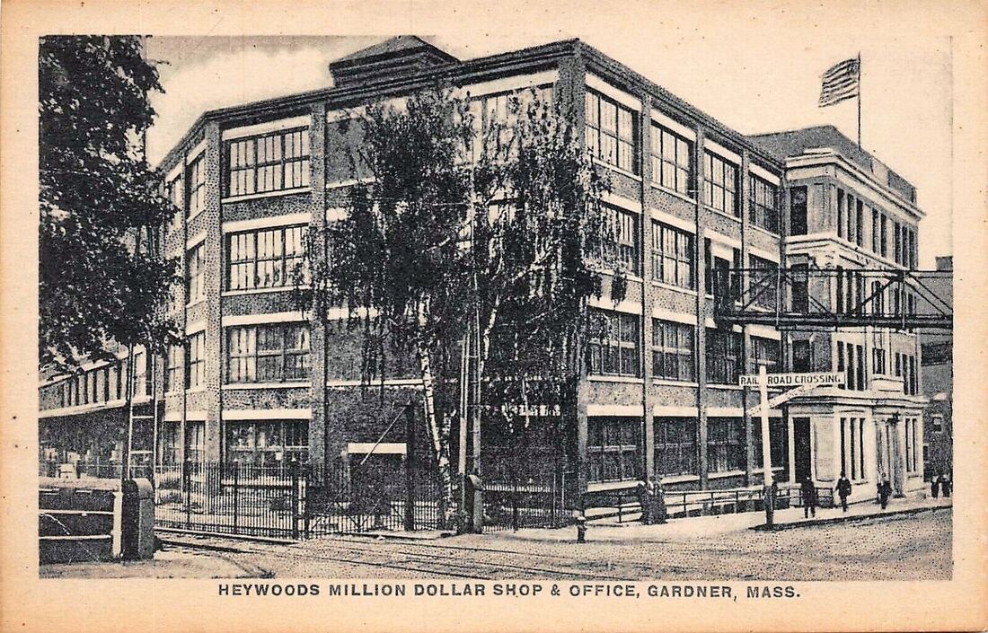
Heywood Brothers and Wakefield's Million Dollar Office - The first and third images are from an unknown date but the second is from c1910.
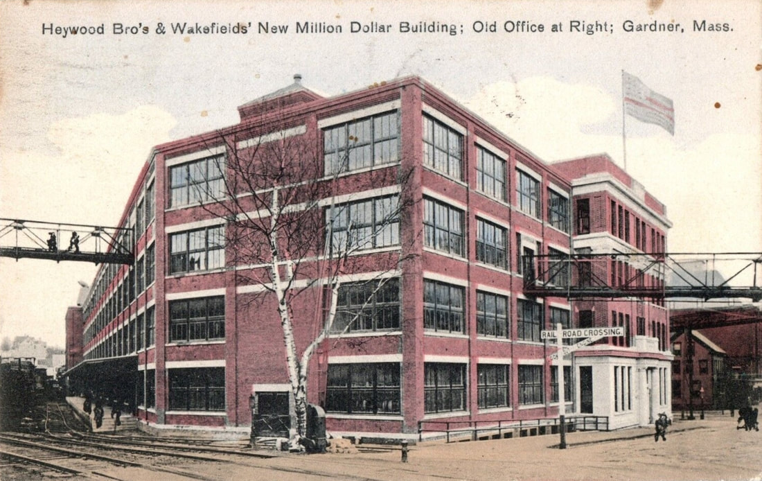 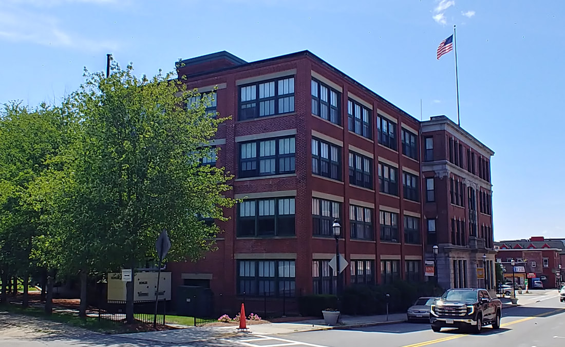 |
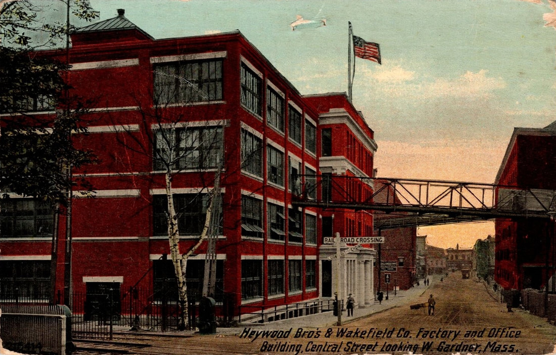 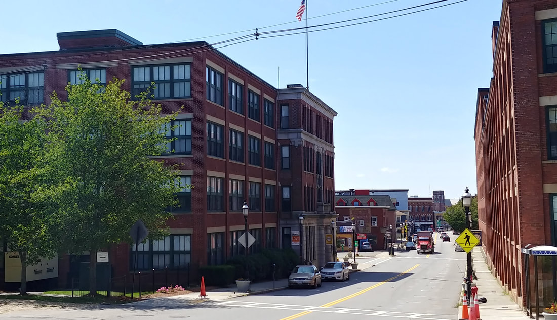 |
Two similar views looking southwest down Central Street. I have not figured out when this was built yet. The building used to have rail tracks that ran all the way to Crystal Lake. There were also overhead walkways. These were taken down some time in the past 10 years or so for safety reasons. The plaque below is on the part flying the flag in the photos.
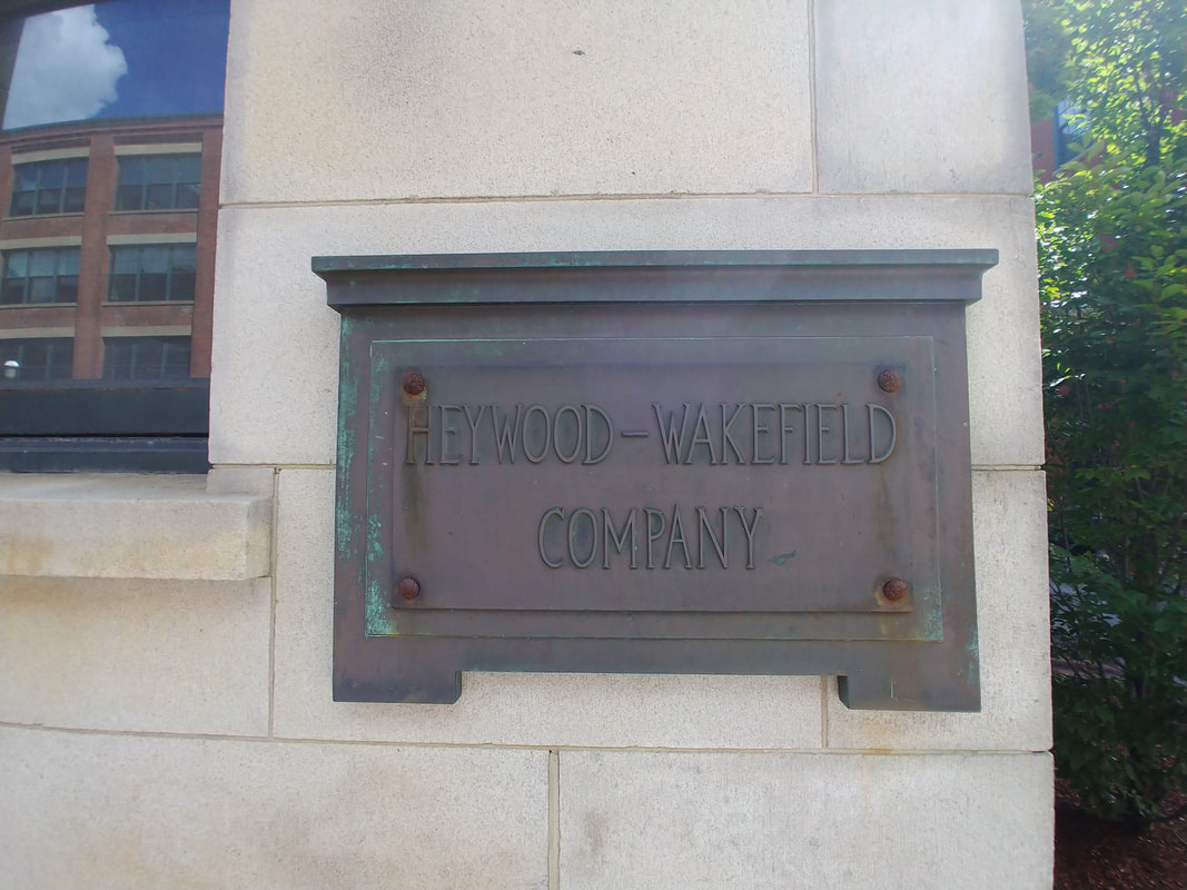
There is more on the Heywood history but first let's talk about this map below. It's a pretty amazing representation of 1880 Gardner showing where everything is - the hills, the trees, the water, the buildings. It's "upside down" because the north is at the bottom of the map (see Crystal Lake is partially shown). What was even more amazing were the images that were attached to the map. I separated the pictures out to view them individually. Many of those places have no other visual documentation that I could find so the map was gold. I only wish it was scanned at a higher resolution as some of the numbers on the building are difficult to read. The Legend, also a little blurry, matches the place to its number.
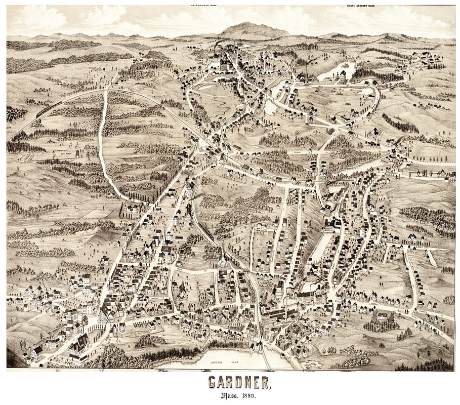
|
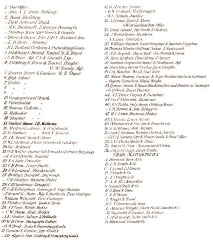
|
Below I have taken the 1880 picture from the map and combined them with the history of the company as given in the 1878 Gardner History. Where possible, I have supplemented with images of the founder/owners and other pictures.
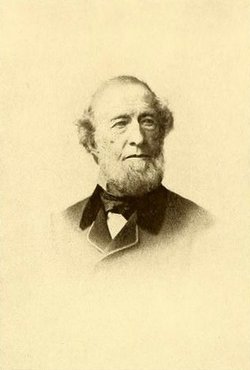
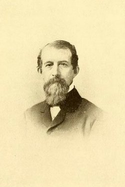
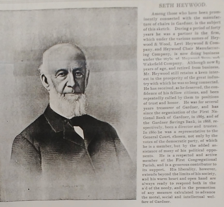
Levi Heywood Moses Wood Walter Heywood William Heywood Seth Heywood Henry Heywood
(1800-1882) (1803-1869) (1804-1880) (1808-1874) (1812-1904) (1836-1904)
(1800-1882) (1803-1869) (1804-1880) (1808-1874) (1812-1904) (1836-1904)
CHAIRS
|
Text below taken from ref. 1, page 168
|
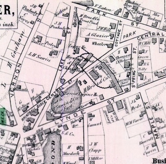  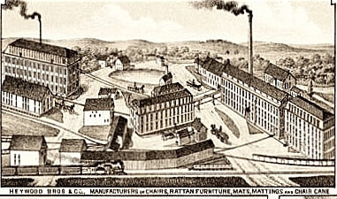 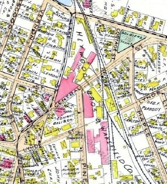 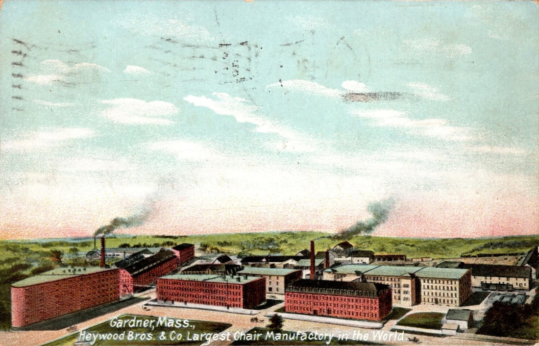  |
The five early maps show how the Heywood complex grew. They are from 1870, 1878, 1880 (bird's eye), 1898, and c1905 (bird's eye). Compare the 1898 map to the 2023 version and you see that many buildings still exist.
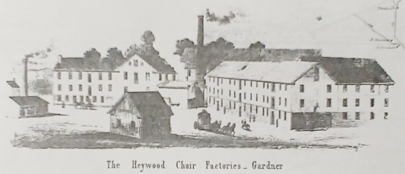
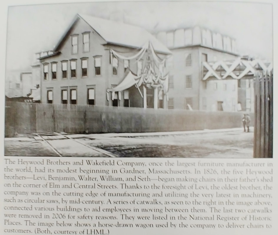

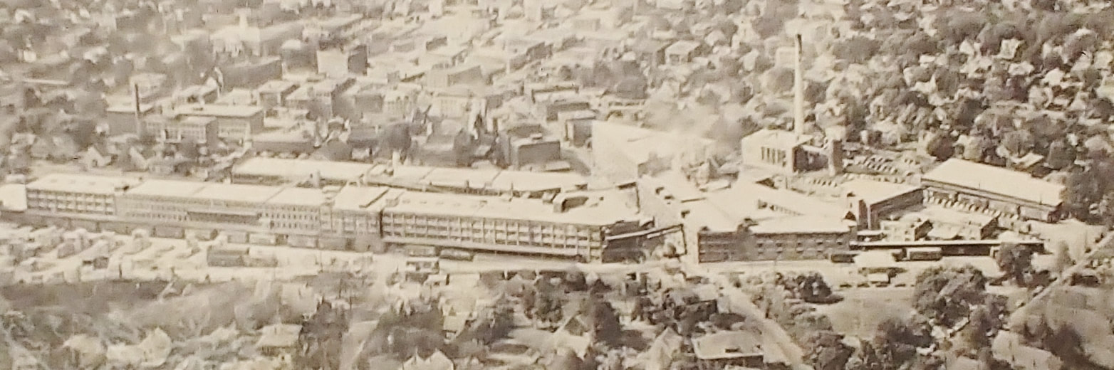
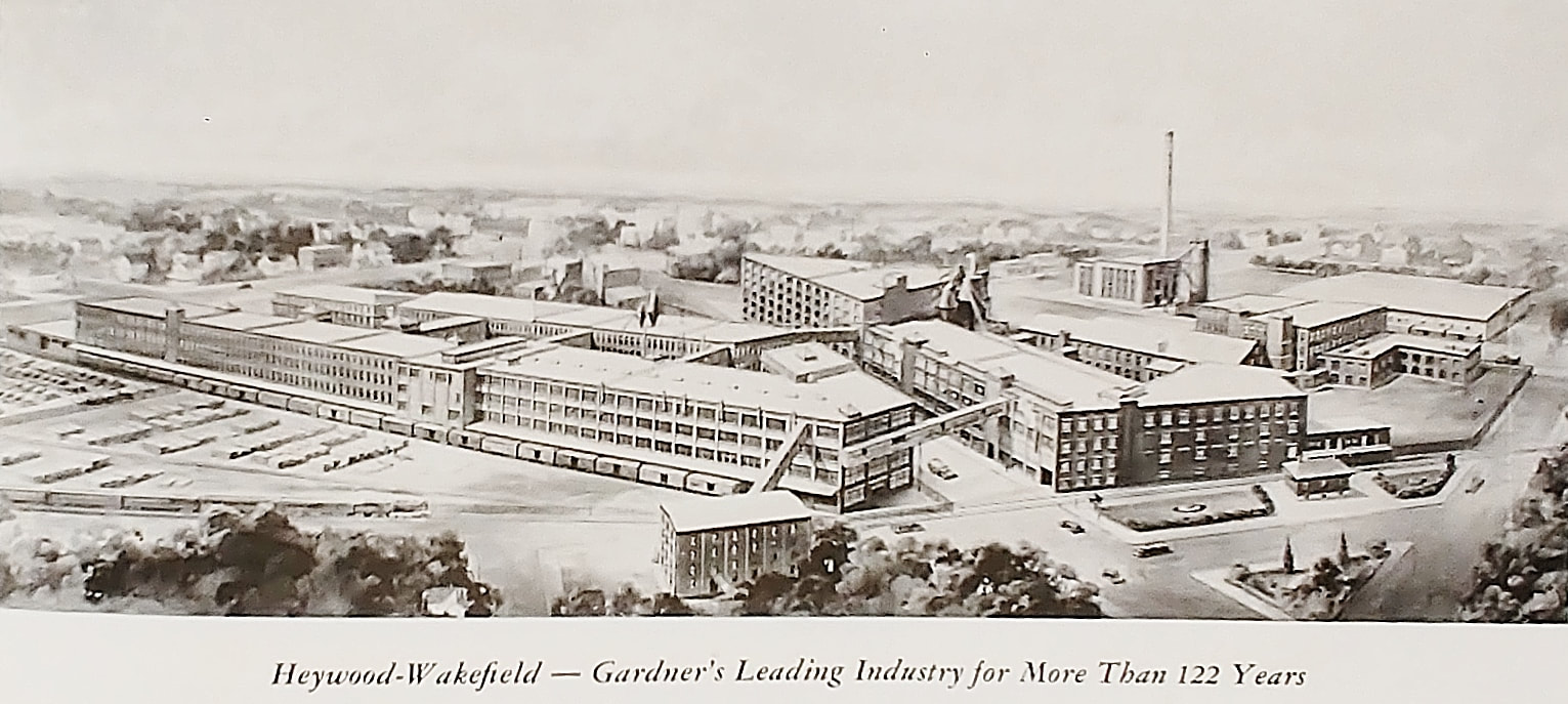
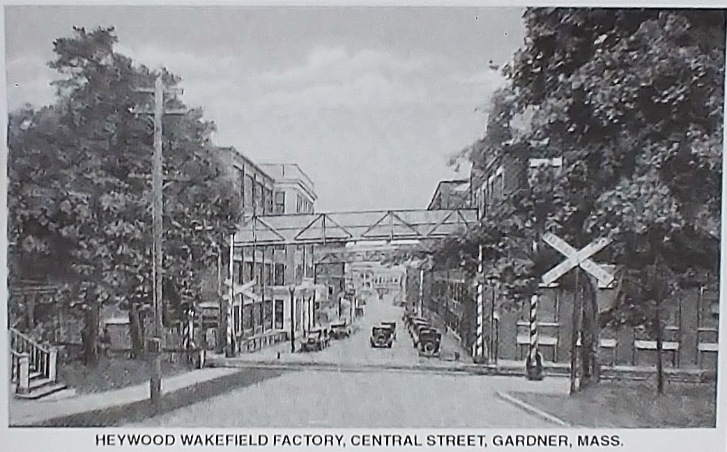
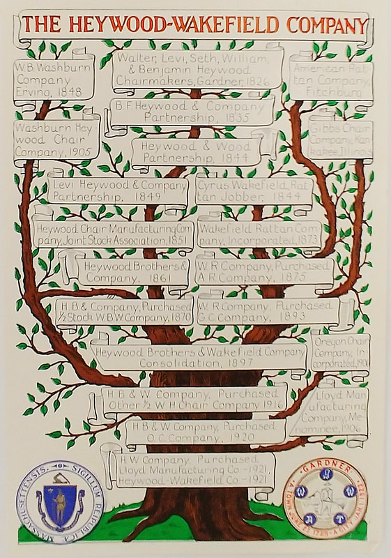
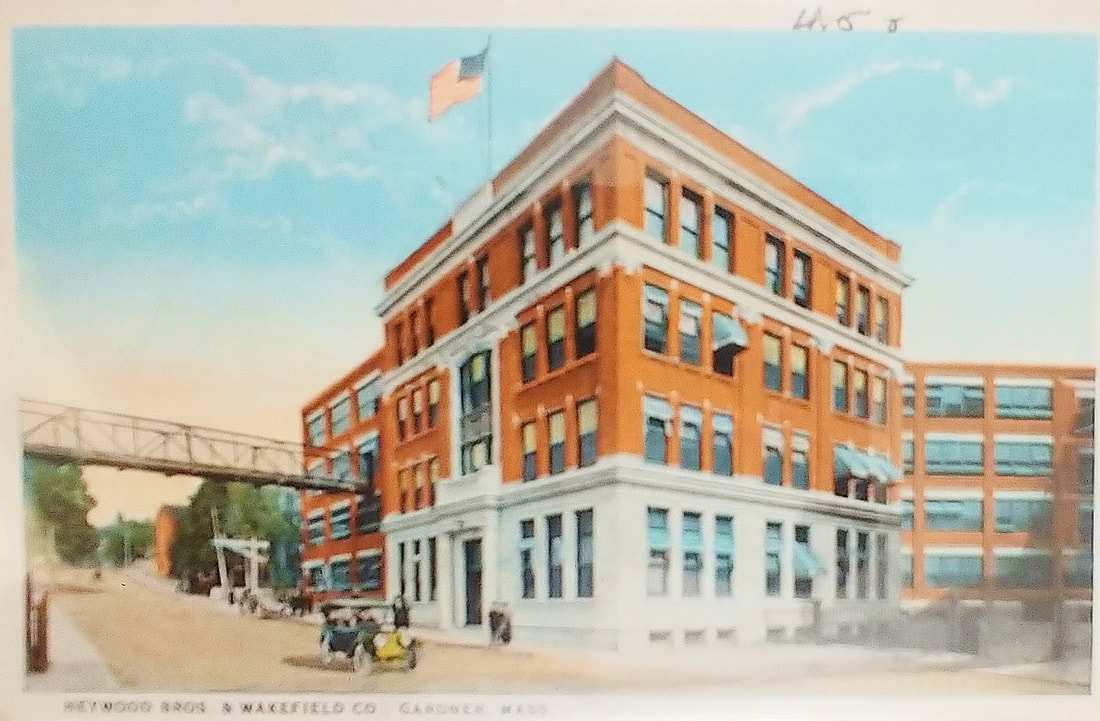
Above are a few more images related to the Heywood history.
1. c1855 - (ref. 29)
2. Unknown date
3. Unknown date - (ref. 7)
4. Unknown date - (ref. 8)
5. 1948 - (ref. 12)
6. Unknown date - (ref. 13)
7. 1951 - (ref. 7)
8. Unknown date - (ref. 27)
1. c1855 - (ref. 29)
2. Unknown date
3. Unknown date - (ref. 7)
4. Unknown date - (ref. 8)
5. 1948 - (ref. 12)
6. Unknown date - (ref. 13)
7. 1951 - (ref. 7)
8. Unknown date - (ref. 27)
|
CHAIRS
Text below taken from ref. 1, pages 172-173
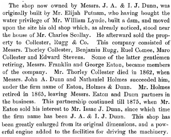
|
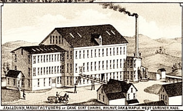
|
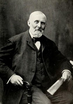
John Ainsworth Dunn (1831-1919)
|
About 1875 is when the John A Dunn Company came into being. An 1898 map has a layout in line with the bird's eye view of the first image below which is from 1903 or earlier. South is to the right. In back of the smokestack you can see some Heywood Brother's buildings. The Dunn smokestack still exists on Derby Drive and has been repurposed as a cell tower. The facility was spread out behind the Main Street buildings on Derby Drive (which used to be a rail line to the factory). I overlaid the 1898 map onto a current Googlemaps image in the second picture. The company closed in 1930.
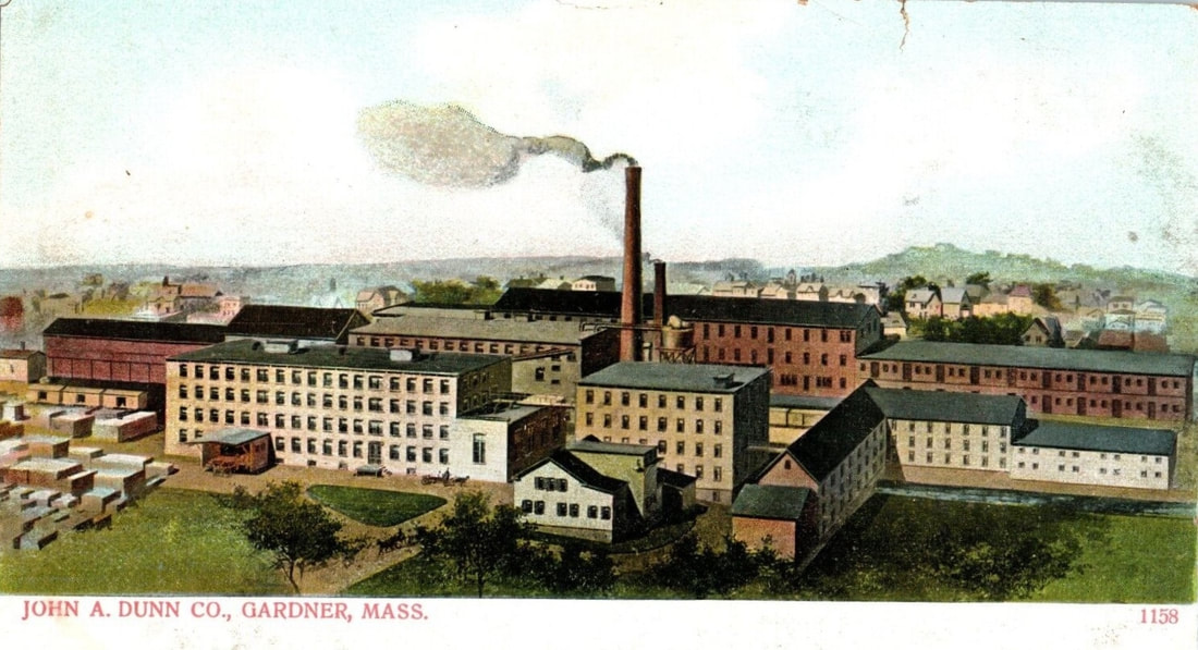
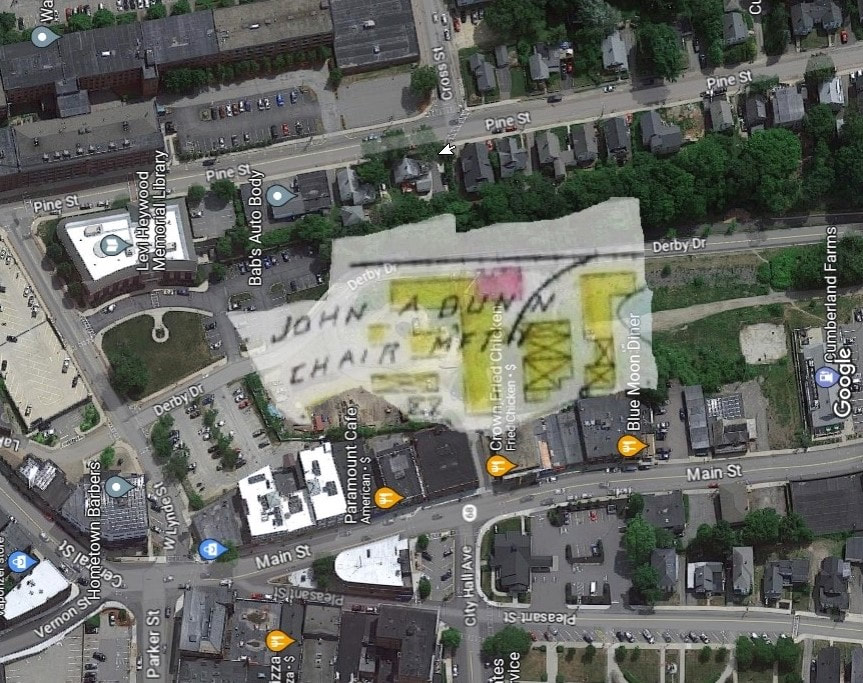
|
CHAIRS, etc...
Text below taken from ref. 1, page 172
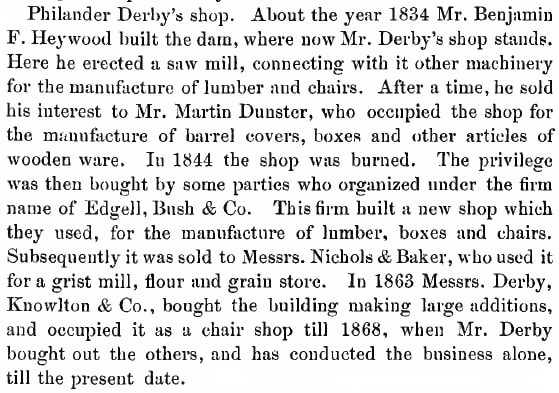
|
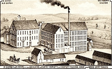
|
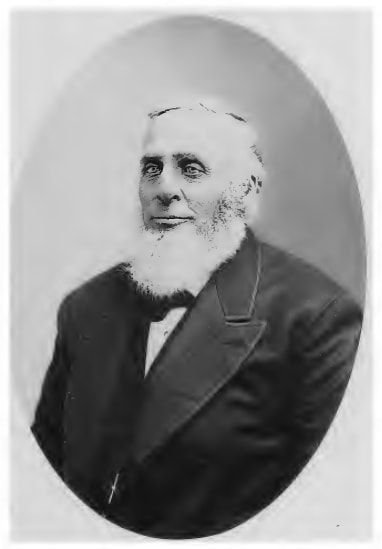
Philander Derby (1816-1902)
|
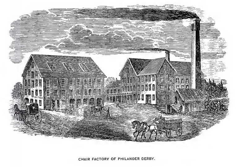
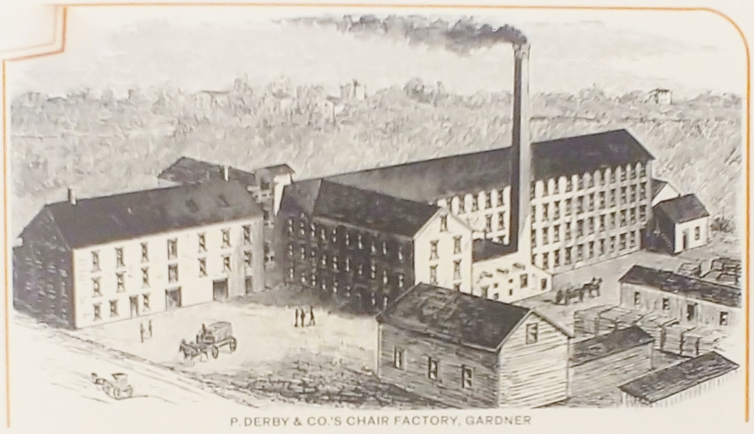

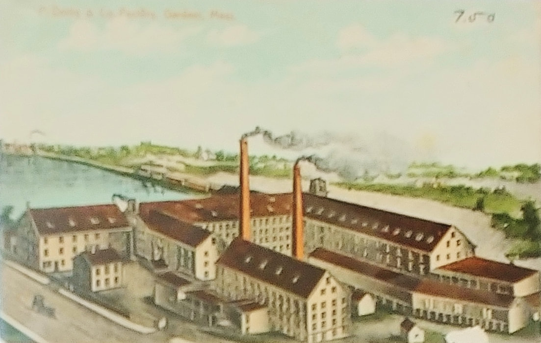
Philander's Shop was where Walgreens is now on Derby Drive. The company closed in 1935 and the entire complex was destroyed in 1997. The image 1 sketch (ref. 1) was likely done in 1878 or earlier. Image 2 (ref. 29) is undated but is probably earlier than image 3 which is from c1903 (refs. 3 & 10). Picture 3a is just a colorized version of 3.
|
CHAIRS & FURNITURE DEALING
Text below taken from ref. 1, page 169
|

|
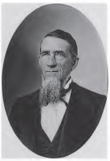
Sylvester Knowlton Pierce (1820-1888)
|
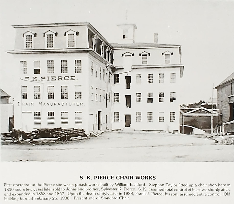

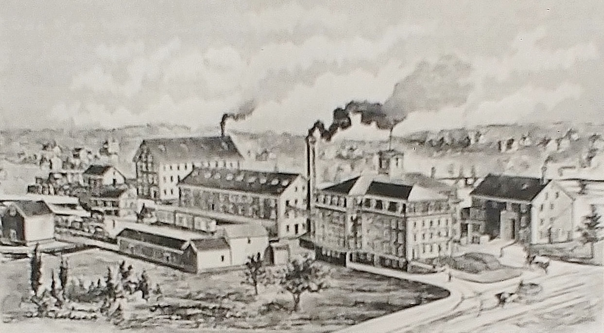
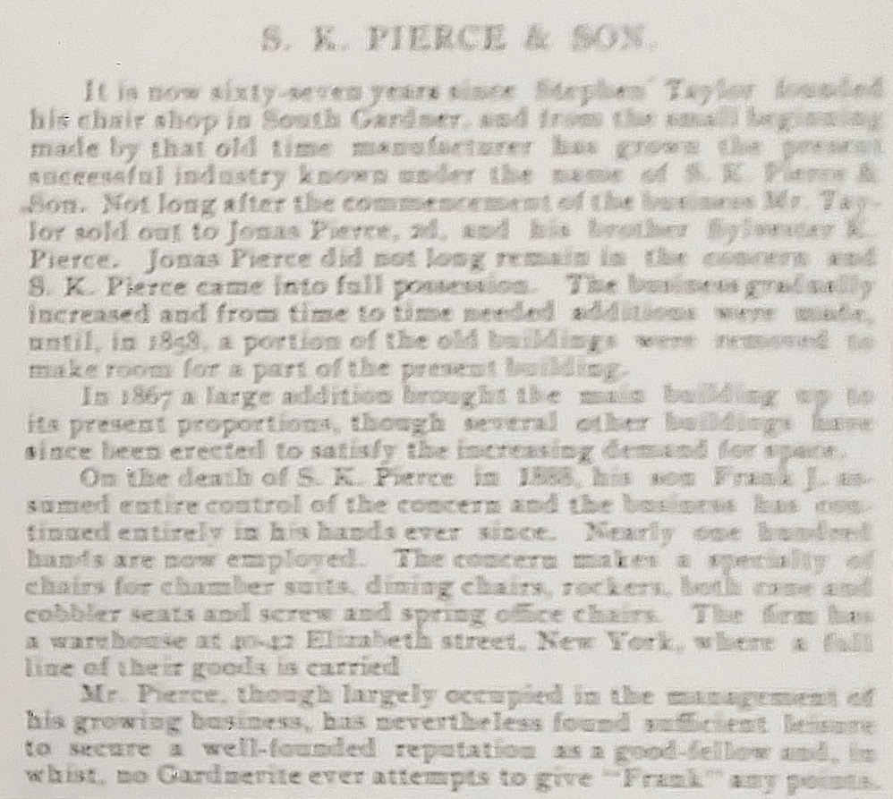
This factory was at 1 South Main Street with showroom at 95 South Main. The building shown above in image 1 (refs. 3 & 14) burned down in 1938 while additions from later years seem to have survived. What was burned was rebuilt and is now occupied by Standard Chair. Image 2 is from c1903 (ref. 10) and shows things from the water's perspective. Picture 3 (ref. 29) along with accompanying text (3a) show the whole complex and talks about the company up to 1897.
|
CHAIRS
Text below taken from ref. 1, page 171
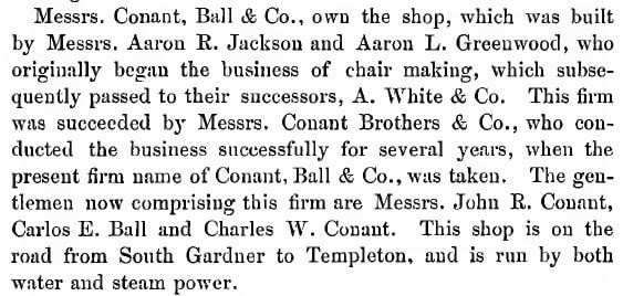
|
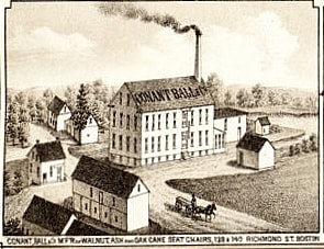
|
Brothers
John Risley Conant (1829-1891) Charles Wright Conant (1833-1910) and partner Carlos E Ball (1836-1909) |
The above bird's eye drawing is from when the company was on West Broadway (near Conant Street). A photo of the larger one is seen in image 1 below (refs. 3 & 15). None of these building exist today because the complex burned down November 22, 1888 (image 2, ref. 29) shortly after the company had moved. In August of 1888 Conant Ball took over the L H Sawin property on West Lynde Street. Image 4 (ref. 29) is from 1897 while image 9 (ref. 29) is probably from the same time or maybe a little later. In the photo from picture 4 you see the factory going up West Lynde Street towards Pine Street. The taller squarish building at the end is part of the Heywood complex and is now the Lofts at 30 Pine. Image 2 (ref. 2, page 61) shows the same spot from the 1940s and image 8 shows the same view in the 1970s (ref. 29). Lake Street goes off to the left. A parking two level parking garage is there now. Image 3 is from 1978 (ref. 2, page 61) and shows the building formerly located at the corner of West Lynde and Derby Drive where a parking lot now exists. In the background you can see the smokestack which still exists as a cell tower. Image 7 is from 1993 and shows the West Lynde Street building looking toward the town center. It was taken after the company had closed in 1990 and at a time when the building's end was imminent.
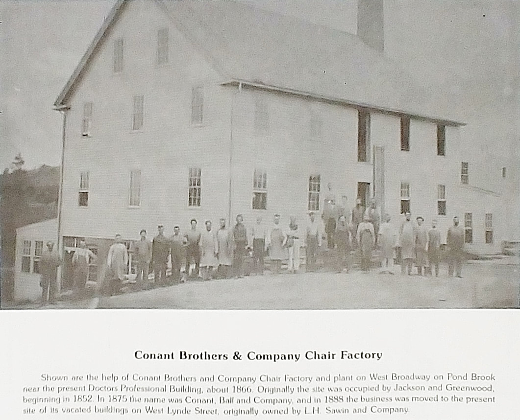
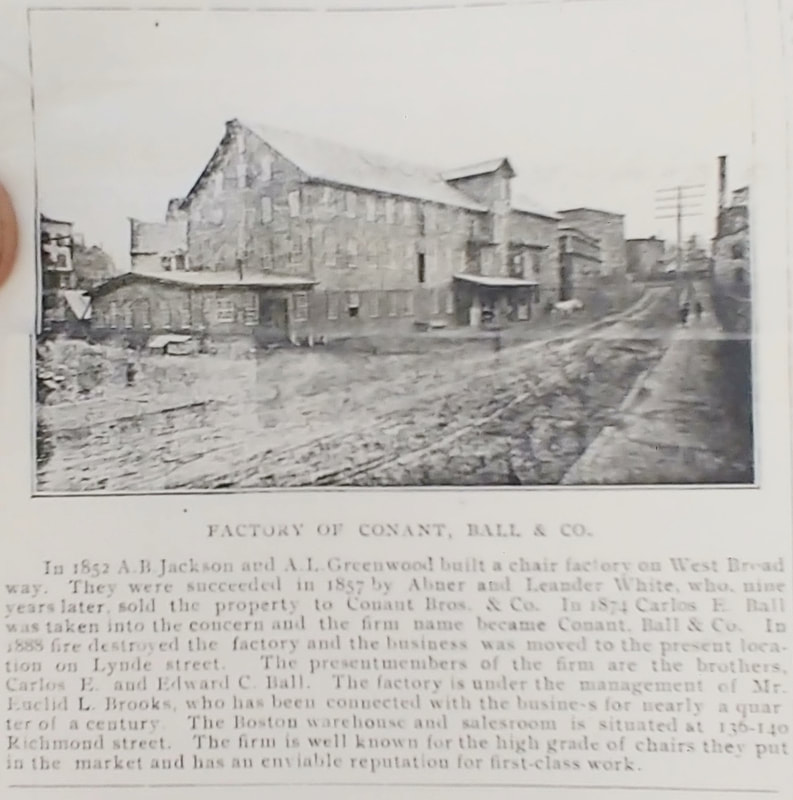
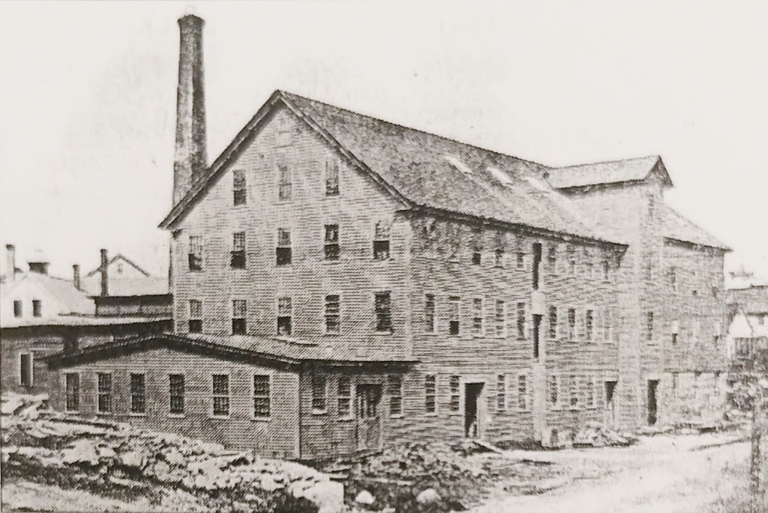
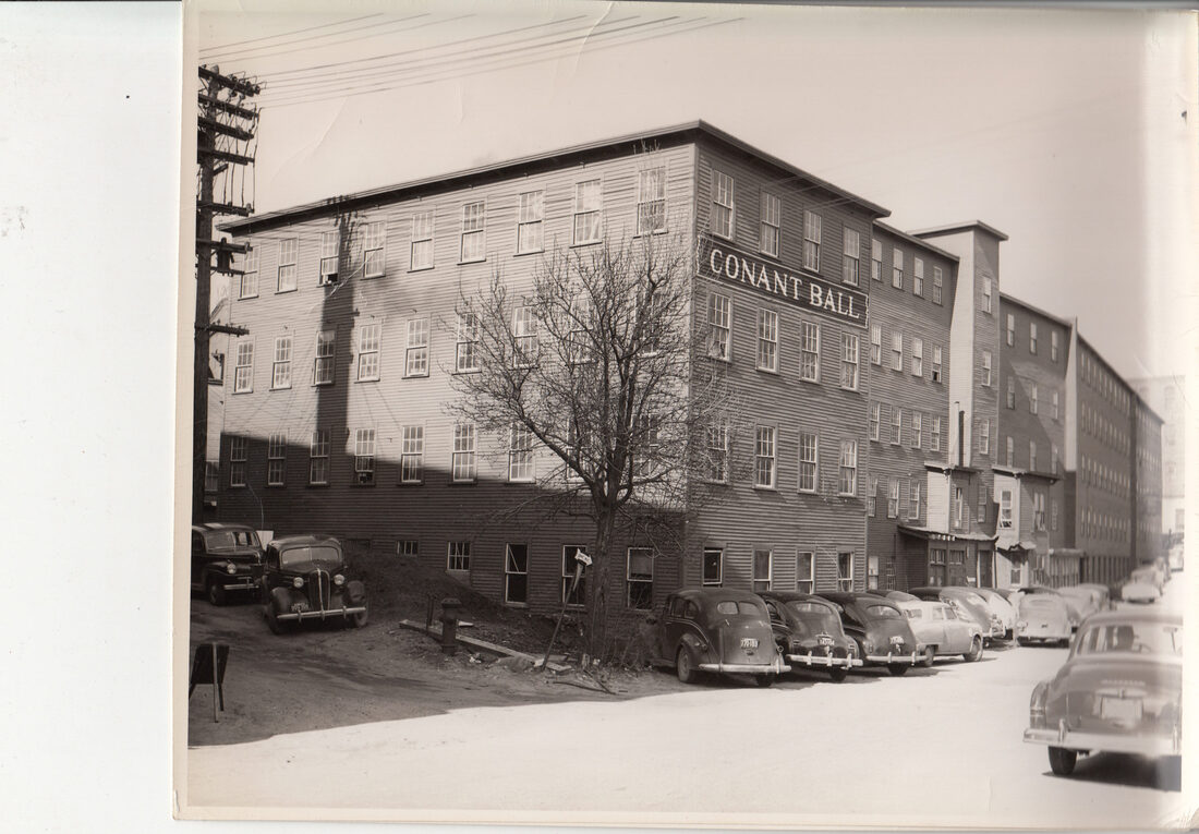
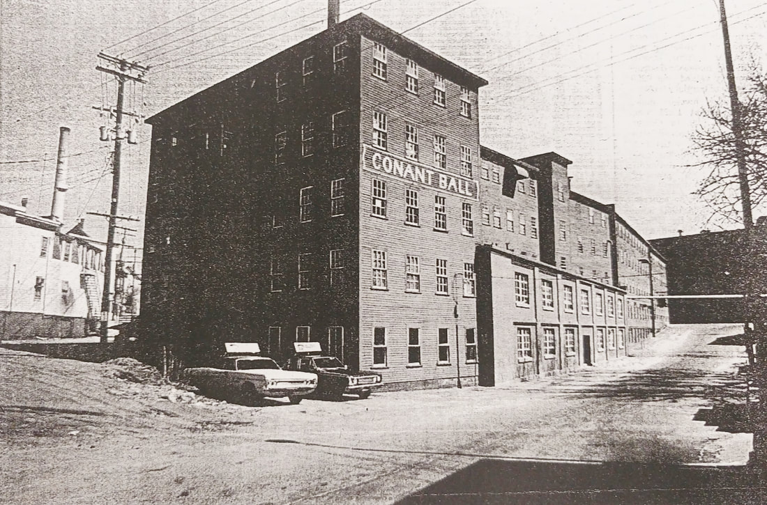
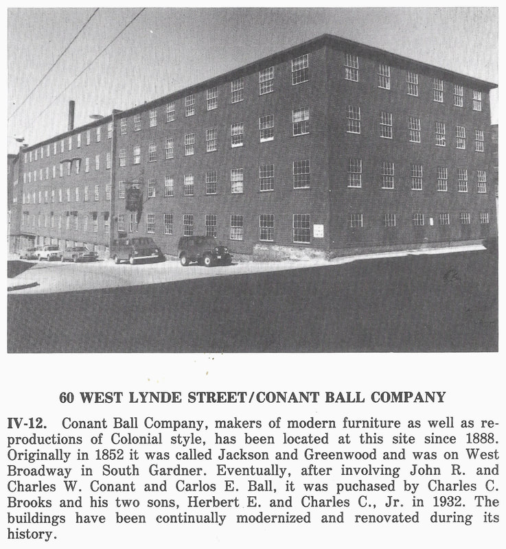
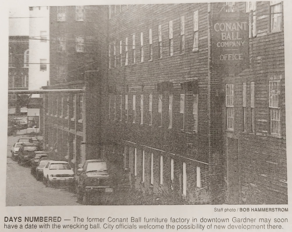
|
CHAIRS
Text below taken from ref. 1, page 171
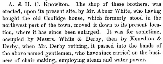
|
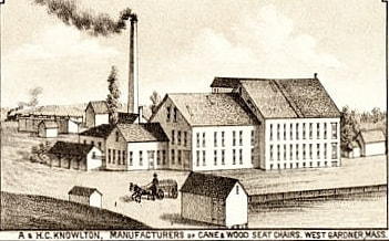
|
Brothers Henry Charles Knowlton (1833-1891) and
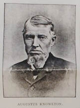
Augustus Knowlton (1831-1895)
|
Image 1 (ref. 29) below and the accompanying text is from 1897. Considering where the tracks are this view must be from Main Street looking west. The spot was followed up by the Hedstrom Union Company it is where Hannaford's Grocery store is today.
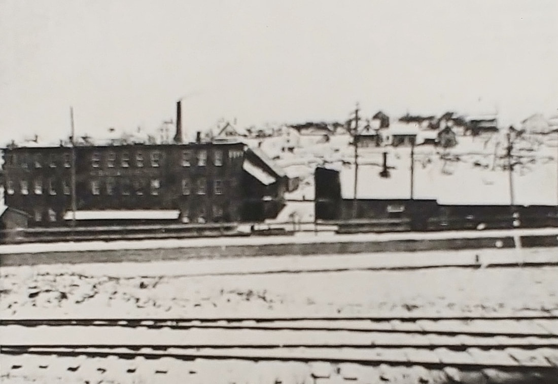
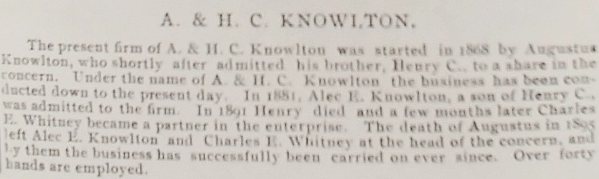
|
CHAIRS
Text below taken from ref. 1, pages 171-172

|
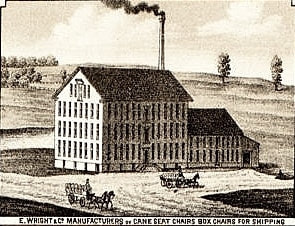
|
Ephraim Wright (1800-1866)
& sons William Wright (1830-1882) Edwin L Wright (1838-1890) |
The photo below shows the factory in 1897 (ref. 29) and the text accompanied the image. The company buildings were located about where the Advanced Auto Parts and CVS parking lots abut on Main Street. Soon after 1897 the buildings were labeled A O Speare Co, Toy Manufactory and by 1905 it was the National Novelty Corporation, A O Speare Branch. By 1909 & 1914 it was the P Derby & Co Lower Factory. In the 1923 map it is unlabeled but the buildings are still there. By 1932 they were incorporated into the Gem Crib & Cradle Company.
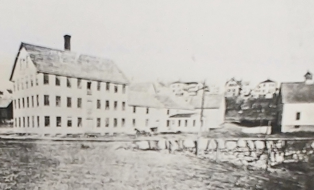
|
CHAIRS
Text below taken from ref. 1, pages 169-170
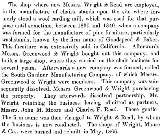
|
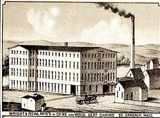
|
David Wright (1808-1899)
and Charles Freeman Read (1835-1921) |
Wright & Read was not mentioned in the 1967 Gardner History and does not appear on the maps past 1895 so it likely did not last long as a company. The company occupied a number of buildings on the east side of Chelsea Street from Broadway up to Sumner Street. In its place by 1900 was A M Pineo, Manufacturer of Chairs with all of the same buildings. Manufacture of chairs continued under Pineo Manufacturing Company until at least 1909 and possibly longer but by 1923 a couple of the buildings had been replaced and Eastern Chair Company was there but that company seemed to be gone by 1932. None of Wright & Read's building still exist while parts of the newer buildings of Eastern Chair are still there and being used by a lumber company.
|
CHAIRS
Text below taken from ref. 1, page 170
|
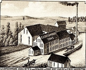
|
Calvin Sumner Greenwood (1810-1873)
& sons Charles Henry Greenwood (1845-1909) Frederick Munroe Greenwood (1847-1924) |
C S Greenwood Sons was located on a lot now called the MIDA Industrial Park which is on East Broadway across from the Baptist Church. It lasted until 1890. Whether some of the company's buildings are still there is unknown but it is possible. The buildings were taken over by the newly formed E H Mahoney Chair Company in 1890 and that company lasted until at least 1932. The Greenwood sons were still part of this venture. The 1967 Gardner History did not mention C S Greenwood Sons but a grandson of Calvin's was mentioned as being part of a company called Greenwood-Carlton Company (1937-1942) which was at the same spot. Image 2 and the text below (ref. 29) about E H Mahoney are from 1897. Prior to C S Greenwood Sons there was Greenwood & Wright. Image 1 below (ref. 2) from 1855 shows the early company.
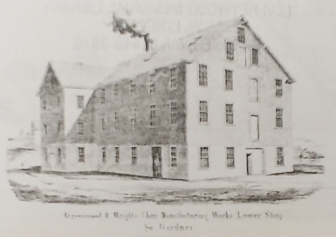
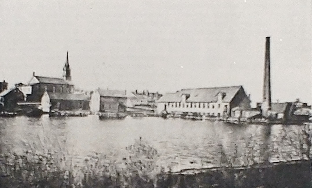
|
CHAIRS
Text below taken from ref. 1, page 173
|
|
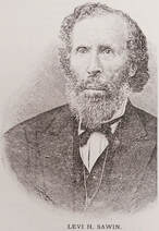
Levi Heywood Sawin (1816-1902)
|
This company moved to New York in 1888 and the Conant, Ball & Company took over the area on West Lynde Street.
|
LUMBER
Text below taken from ref. 1, page 186
|
|
Marcus Wright (1825-1883)
|
Marcus Wright Chair Stock & Lumber was in business by 1870. Marcus Wright (1825-1883) owned itup until his death and his son Lewis Ashley Wright (1861-1927) took over running it in 1883 under the name L A Wright & Company along with his two partners, mother Maria Bent Wright (1828-1917) and his step-sister Lois Maria Wright (1850-1902). Image 1 (ref. 29) below shows the company in 1897 and discusses Lewis' involvement. Some time between 1897 and 1907 the mill was taken over by S Bent Brothers and then it was sold to a Mr. Swartz who turned it into Arcadia by the Lake or the Arcadia Ballroom (image 2 below, ref. 29), a dance hall that was used into the mid 1940s. It was then used for business and finally demolished in 1973.
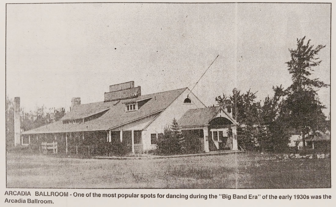
|
TUBS & PAILS
Text below taken from ref. 1, page 186
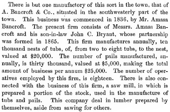
|
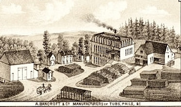
|
Amasa Bancroft (1812-1888)
and son-in-law John C Bryant (c1837-1882) |
Amasa Bancroft started business in 1836 while the Company came later in 1865. The company shows up in 1870 and 1886 maps as two places - A Bancroft & Co and A Bancroft & Co Pail Factory & Saw Mill. The Pail Factory was on Foster Brook just southwest of the Sawyer & Mill Streets intersection and A Bancroft Co was at about 501 Mill Street; there is a house at 501 Mill Street which may be at least the 1870 original. Neither makes it onto the maps from 1889-1932 probably because they were off the beaten path. The Pail Factory burned in the early 1930s.
|
DEALER of CANE, CHAIRS, TOY CHAIRS & SPECIALTY
Text below taken from ref. 1, page 170
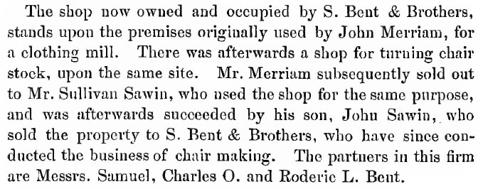
|
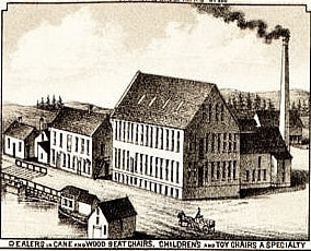
|
Samuel Bent (1817-1883) and sons
Charles Orra Bent Roderic Leslie Bent
(1835-1929) (1843-1895) |
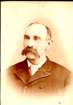
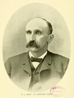
S Bent and Brothers formed in 1887. The company occupied both western corners of Mill and Winters Street until 2000. The area is empty today. Image 1 below from 1897 shows a later picture of Charles (ref. 29). The second picture below is from c1903 (ref. 10 and ref. 1, page 170). The third picture (ref. 29) is an aerial view of the complex in 1942. The fourth picture (ref. 29) shows the mill on High Street that was shared with L A Wright in 1900.
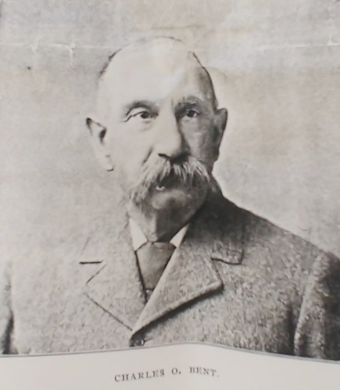
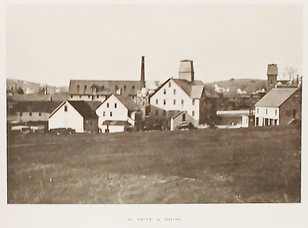
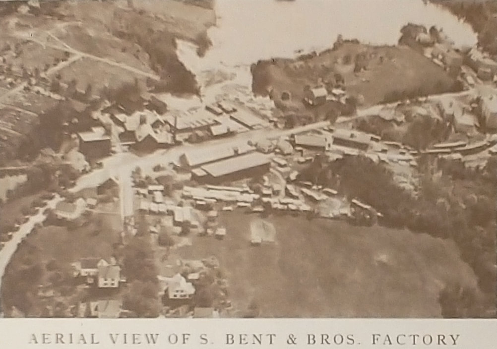
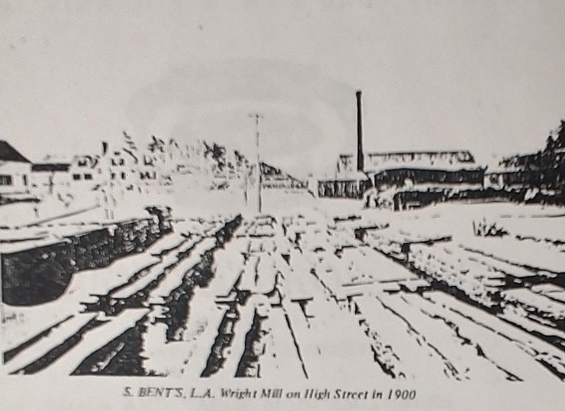
Of course, there were many other business in Gardner over the years. There are many manufacturers not included in these pages but here are some more businesses that I found late in the game...
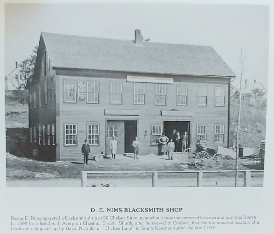
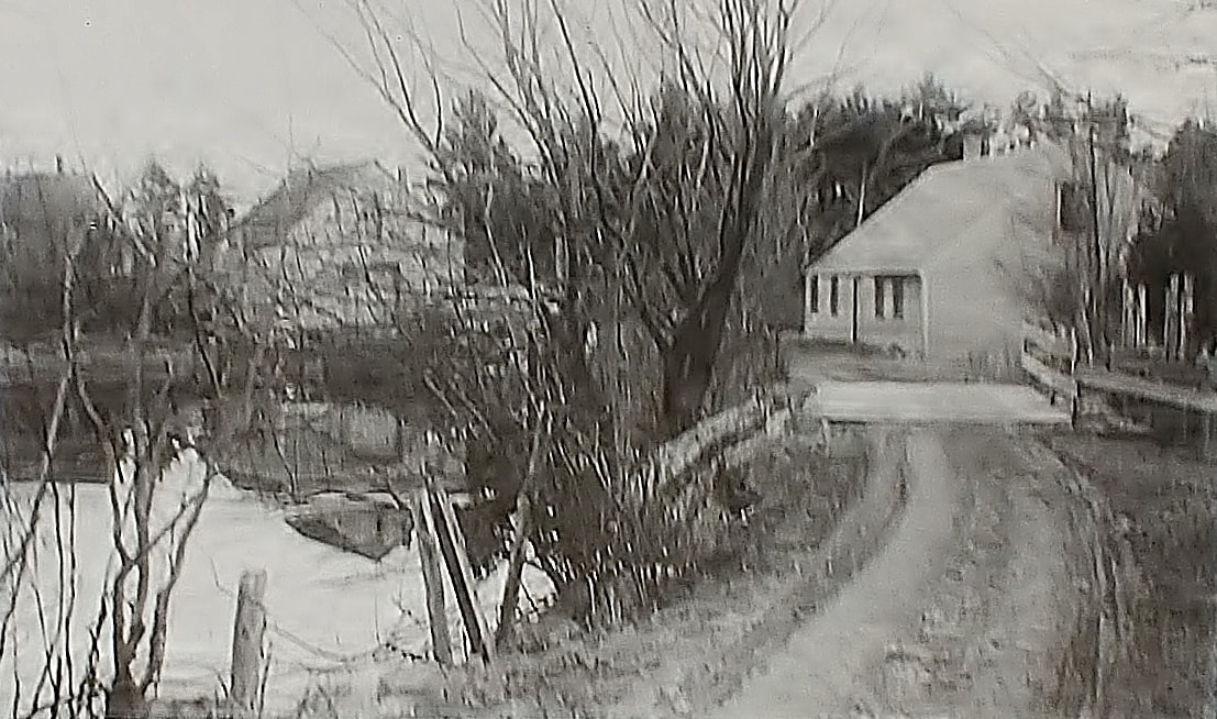
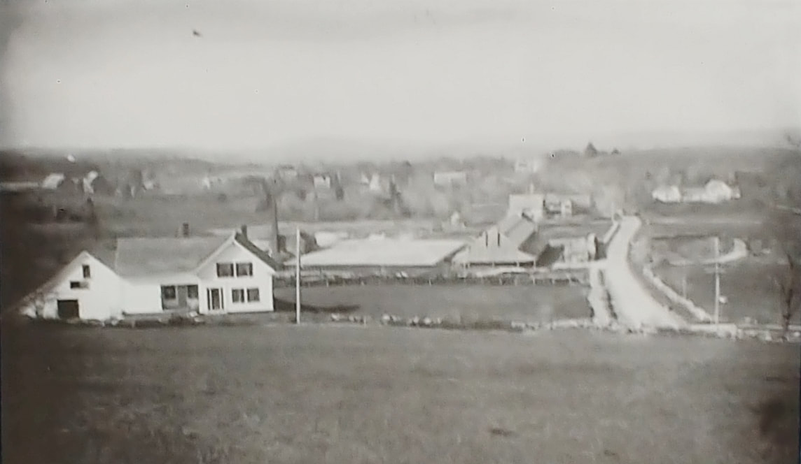
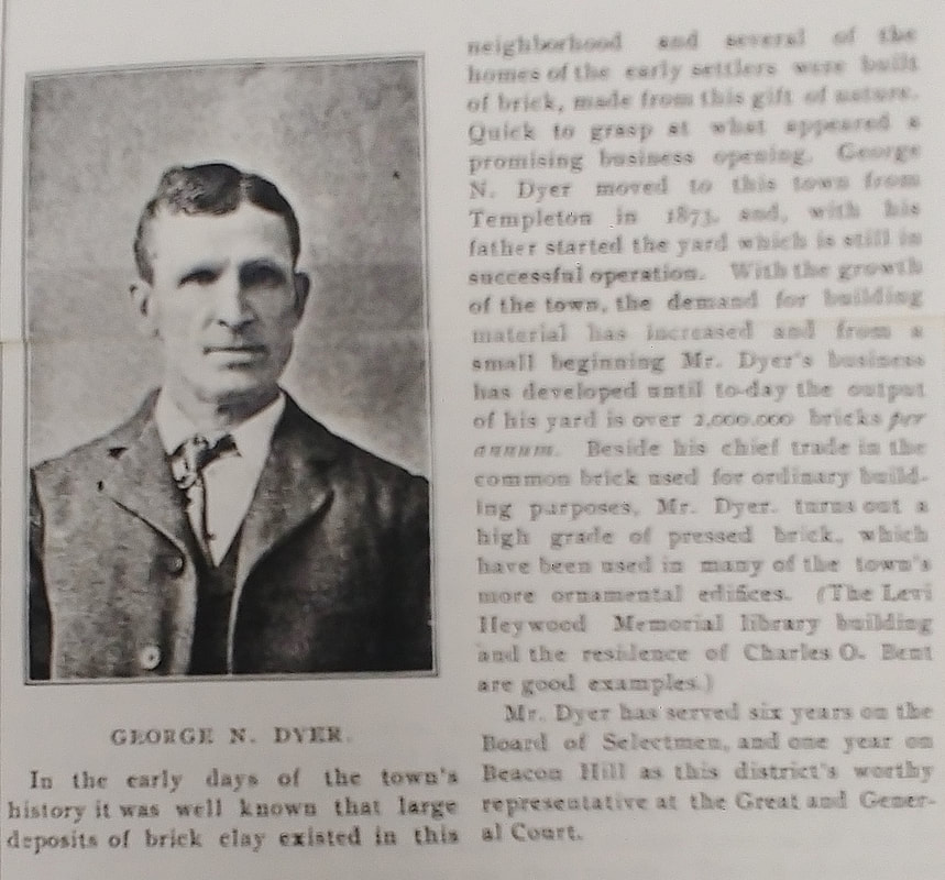
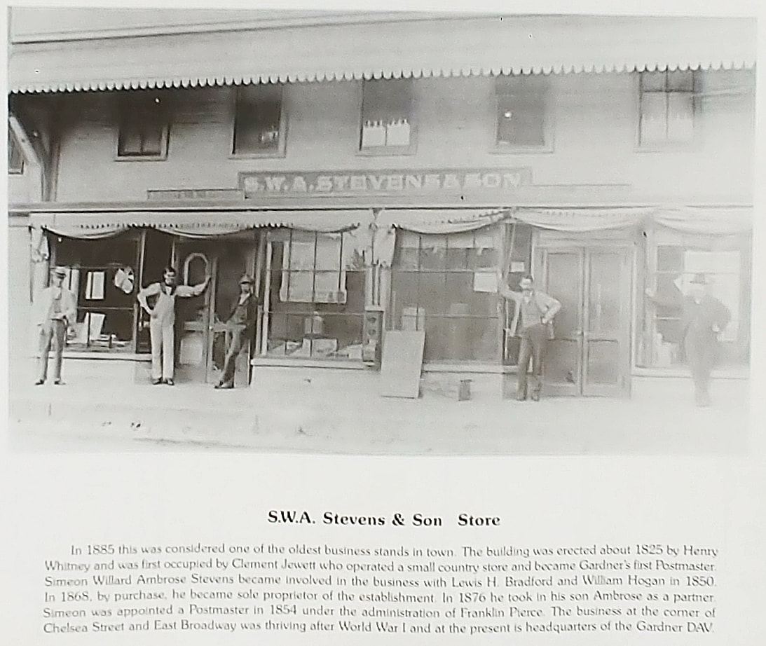
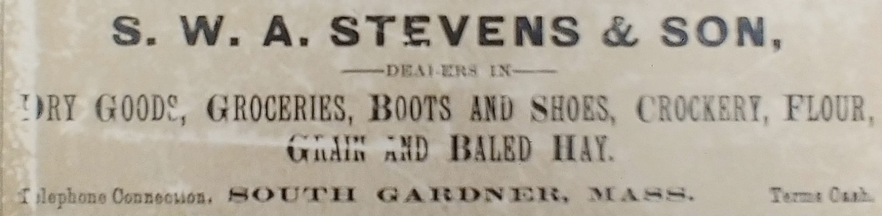
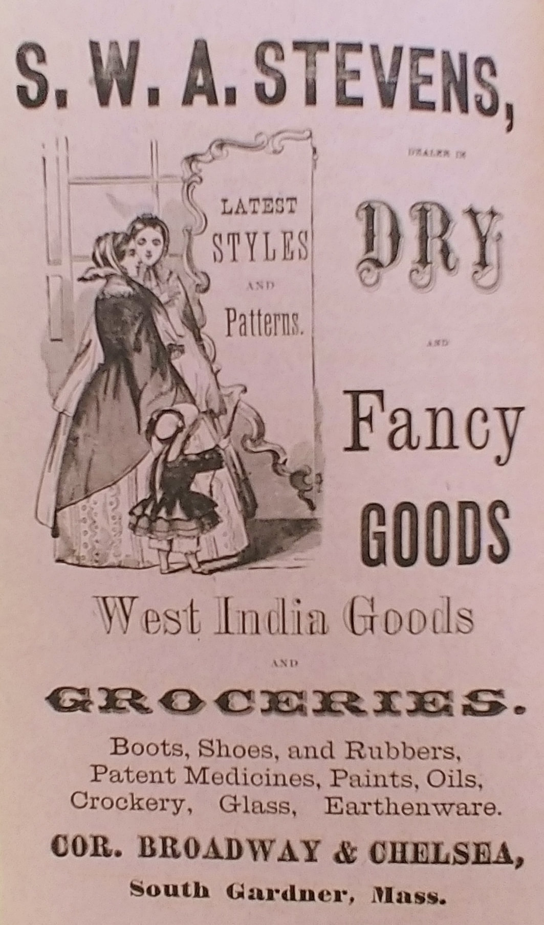
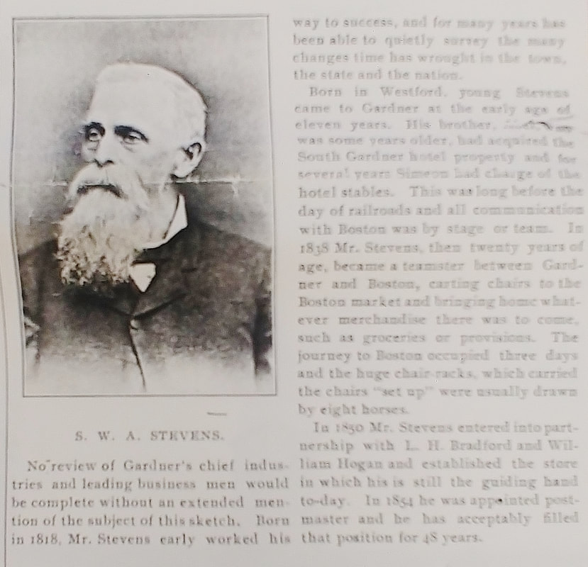
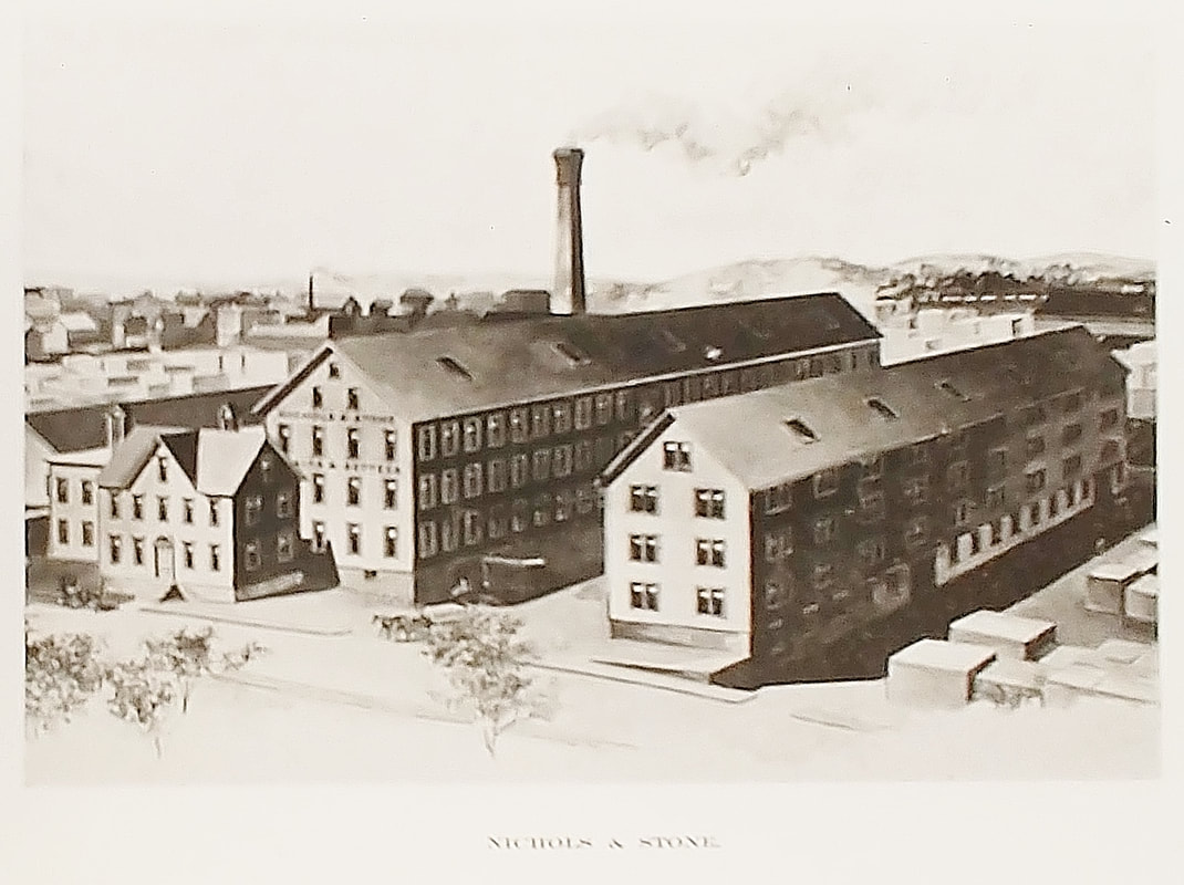
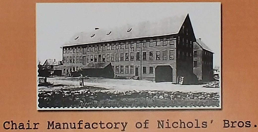
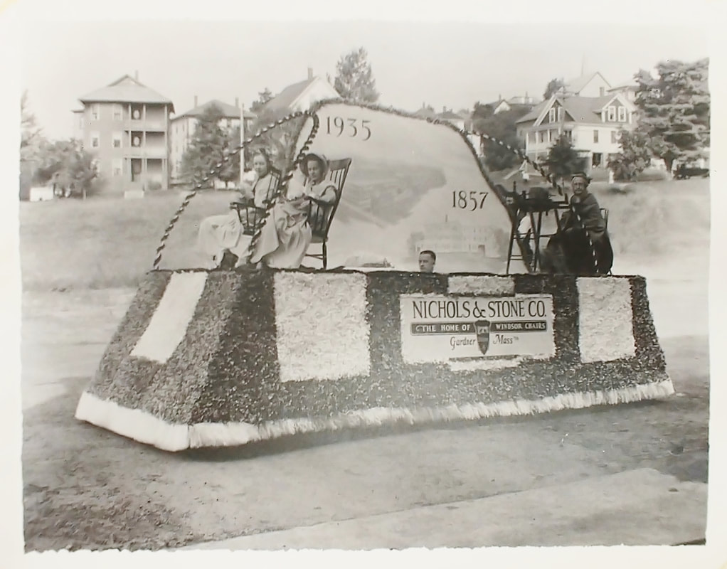
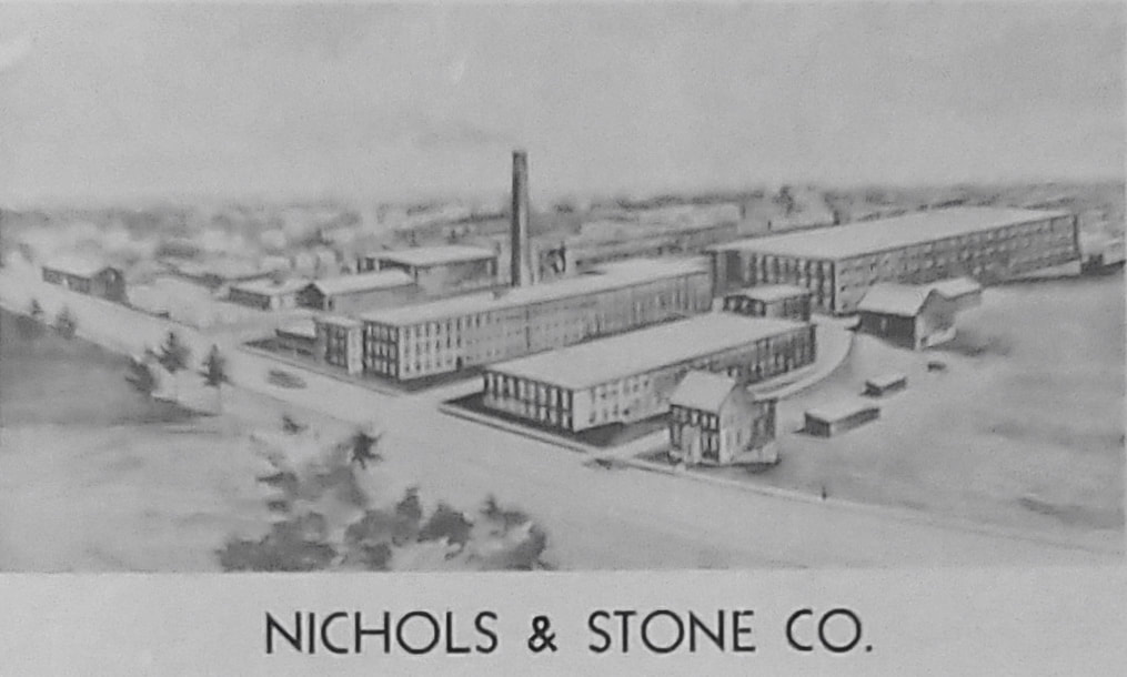
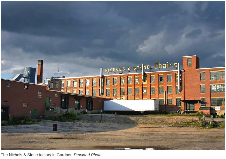
1. D E Nims Blacksmith Shop - Unknown date - (ref. 14) - Darius Elihu Nims (1850-1918) was blacksmith on the corner of Sumner and Chelsea Street [50 Chelsea Street] from 1894 until 1918. The building is no longer there.
2 & 2a - Howe's Grist Mill - 1871 - (ref. 15 and ref. 1, page 189) - Appears on the 1870 map as a grist mill but not Howe's until 1878. It was there until 1900 but vacant and by 1905 it was used as a sawmill by S Bent and Bros but abandoned again by 1909. It was effectively on an extension of Sawyer Street running from the intersection of Saye and Dyer Streets and cutting across to Mill Street but any signs of the building and the road are gone.
3 & 3a & 3b - Dyers Brick Yard - Unknown date - (ref. 15, ref. 1, ref. 29) - Started 1873 - Shows up on Sawyer Street (the current Dyer Street) near West Broadway in 1878 as H N Dyer & Sons Brick Kiln. The kiln was basically located at the entrance to the Timpany Plaza. Horatio Nelson Dyer (1817-1880) had sons George N (1851-1921) and Charles (1857-1920 of after). George remained in Gardner and carried on the business at 20 Dyer Street until 1907 while Charles migrated to Greenfield to make his bricks.
4 & 4a-4c - S W Stevens and Son Store - Unknown date - (ref. 15, Gardner Directories, ref. 29) - Simeon Willard Ambrose Stevens (1818-1910) started in 1868 and joined up with his son Ambrose (1847-1924) in 1876. The store was a grocery and housed the a post office. The name was attached to the building in 1886 but later maps don't assign any names so it is difficult to ascertain how long the store lasted. Match Shot Firearms is now there in this nearly 200 year old building.
5 - N Alzingre Shop - Early 1900s - (ref. 15) - Napoleon Alzingre (1859-1947) was at this store at 51-55 East Broadway from 1901 to about 1914 when the Gardner directory noted he had "Removed to Fitchburg". His wife Alice (1864-1940) was at 51 East Broadway until at least 1930. A laundromat now occupies the space.
6 - A H Brick - c1855 - (ref. 29) - The picture says it is the Chair shop of A H Brick. The best I can come up with is that it was Alfred Harrison Brick (1815-1905). He was in Gardner up until at least 1865 and he was listed as a painter. Maybe that's what he DID in his chair chop because by 1870 he was living in Vermont as a "Retired Chair Manufacturer".
7 - Nichols & Stone - 1897 - (ref. 29) - This company was established in 1894 by Charles Nichols (1847-1917) and Reuben Sylvester Stone (1849-1936) but had its roots much earlier in Westminster; The place at 232 Sherman Street was built in 1893. The company closed in 2008 and Data Guide Cable has occupied the complex since 2010. See the 7/9/2021 Gardner News article.
7a - Nichols & Stone - c1903 - (ref. 10)
7b - Chair Manufactory of Nichols' Bros. - Unknown date - (ref. 9)
7c - Nichols & Stone Float - 1935 - (ref. 24)
7d - Nichols & Stone - 1950 - (ref. 29)
7e - Nichols & Stone - Date unknown - (ref. 7/9/2021 Gardner News article)
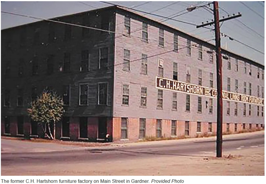
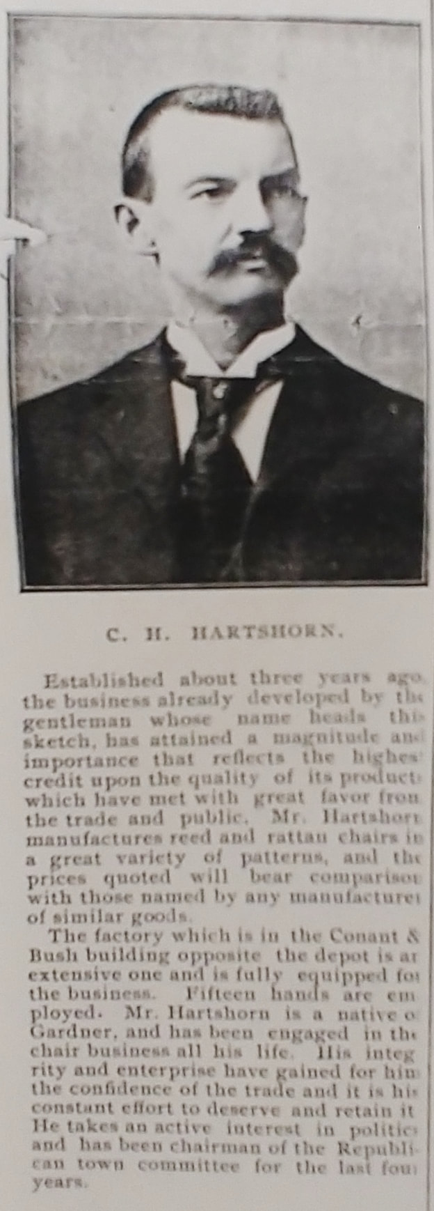
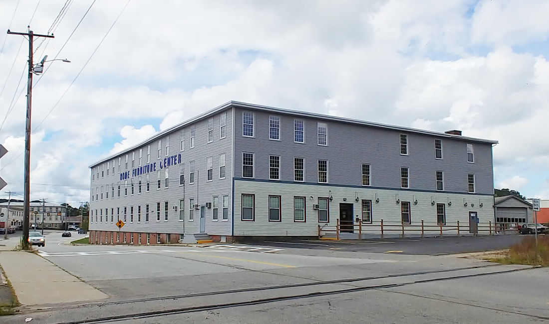
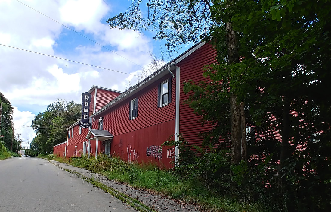
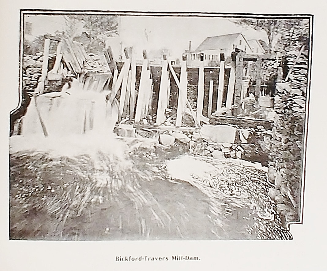
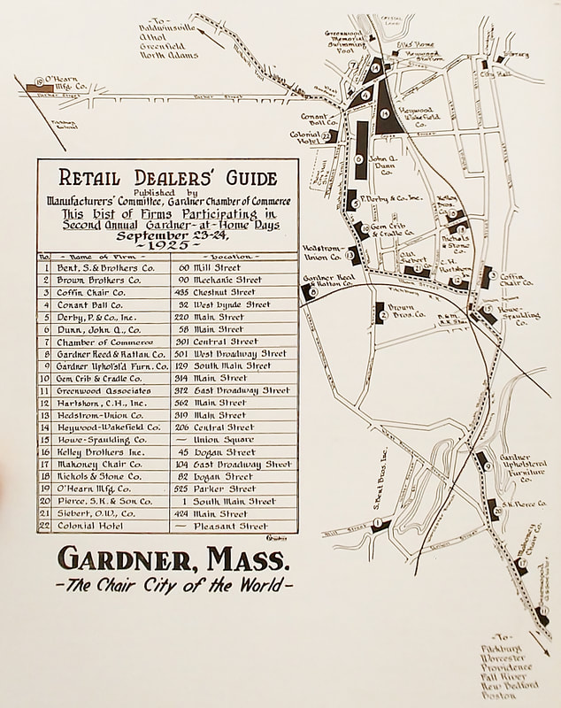
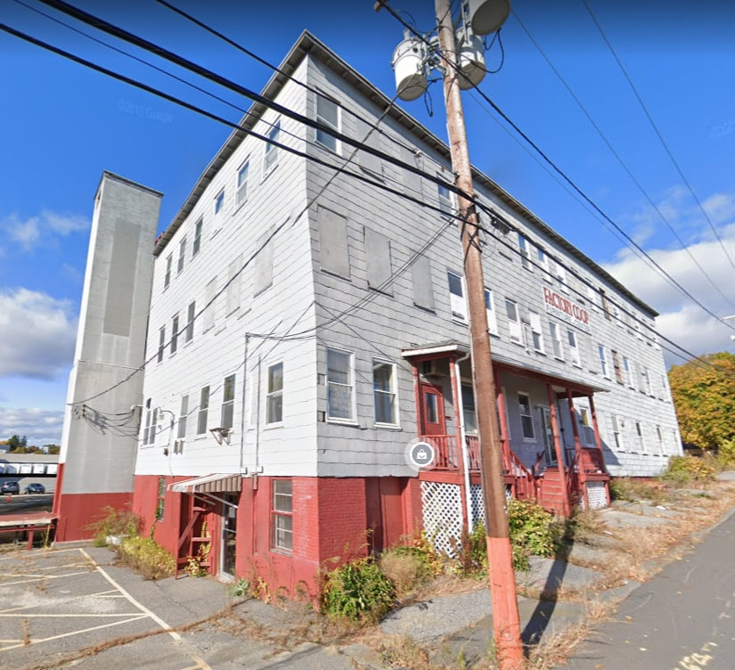
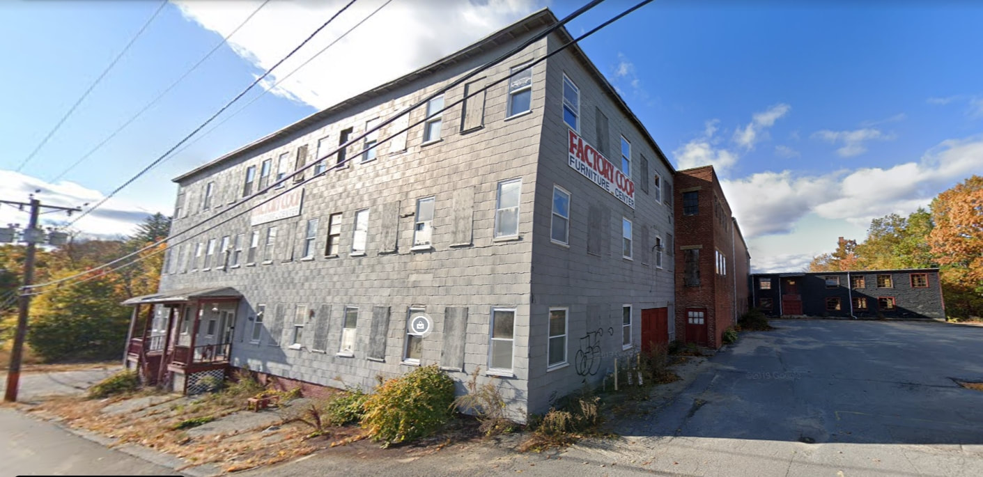
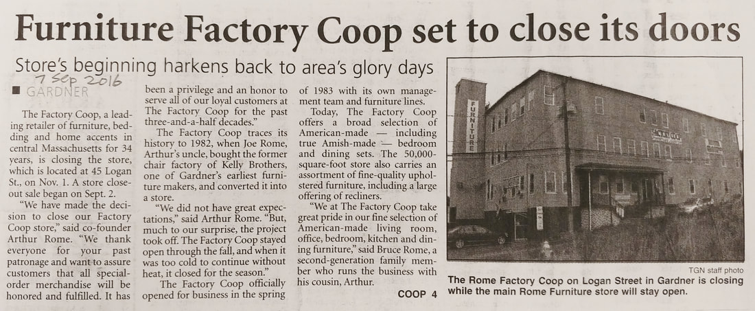
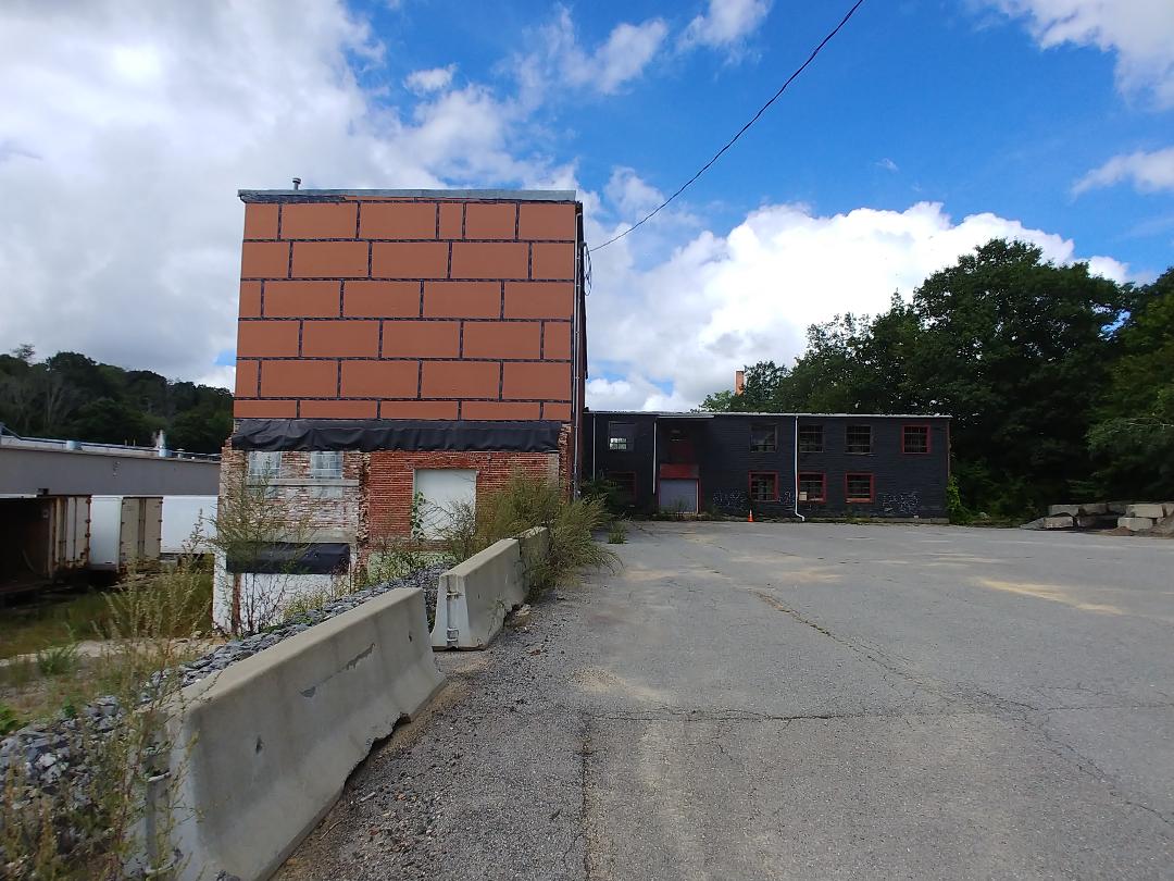
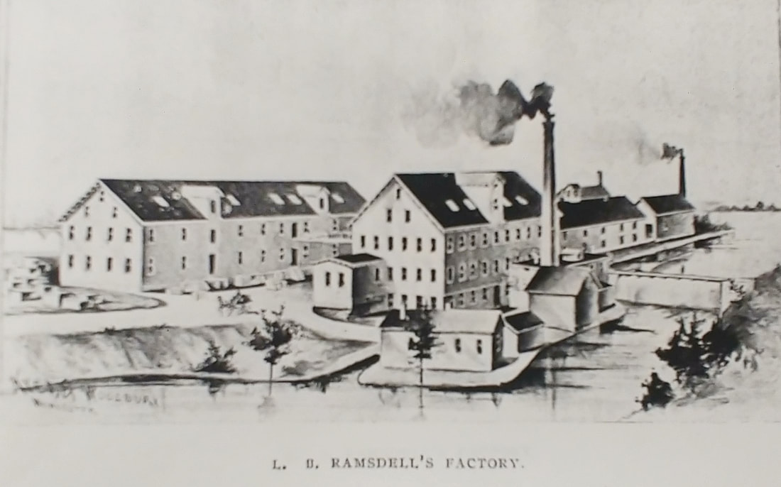
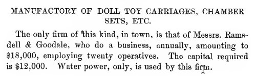
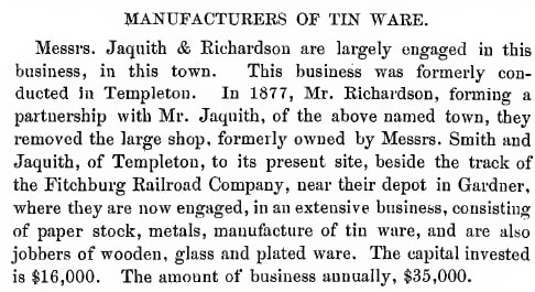
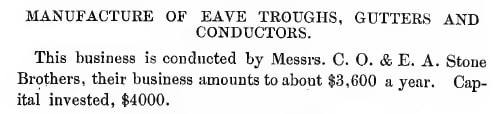
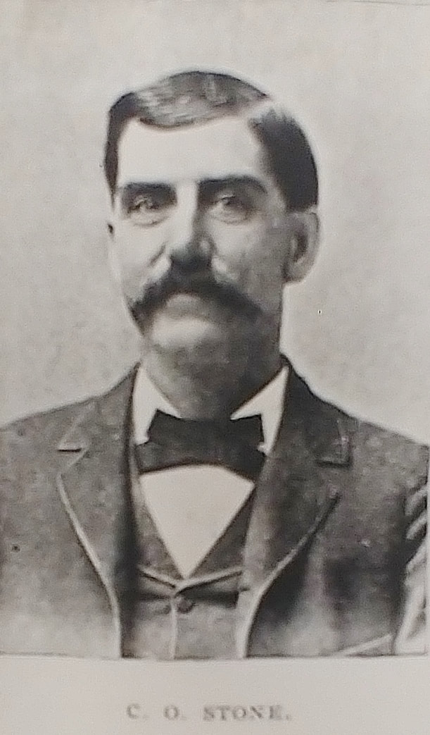
8 - C H Hartshorn - Date unknown - (ref. 7/9/2021 Gardner News article) - Charles Henry Hartshorn (1859-1946) started furniture his business in 1893. By 1908 he had built the large place at 562 Main Street. The business closed in 1993 and the building was taken over by Rome Furniture.
8a - C H Hartshorn - 1897 - (ref. 29)
8b - Rome Furniture Center - Furniture sales from 1997 until c2020. 562 Main Street appears to be occupied today.
8c - Rome Sales Co. - Established 1945. Currently empty. Associated with the Rome Furniture Center.
9 & 9a - Bickford-Travers Mill Dam - c1896 - (ref. 11 and ref. 1, page 171) - The dam appears to have been on the eastern side of Travers Street in the path of Foster Brook. It was on maps at least up until 1914. E C Travers and H C Bickford showed up on the 1878 map near this spot. E C Travers was Elijah Clement Travis (later changed to Travers, 1826-1905). H C Bickford was Horace C H Bickford (1848-1928).
10 - 1925 Retail Dealers' Guide - (ref. 12)
11 & 11a-11c - Factory Co-op Building - Some of it is dismantled. The first two images are a screengrab from Googlemaps so they are probably from c2020. Image 11b (ref. 29) is an article from 2016 about how the Co-op was going to close down. Image 11c shows what is there now. In this spot at 45 Logan Street was the former Kelly Bros. Inc. which made chairs and baby carriages starting 1895 or earlier and up until at least 1923. The brick building seems to have been part of Kelly Bros but it is unknown if the gray building of the first two pictures was original to the site. Sure looks like it. The black building off to the right was probably part of Gardner Gas, Fuel & Light Co which was there from at least 1889-1923.
12 & 12a - Ramsdell & Goodale Toy Carriage Factory - Manufactured doll carriages, chamber sets, etc...The plant image (ref. 29) is from 1897 and the brief text is from the 1878 Gardner History (ref. 1). The company was formed some time between 1870 and 1878, showing up only on the 1878 map and not the 1870 one. It was located at 170 Mill Street although there were buildings on the other side of Mill Street too by at least 1905. By 1886 it was called L B Ramsdell Company. The plant image (ref. 29) is from 1897 and the brief text is from the 1878 Gardner History (ref. 1). The company was around until 1957. Superior Kitchen Design is there now and the pond near it is call Ramsdall Pond. One of the buildings across the street is also still there.
13 - Jaquith & Richardson - 1878 - (ref. 1) - This company which was formed in 1877 by Andrew H Jaquith (1840-1895) and Charles Richarchardson (1809-1937) dealt in Stoves and Tin Ware. It is found under that name on the 1889 map but by 1895 it was called A H Jaquith & Company and by 1900 it was owned Herman Goddard Partridge (1861-1925) up until at c1917. Then it was occupied by R W Symons by 1920 who was still selling stoves. After that the buildings were there up until at least 1932 and seem to have had some stove shop company there. It occupied the 501-517 North Main Street and was where Gardner Power Equipment and part of Chair City Oil is located today. The power equipment building appears to have been the shop of Jaquith & Richardson while Chair City Oil was where storage sheds were located. The leftmost building of Chair City Oil occupies a spot not associated with any Jaquith & Richardson structures.
14 & 14a - C O Stone - 1878 (ref. 1) and 1897 (ref. 29) - Charles O Stone (1851-1930 or after) and his brother Edward Allen Stone (1853-1941) manufactured "Eave Troughs, Gutters, and Conductors". Conductors seem to have been ladders. At least by 1886 they had their company well ensconced on Chestnut Street (361-395) but by 1905 they had redesigned/rebuilt the main building. They were there until c1915 with the buildings remaining until at least 1923. In the 1915-16 directory it was noted that he had "Removed to Saxton's River VT".
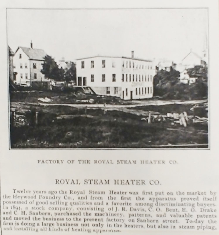
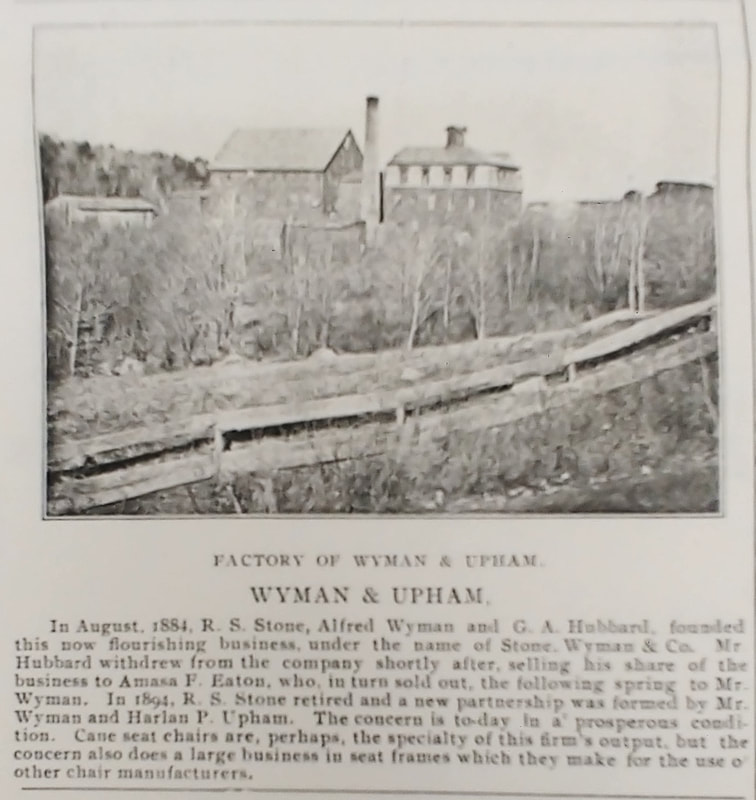
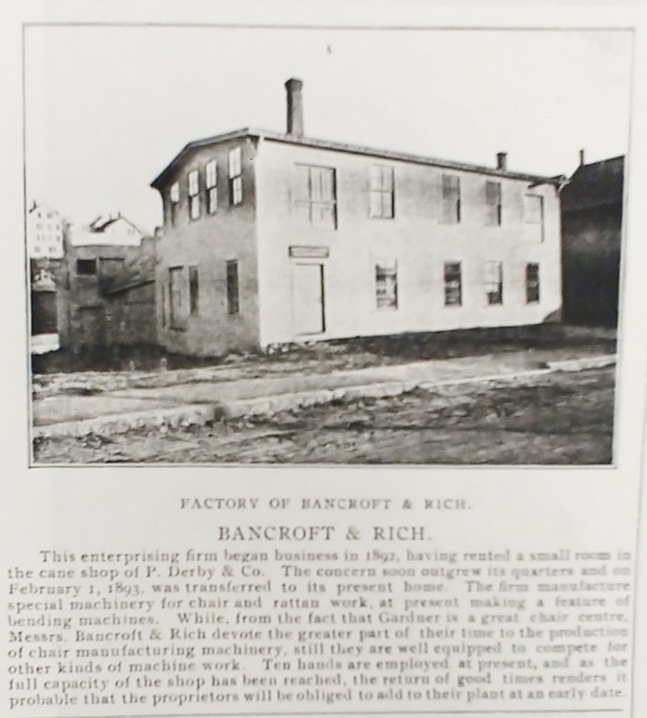
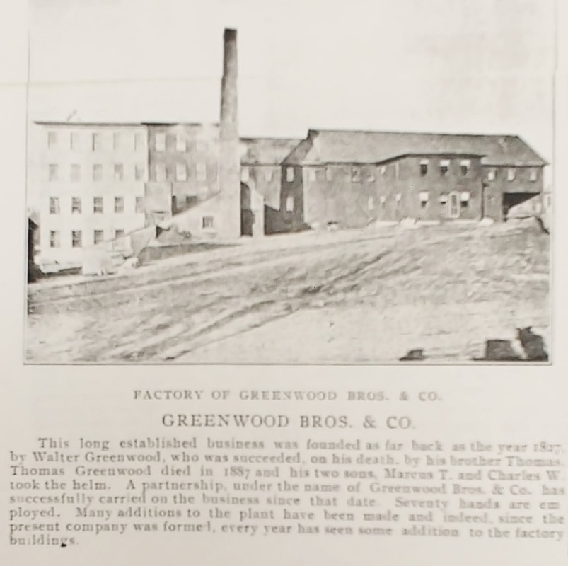

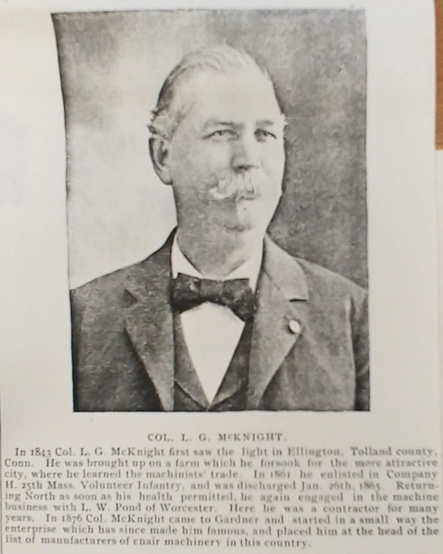
All of the above black and white photos come from a news article from 1897 (ref. 29).
15 & 15a - Royal Steam Heater Company - Created in 1894 and housed on the first floor of Sanborn Street until it moved to 499 North Main probably by 1910. The company is still there today! The Sanborn Street location was where the CubeSmart parking lot is today. The picture shows how it looked. The building was shared with The Russell, Briggs & Favor Chair Factory and later the Simplex Time Recorder Company. The modern snapshot shows the company on North Main Street today.
16 - Wyman & Upham - I am unable to figure out exactly where this was. At best, I found The Wyman Cane Seat Chair Manufactory (Not Running) "1 1/2 miles S W of Town Hall" on the 1900 map but there was no placement of it on the larger map, just the quote. Wyman & Upham referred to Alfred Wyman (1853-1900 or after) and Harlan Pillsbury Upham (1860-1931). In 1890-1891 it was referred to as Stone, Wyman & Co and it was located at "Parker at railroad crossing". By 1894 it was Wyman & Upham and the last listing was in 1900 and then in 1901 as Alfred Wyman.
17 - Bancroft & Rich - It was located at about 210-212 Main Street. From 1892 it was Bancroft & Rich up to 1900 or so, then F H Bancroft in 1905 as Mr Rich had passed away, and Bancroft & Barnard from 1909-1924. In 1932 it looks like the original Main Street building was still there but today the building is gone. It would have been located about where the handicapped parking is near the main entrance to the new Police Station. It seems that Bancroft would have been Frank Herbert Bancroft (1855-1927) and Rich was Henry M Rich (c1847-1901) and they were machinists. Barnard was probably Charles A Barnard (1865-1933).
18 - Greenwood Bros & Company - The origins of this company go back to 1827 but Greenwood Bros & Co was formed in 1887 by Marcus Judson Greenwood (1866-1948) and Charles Walter Greenwood (1863-1924) after their father Thomas (1834-1887) died in that year. Thomas' place can be seen on the 1870, 1878, and 1886 maps. After that it didn't really make it onto the main maps but into small cutaways describing it as "3 1/4 Mile S E of Town Hall". It looks to have maintained the shape seen in the 1886 map up until 1900. It was not even in a cutaway on the 1905 map but made it full-fledged on the 1909 map. It looks like a huge redesign was done. By c1913 the company was Greenwood Associates, having added their sister Helen M Greenwood (1860-1943). By 1914 we see another redesign of the part over Mahoney Brook and again in 1923. They were busy! By 1932 it was almost completely gone from the spot yet the company was listed until 1938. Unless the 1932 map was wrong I can only imagine there must have been a huge fire. Two buildings that were on the main road in 1914 are still there today. Manufacturing of chairs apparently continued in this area up until recently. The buildings are at 372 Main Street (the old Wayside Furniture with the big yellow chair) and 378 Main Street (the old Ralph Curcio & Co) across from Comiskey Automotive.
19 & 19a - L G McKnight & Company - Levi Gilbert McKnight (1843-1916) manufactured machinery to make chairs. He started his business in Gardner in 1876. By 1886 his shop was about where the Gardner News is today at 330 Main Street across the street from the Hannaford's parking lot. In 1905 the company was now called L G McKnight & Son Company. He had only one son named Elliot John (1879-1944) so he was presumably the "Son". It looks like he sold it to the Collier-Keyworth Company because by 1909 he had built a new place just a little further south, about where the part of the new building is that has Edward Jones in it at 354 Main Street. The company was still there in 1942 and its name changed to McKnight Machinery Company after that. It was there at least until 1970.

|
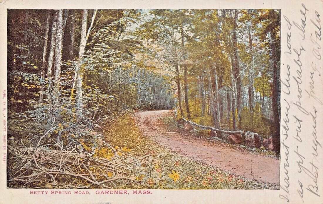
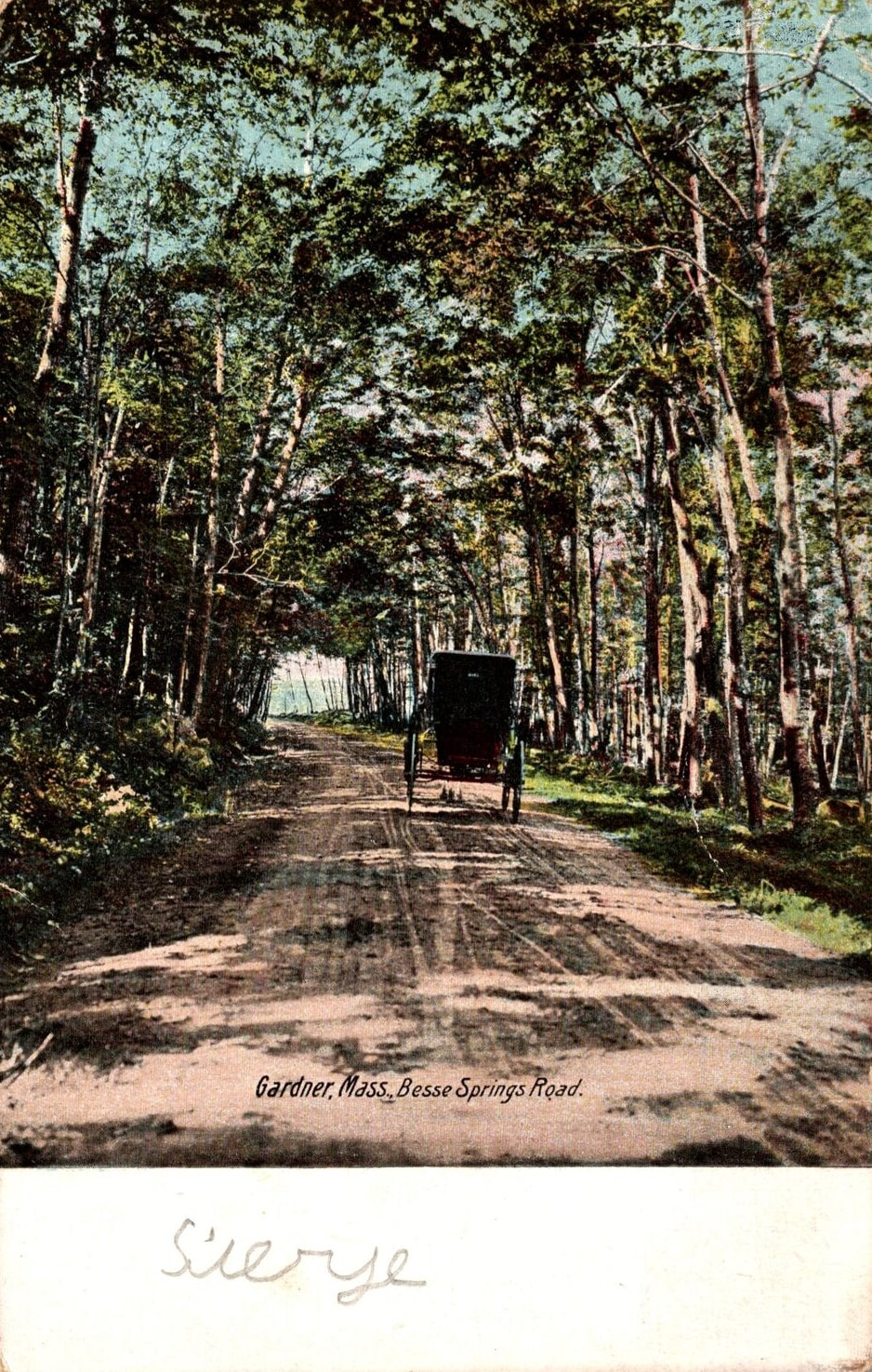
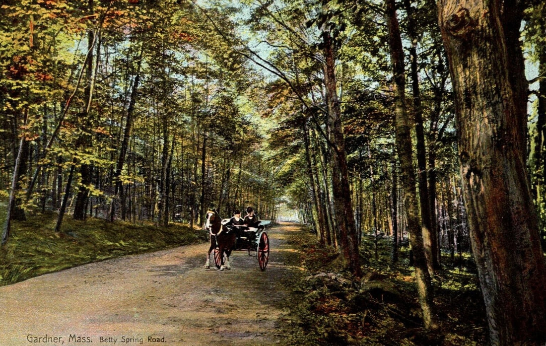
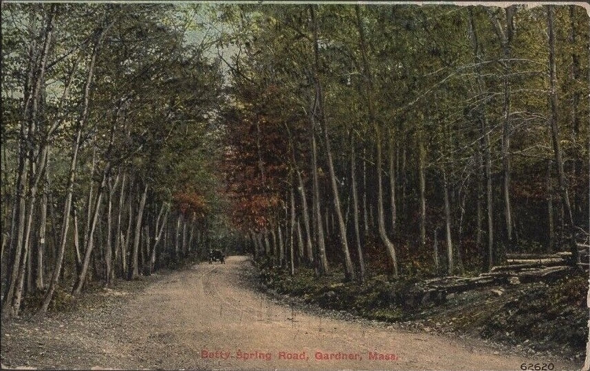
Betty Spring Road - Once known as Indian Spring Road and East Road, it runs southeast along the side of Dunn's Park. Reference 2 has a story on the origins of the name on page 29.
1. 1889 - Indian Spring Road - Reference 22, page 37
2. 1906
3. c1906 - Misidentified as Besse Springs Road
4. 1908
5. 1914
1. 1889 - Indian Spring Road - Reference 22, page 37
2. 1906
3. c1906 - Misidentified as Besse Springs Road
4. 1908
5. 1914
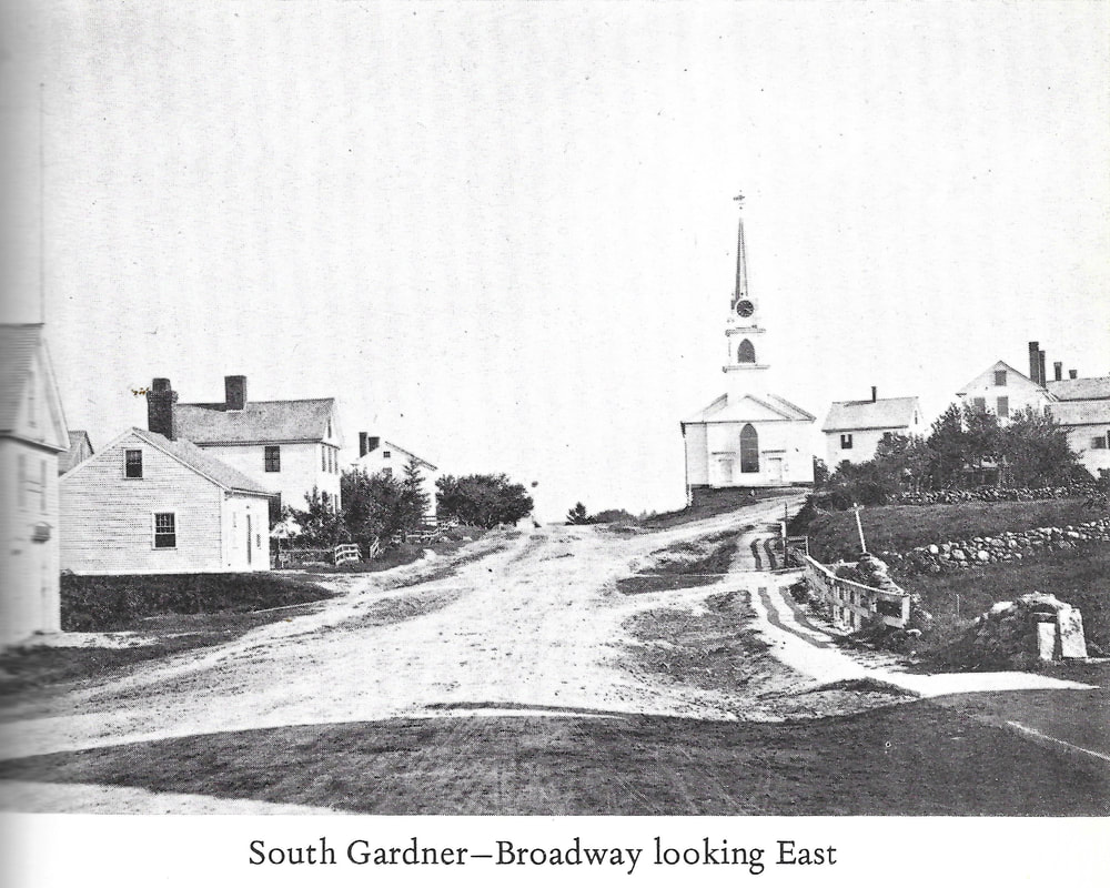
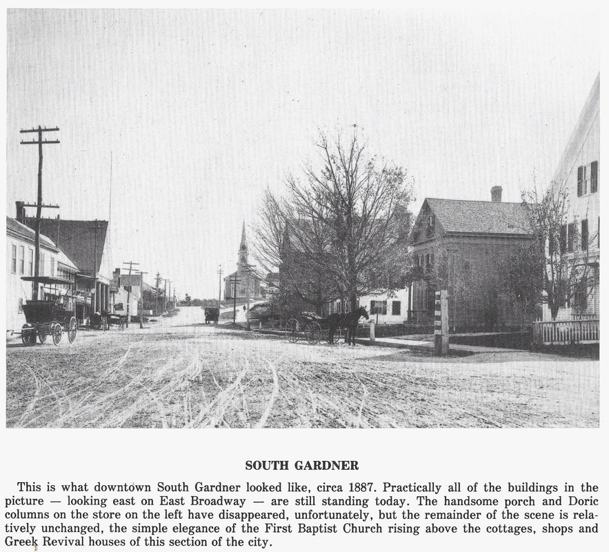
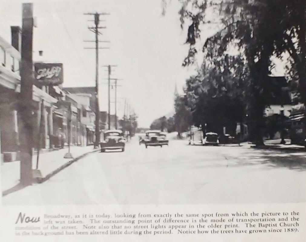
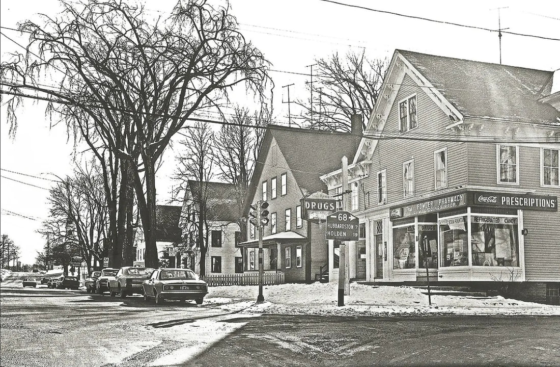
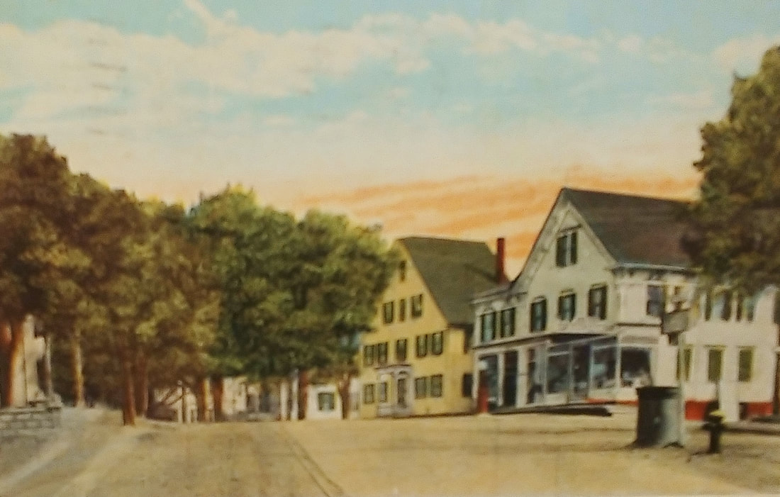
The First Baptist Church (see Churches section) of South Gardner is seen in the distance in the first two photos. The church is at the intersection of East Broadway and High Street. The view is looking east. The Gardner Hotel (see Hotel section) is just to the left out of the picture. The first two similar images are from earlier times. The first is clearly the older, perhaps from the 1870s, while the second is from c1887 (ref. 22, page 5 & ref. 2, page 77). The third, also a siilar view, is from the 1940s (ref. 29).
The "modern" photo is from the 1965 and is similar to the others, just panned a little to the right. This photo is from the Charles P Clark collection (ref. 19). In it, you can see the church through the trees. The Fowler Pharmacy building was torn down a couple of years ago and in its place is the new Gardner Spirits building, opened in 2023. The other three houses are still in use. The road leading to the right is Union Street. The traffic light has been replaced with an old-time lamp. The "haunted" S K Pierce house is to the right out of view. Image 5 (ref. 27) is undated but similar to and earlier than number 4.
The "modern" photo is from the 1965 and is similar to the others, just panned a little to the right. This photo is from the Charles P Clark collection (ref. 19). In it, you can see the church through the trees. The Fowler Pharmacy building was torn down a couple of years ago and in its place is the new Gardner Spirits building, opened in 2023. The other three houses are still in use. The road leading to the right is Union Street. The traffic light has been replaced with an old-time lamp. The "haunted" S K Pierce house is to the right out of view. Image 5 (ref. 27) is undated but similar to and earlier than number 4.
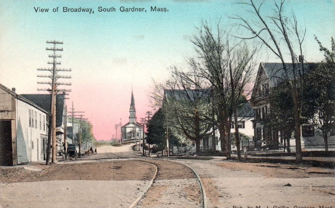 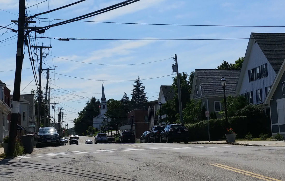 |
Much has changed in South Gardner. No tracks, no stable (left), no Fowler's Pharmacy. Still, it's interestingly similar, too.
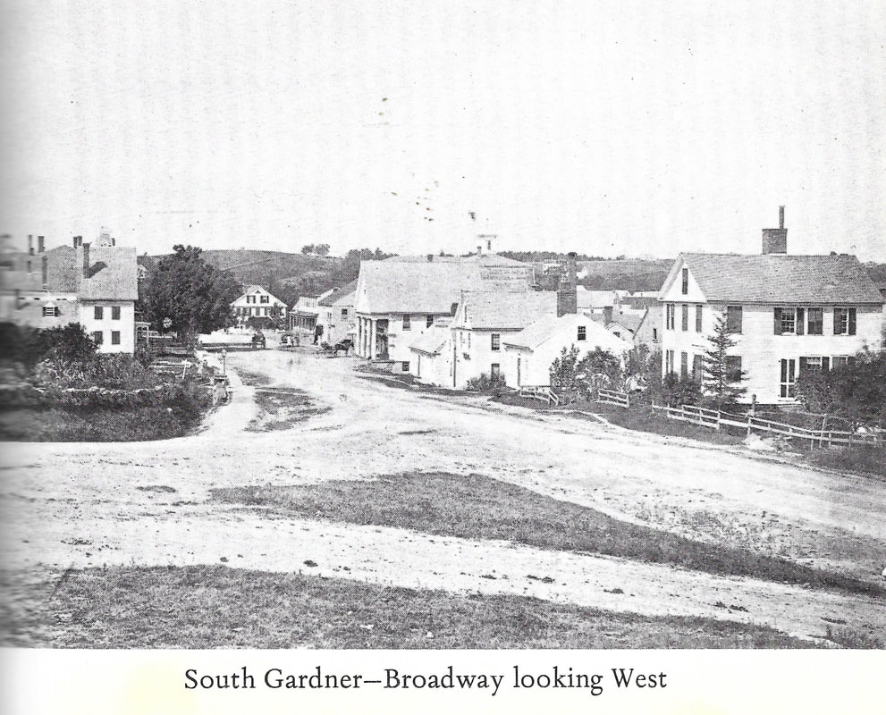

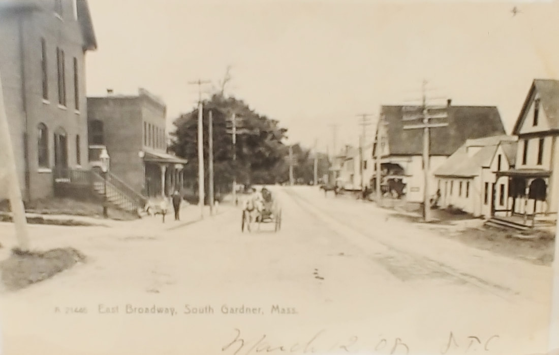
The first image above appears to have been taken at the same time as the "South Gardner-Broadway Looking East" photo so about the 1870s. It is looking west from the Baptist Church's lawn. You can see the Cataract Engine No 1 building in the center (between two short buildings). The second one, undated, is looking down South Main Street from where Broadway splits into to East and West. The third picture is East Broadway looking west but it's undated. Image 3a (ref. 27) is very similar to number 3, just pulled back a little. Rough estimate is late 1880-1910.
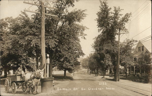 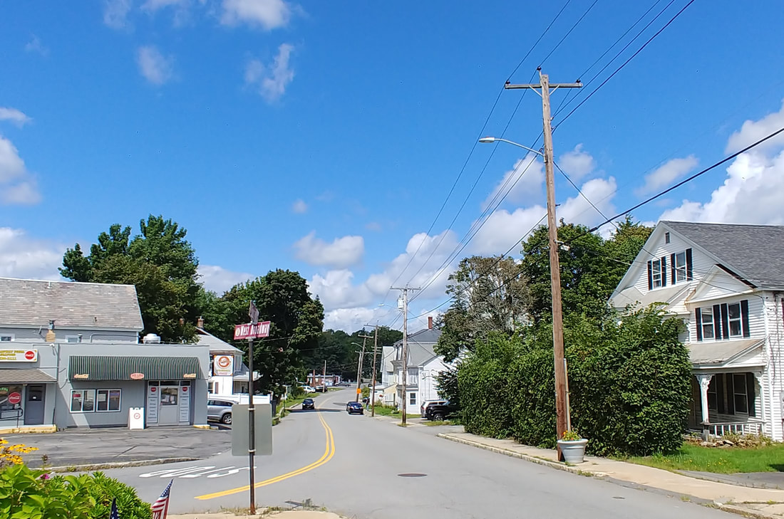 |
South Main Street - This view is as if you were at Fowler Pharmacy looking diagonally down South Main Street. The house to the right still exists with some large hedges out front. West Broadway Pizza would be basically behind the horse's head.
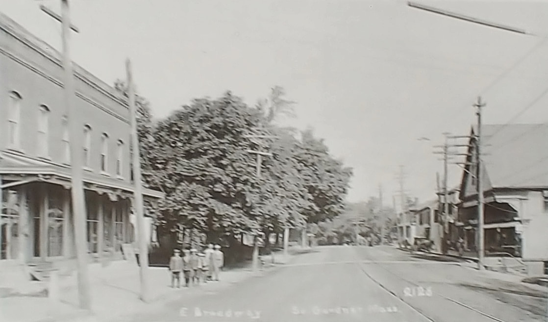 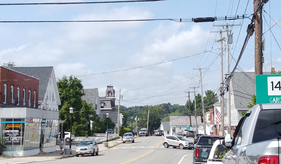 |
The undated photo shows the view on East Broadway looking west to where it branches into West Broadway (straight ahead) and South Main Street (veering off to the right but you really can't see it). Napoleon Alzingre's (1859-1947) Store is on the left and S. W. A. Stevens (Simeon Willard Ambrose Stevens, 1818-1910) & Son is on the right. You can just see how Chelsea Street branches off to the right in the lower right corner. In the 2023 photo you can see Alzingre's place has an addition on the front. This is now the South Gardner Laundromat at 55 East Broadway. The lamp post is taking up the spot of the second telephone pole from the old photo while the other poles seem to still be in place. On the right the S W A Stevens building still exists and it is now the Match Shot Firearms shop at 38 & 40 East Broadway.
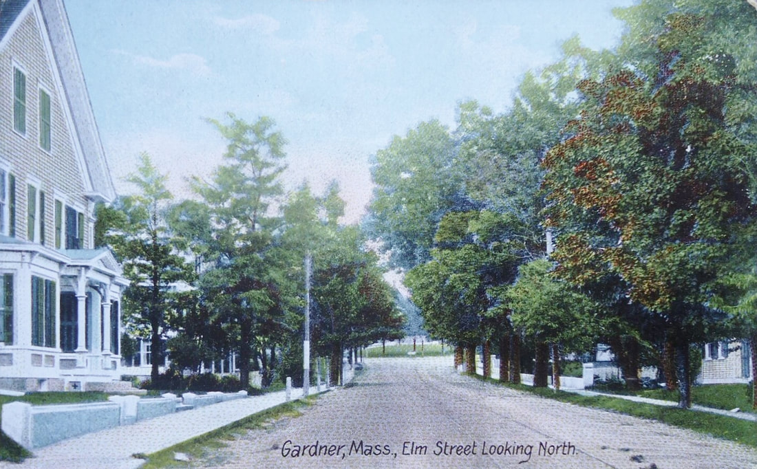 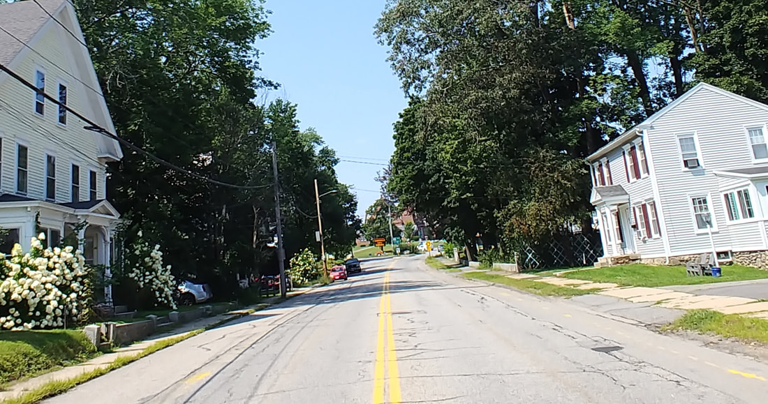 |
Elm Street Looking North - This view looks towards the rotary (the old center of Gardner) with the First Congregational Church on it. The house on the left is the current 45-49 Elm Street. Reference 2 has some information on the left house on page 40.
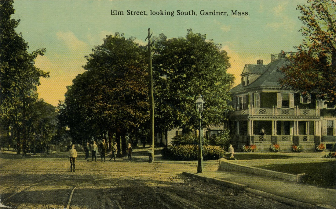 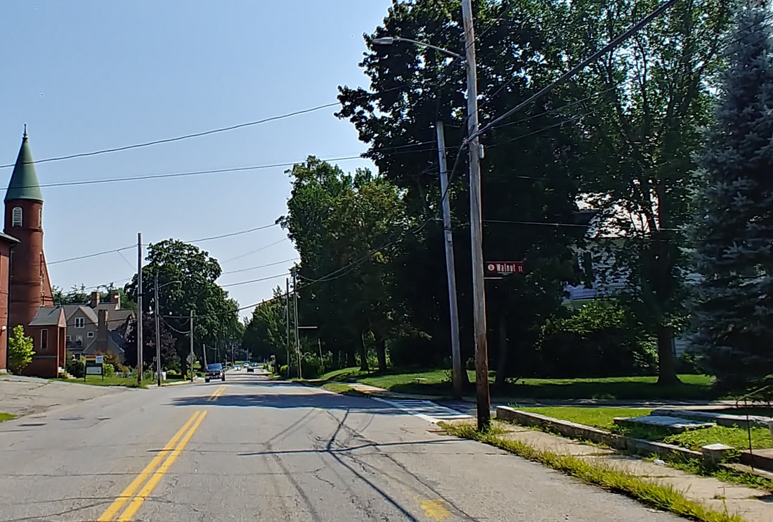 |
Elm Street Looking South - This view is virtually from the same spot as the north view only looking the other way. The wall is from the property at 45-49 Elm Street.
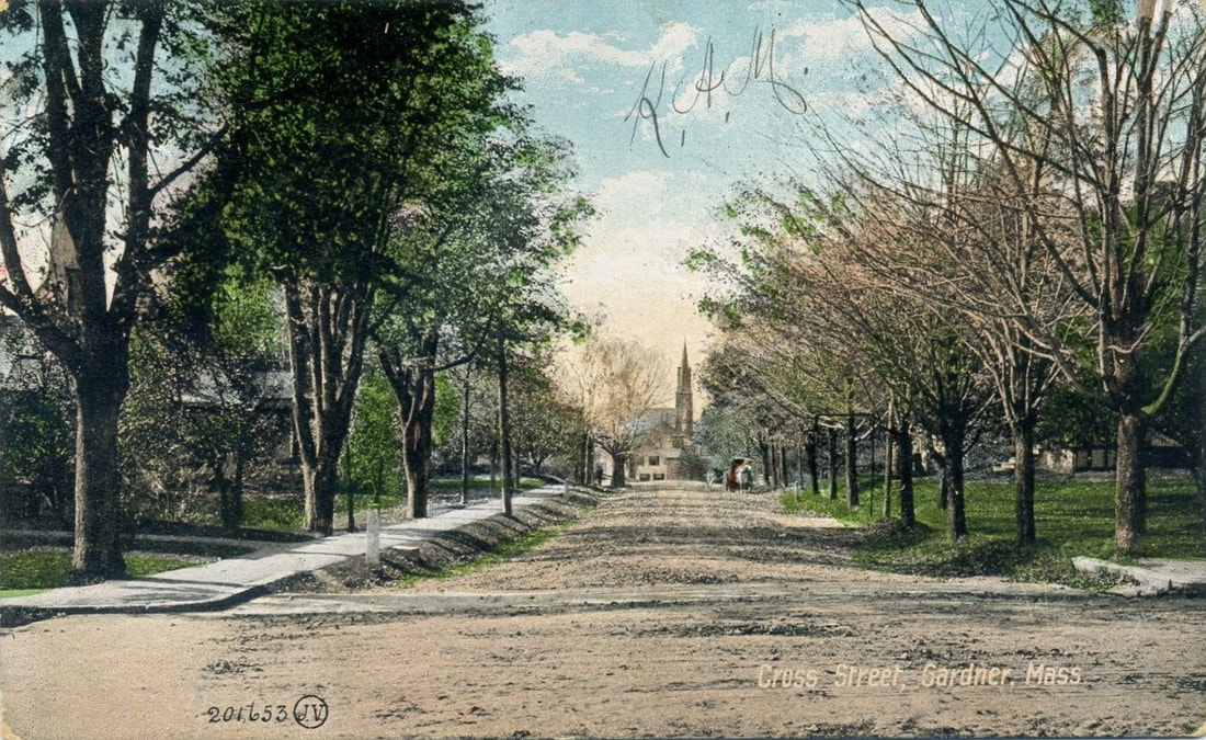 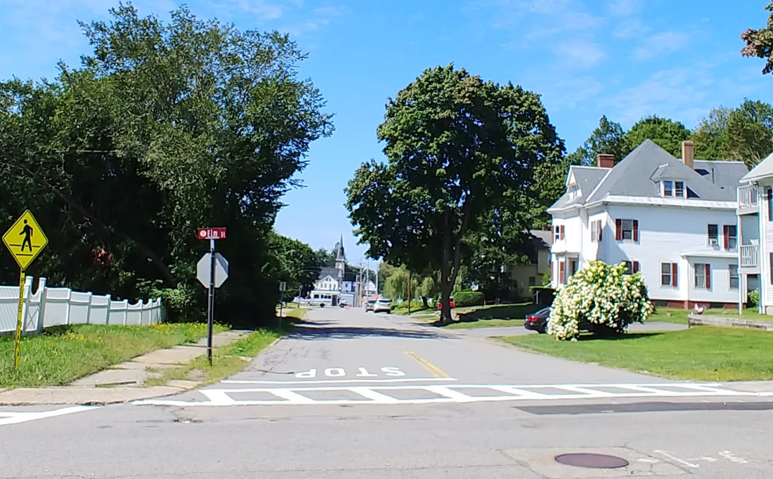 |
Cross Street - This picture looks west. Note the spire of Sacred Heart Church in the distance. The cross street is Elm Street.
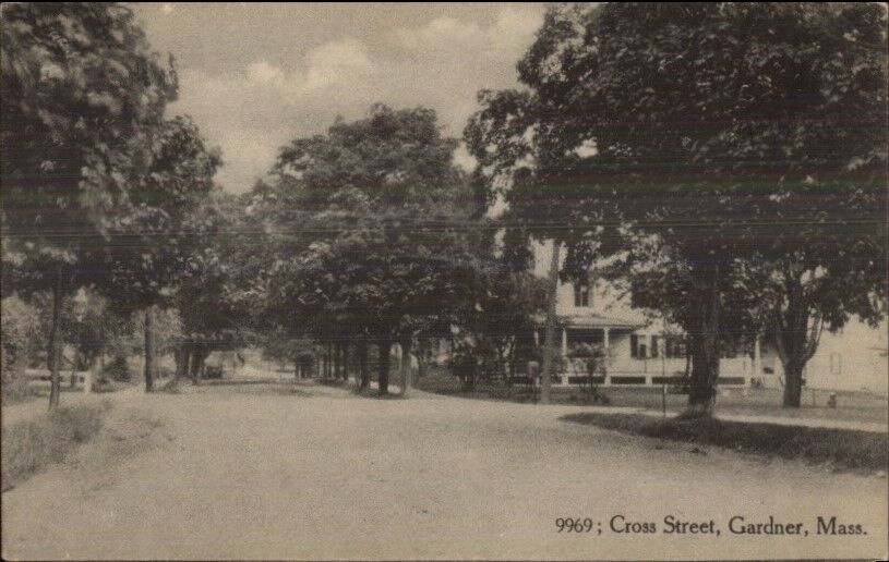 |
Cross Street - Not pinpointed but I would guess it is where Cross intersects with Lincoln/South Lincoln Streets and is looking east.
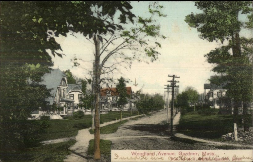 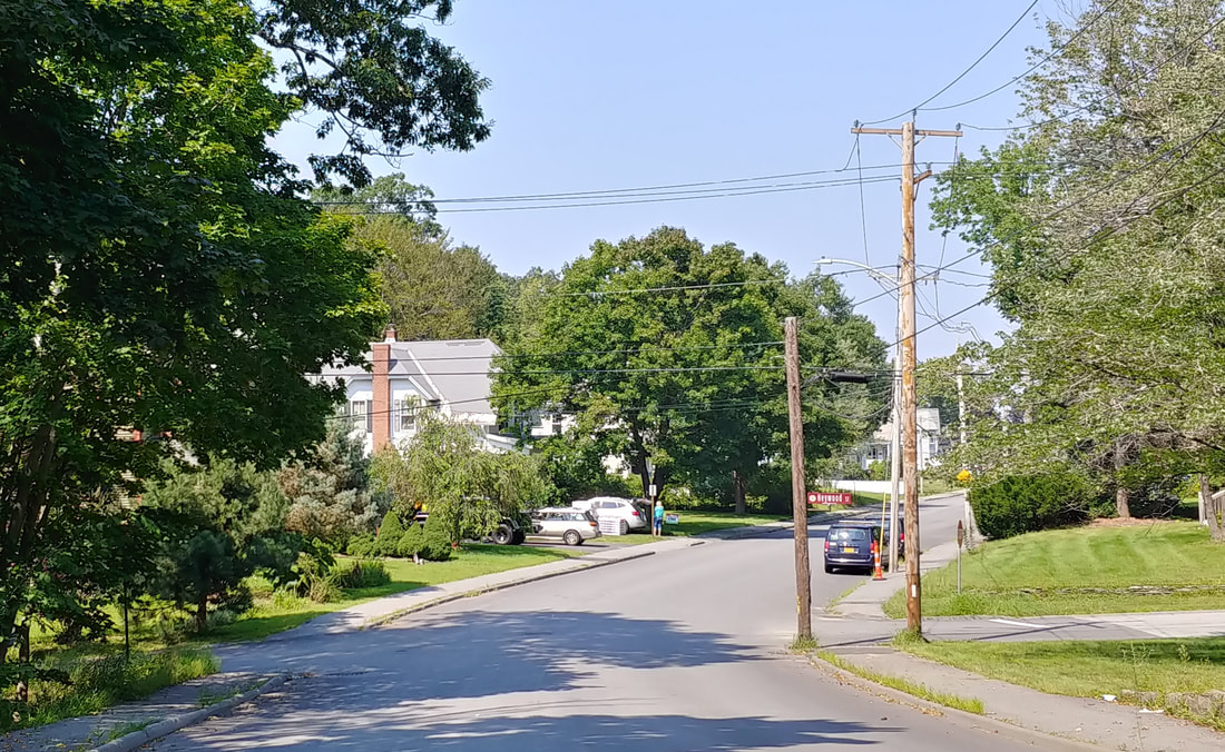 |
Woodland Avenue - Looking north from just past the Old Burial Ground. The cross street is Heywood Street. In the modern view the leftmost house is obscured by trees. I have provided a different angle below to show the distinctive house at 74 Woodland Avenue that still exists in 2023. The other picture from 1889 (ref. 22, page 32) is clearly earlier than the comparison image.
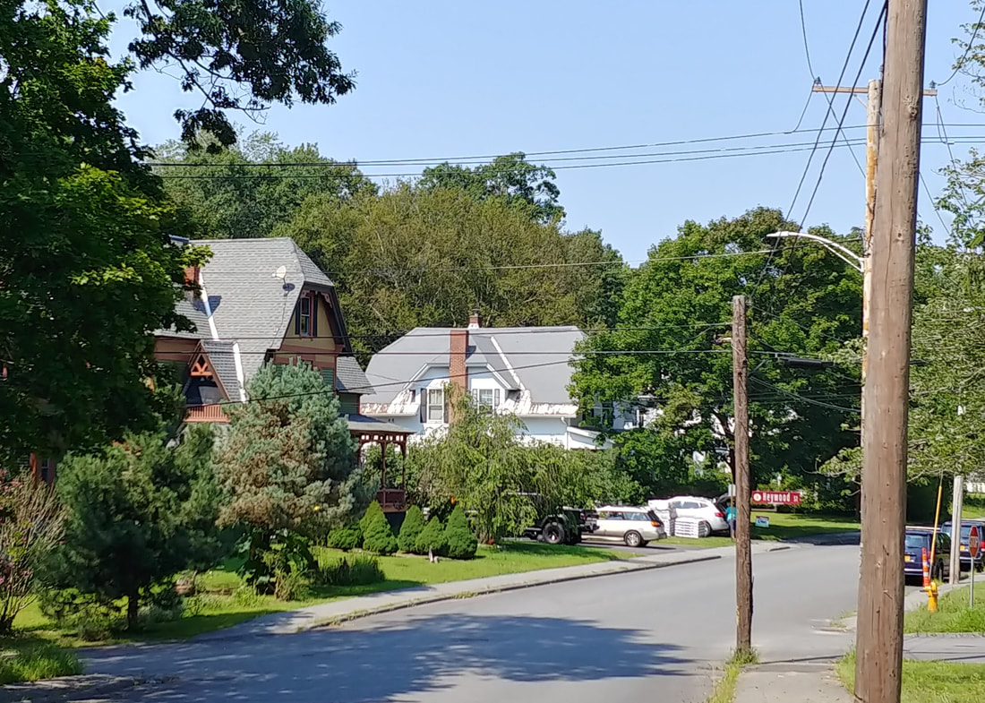
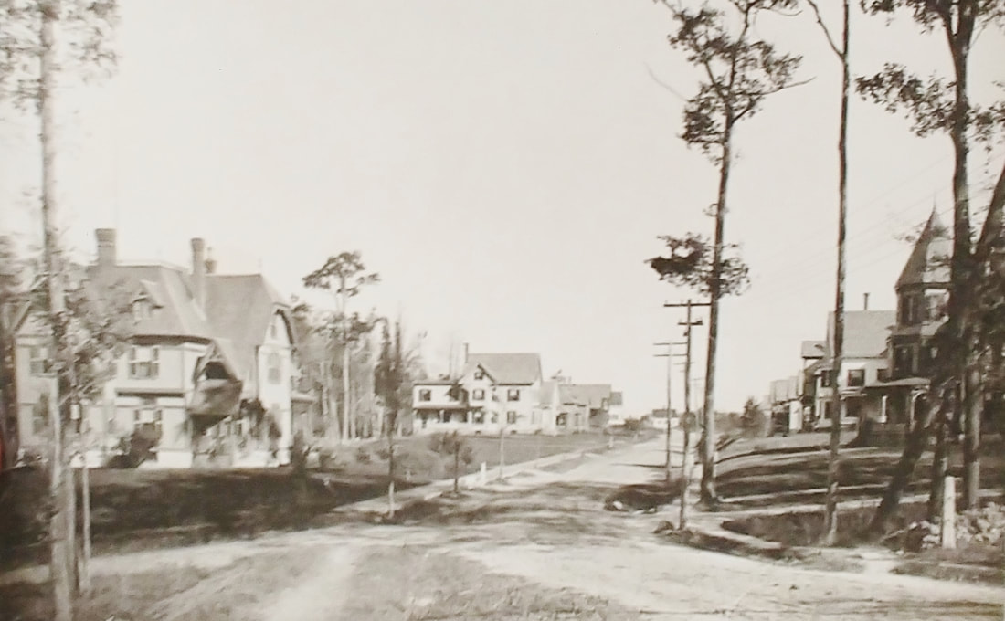
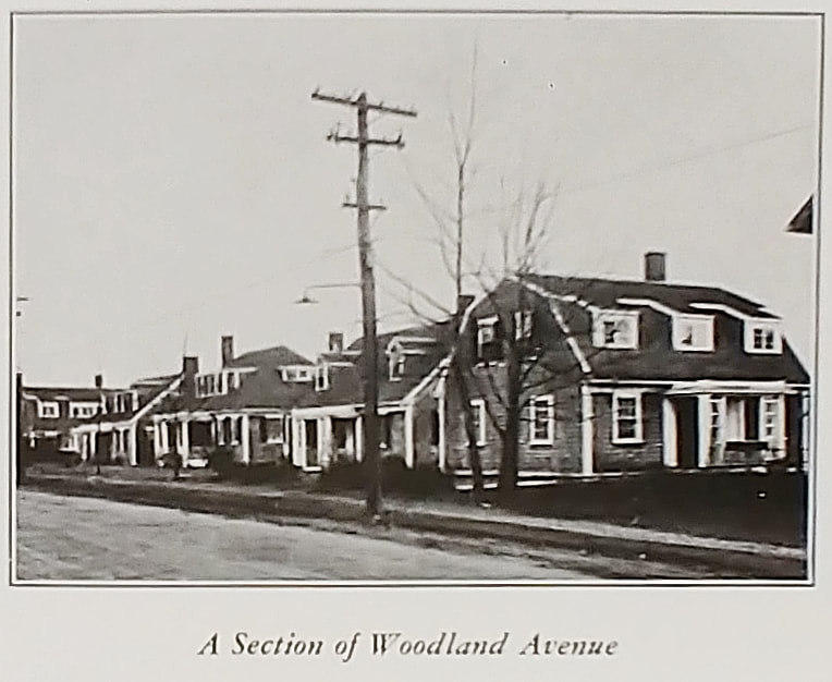  |
Woodland Avenue - This view from 1948 (ref. 12) is from right in front of the 1st hospital parking lot entrance heading north. All of the houses seen in the old picture are still there. The 2023 image is a placeholder Googlemaps snapshot.
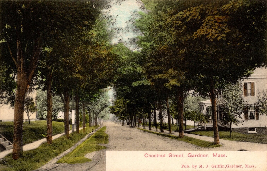  |
Chestnut Street - Looking south. The steps to the left are from the residence at 82 Chestnut Street. To the left and in back of this viewpoint is the old Frank Smith's Silver Ware building.
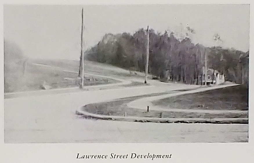 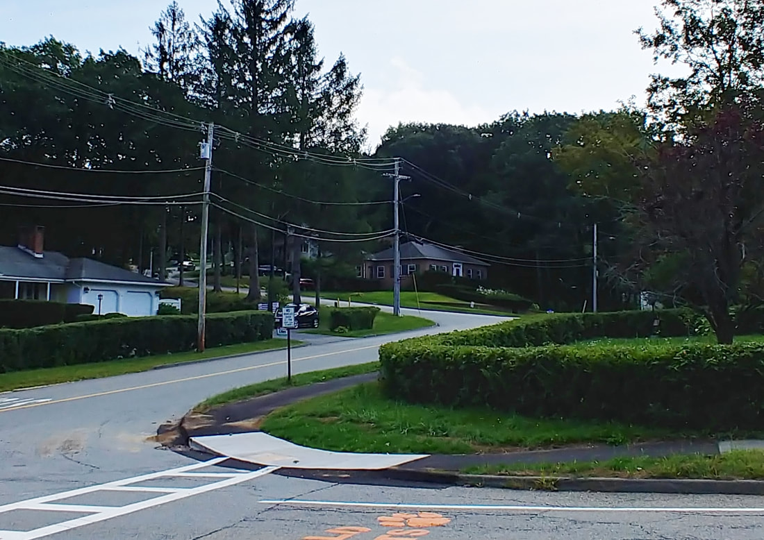 |
The original photo is from 1948 (ref. 12) where the reference seemed to indicate that the city was very proud of getting this development in swing. The view is from Pearl Street with Lawrence Street going off to the right and Bickford Hill Road up and to the left. The house in the old photo, still there, is at 38 Lawrence but the new photo doesn't show the house because of the trees.
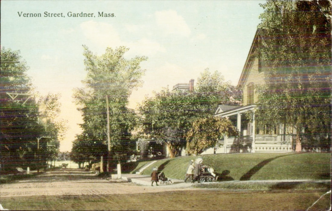 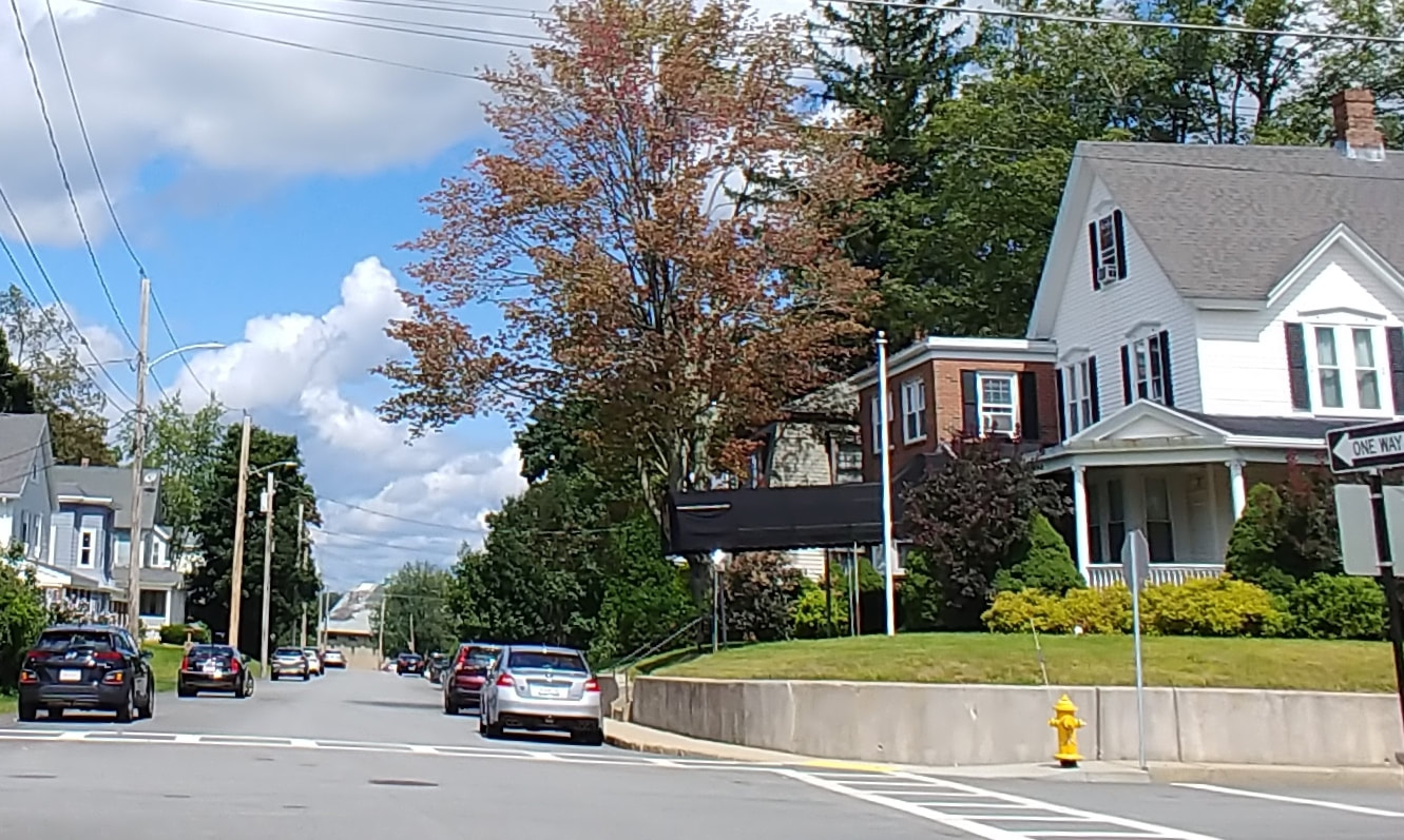 |
Vernon Street - The house to the right is 91 Vernon Street on the corner of Richmond Street. It's now the John H Mack Funeral Home with some additions and a cement wall added. The view is to the north toward Crystal Lake which you can see down the street.
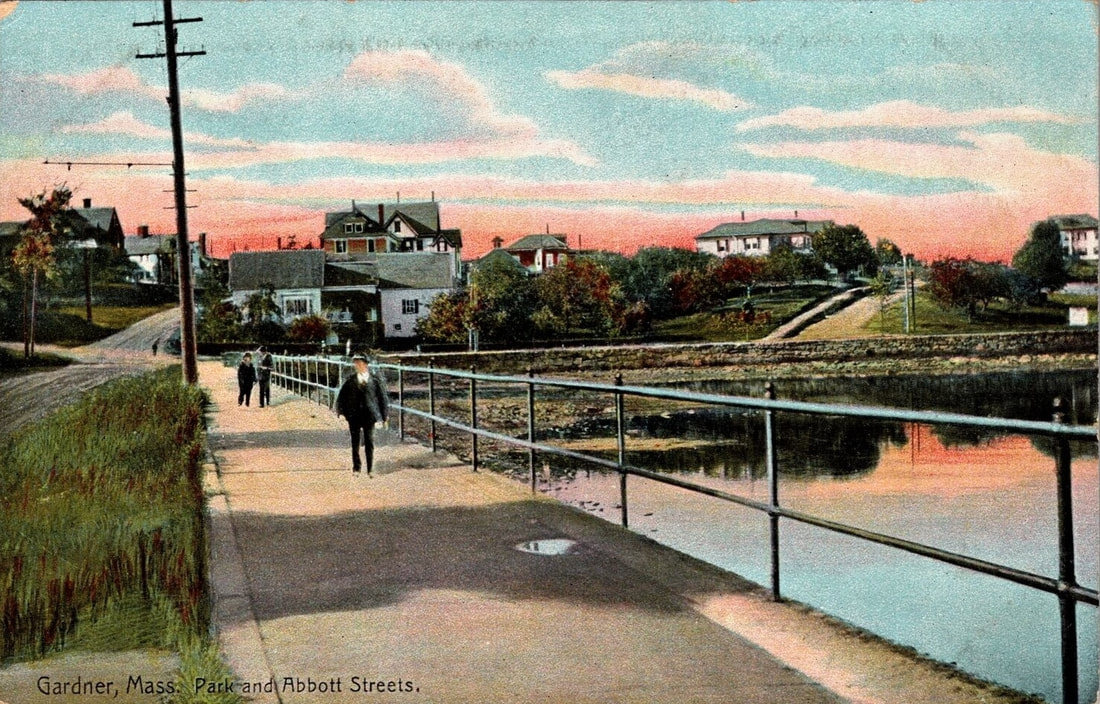 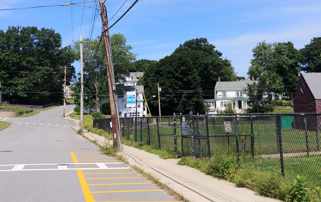 |
Park & Abbott Streets - View is northeast looking down Park Street. You can see Greenwood Pool to the right. There appears to be some artistic license with perspective as the road up to the right, Abbott, goes left up a hill and not right as the picture shows. The cross streets are Graham Street (left) and Crystal Lake Drive (right).
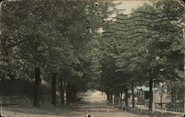  |
School Street - Looking south. The view is from the corner of Lynde and School Streets.
The next three pictures for comparison below are all Central Street images but none had dates.
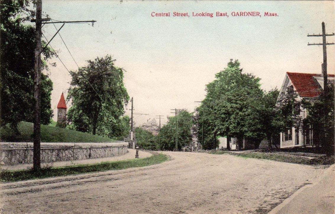 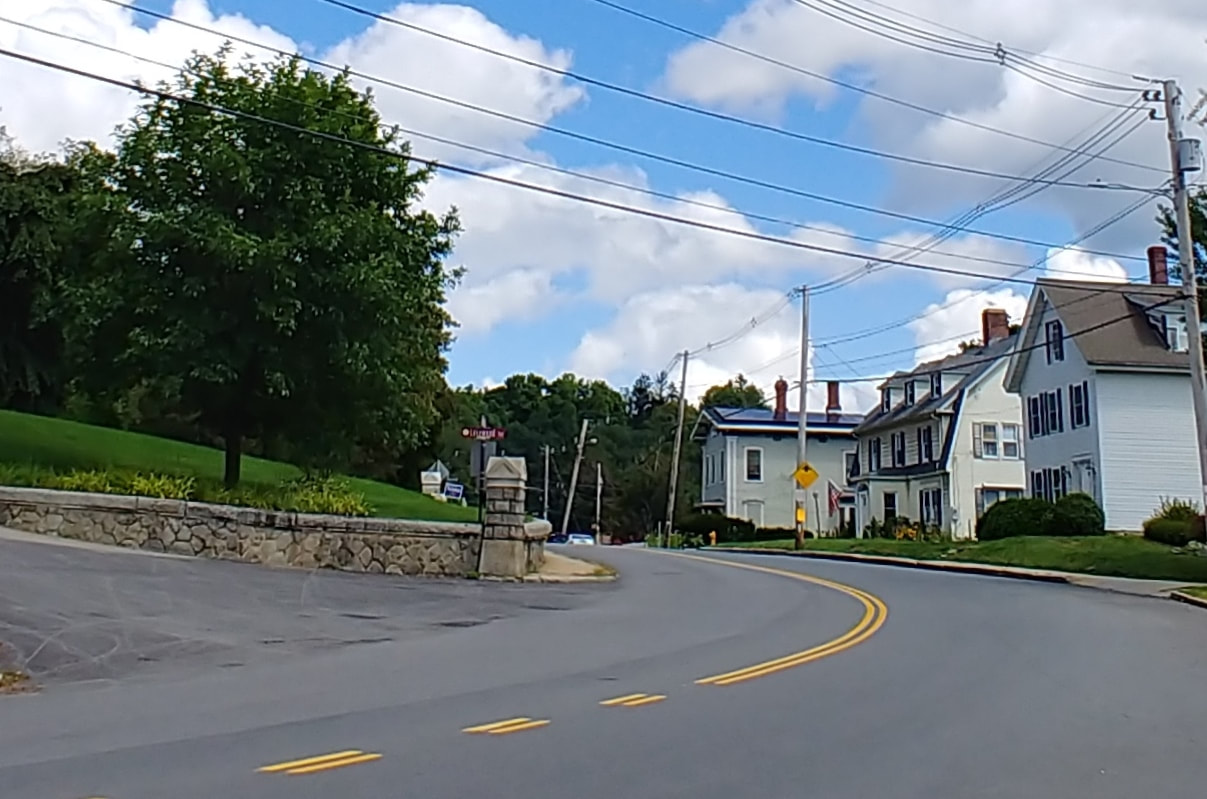 |
Central Street - Looking northeast - This is northeast going towards the First Congregational Church, whose spire you see. It was difficult finding the correct spot but the house on the right helped pinpoint it. The wall on the left was cut into and there is now a driveway. The view is from the intersection of School and Central Streets. In fact, the School Street photo above was taken just a few steps away from this one.
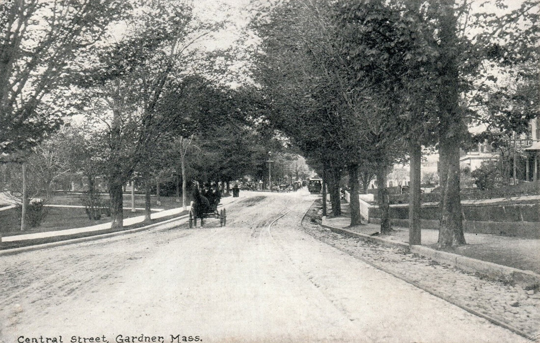 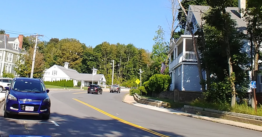 |
Central Street - Placing this one was tricky as the houses are obscured and the postcard doesn't give a direction. Once I found the cement wall to the right I was able to deduce that Monument Park is on the left and there is a stone wall just visible to the left which is at the vertex of Central & Park Street (the wall is no longer there, though). So, the view is looking east with Central curving to the right. The old Post Office would be just to the right out of frame. The trolley tracks are on the right side of the street (the south side). This threw me a bit because on the other Central Street pictures they are on the opposite side. There must have been a crossover right about where you see the trolley in the distance or the tracks could have just ended. The image below is from 1889 (ref. 22, page 19) and is similar but a little off to the left and taken from on the park's vertex. Park Street is on the left and Central on the right.
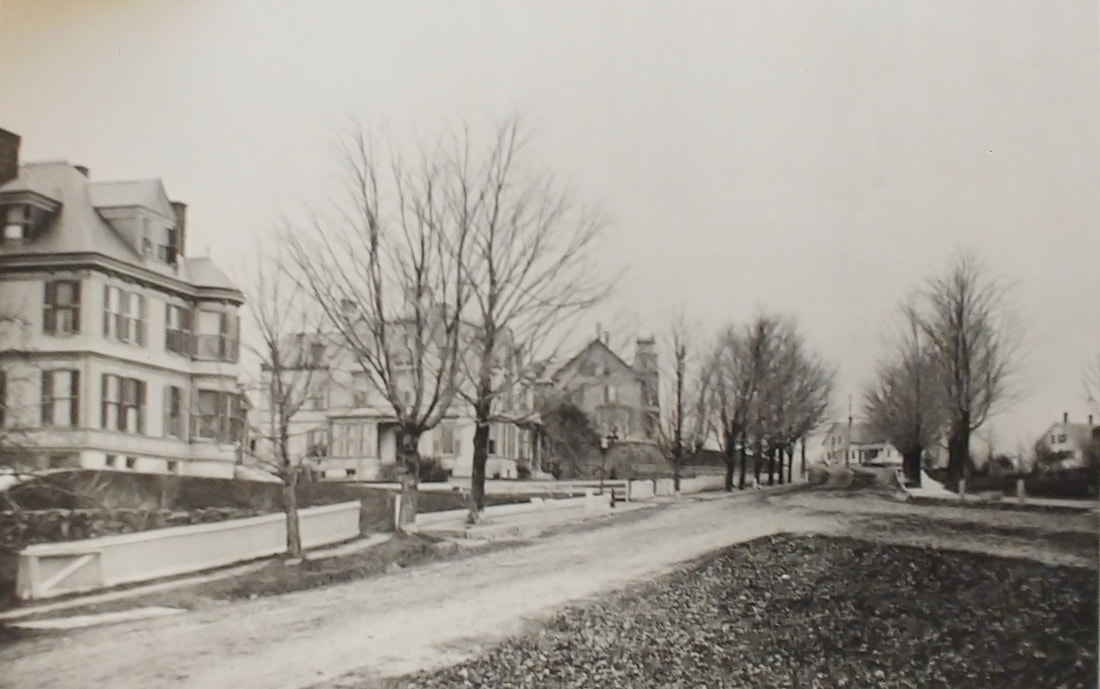
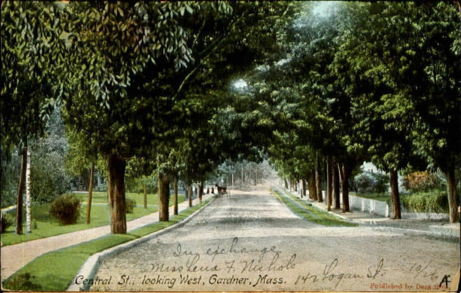 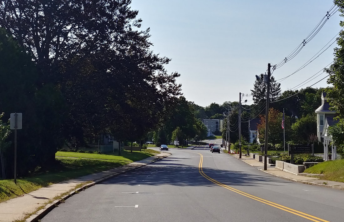 |
Central Street - Looking west - This one was even harder to find because there is practically nothing to work with. The wall on the right is fairly generic, there are no houses, and only one visible telephone pole on the right. There is a bend in the sidewalk. That severe a bend appeared nowhere along Central Street that I could find. The tracks are on the north side of the street and I was given the direction, west. Once I figured that Monument Park had a stone wall I was pretty sure I could see it in the distance in this image and that locked it in that I was looking at the park with Central veering off to the left and Park Street to the right. The telephone pole seems to be in the same spot too, so that helped. Finally, you can see a very thin path branching off to the left toward some unknown place. As it happens, the Henry Heywood house (below) does have a walkway up to the house right about there and both old images show the bend in the sidewalk and the thin aspen tree. The modern picture shows the walkway.
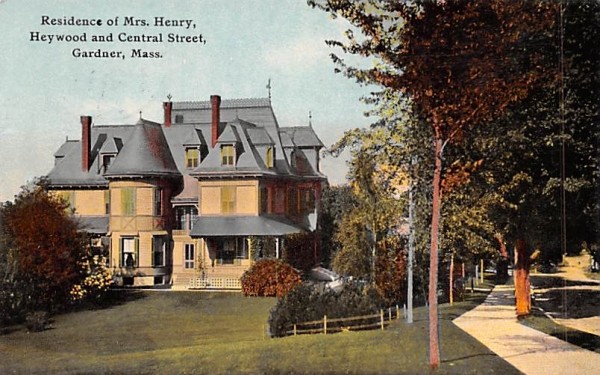
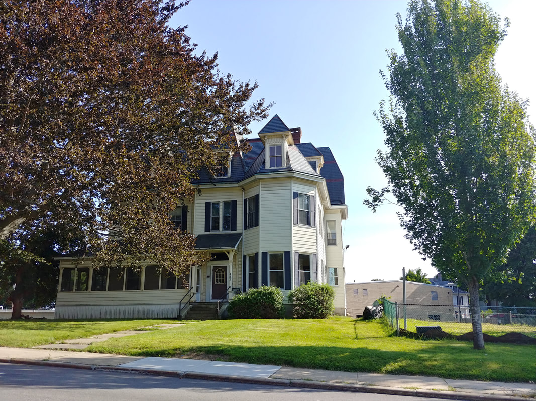
The next bunch of images all center around the area known as "West Gardner Square" or "The Square". This is where Parker, Pleasant, Main, West Lynde, Vernon, and Central all come together.
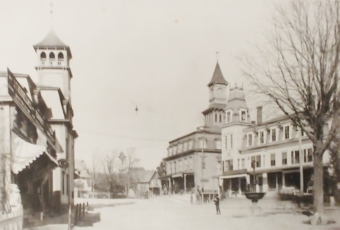
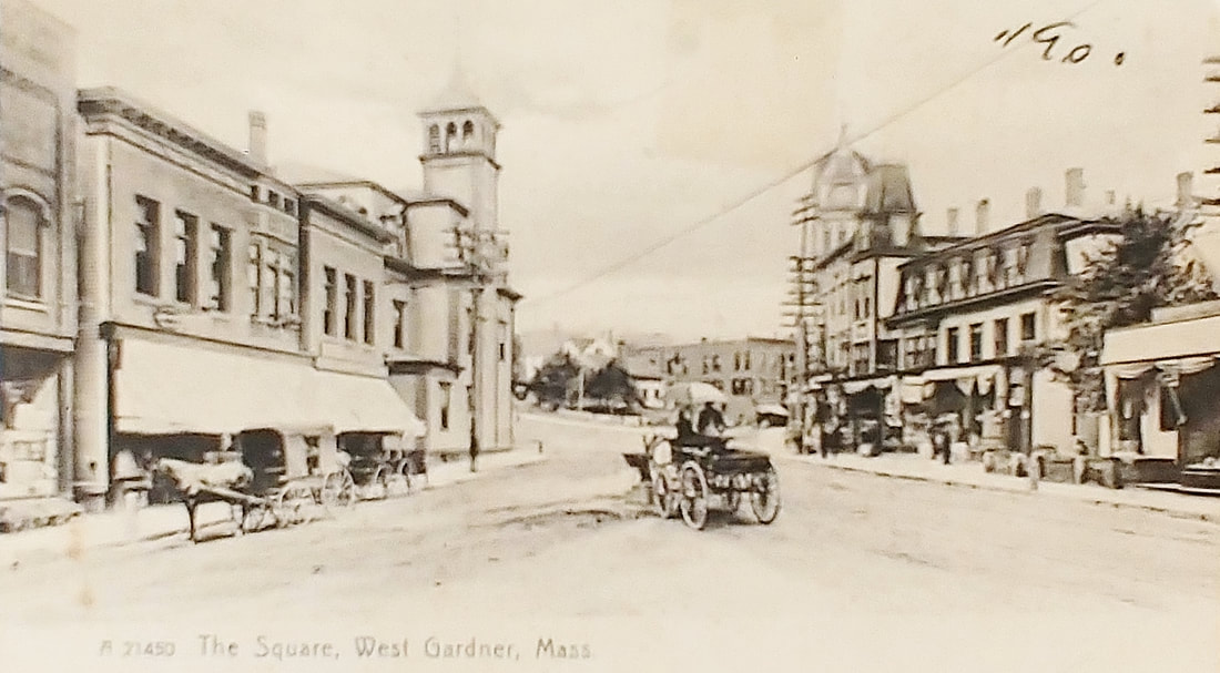
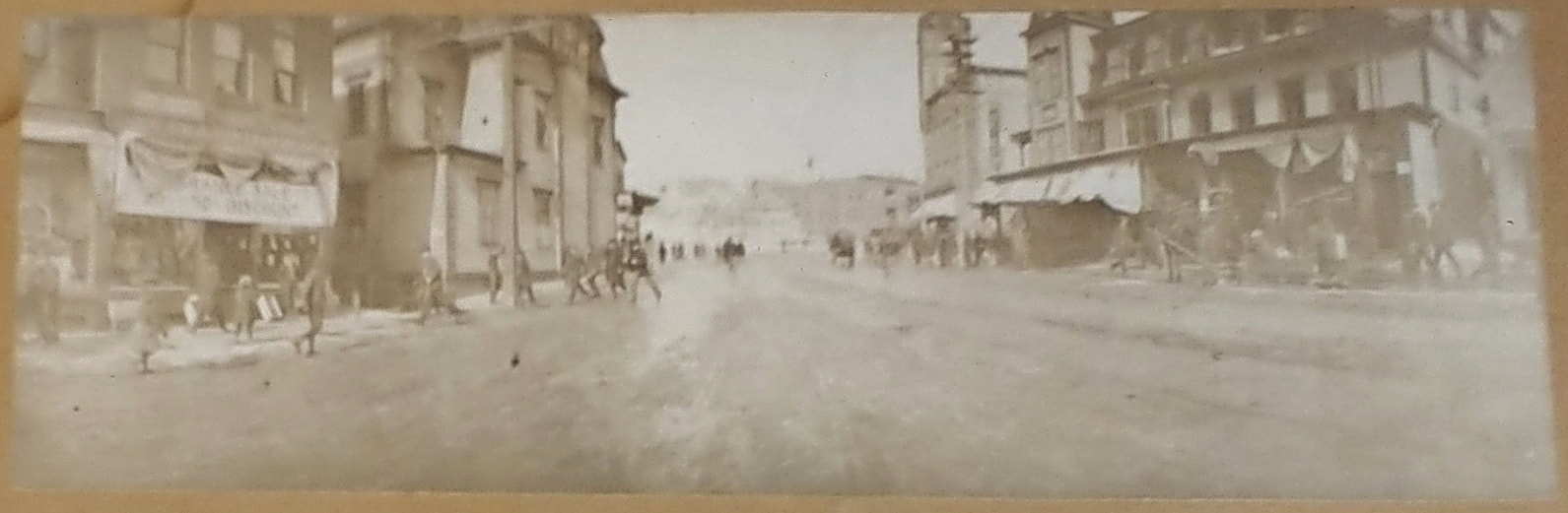
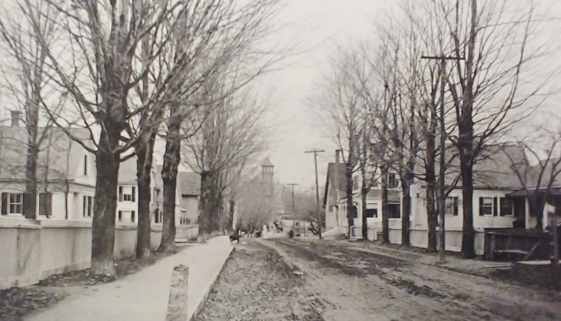
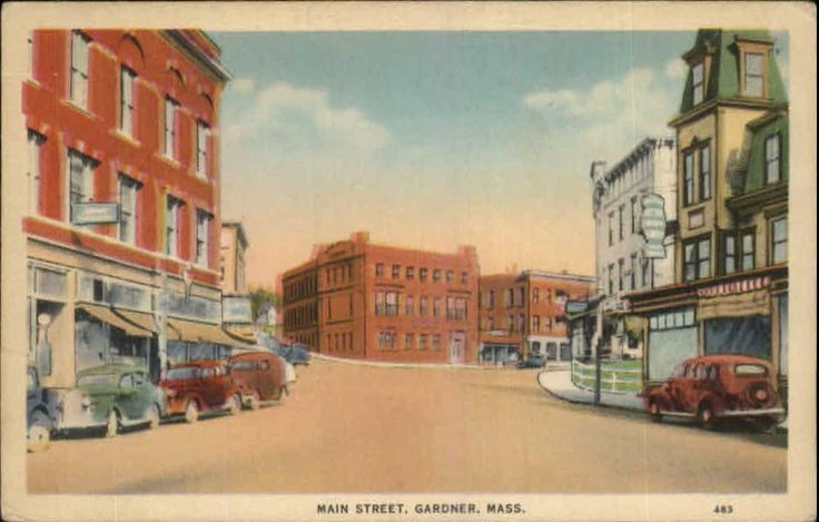
These views look north toward the Gardner News Building. Central Street veers off to the right and Vernon Street to the the left. Parker Street, though effectively unseen, branches off to the left and West Lynde to the right. The first image is from 1889 (ref. 22, page 2) and the second is from 1907. The third is undated (ref. 27). The tall building on the left is the Garbose Building (redesigned some time between 1907 and 1927) and on the right (not the clock tower) is what is known as Hagar's Block. Picture 4 is undated but is probably from around the same time as the first three - this picture is displayed in the library's Local History Room. Image 5 is looking north toward the center (ref. 22, page 21). Note the tower of the Garbose. The final two are undated but the seventh one is probably from the 1940s.
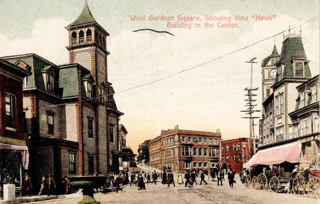 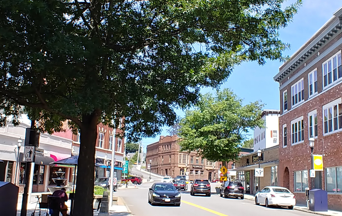 |
West Gardner Square - Looking north - Note that the Garbose building on the left at the corner of Pleasant and Parker Streets has been replaced with the brick-faced version. The original was built in the mid 1880s by Guy Garland. You can see that the buildings to the right have been replaced in the 2023 photo. The clock tower was actually on the Stevens Block, on the corner of West Lynde (north side) and Central Street, and removed in 1909.
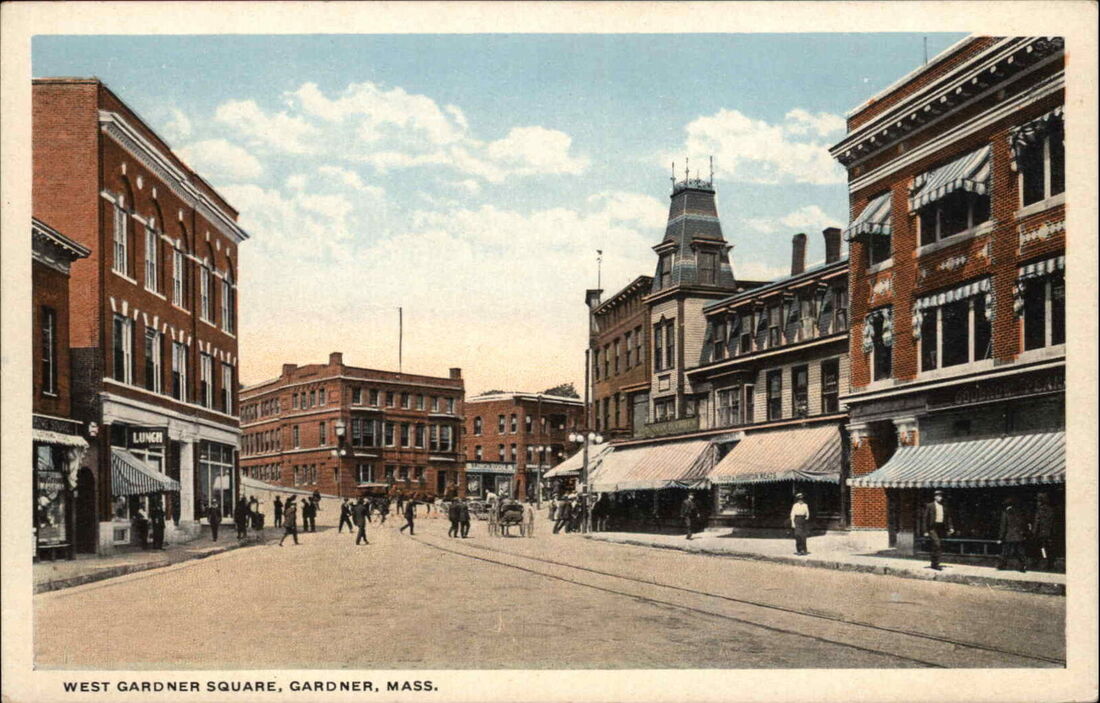 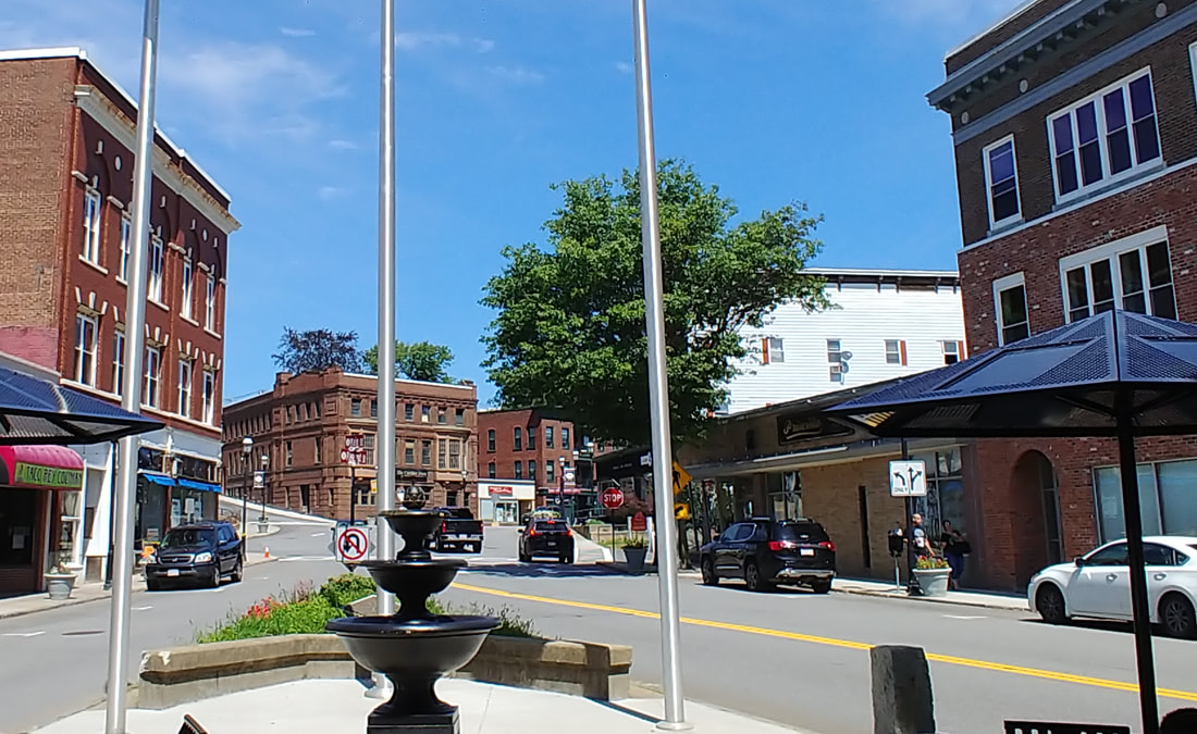 |
West Gardner Square - Looking north - This is a little later than the previous picture as the Garbose Building on the left has been redesigned. Comparing this to the previous picture you see that the clock tower from the Stevens Block on the right is gone. This dates the old picture to 1909 or later since the clock tower was removed in 1909. The brick building on the right in both pictures was part of Goodnow Pearson, a large department store, which closed around 1987-1988.
If we pull back a little the view expands to the first picture below. Notice how the old version of the Garbose is retained in the back. The second picture shows a 1935 parade (ref. 24) coming down Main Street from the Square. Goodnow Pearson in all its glory is seen in the 1937 picture below (ref. 29) at 14-34 Main Street and as it appears today. Image 5 (ref. 27) shows the rightmost of the three Goodnow Pearson buildings and the one next to it which is where John's Sports Shop is now. John's building at 36-38 Main Street says 1915 at the top of it and looks nothing like the one in the picture so this must be before then. Otherwise, the photo is undated.
If we pull back a little the view expands to the first picture below. Notice how the old version of the Garbose is retained in the back. The second picture shows a 1935 parade (ref. 24) coming down Main Street from the Square. Goodnow Pearson in all its glory is seen in the 1937 picture below (ref. 29) at 14-34 Main Street and as it appears today. Image 5 (ref. 27) shows the rightmost of the three Goodnow Pearson buildings and the one next to it which is where John's Sports Shop is now. John's building at 36-38 Main Street says 1915 at the top of it and looks nothing like the one in the picture so this must be before then. Otherwise, the photo is undated.
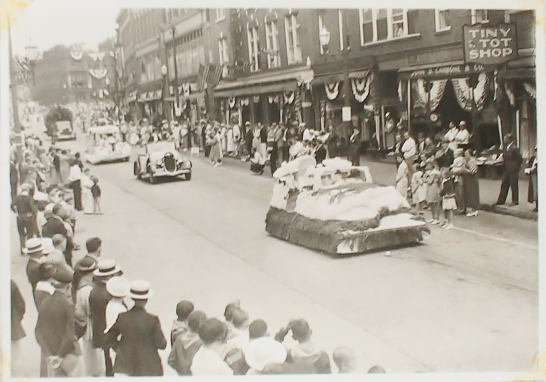
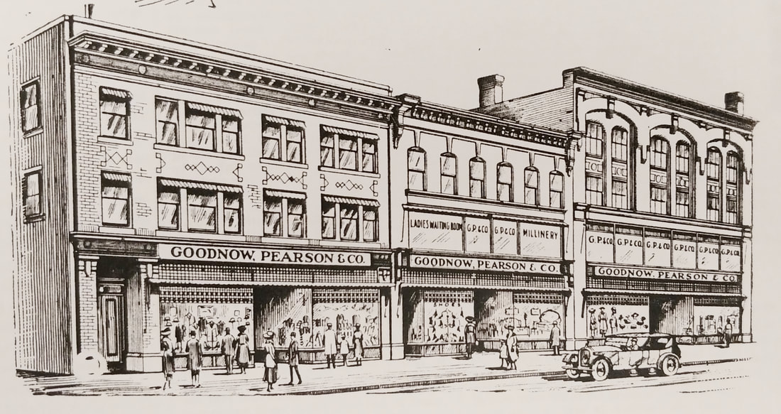
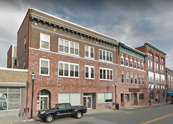
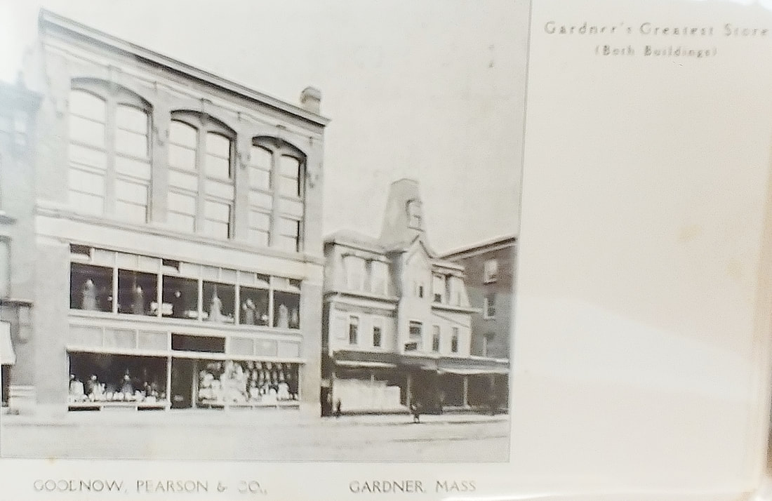
|
|
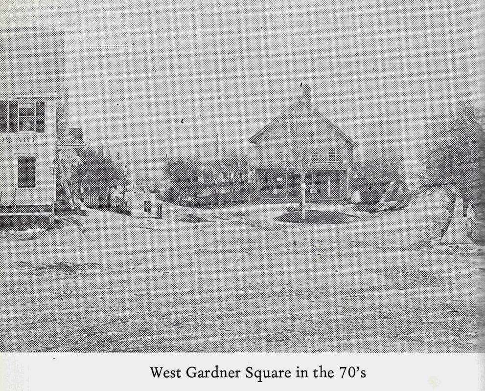
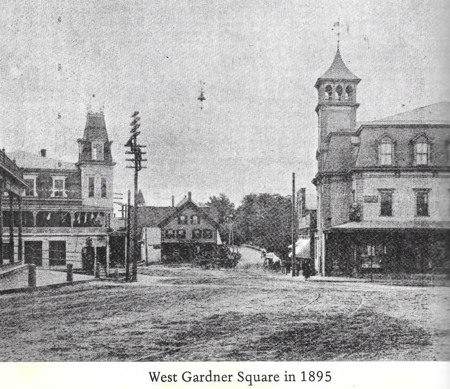
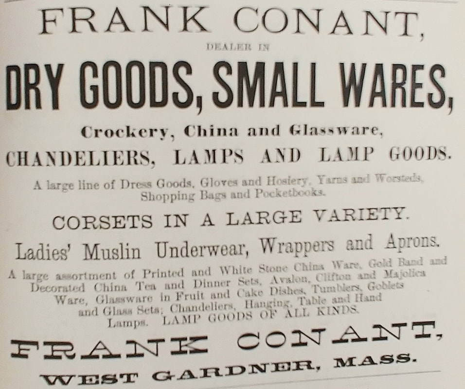
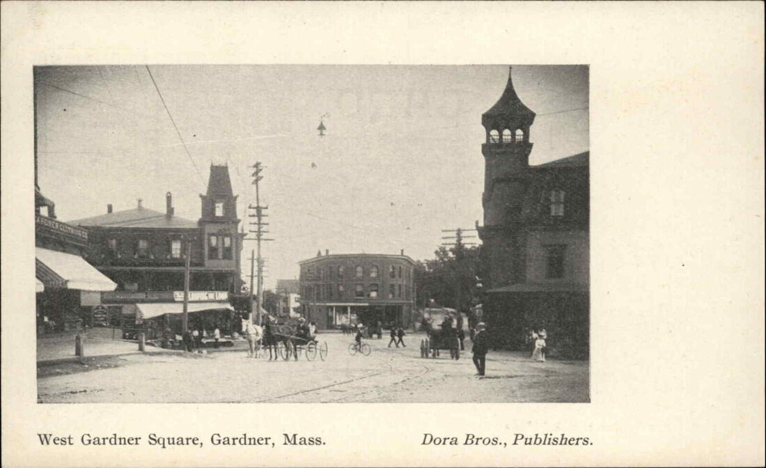
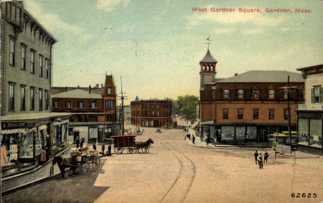
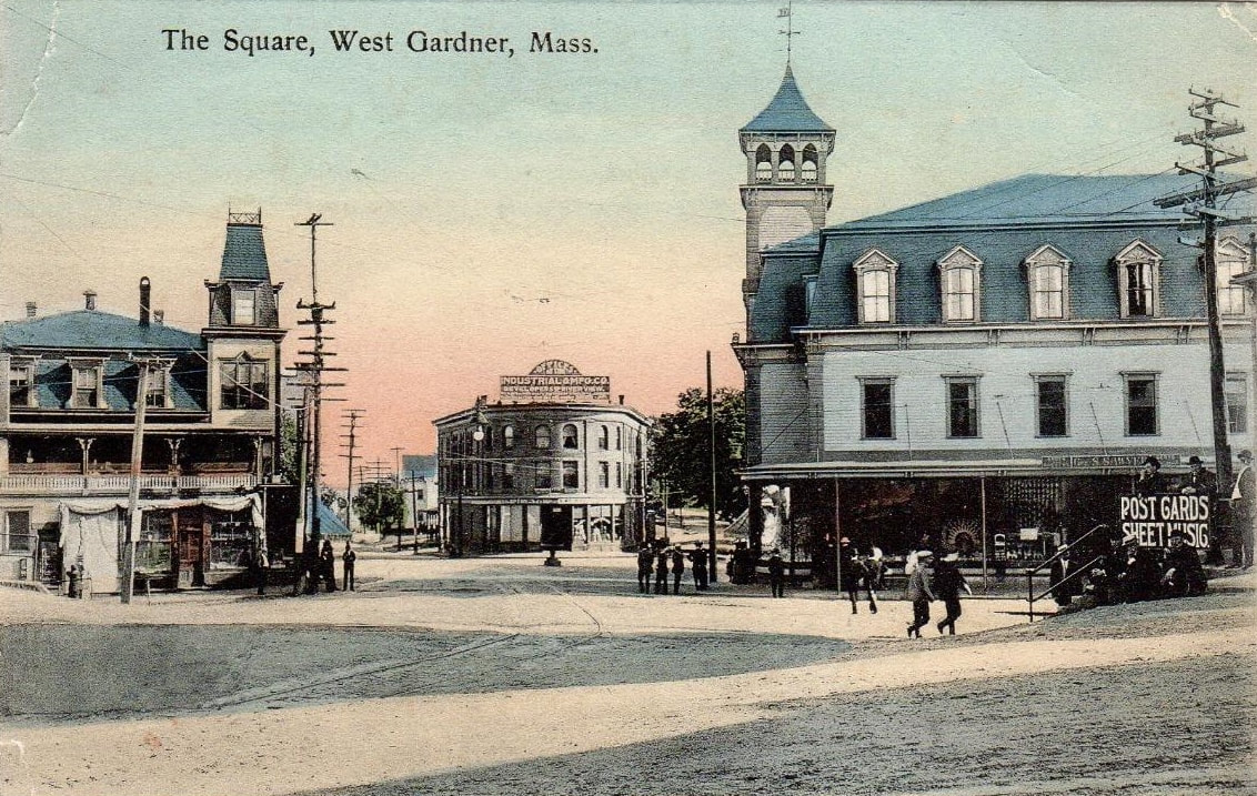

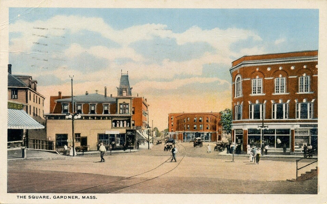
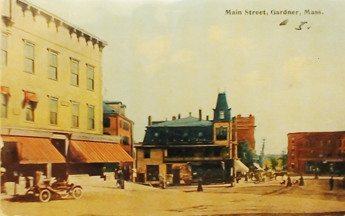
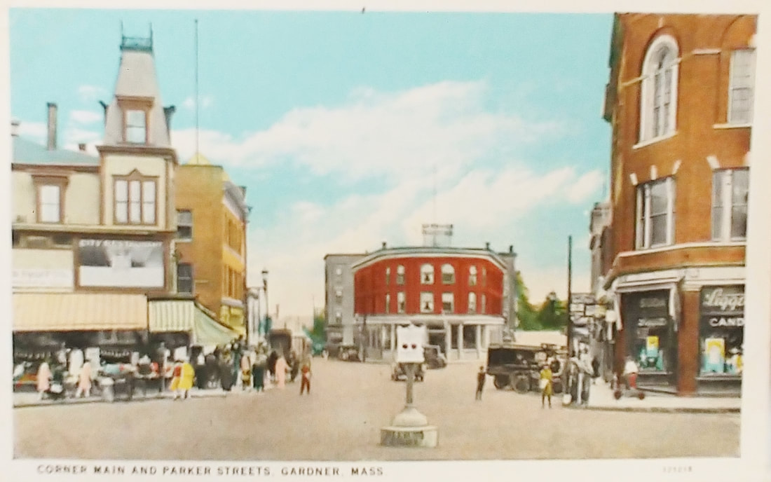

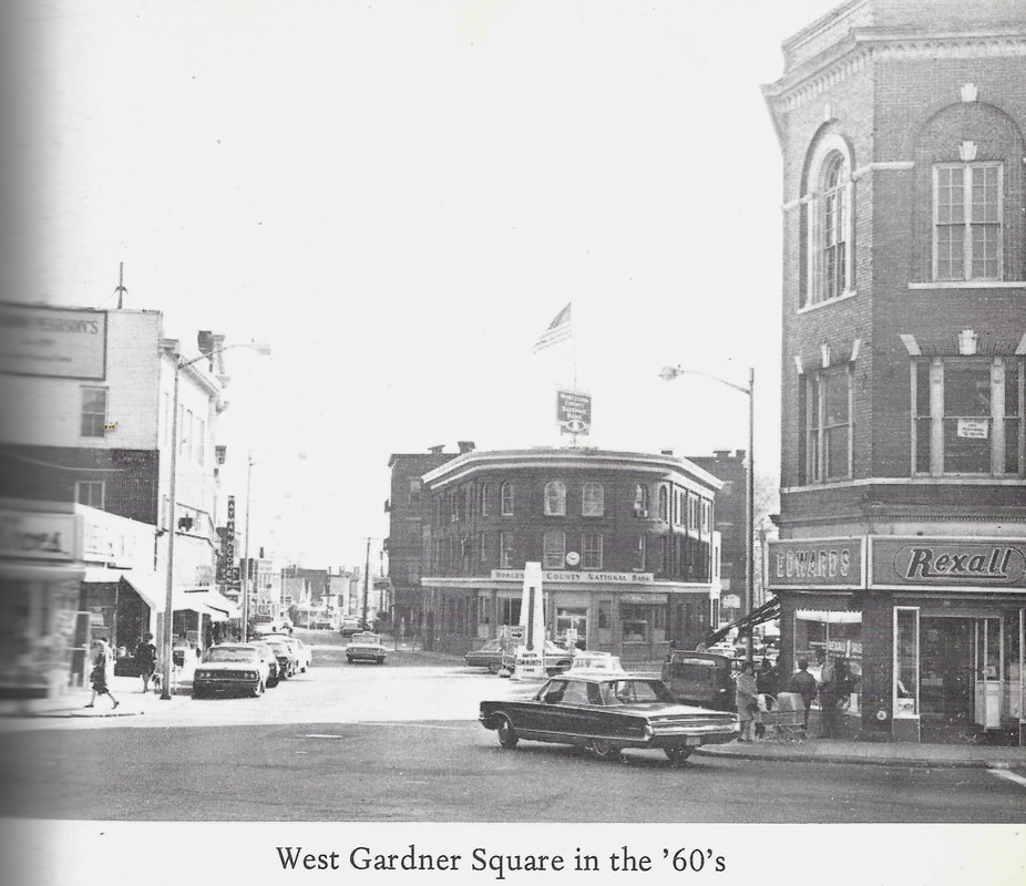
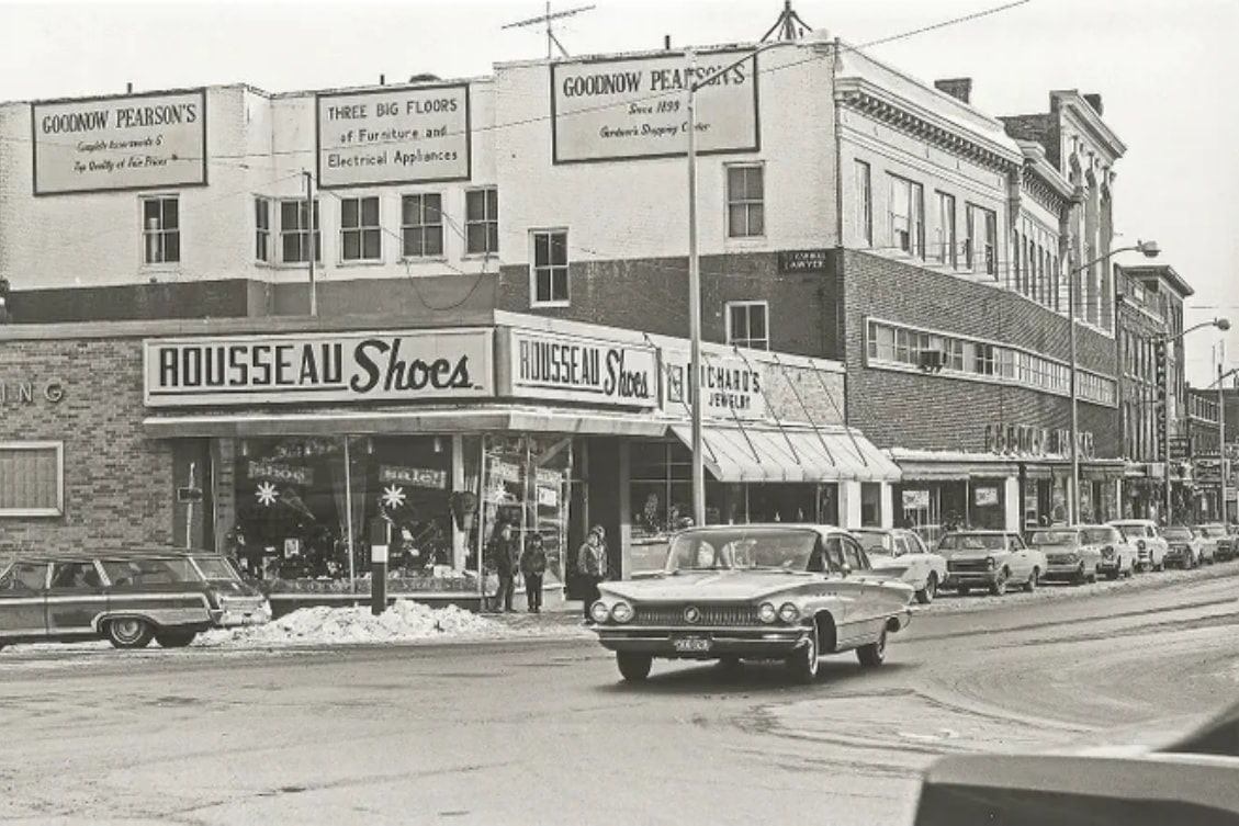
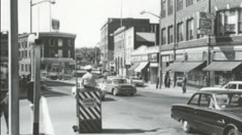
These views look south toward the intersection of of Main (veering to the left) and Pleasant Streets (veering to the right). West Lynde Street branches off to the left and Parker Street to the right. In the first two from the 1870s (ref. 24) and 1895 you see that the curved building, Rosenberg's Block, has not yet been built. In its place is a store owned by Frank Conant (1835-1888) whose business was there from at least 1870 until 1888 when he passed away. The curved building was known as Rosenberg's Block from c1913 to c1920. Abraham Rosenberg (1866-1941) himself "removed to Fitchburg" by 1923. In the 1870s view the Hagar Block has also not been built yet. The third image is from 1907. The next three are undated. The seventh is also undated but has the Garbose redesign. Images 7a and 7b (ref. 27), undated, are probably from the 1910s and 1930s, respectively. Note you can now see the Post Office Block behind the curved red building. The eighth one is from 1935 (ref. 24) and the ninth from the 1960s. The "modern" picture showing Rousseau Shoes and Richard's Jewelry is from 1965 (ref. 19). Rousseau's is now Priscilla's Candy Shop. The view to the right is looking south down Main Street. The final picture is a street shot from in front of Priscilla's looking down Pleasant Street. The large building in the middle is the Colonial Hotel/Apartments. It is also from 1965 (ref. 19).
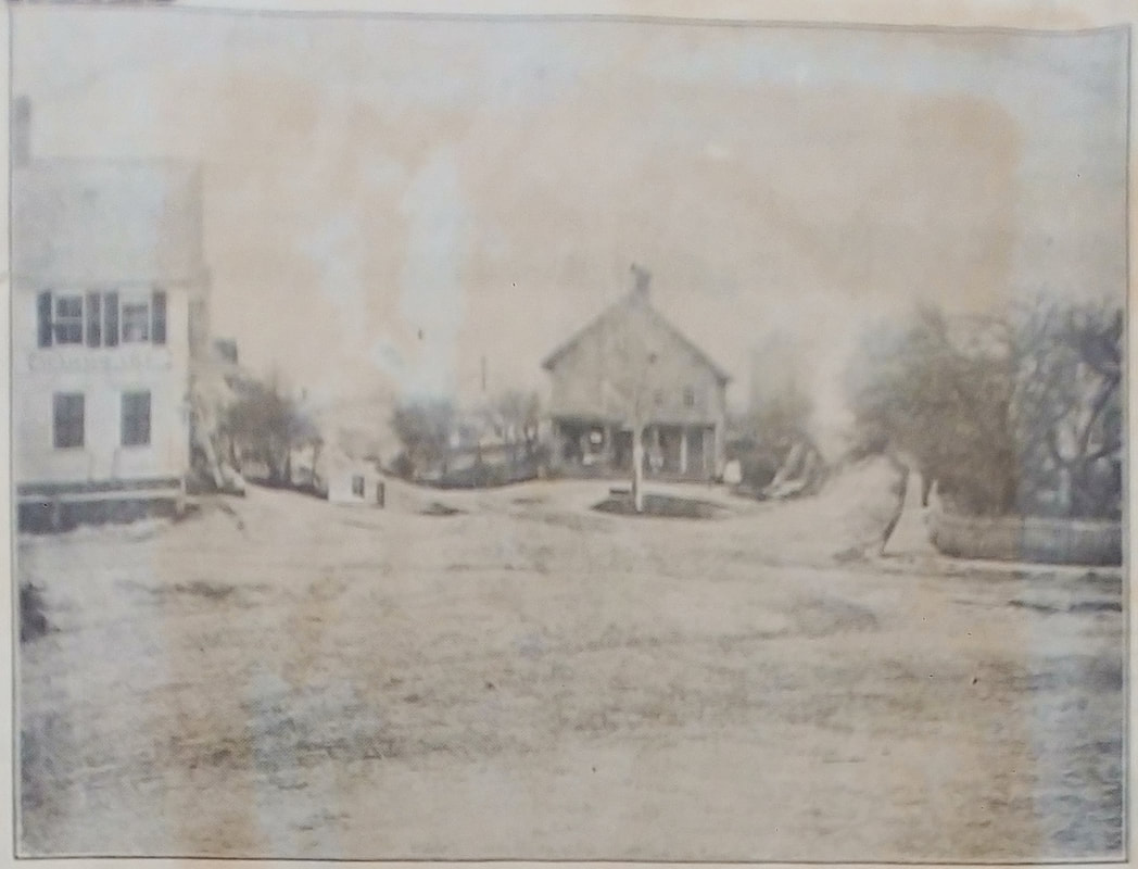 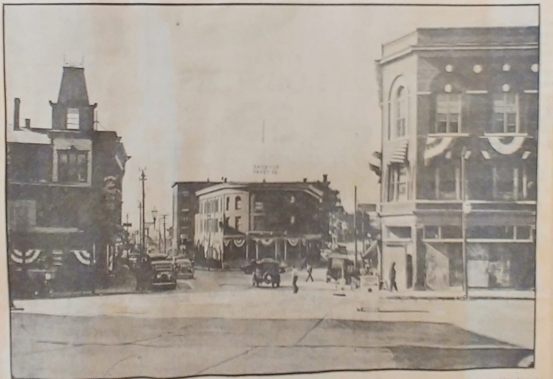 |
For the sesquicentennial celebration for Gardner the local newspaper did a comparison between the 1870's image (left) and what the same spot looked like in 1935. The caption to the comparison was the following:
These pictures, taken from very nearly the same spot more than 50 years apart, are of particular interest during the City's Sesqui-Centennial observance.
The upper photo shows the general store of Frank Conant, now replaced by the Gardner Trust Company Building. Mr Conant's store was famous in the section and drew patrons not only from Gardner but from surrounding towns. He was the father of Mrs. Don C. Gates of 37 Elm street.
On the left is the J. Walter Davis hardware store and the white picket fence opposite enclosed the Jackson home which was to give way to the Garland, now Garbose block. Hagar & Houghton's store is in the Davis hardware location.
There are older photos of West Gardner than the one at the top but it was selected to show the great change, indicative of a healthy, growing community that has been effected through the years.
 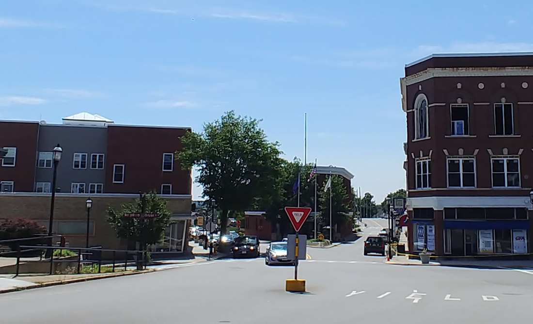 |
West Gardner Square - Looking south - A lot has changed over the years. One thing that hasn't is that the intersection is a bit of a nightmare to negotiate.
 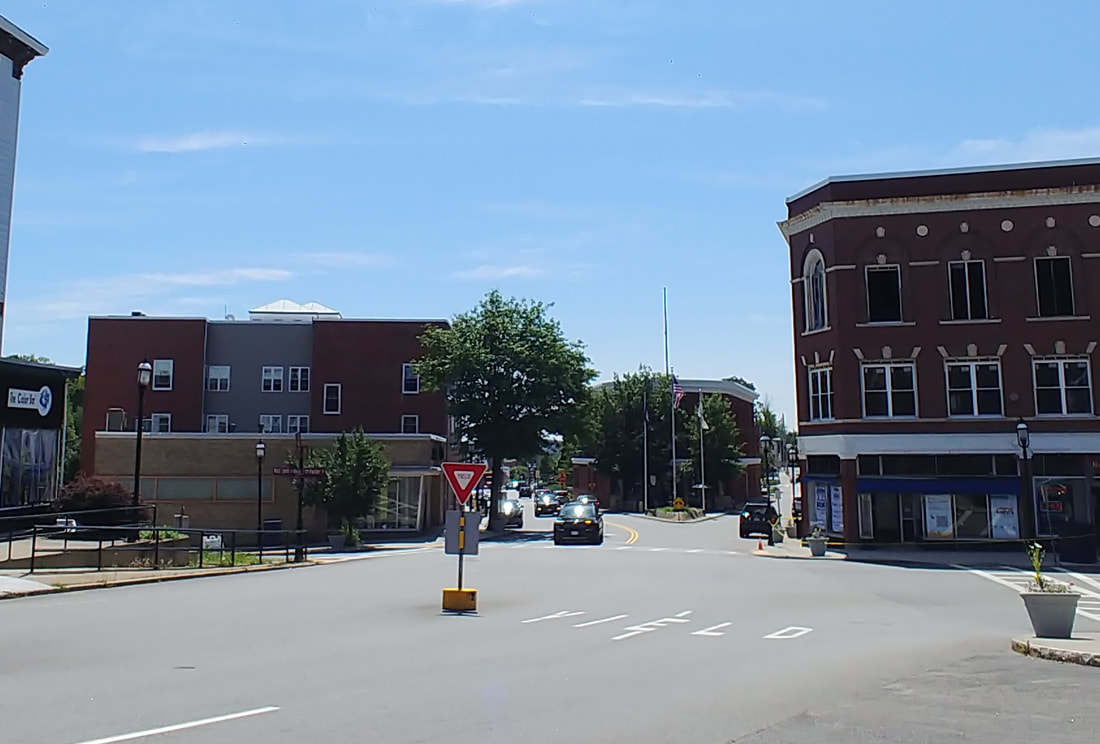 |
West Gardner Square - Looking south - This shows the later version of the Garbose Building on the right. Rosenberg's Block in the middle remains.
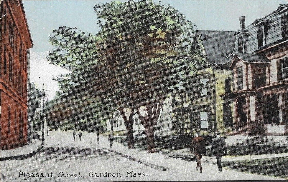 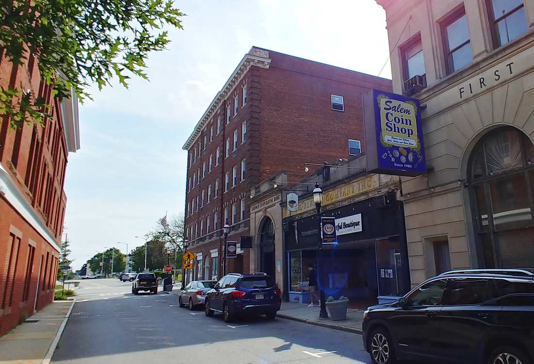 |
Pleasant Street - I was unable to pinpoint the location of this postcard on my own but one of the references had the same picture and identified it. It said that Rosenberg's Block was on the left and it was dated to c1900. This view is looking south down Pleasant before City Hall Avenue was constructed so there is no road crossing about where the couple is walking down the street. The building on the left does still exist. It's the curved one at the intersection of Main and Pleasant. The houses to the right were all eventually demolished, likely 1920-1923, to make way for the City Hall (1940), Colonial Hotel (1924), Gardner Cooperative Bank (1927), J C Penney (1925), and First National Bank (1924).
|
|
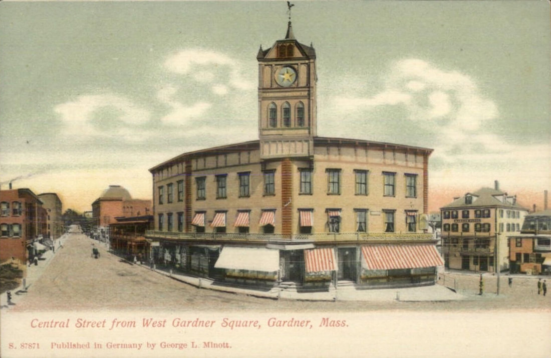 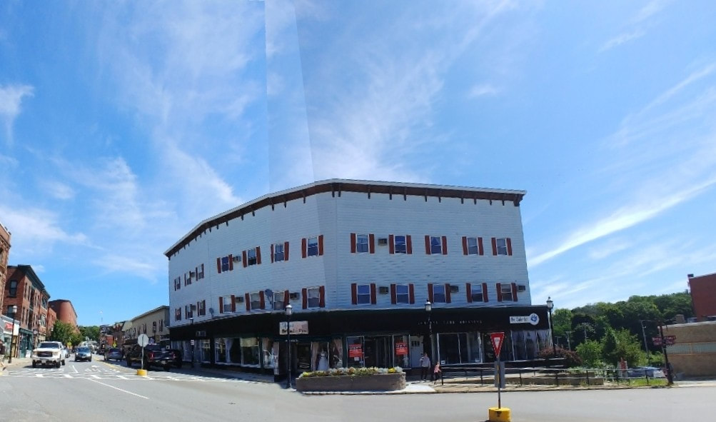 |
Central Street from West Gardner Square - Unknown Date - This picture appears to be an elevation shot taken from a building diagonally across the way. Note the clock tower. It was removed in 1909. The modern version has been significantly altered but retains the same basic shape. Originally known as the Stevens Block, today is is called the Central Park Building and it sits on the corner of Central (left) and West Lynde Streets. It was originally built in 1872 as a hotel but it was located behind Glazier's Hill on the road from Ashburnham to Winchendon (presumably Route 140). As Glazier Hill is not near any road between those two towns I suppose it's possible the reference got the hill name wrong. It was later moved to The Square. Image 1 below is from 1885 (ref. 29), has no tower, and says the building was put there in 1880. So it appears the tower came later. Image 2 below is what it looked like prior to a fire in 1890 - the picture is displayed in the library's Local History Room. The undated photo 3 (rev. 29) shows the West Lynde side of the building. Image 4 (ref. 27) is an interesting postcard that shows two versions of the Steven's Block from 1876 and 1905. One can only assume that the first place in the postcard is what was there before and image 1 mentions that there was a store there for 35 years prior.
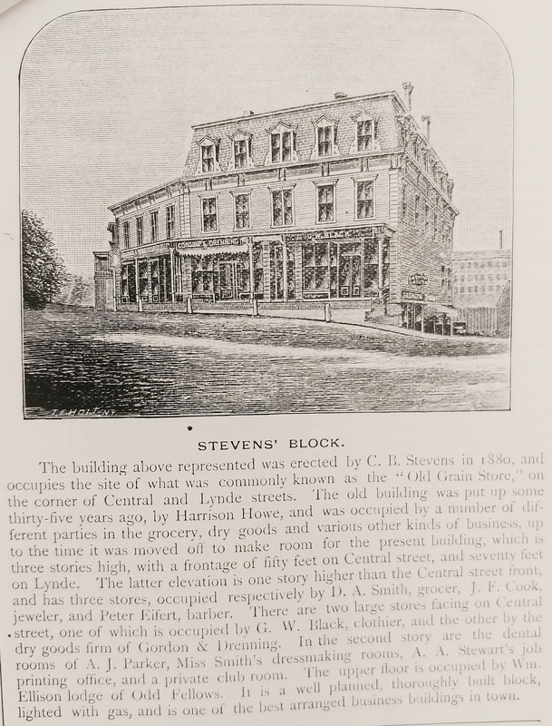
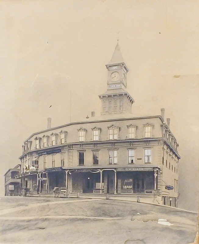
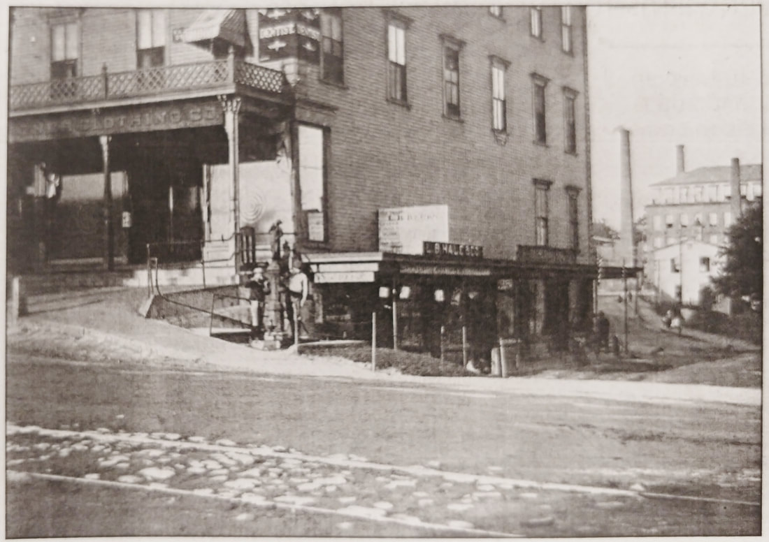

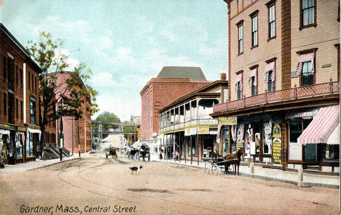 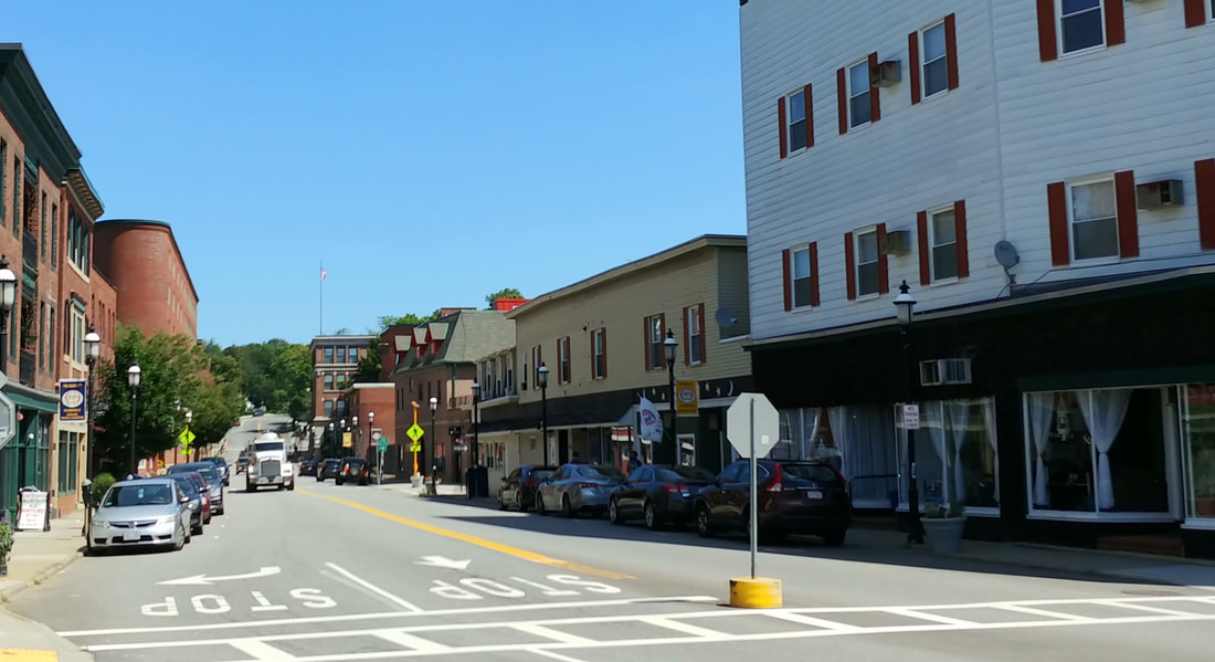 |
Central Street - Looking north - Unknown Date - On the right you see the Central Park Building and in the distance on the left is the triangular Heywood Factory building. It appears that the remaining three buildings on the left still exist. The building adjacent to the Central Park Building looks to be still there but it no longer has the second story porch. The big red building on the right, the Gardner Music Hall, is now gone and appears to be replaced by the Montachusetts Veteran Outreach Center facility. The undated photo below shows a similar view of Central Street (ref. 24). By what's in the picture (and not) I estimate this to be from 1889-1895.
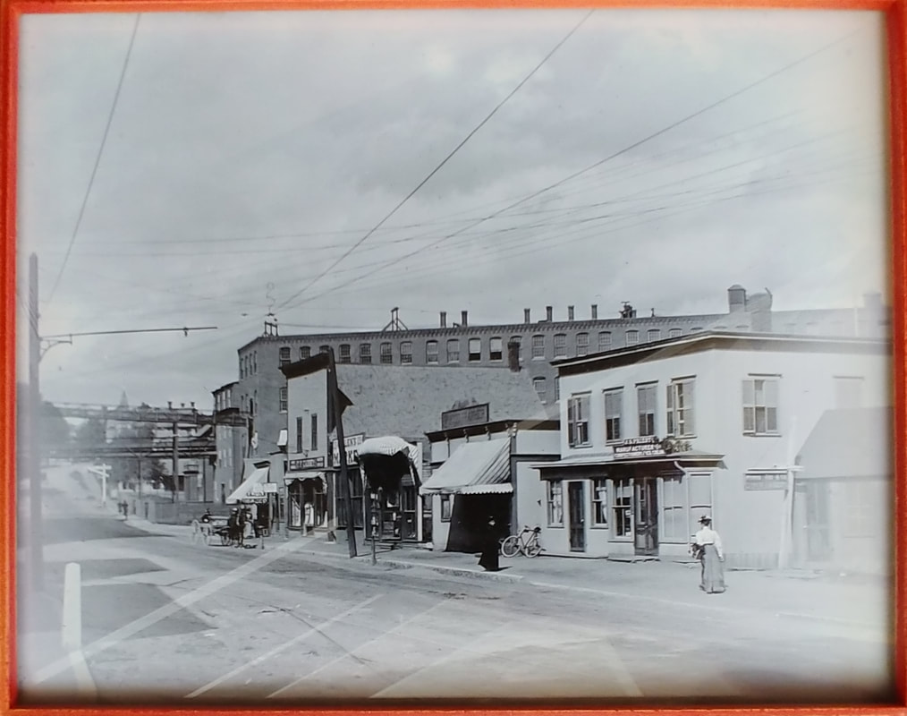
|
|

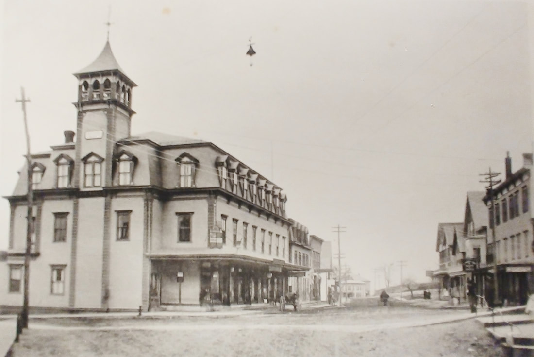
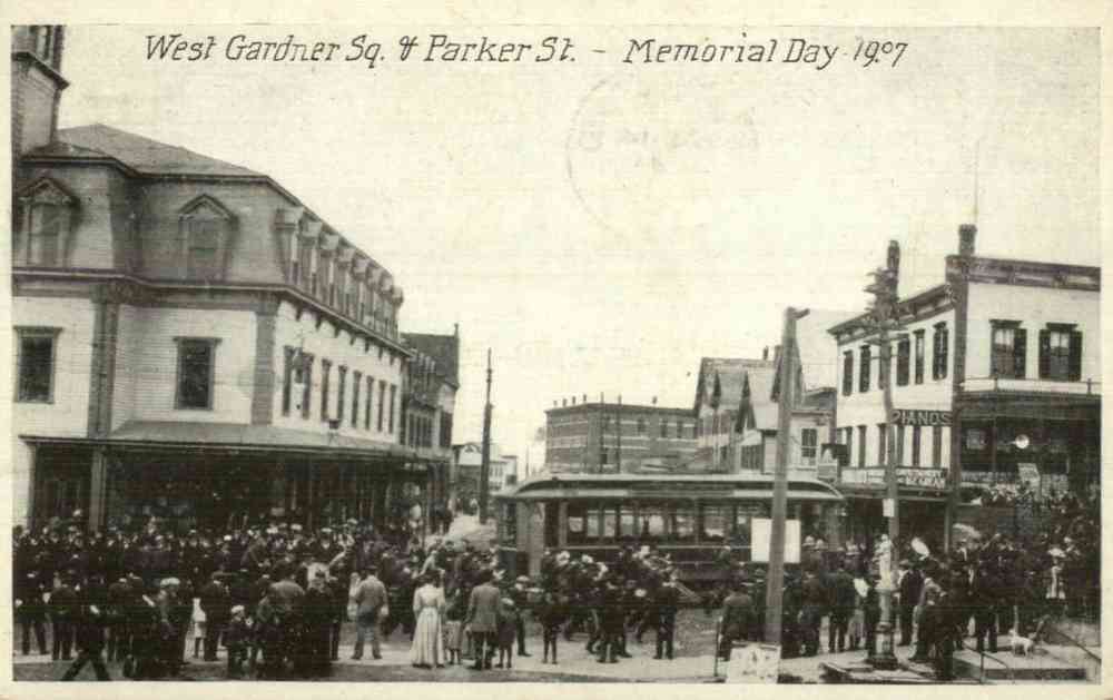
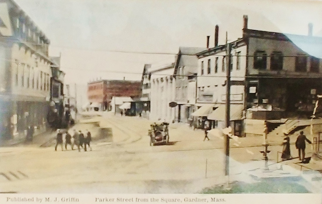

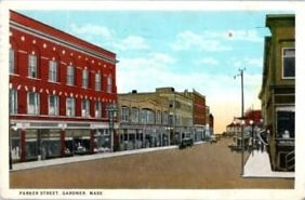
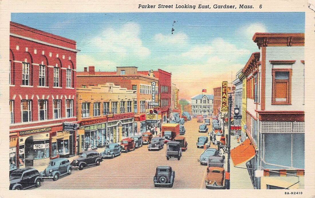
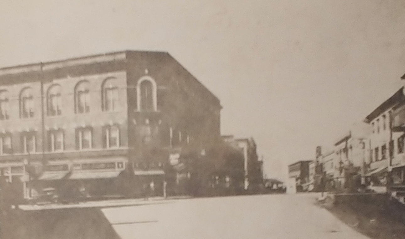
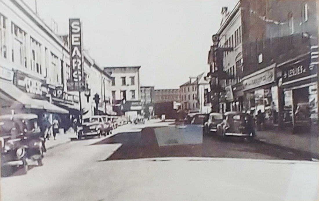
There are no dates associated with any of the Parker Street views except the first three which are from 1895, 1899 (ref. 22, page 3), and May 30, 1907. The first nine are from the square looking west. Image 2a (ref. 27) is undated but clearly belongs with the first three. By the cars we can guess that image 3 is from the 1920s and 5 and 5a are from the 1940s. Sears was there by 1938. Number 6 is probably the 1950s. The next two are looking east toward the square with the one with cars from the 1920s. The ninth and tenth are a little further west and show both sides of the street. The tenth one is from the 1940s. The eleventh one is from even further west on Parker, maybe taken from Oak Street in the 1940s and probably from an upper level of the Commercial Hotel (the one at the end of the street seen in picture 3). The last one apparently posed a mystery for newspaper readers to solve. The thought was that maybe this view was Parker Street.
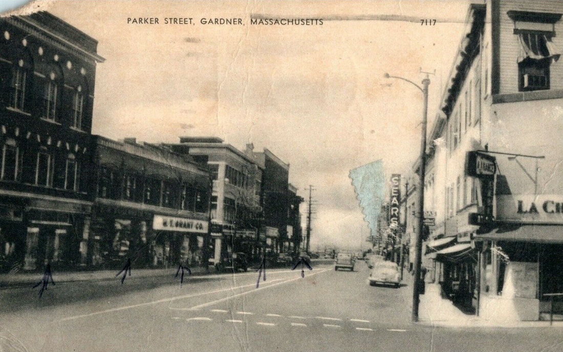 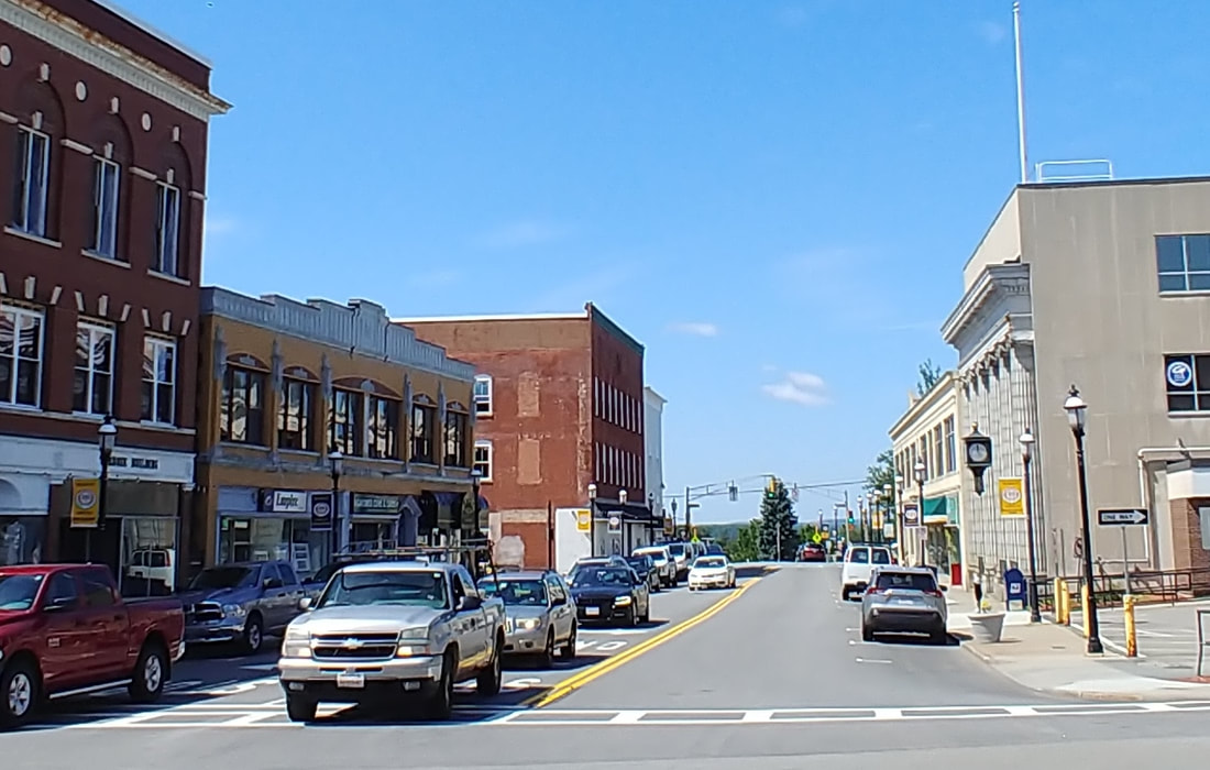 |
Parker Street - Looking west. The view is from in front of the Central Park Building. In the old photo you can see a Sears sign on the right side. The Garbose Building is the left-most one. The one next to the Garbose was Michelman's Block. There is a large "M" at the top-center. I took the picture below of the two buildings so you could see them better.
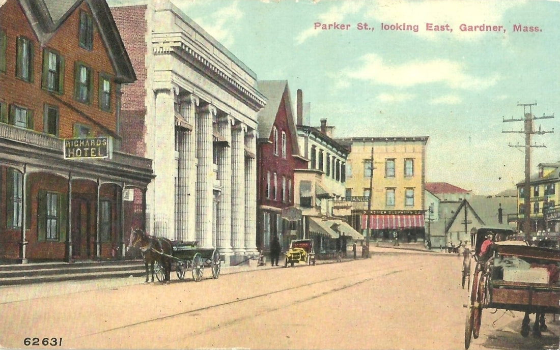 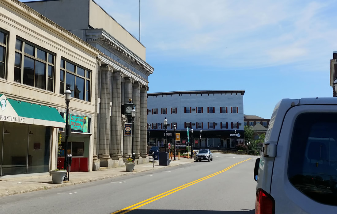 |
Parker Street - Looking east. You can see that Gardner Savings Bank (with columns) is the only building left today in this view of Parker Street. At the end of the street across the way is the Central Park Building (aka Stevens Block). It looks like one of the buildings to the right in the distance is still around.
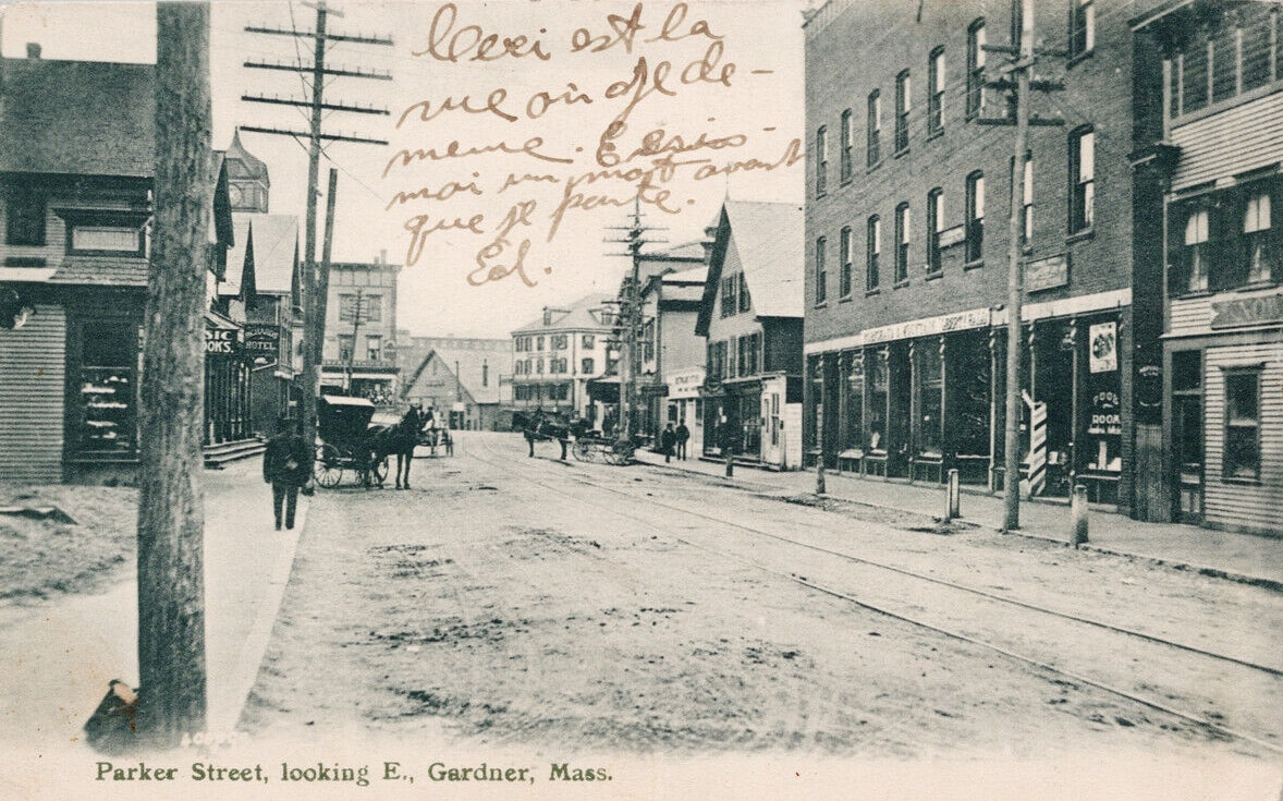 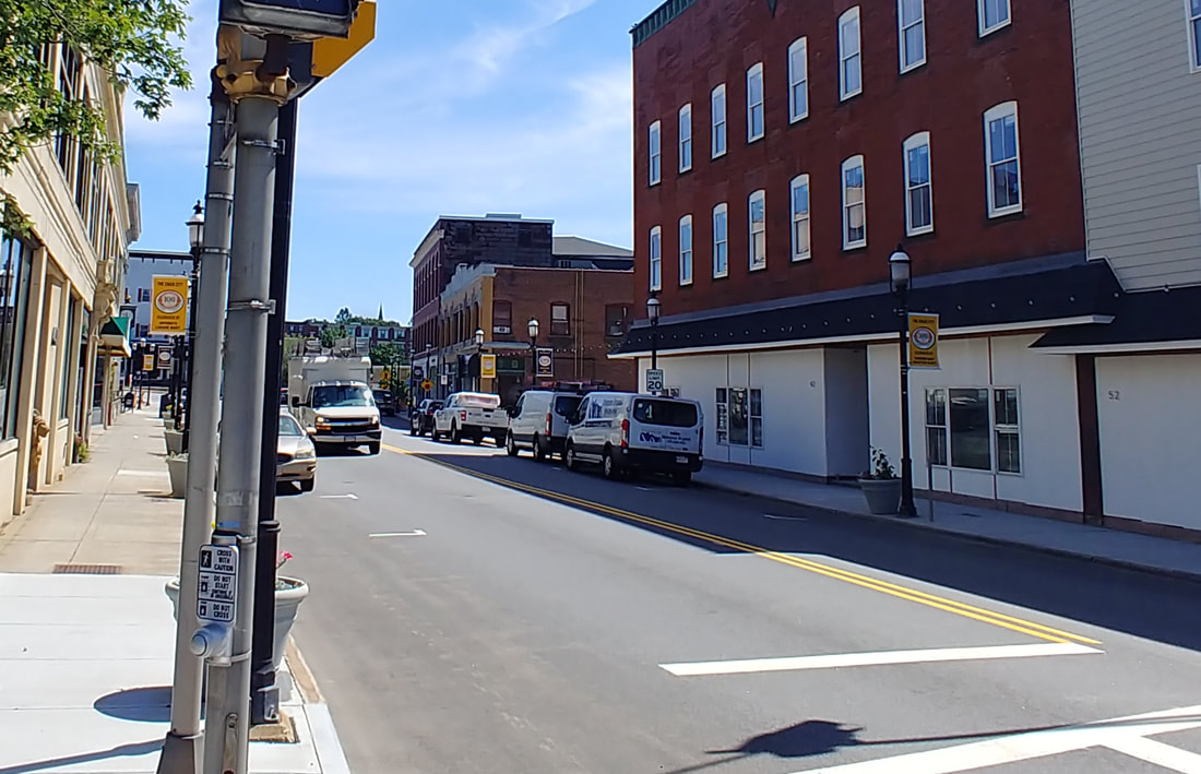 |
Parker Street - Looking east - This view is from the corner of Graham and Parker Streets. On the horizon you can see a horizontal strip of windows which is the top floor of the Heywood Brother's Factory and which is now Heywood Wakefield Commons. The whole left side of the street looks very different. The two buildings on the right are still around but much of the rest on the right side is different today.
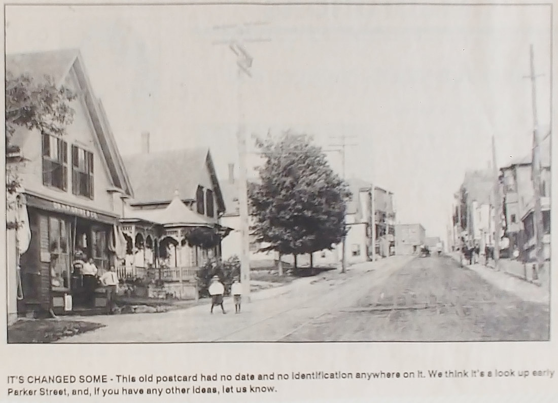  |
Now the mystery photo. I feel that the Googlemaps on the right view shows the basic position and direction of the old photo. The street branching to the right in the lower right is Greenwood Street and we are looking up the hill east up Parker. Note that the road curves slightly to the right and you can see buildings on the horizon. Past the yellow building is the Shell station and on the horizon is the long building at 33-47 Central that used to have a Sears in it. The building goes from The Gardner Savings Bank Building to about Graham Street. On the other side of Graham Street is a parking lot. A long time ago, however, there was a red brick building on that empty lot which was there by at least 1907 but likely earlier.
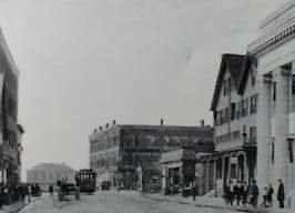
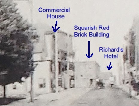
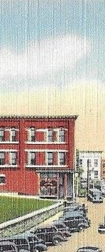
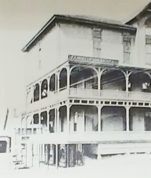
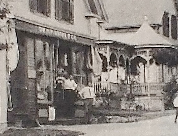
The first picture is looking west from the Square. See the tall, squarish building? Also note the Commercial House peaking at us from the horizon and the Richard's Hotel next to the Gardner Savings Bank. This picture is from Images of America Gardner on page 55. Now flip back to the original old image. I have blown up a section (second image) where I believe we are looking at, from left to right, the back of the Commercial House, the squarish building, and the Richard's Hotel. The third image shows the squarish building as it would appear from this side too (it gives us color and it is likely brick). This building existed at least by 1907 and was soon after referred to as Rome's Block. See how it compares to the squarish one in the second image?
The Commercial House was built where the Shell Station and its parking lot are today. You can see in the fourth picture (from a Gardner Museum display) that although the Commercial House appears to have three levels from the front, the ground slopes down to reveal another level below. Also note the gradual sloping roof and the single window on the top floor on the left side. It looks to me in the closeup of the second image that the building I have marked as the Commercial House has three lower levels, a gradually slanting roof, and an uppermost level with a single window. So, this is why I think the mystery photo is looking east up Parker.
The final picture is a blowup of the building on the left with wording above the store. It's a bit fuzzy but is say Dr. H P Grise & Co. Doctor Herman P Grise had the People's Drug Store at 221-223 Parker Street with his house at 217 Parker. It was there by c1896. Prior to this he was on the other side of the street at 224 Parker Street. His store was at 221-223 until at least 1900. I have to look into this more but we can at least say the picture is from 1886 to 1907.
|
|
Parker Street Throughout The Years - 1870 to 1932
|
|
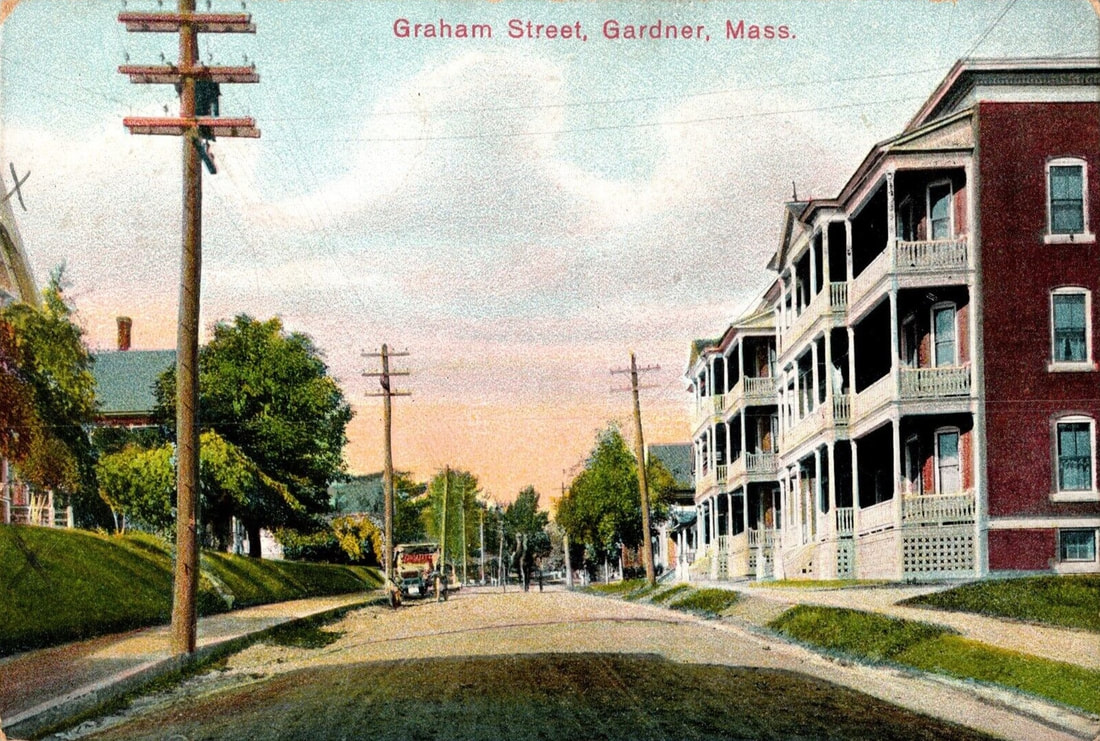 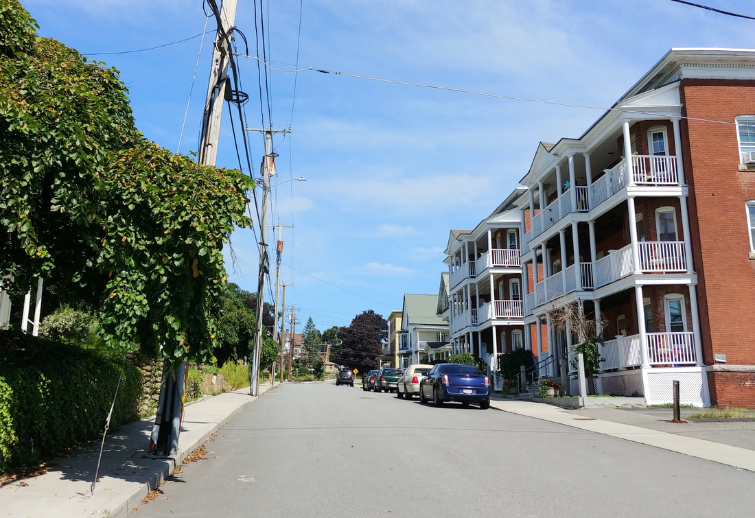 |
Graham Street - Looking north - Unknown Date - The two identical buildings on the right barely look any different in 2023. The first two telephone poles look like they're in the same spot. The picture below is an alternate view of the apartments from 1978 (ref. 2, page 64) .
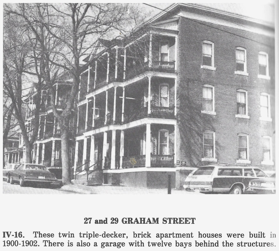

|
I didn't attempt to look at all of the historical houses of Gardner but picked the ones relevant to my project. I urge you to check out Gardner/A Portrait of Its Past (ref. 2) at the library done by the Gardner Historical Commission for many more houses.
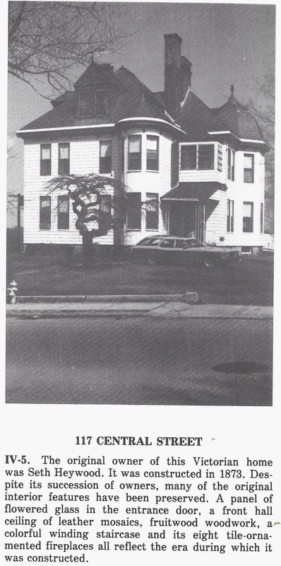
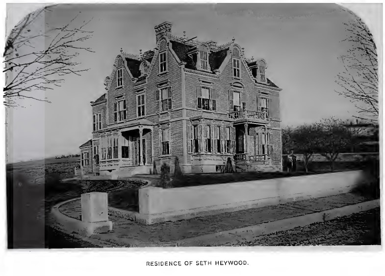
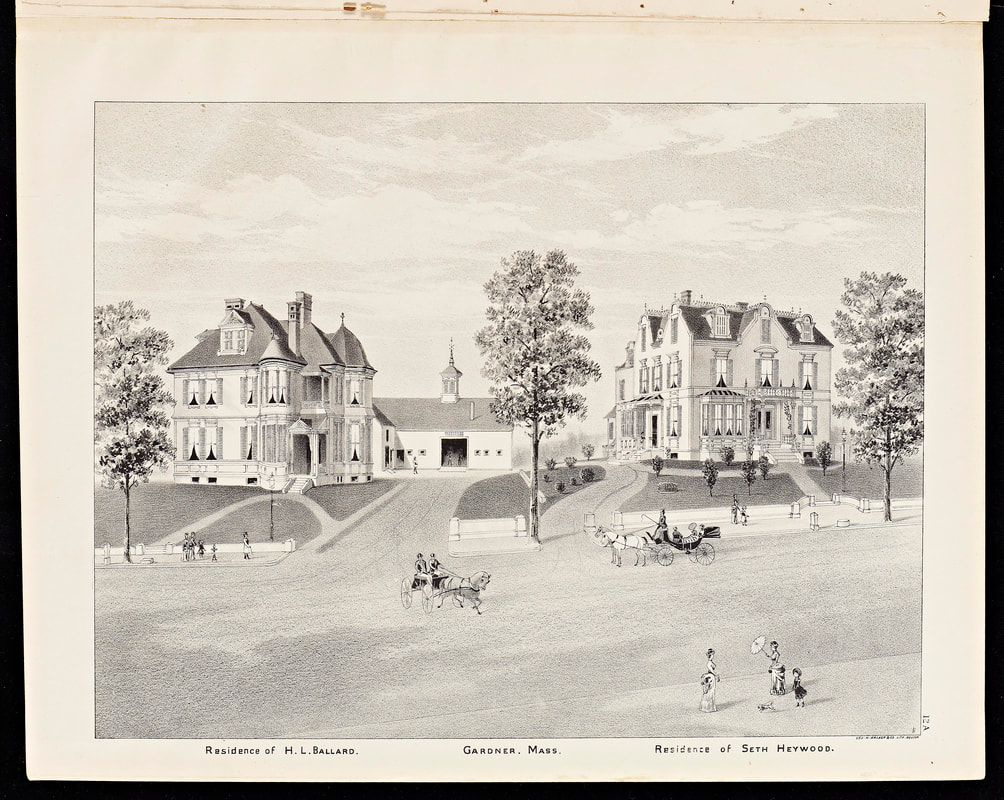
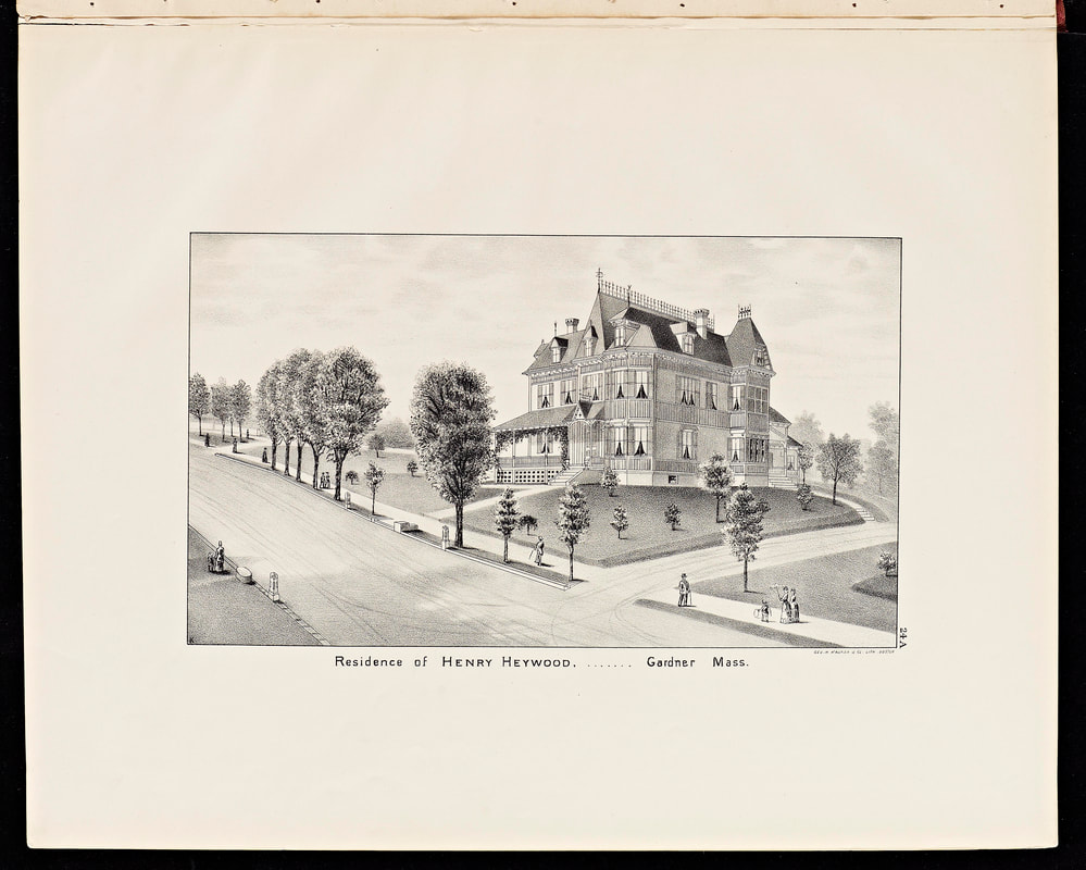
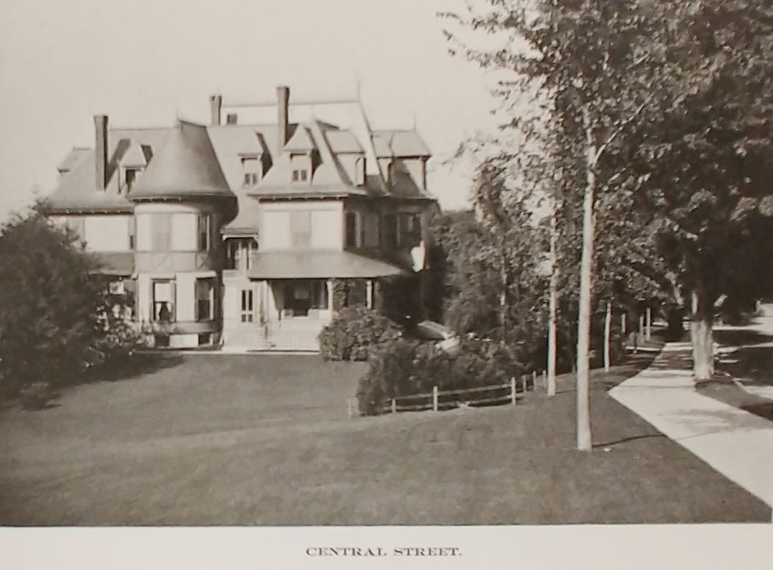
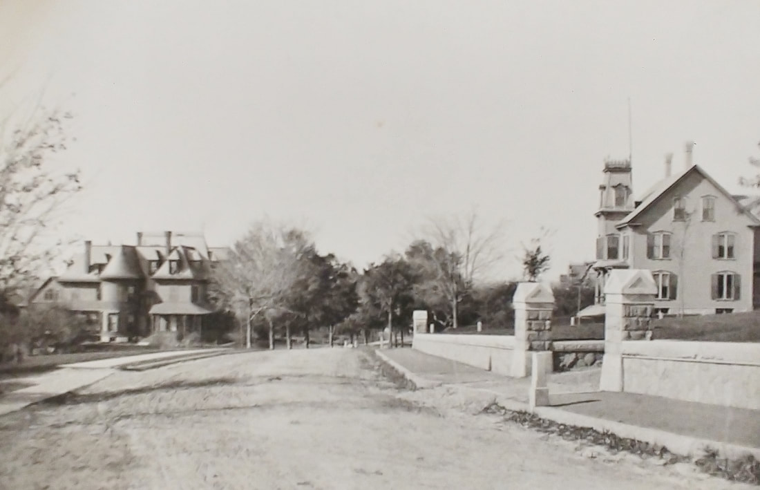
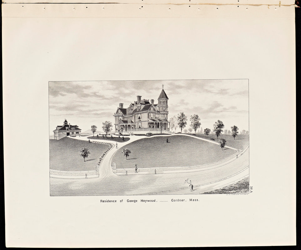
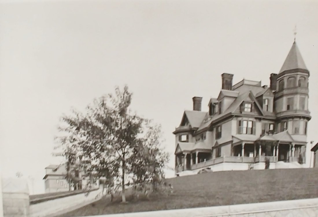
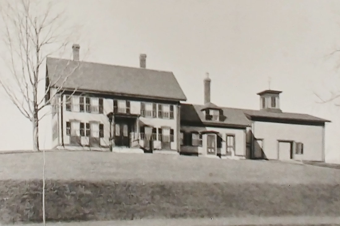
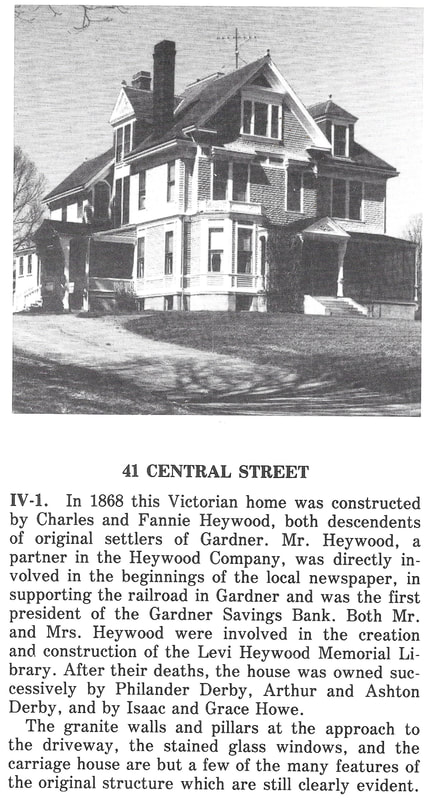
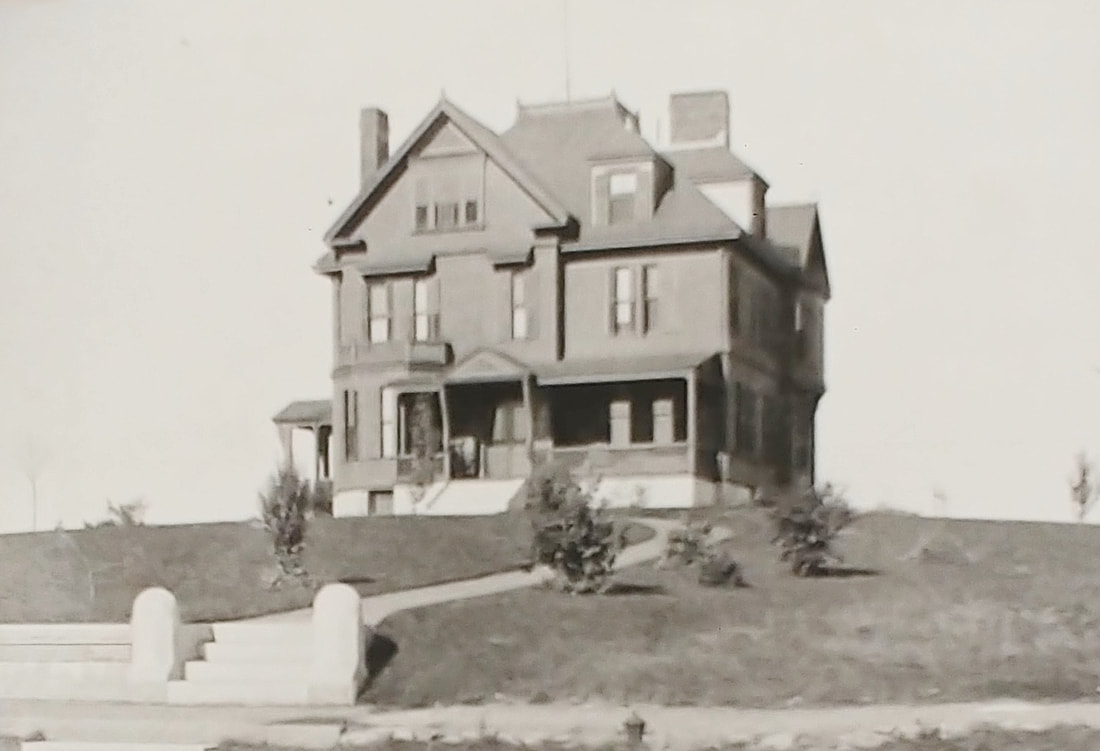
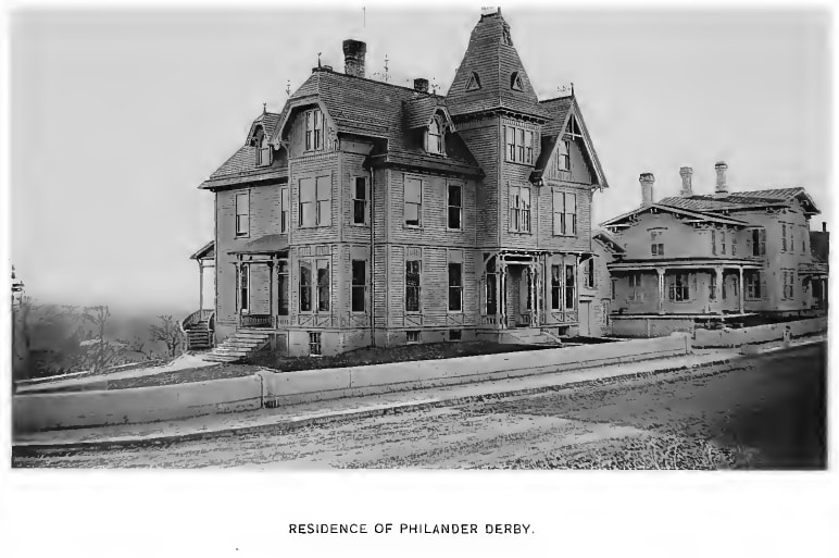
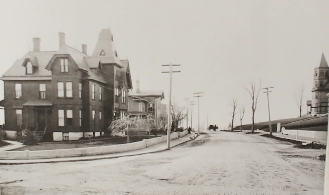
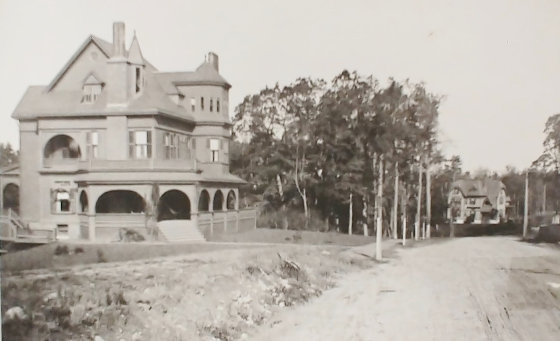
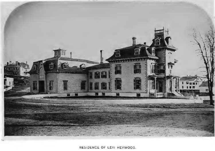
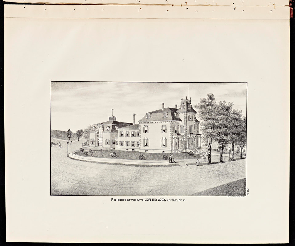
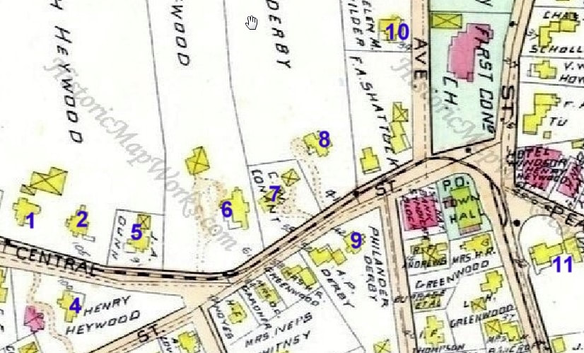
1898 map showing the location of the houses above.
|
1: H L Ballard & Seth Heywood - Seth's house at 117 Central Street, pictured above (image 1) in 1978 (ref. 2, page 58), was built in 1873 and is still around and being used/lived in by a dentist. Seth may have owned it but in 1886 Howard Livermore Ballard (1853-1922) occupied it while Seth lived in the next house. Figure 3 shows the two houses side by side.
2: Seth Heywood (1812-1904) - Seth's mansion pictured in the 1878 image (ref. 1) is no more. It once occupied the plot at 105 Central Street. The Mack Family Funeral Home occupies the lot although the wall out front remains.
3. H L Ballard & Seth Heywood - 1886 - (ref. 28)
4 & 4a. Henry Heywood (1836-1904) lived at 100 Central Street. The first picture is from 1886 (ref. 28). The second is from 1903 or prior (ref. 10). By the 1870 map it looks like Henry had a house on the same spot but the outline on the map seems too simple for it to have been the one above. The one above still exists today and it looks to be well maintained. Reference 2 has some history about the house on page 57.
5. J A Dunn - (ref. 22, page 18) - 91 Central Street. Empty lot is now there.
6 & 6a. George Heywood (1839-1905) - 1886 - (ref. 28) - This house at 61 Central seemed to exist in 1914 but may have been gone by 1932. It was probably built no earlier than 1880. The second picture is from 1889 (ref. 22, page 29).
7. Charles W Conant (1833-1910) - 1889 (ref. 22, page 26) - This house at 55 Central Street still exists with a few minor modifications. It seems to have been built by at least 1870.
8 & 8a. Charles Heywood (1831-1882) - Charles lived at 41 Central Street. The house was made in 1868 while the image shown is from 1978 (ref. 2, page 56). The house still exists but there is a phalanx of trees preventing one from getting a good look. The older picture of Charles' house is from 1889 (ref. 22, page 26).
9 & 9a. Philander Derby (1816-1902) - His house was once on the lot at 42 Central Street where the Masonic Lodge is now located. It appears on the 1878 and 1898 map as his house and it still seemed to be there in 1932. He also had a house at 52 Central Street and that appears to still be there. The second view, from 1889 (ref. 22, page 24), is taken from Chestnut and Central Streets. The house on the left was Philander Derby's and the sliver of house on the right is George Heywood's house.
10. The big house, shown in this 1889 (ref. 22, page 31) picture, was once owned by William Henry Wilder (1855-1913). It no longer exists and there is now an empty lot at 34 Woodland Ave across from the Congregational Church. It was there at least until 1932.
11 & 11a: Levi Heywood (1800-1882) - This house was located where the American Legion is now. The back third of the house still exists on Pine Street but the rest of the house was remodeled and rebuilt. The first image shown is from 1878 (ref. 1) but the house was built in 1864 or earlier. The second is from 1886 (ref. 28).
|
|

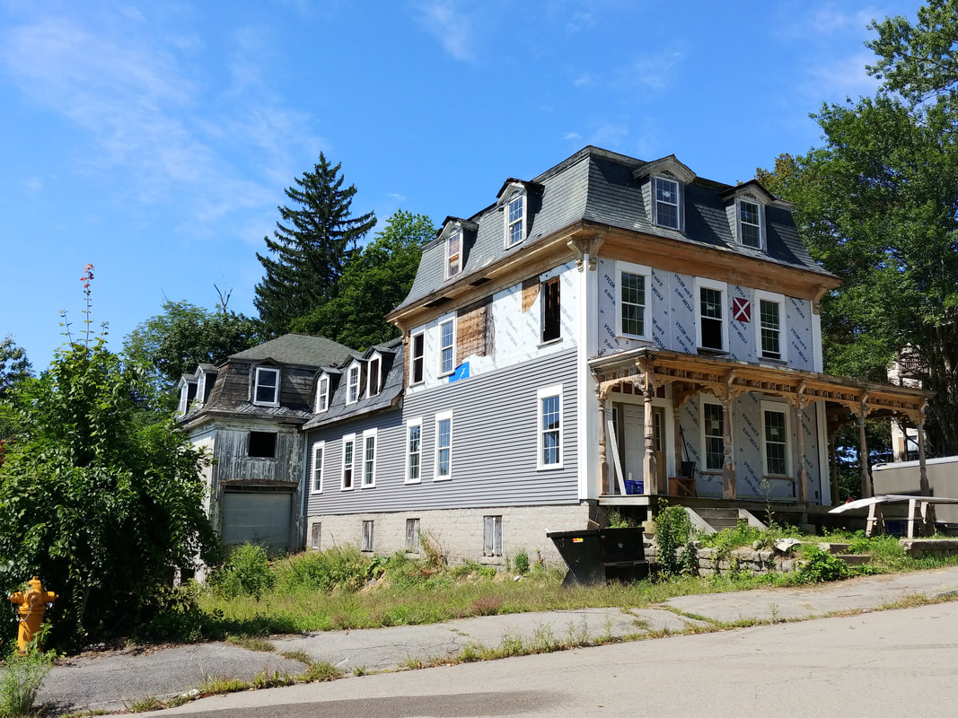
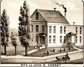
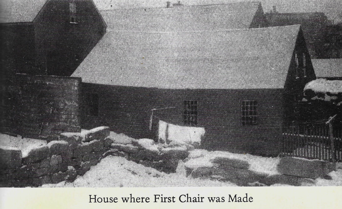

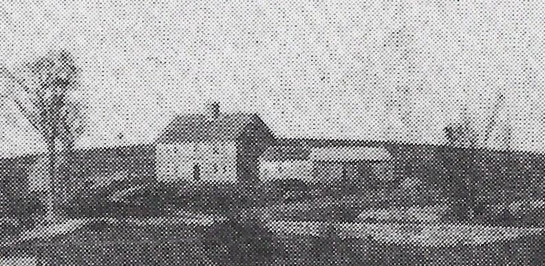
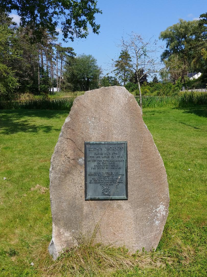
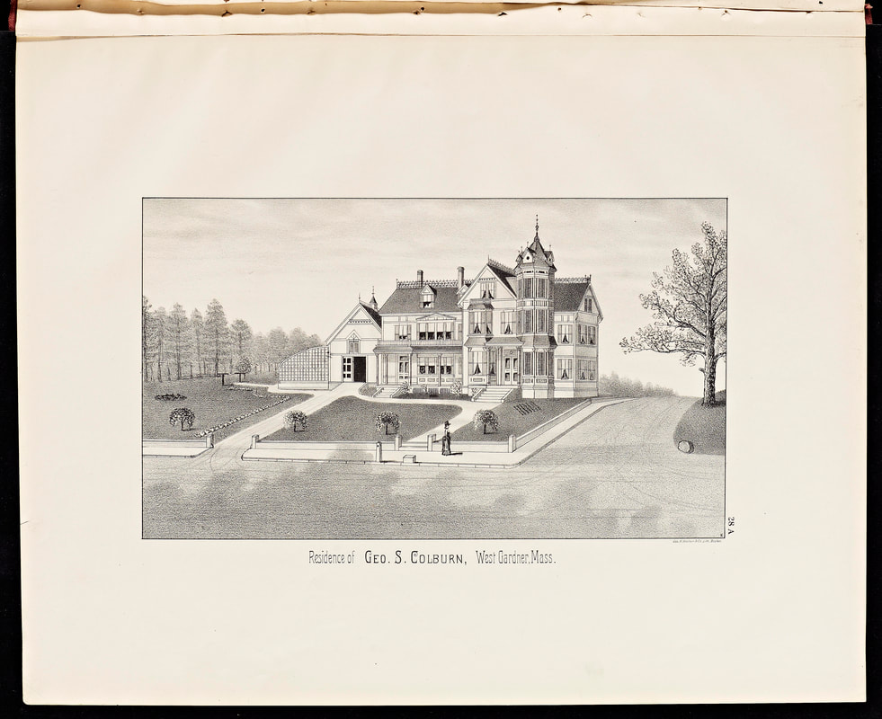
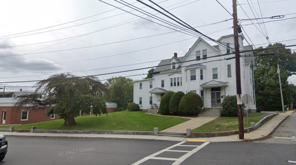
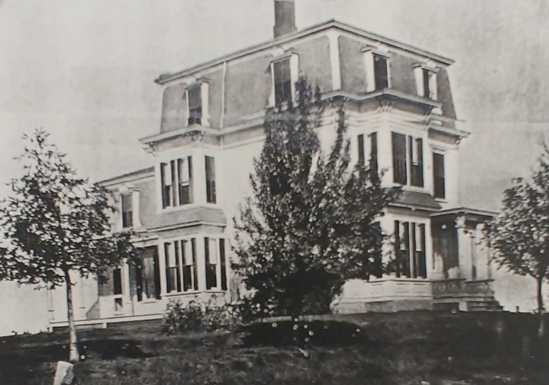
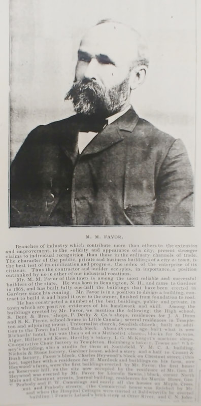
1 & 1a. House at 39 School Street - I just took the 2023 picture when I went to get the School Street School photo. It looked big and cool and seems like it might be slated for demolition so I "saved" it. It appears on the 1898 map as owned by G W Garland and by N. Garland on an 1870 map. It was built c1869. The people would be Guy W Garland (1844-1920) and his father Nathaniel Garland (c1816-1896). The earlier photo is from 1978 (ref. 2, page 51) .
2. John R Conant - This house was owned by John Risley Conant (1829-1891). His house seems to have been where Route 2 crosses the north side of West Broadway or at the current 566 Pleasant Street where a small house resides - the 1898 map indicates two house belonging to Mrs John R Conant. The house of the picture is likely gone.
3. House Where First Chair Was Made - According to Gardner lore, James Maltman Comee (1777-1832) manufactured his first chair in the house at 162 Pearl Street in 1805. The 1967 history (ref. 20) from which the photo was taken makes no mention that the house was ever replaced. Looking at the house at 162 Pearl today one could imagine the one in the photo is still part of that house.
4 & 4a & 4b. Elisha Jackson (1736-1814) - The drawn image (ref. 20) was drawn from a description give by Edward G Watkins so take that for what it's worth. However, the blowup of a bird's eye view, c1885, shows the Jackson house pretty much as described (The full photo can be seen in ref.2, page 84). At the top of Jackson Park there is a plaque where the house once stood (see ref. 2, page 83) .
5 & 5a. George S Colburn - 1886 - (ref. 28) - George Simeon Colburn (1820-1909) lived for about 20 years at 68 Graham Street. The house still exists with the front wall in tact but with only the right walkway still around byt not the driveway. It is probable that the second tree from the left is now a big one seen in today's photo (Googlemaps Screen capture). The street of the right is Richmond Street.
6 & 6a. M M Favor - Unknown date - (ref. 29) - This house is at 81 Peabody Street on the corner of Peabody and Favor Streets by at least 1886. It still exists today. The article about him tells you why Milton Moses Favor (1839-1913) was a big deal in Gardner.
|
|
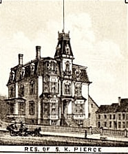
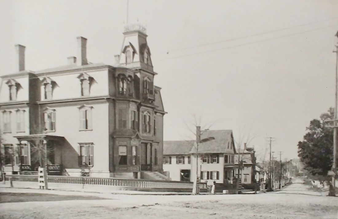
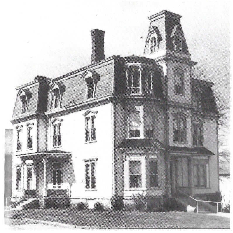
S K Pierce - The early photograph is from 1878 (ref. 1) and the drawing came from an 1880 map (see above). The third picture is from 1889 (ref. 22, page 6). The fourth image is from 1978 (see ref. 2, page 89).
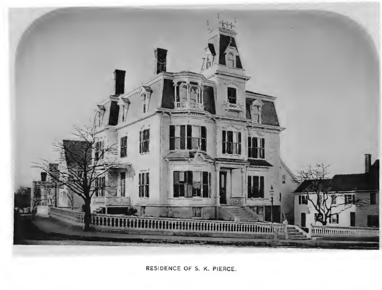 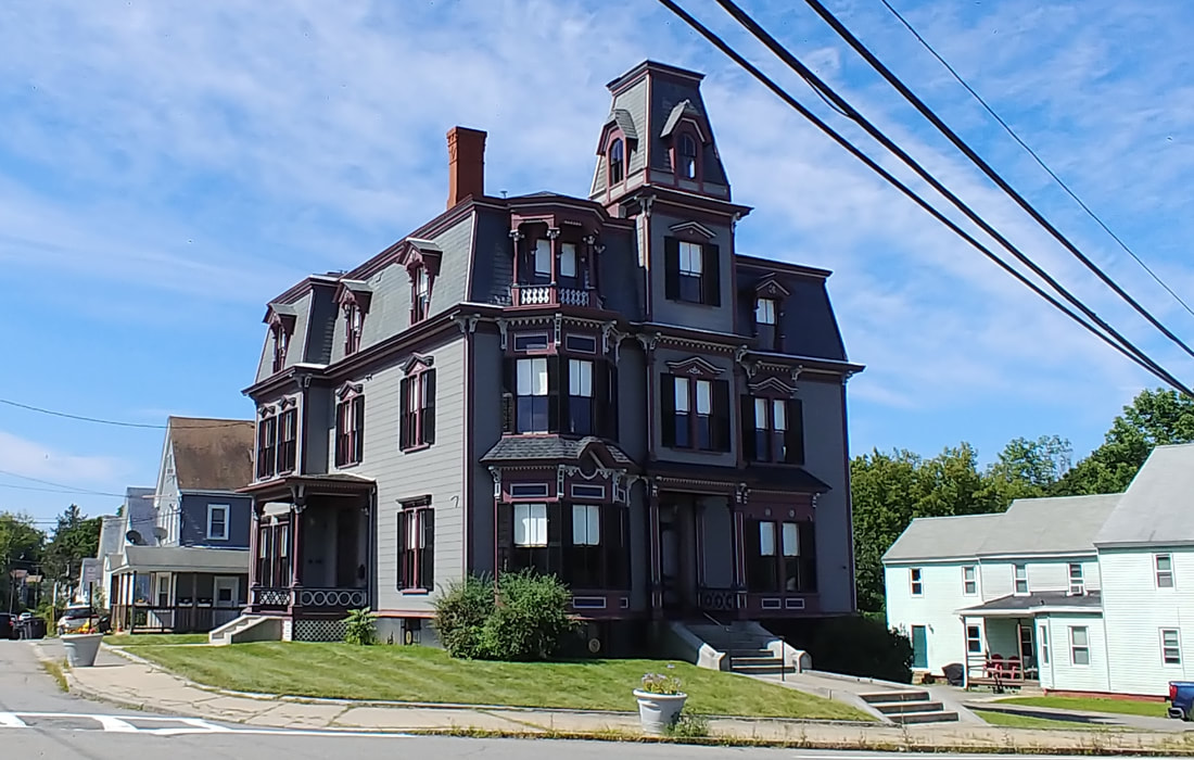 |
The famous "haunted" Victorian of Gardner still exists at 4 West Broadway. It was restored within the past 5 years or so to look very nice. Prior to that it was showing its age and looked, well, haunted. The view for the comparison photos is from in front of the Gardner Hotel. The S K Pierce has been shown on television, most notably on Ghost Hunters. Go to the S K Pierce house's website and the House Beautiful site for more information on its interesting history. Something nobody ever shows is the right side so I took the extra photo (below). Note in the second photo that the fence is now gone. What is not gone are the holes where the fence was anchored. Also, the lamppost seen in front of the house in the old photo was cut to be level with the ground. You'd have to zoom in on the third photo but you can see the round post nub in the grass, just next to where you see the rusty rail-post bracket.
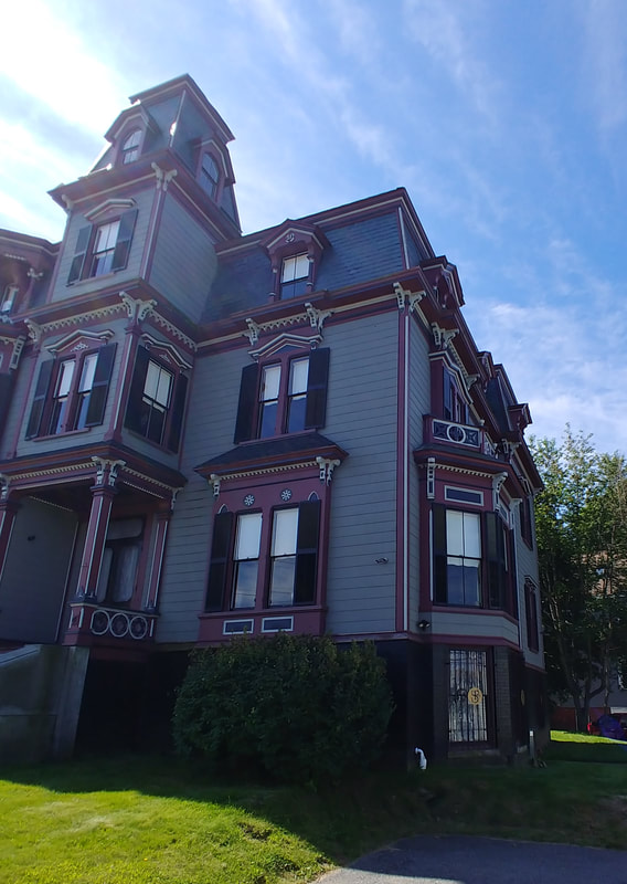

|
Let's face it. Duplicating these was going to be difficult so I only got one, kinda. Either they were taken from the air, an artist's take, or there are just too many trees nowadays to get a good picture. They are still cool and I had the pictures so I've included them here.
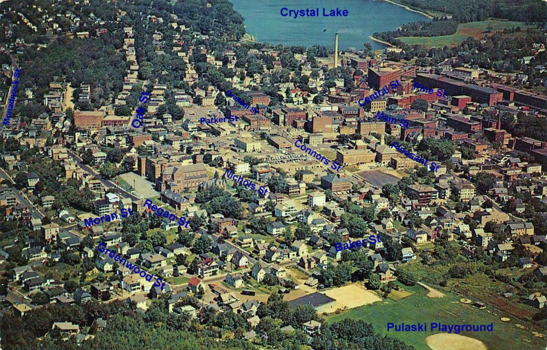
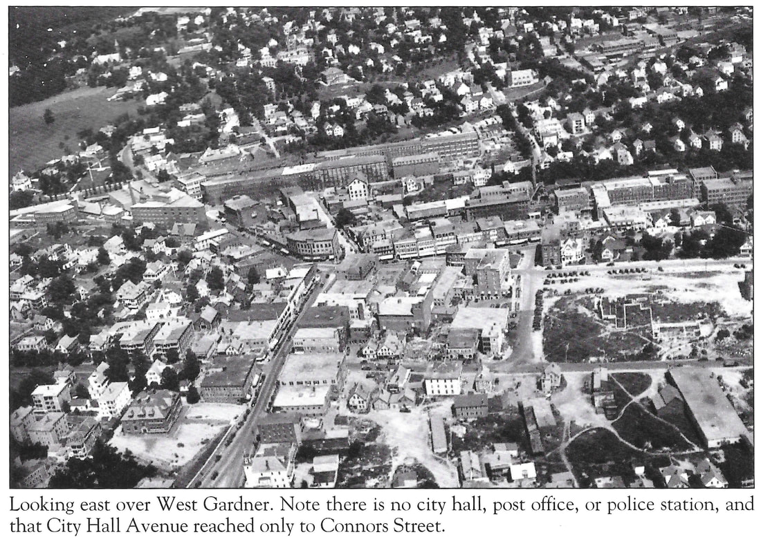
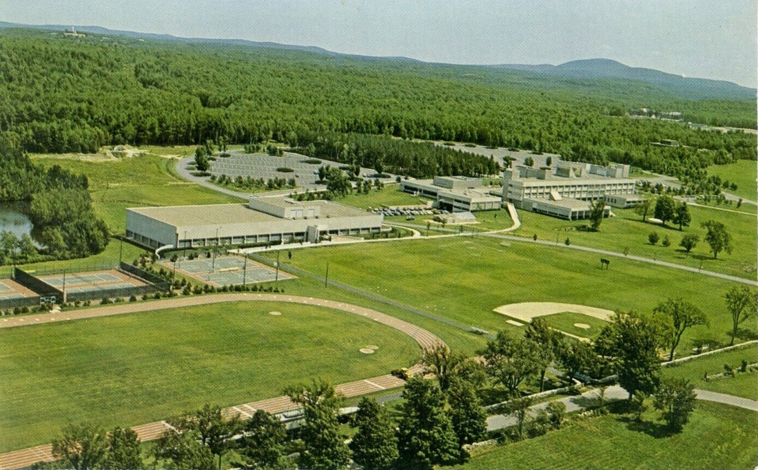
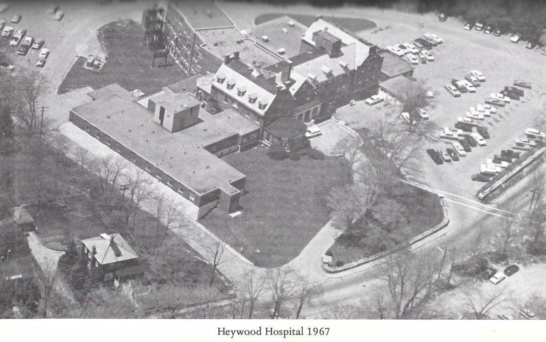
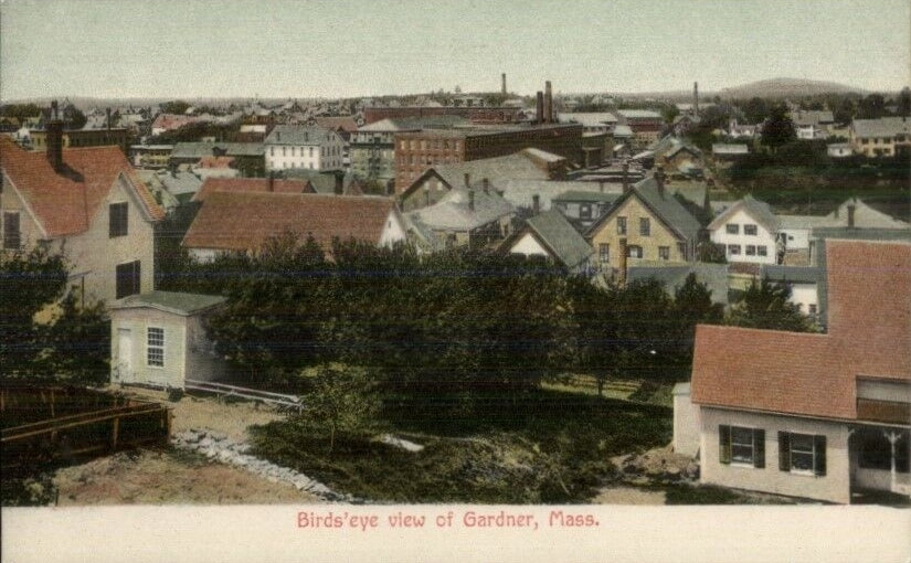
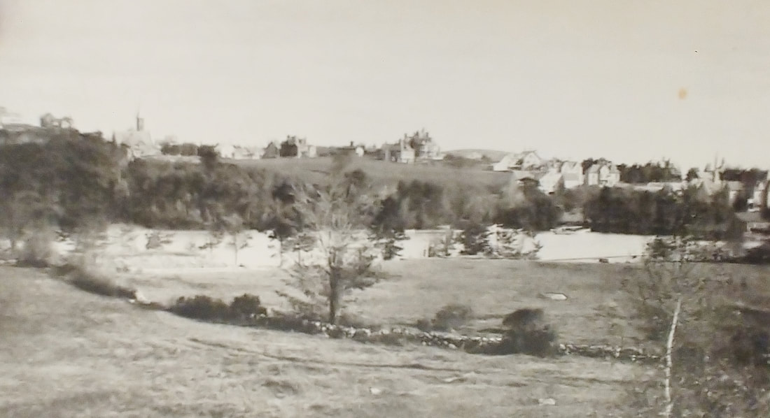
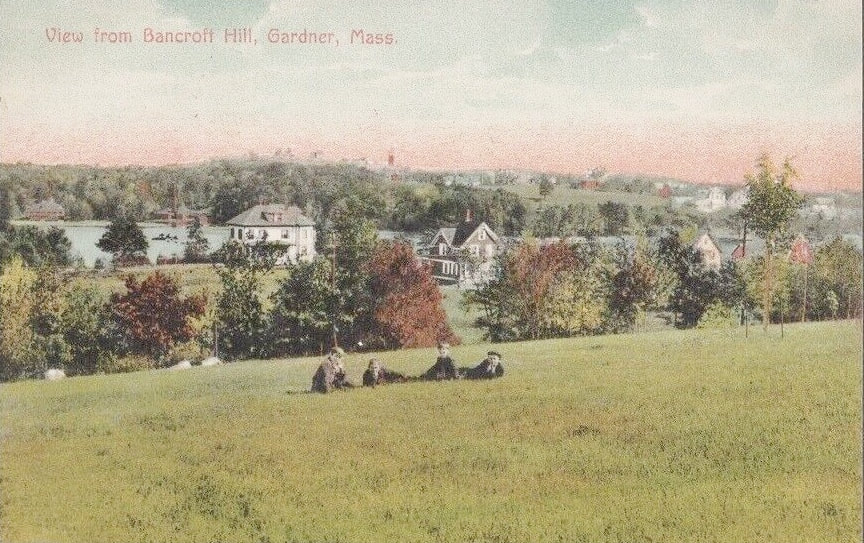
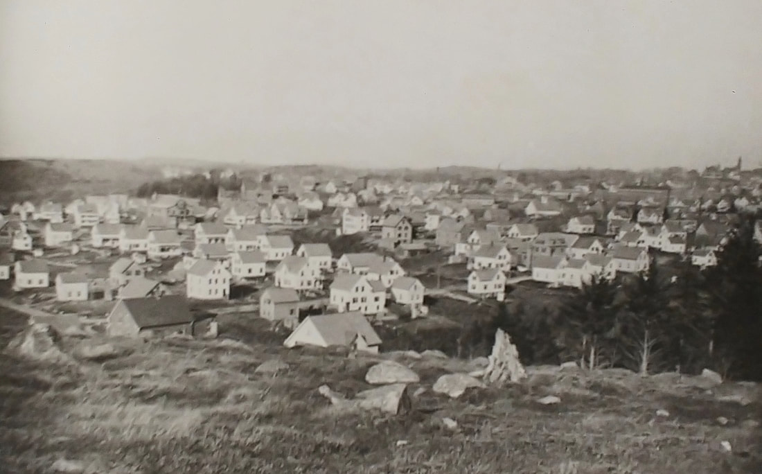
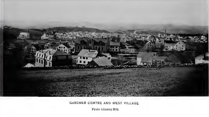
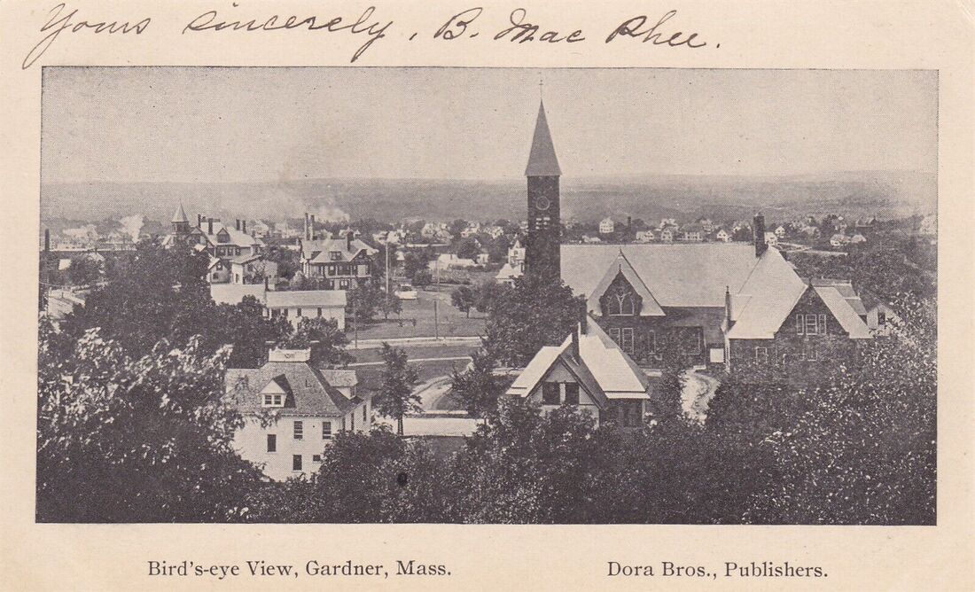
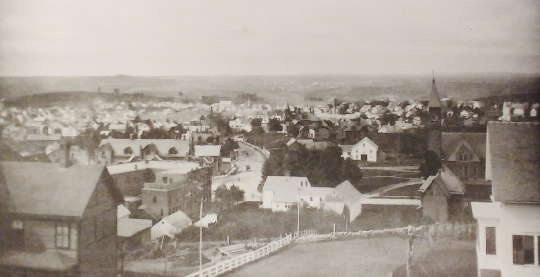
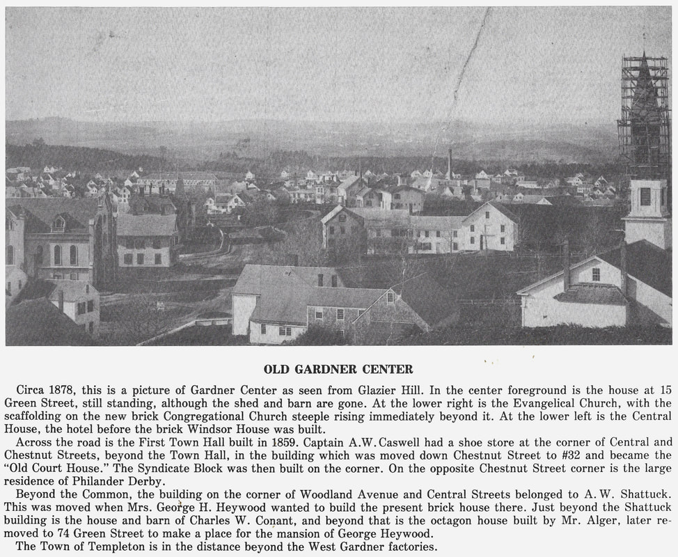
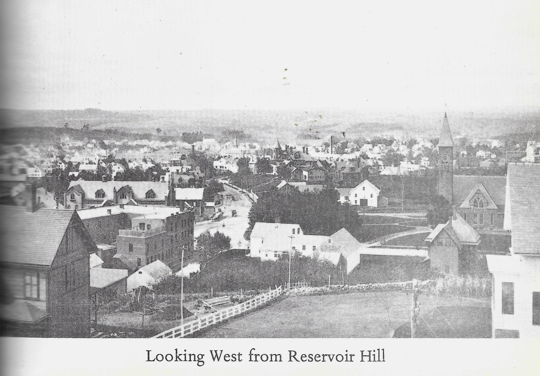
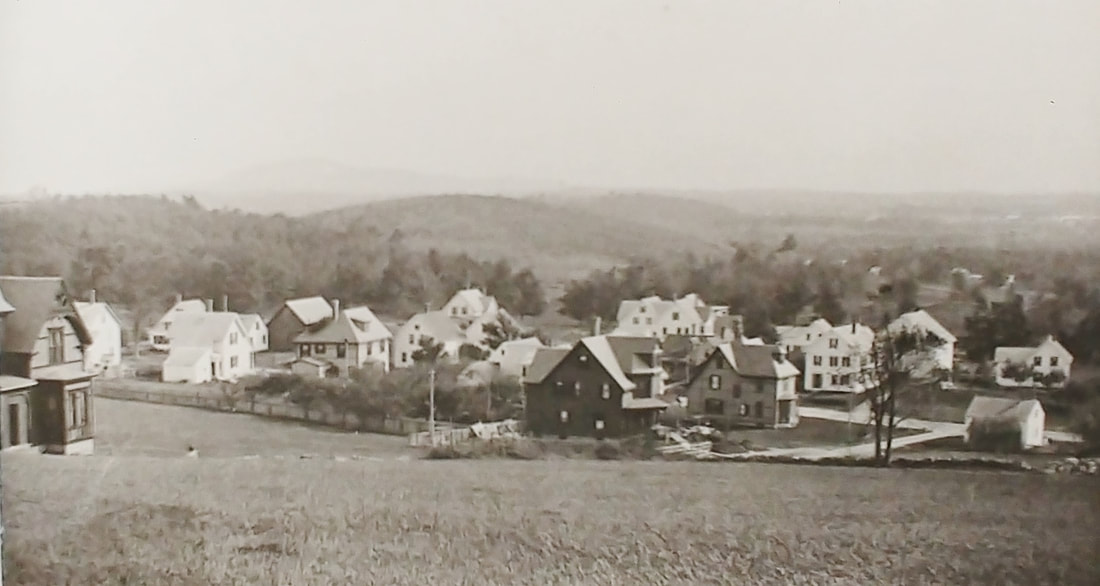
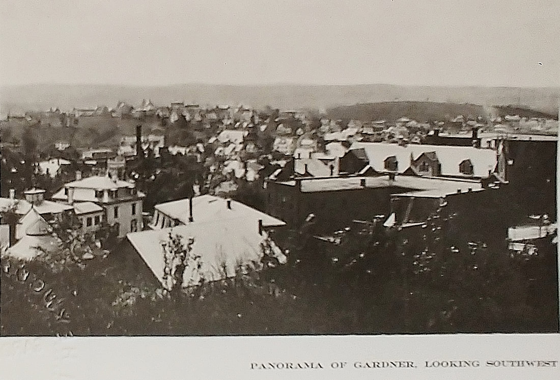
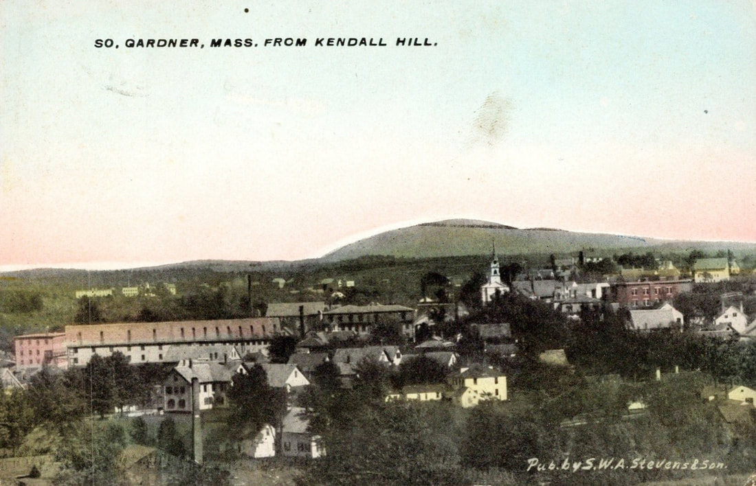
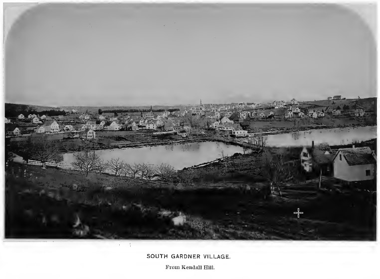
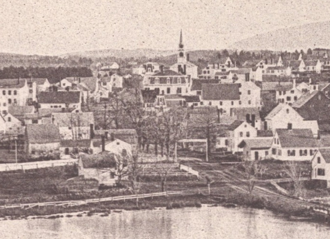
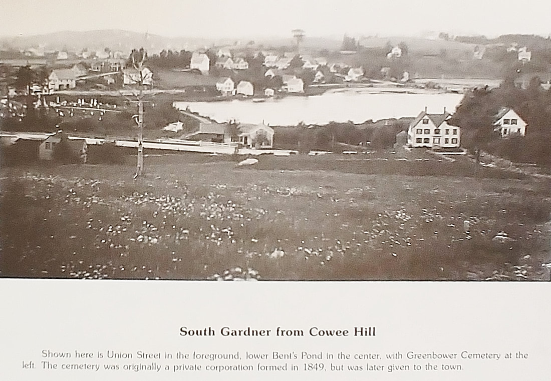
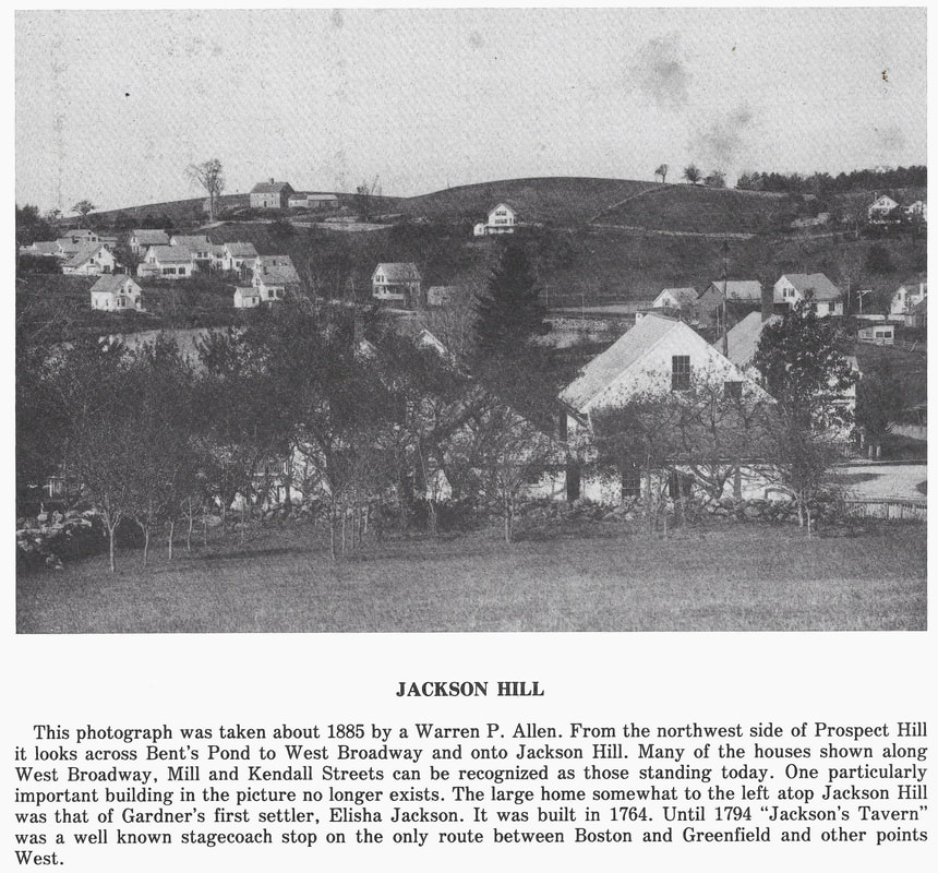
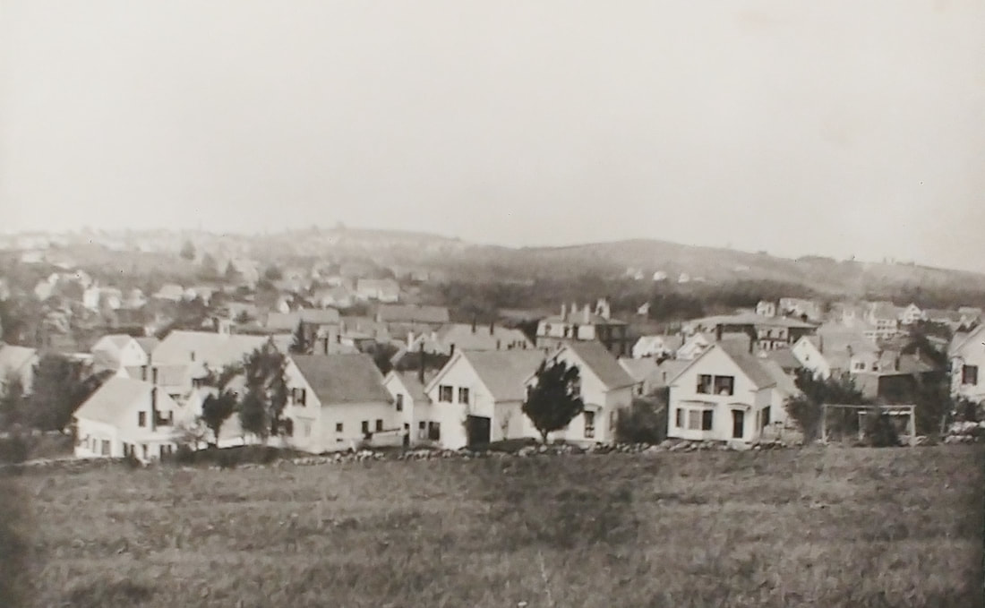
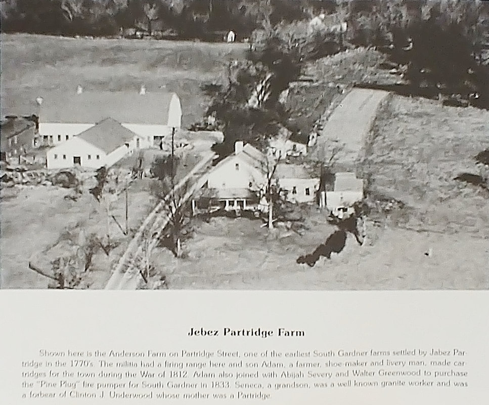
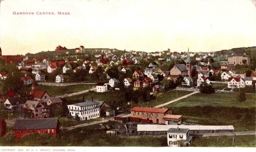
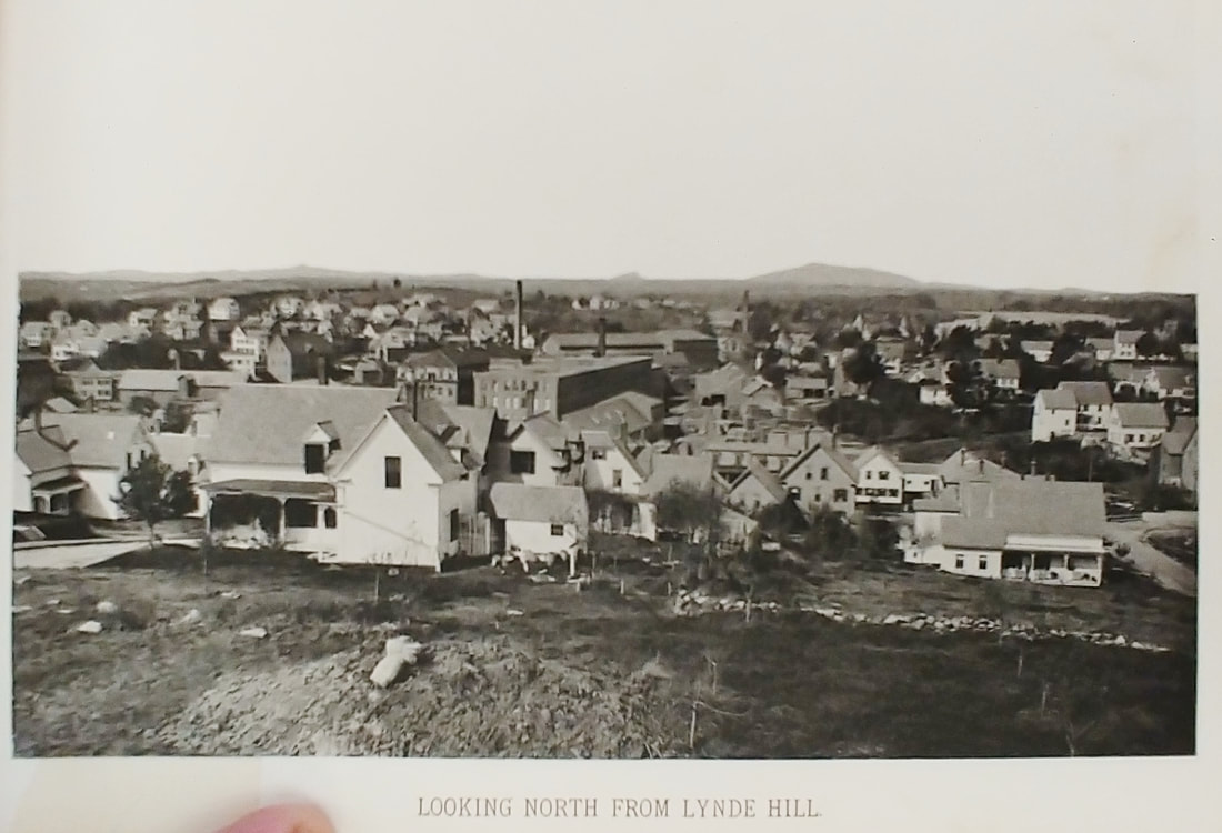
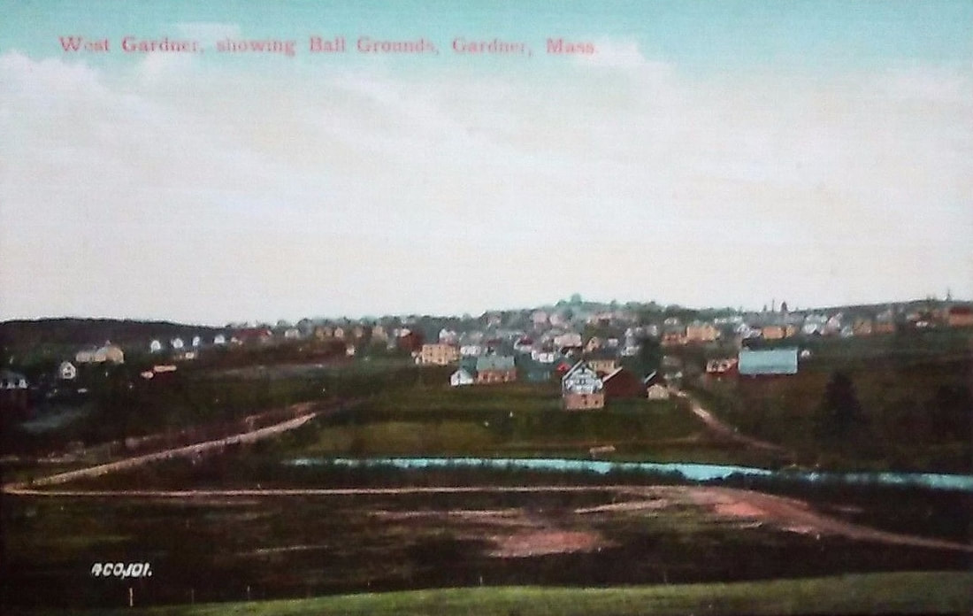
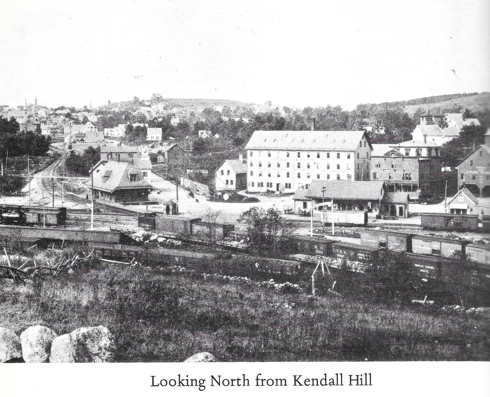
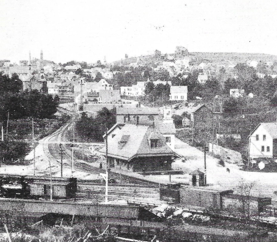
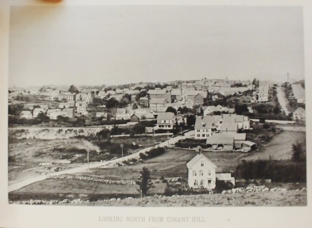
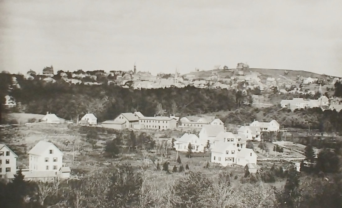
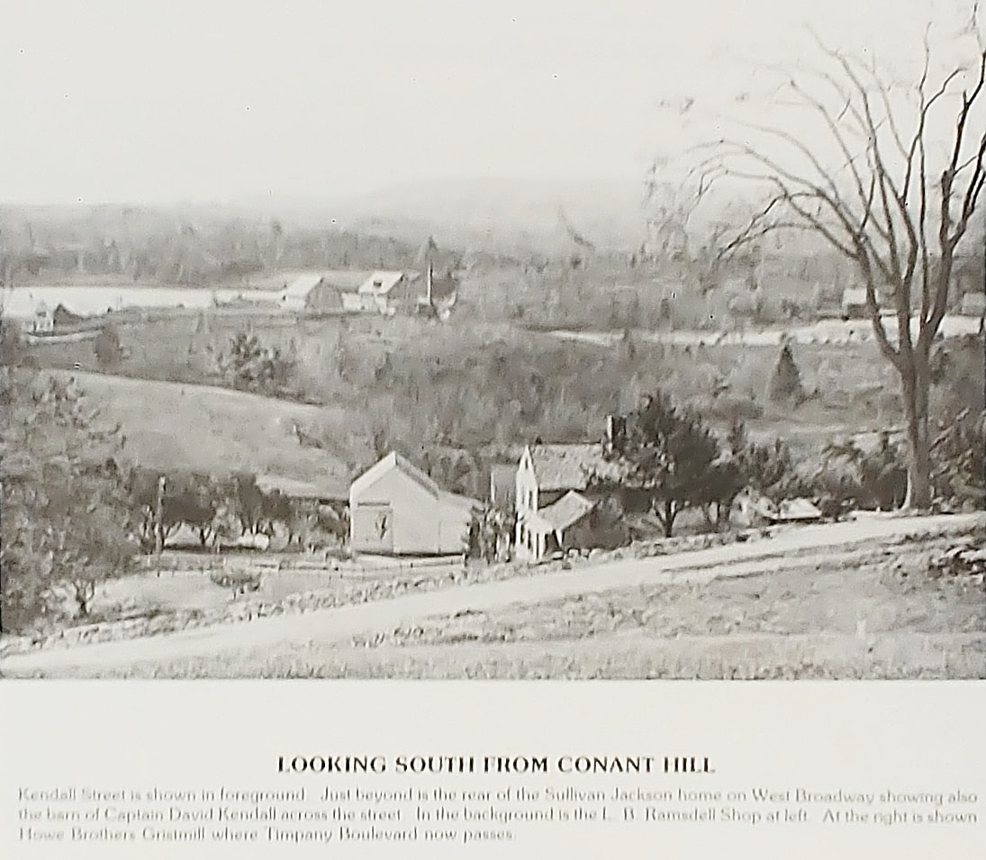
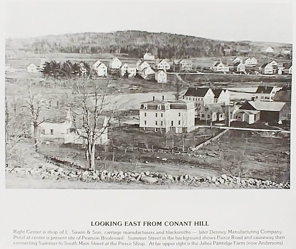
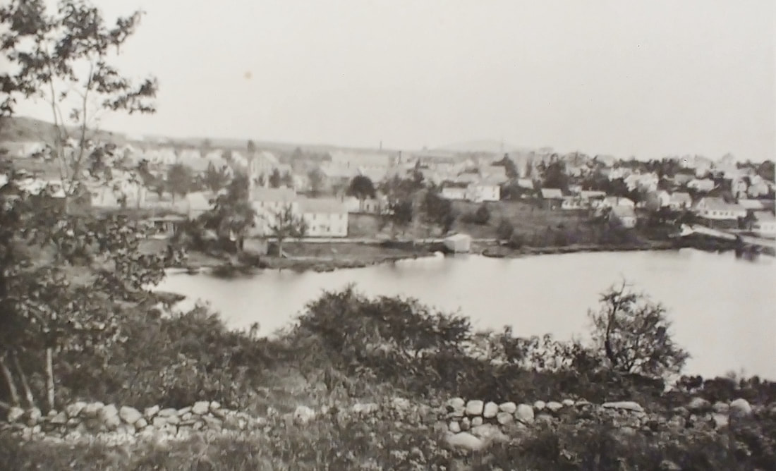
1. Aerial View of Gardner - The aerial view is truly from the air. I overlaid some main street names for better reference - 1963
1a. Aerial View of Gardner - c1930s - (ref. 3, page 68)
2. Aerial View of Mount Wachusett Community College - Unknown Date
3. Heywood Hospital - 1967 (ref. 20)
4. Early Route 2 - 1967 (ref. 20)
5. View from Bancroft Hill looking south? - 1907
6. View from Bancroft Hill looking southeast - 1889 (ref. 22, page 36)
7. View From Bancroft Hill - Looking east over Crystal Lake - 1909
8. View From Greenwood Hill - Looking northeast - 1889 (ref. 22, page 23)
9. Gardner Centre and West Village From Glazier Hill - View from Glazier Hill looking west - note the Town Hall in the center - 1878
10. View from Glazier Hill looking west - 1906 - Glazier Hill is now Reservoir Hill
11. View From Reservoir Hill Looking West - 1889 (ref. 22, page 1)
12. Gardner Center - View from Glazier Hill looking west - c1878 (ref. 2, page 7) - Glazier Hill is now Reservoir Hill
13. View from Reservoir Hill looking west - Unknown Date
14. View From Reservoir Hill looking south - 1889 (ref. 22, page 28)
15. View from Reservoir Hill looking southwest - c1903
16. South Gardner From Kendall Hill - Looking southeast - 1912
17. South Gardner Village From Kendall Hill - Looking southeast - The photograph shows Travers Pond (left) and Bent's Pond (right) - 1878
18. South Gardner closeup of picture #14 - You can see the spire of the Baptist Church.
19. View from Cowee Hill - The picture is labeled as being from Cowee Hill but I couldn't find that hill anywhere close to where this picture was obviously taken from. There is a Cowee Hill too far away so the best I have for you is that it was probably taken from where Prospect and Charles Street meet at a peak and it's looking northwest.
20. Jackson Hill view as seen from Prospect Hill - c1885
21. View From Prospect Hill looking northwest - 1889 (ref. 22, page 25)
22. Jabez Partridge Farm - Unknown Date - Partridge Street
23. Gardner Center - View looking northeast from approximately the intersection of Favor and Peabody Streets which is on what was Lynde Hill and is now Washington Hill - 1905
24. View from From Lynde Hill looking north - 1889 (ref. 22, page 11)
25. West Gardner Showing Ball Grounds - View from??? - Unknown date
26. View from Kendall Hill looking north - 1889 (ref. 22. Page 4) - This view looks up Chestnut Street. You can see two houses on top of Glazier/Reservoir Hill in the distance (see closeup view). On the left you see the spire of the original High School on Chestnut lining up with the spire of the First Congregational Church and just to the left the spire of the Methodist Church.
26a. Closeup of #26
27. View From Conant Hill looking north - 1889 (ref. 22, page 15)
28. View from Conant Hill looking northeast - 1889 (ref. 22, page 34) - Here you can see the First Congregational Church spire, then the Methodist Church spire a little to the right and then the spire of the original High School further to the left, just under the larger house on Glazier/Reservoir Hill.
29. View from Conant Hill looking south - Looking across Kendall Street at Travers Pond (left) and Bent's Pond (right) from what is known today as Kendall Hill. The view is probably from the western side of the hill at about the top of Jackson Park.
30. View from Conant Hill looking east - Looking toward the pond that used to be between South Main and Sumner Streets. This one is also probably taken from the top of Jackson Park. Effectively, Gabby's and The Williams Restaurant would be off to the extreme right in the water. The large house in the middle is 5 Travers Street and we are looking at the back of it. South Main Street goes to the right and slants up to the right a little with a few houses on it. Across the pond is Sumner Street and Horrigan Cleaners would be at about the middle of the left side of the picture. The house at 5 Traver still exists in beautiful shape. It was once owned by Orrin Clark Jillson (1827-1887).
31. View from Conant Hill looking southeast - 1889 (ref. 22, page 20)
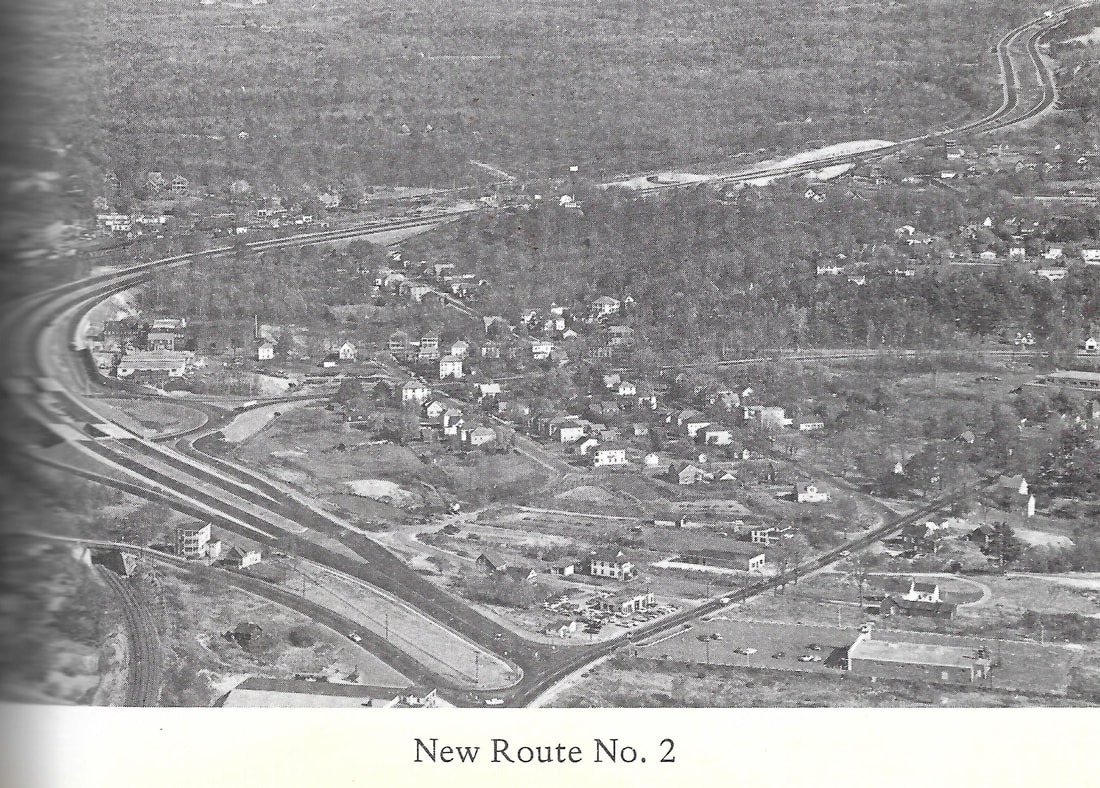  |
Note that Route 2 at this point just dumps onto East Broadway and ends! The modern view is from Googlemaps 3D view so things are kind of squished but there are some landmarks noted so you can get your bearings. The older image came from the 1967 History (ref. 20) so I have assumed it's from 1967 but it could be a little older but not older than 1963 when Route 2 opened. The Route was extended further west c1970 (see https://www.mit.edu/~jfc/Route%202.html).